Good Tuesday, folks. It’s inauguration day in Kentucky and the weather is looking seasonably cold, but really nice. This pattern hangs tough for the rest of the week before we track the potential of a big eastern US storm for the weekend.
I’ll take a look at that possibility and looking farther down the road toward the long awaited winter changes.
Temps for the next several days are pretty seasonable for this time of year and we get some really nice skies to boot.
The weekend continues to be a work in progress as we watch to see what happens with a couple of upper level systems diving into the eastern half of the country. These will try their very best to merge with a strong upper level system down in the Gulf of Mexico, lifting it to the north up the east coast.
The models are still a few days away from settling on a solution as they are still pretty far apart. As a matter of fact, we are getting big swings with each model run and I expect that to continue for a bit longer.
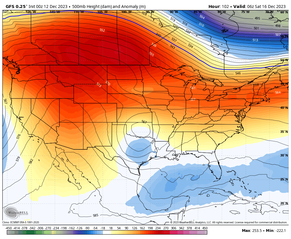
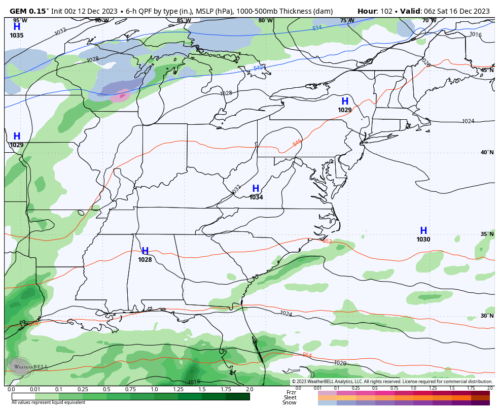
The latest GFS shows our southeastern system lifting north into the Carolinas before pushing to the east…
The Canadian is going for a bigger merger with the whole thing trying to go up the east coast…
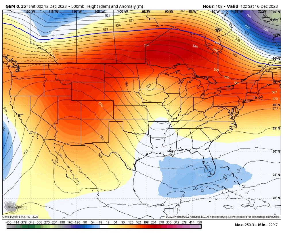
The ICON is the model going for a full blown merger all the way back into our region…
![]()
![]()
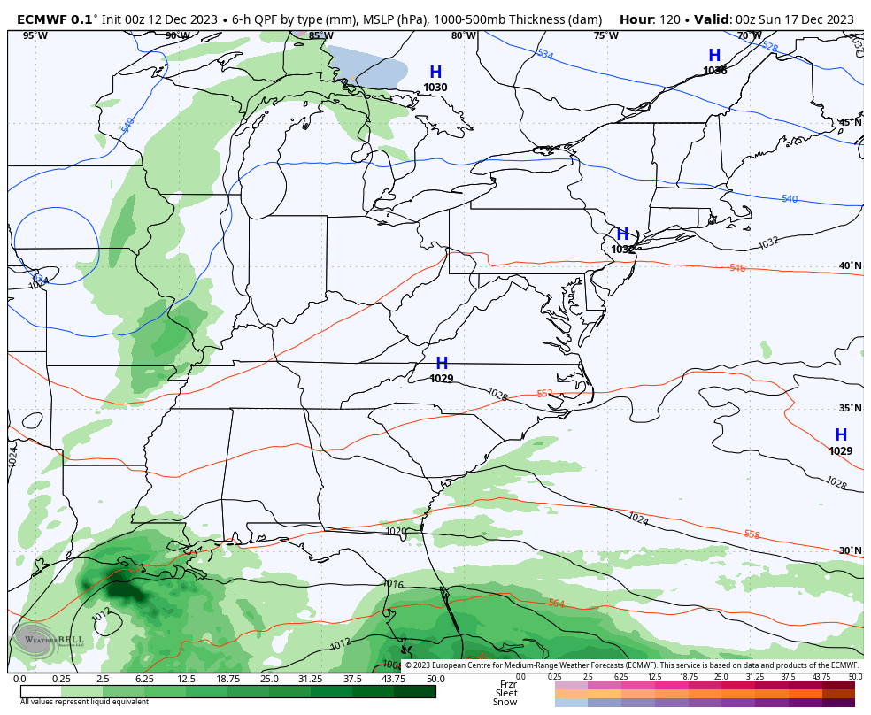
The EURO is also trending strongly toward a much more phased look in the east…
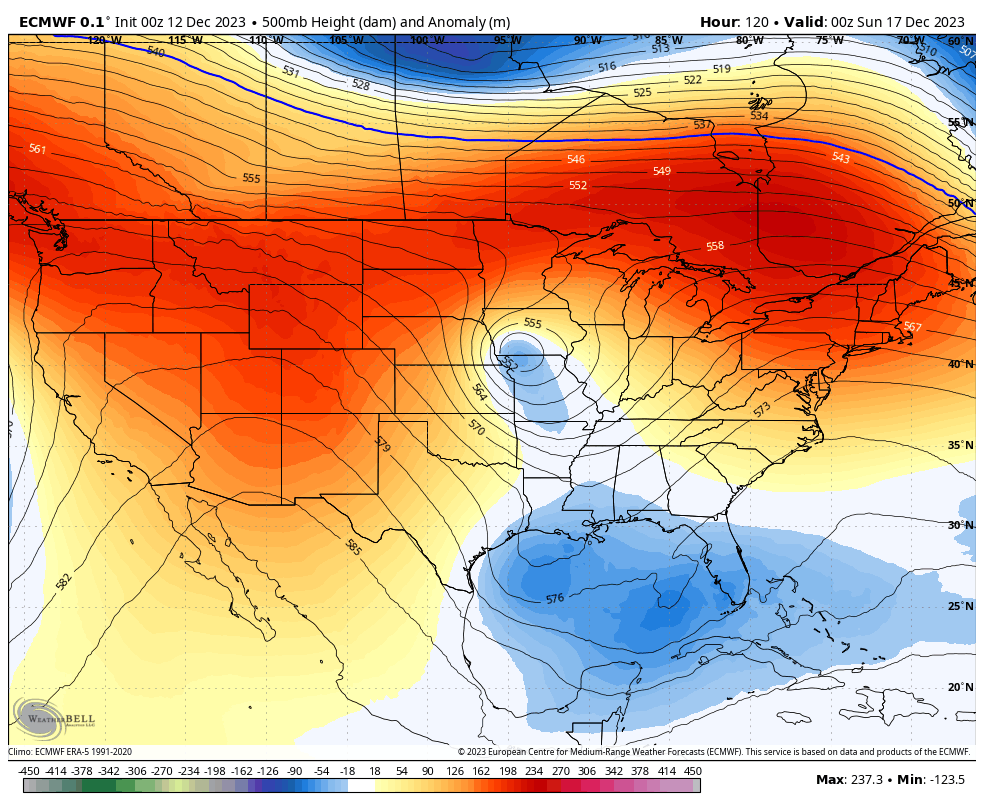
As I’ve said for a while now, winter lovers need this storm to come together and work up the eastern US instead of dillydallying around along the southeast coast. I do think this storm will come out instead of staying down there and I think it’s a monster of a storm.
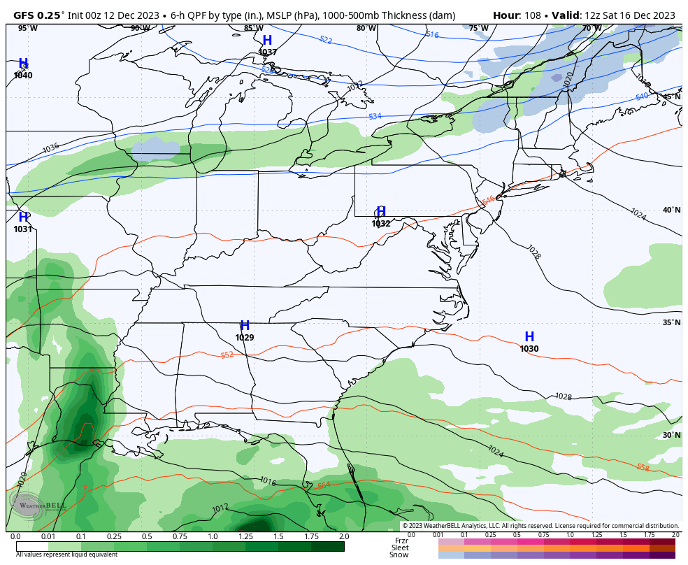
If we look at the surface reflection of the models, the GFS puts together a healthy system that brings some rain into eastern and southeastern Kentucky before it turns east…
The Canadian sees a stronger system dropping in from the northwest and turning this main low northward up the east coast. It also manages to throw out some winter weather under a smaller upper low spinning on top of us…
The new EURO bombs this system out up the east coast and even brings us a few flakes by early next week…
Looking farther down the road toward the end of the month and into January, we continue to find a strong signal for a stout second half of the winter. My winter forecast had a slow starting winter with December averaging above normal with only minimal snow. So, what’s happening so far this month was 100% expected. My forecast then brought in quite a bit of cold and snow threats for January and February with the potential lurking for a big event.
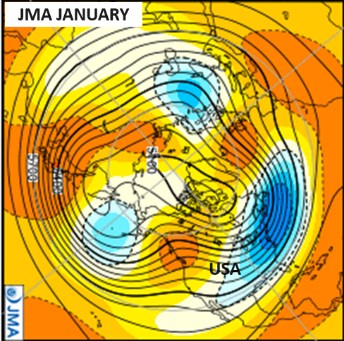
The seasonal models we look at are backing up my forecast as they continue to transition toward a winter setup later this month before locking it in for January. The latest JMA January forecast shows a deep trough in the east as a ridge holds in the west…
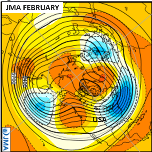
That same look takes us through February…
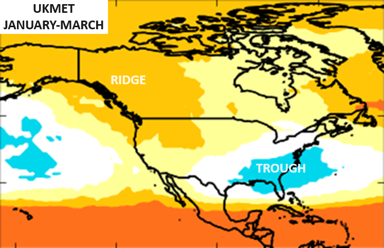
This has been a constant signal from all of the seasonal models I look at and that includes the new UKMET for January through March…
Does it make me worry that all the seasonal models are now supporting my winter forecast from a few months ago? Yessssssssssssssssssssssssssssssssssssssssss! 😜😎
I will have another update later today. Have a good one and take care.

Thanks for the update Chris. Hoping your outlook for Winter pans out.
Have a Great Day !
The blog has been giving me fits these past few days; I’d write a comment, press Post, and nothing happened.
Glad to see that you escape that awful Storm Joe. I’ve been hearing about all the damage down your way. I don’t know why you are having problem posting on the Blog. Everyone one I post goes through. Don’t know what’s going on ???