Good Wednesday to one and all. Our weather continues to be very calm and quiet and will continue that way for a few more days. Once into the weekend, we find a complicated scenario that will likely bring, at least, some rain into Kentucky.
Let’s get straight to the weekend system and break down what the models are saying. Yes, they still disagree with one another.
The latest GFS continues to be the farthest west solution of the models as it brings the low well inland toward the Carolinas before it meanders around along the Mid-Atlantic coast into the first few days of next week. This continues the trend of the GFS in bringing a lot of rain to central and eastern Kentucky, but this run has a little light snow to end things…
That slow scenario is a little too slow for my taste as I expect this storm to ride up the east coast with a little better shot of cold coming in behind it. The solution I just described isn’t’ too far away from what the Canadian is showing…
The EURO continues to be the most inconsistent of the models, but it’s finally starting to see this system lifting northward along the coast. That said, it’s way too weak and fast with it and that’s a far cry from recent runs that were keeping this thing hugging the southeastern coast.
This overall pattern won’t be kind to the EURO as it’s one the model typically struggles with.
Regardless of which solution verifies, the end result for our region would be for cold rain Saturday night and Sunday with some lingering stuff into early next week. Can we squeeze some flakes out of this? Meh… Maybe.
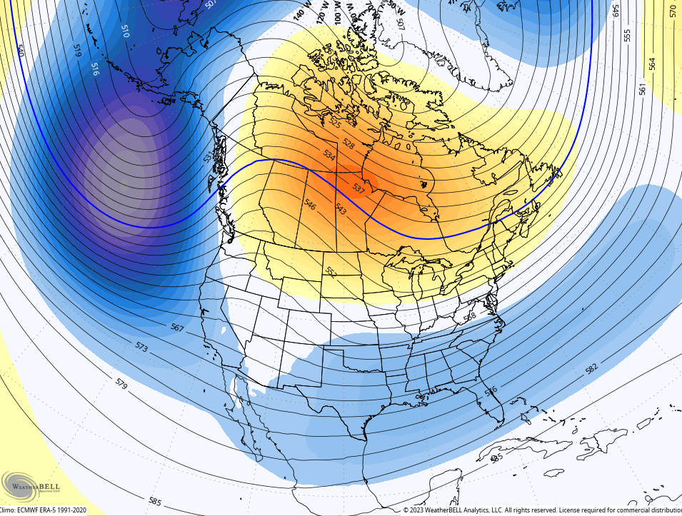
Looking longer range toward the Christmas holiday period, we find the GFS operational model starting to take on a colder look, matching some of the recent runs of the GFS Extended and the EURO weeklies. They’ve been showing higher heights slowly being pushed northward into Canada, allowing for undercutting systems and colder air.
The 7 day period from the GFS is now showing something similar…
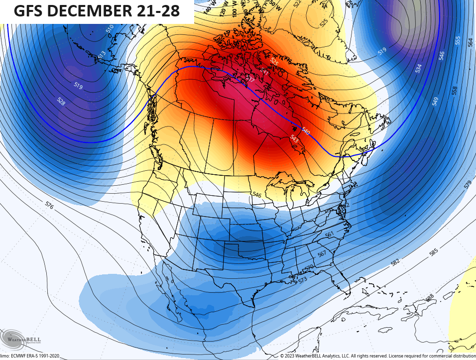
Watch the MUCH above normal air get pushed into Canada and Alaska, allowing for colder surges coming undernearth that across the country…
Tbe GFS Ensembles have this same undercutting look to them…
Now, the models may very well be rushing this a little too much, but I fully expect this pattern to take over at the end of the month and into January.
I’ll see you guys back here for another update later today. Make it a great day and take care.

Thanks Chris for the update.
Yes, thank you for the temperature forecast. I’ll ask the question towards which Schroeder usually points us. “Where is the moisture?”
Right on baby!
Here’s the 10 day GFS ( good as any model here lately ) on precipitation across the Country. Doesn’t look very wet for Kentucky :
https://weatherstreet.com/models/gfs-acc-precip-forecast.php
Here’s the GFS 10 day Snow accumulation for the Country. Sad for all the Snow Lovers out there. Well maybe we will have a late Snow season ? One can hope.
https://weatherstreet.com/models/gfs-acc-snow-forecast.php