Good evening, folks. It’s full steam ahead toward the weekend and the big system likely coming out of the Gulf of Mexico and impacting our weather. The models are starting to come around to a farther west and stronger system.
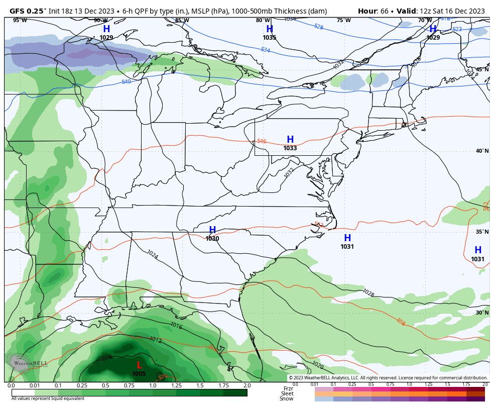
The GFS is now going with a fully phased system that comes much farther west with this storm. That track means a lot of rain and wind before colder temps and maybe a few flakes early next week…
The GFS has a friend in the ICON which has almost the exact same track…
![]()
![]()
The EURO is getting in on the west trend as well, though not to the extent of the above models…
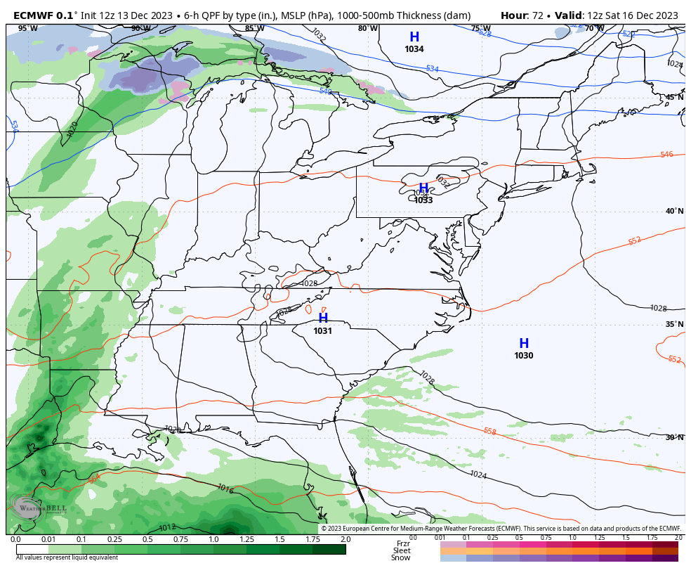
Keep in mind that the EURO had a much farther east starting point compared to other models.
The Canadian model is the most progressive of the models…
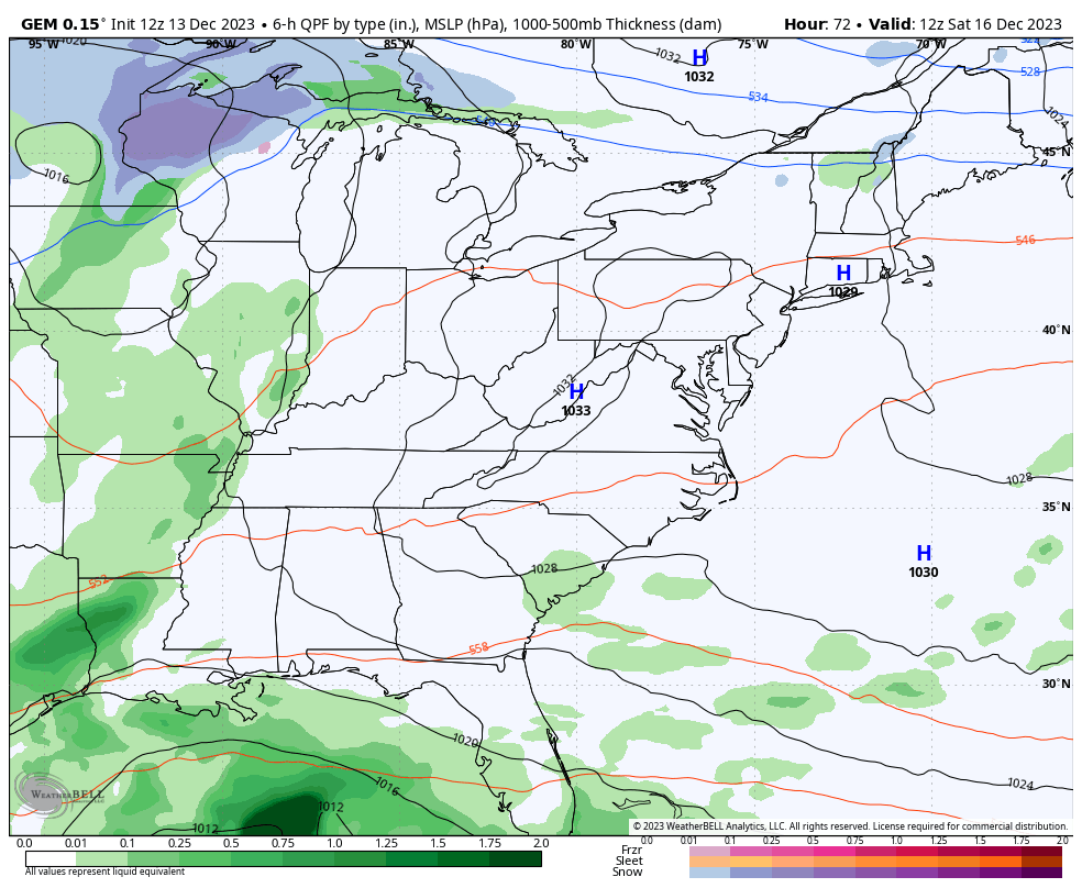
The funny thing is, I can see how each of those runs could be correct.
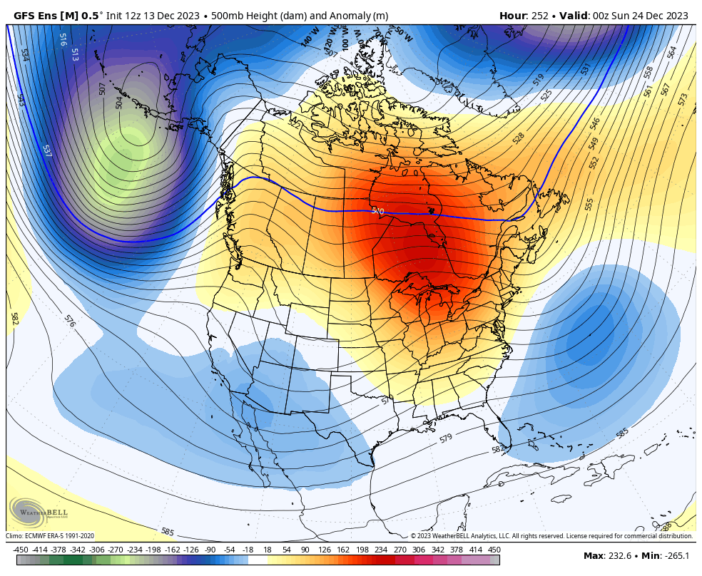
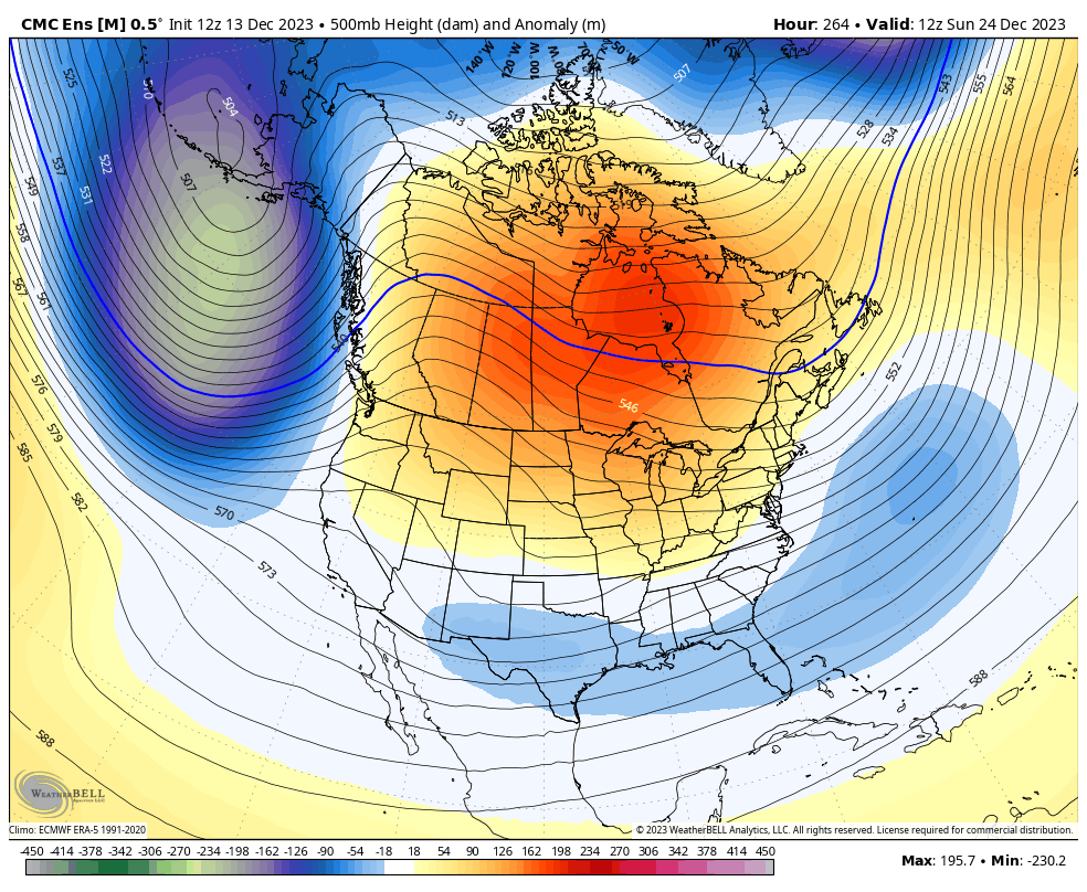
Looking farther down the road toward Christmas week, we are finding the Ensembles showing the highest heights migrating into Canada, allowing for deepening troughs to sweep underneath across the country…
GFS ENSEMBLES
CANADIAN ENSEMBLES
Enjoy the evening and take care.
