Good Thursday, folks. It’s all eyes on the weekend as our big storm system slowly comes into better focus. The models are keying in on the general idea of how this storm rolls, but disagree still on the track of our system.
This complicated scenario finds the forecast models tacking the track of the low anywhere from the eastern slopes of the Appalachian Mountains to the Interstate 95 corridor along the east coast. With a track like that, snow lovers should be licking their chops for a big snowstorm around here, BUT… There’s always a BUT… There’s no big cold high to the north or west of the storm as of now.
Now, does that mean there’s no chance for any snow from this? No it does not as I do think we have a chance for some wraparound flake action late Monday and Tuesday. Hey, we will take whatever we can get. Am I right?
The GFS continues to show a monster low pressure that comes farther west than any other model. The GFS brings this low from the Florida Panhandle to the southern Appalachian Mountains before working it toward Charleston, WV and then toward the northeast. The end result is a lot of wind and rain for Kentucky with the chance for some flakes at the end…
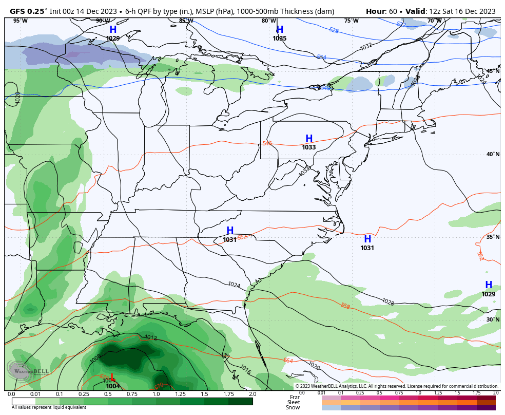
That may very well be too far west and a bit overdone, but if we take that model at face value, check out the wind gusts…
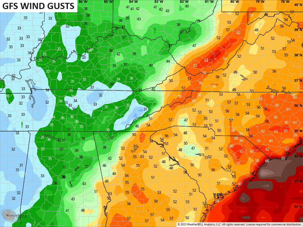
That would be a major wind event along the Appalachian Mountains and east. Wow.
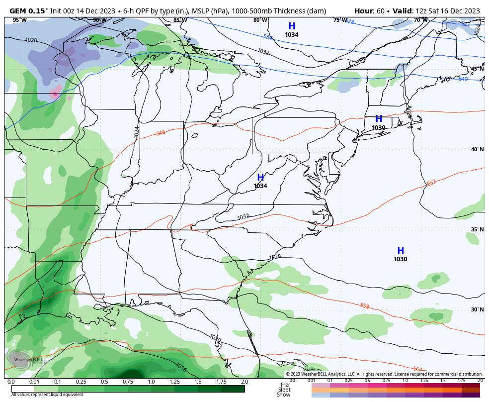
The Canadian model also has a monster of storm that is a bit faster and farther east with the track. The end result for is is lower rain and wind amounts, but a better chance for some northwest wind producing flakes…
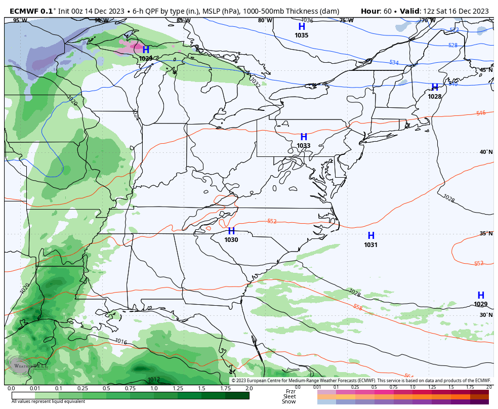
The EURO trend toward the west has been pretty amazing to watch unfold over the past few days. We are now to the point to where the EURO is actually pretty close to making this into a much bigger winter storm. It’s the strongest with the storm and has the strongest upper air energy diving into the system from the northwest. The end result for Kentucky is the EURO showing a lot of rain and wind with a light snowfall to follow…
Interesting!
To recap, the trend of the models is farther west, stronger and with more cold air coming in behind the storm. The fact this system is coming out instead of dillydallying off the southeast coast is a positive to help get the pattern to trend colder next week and into Christmas week.
The EURO Weeklies really kick this into high gear during the first week of the new year…
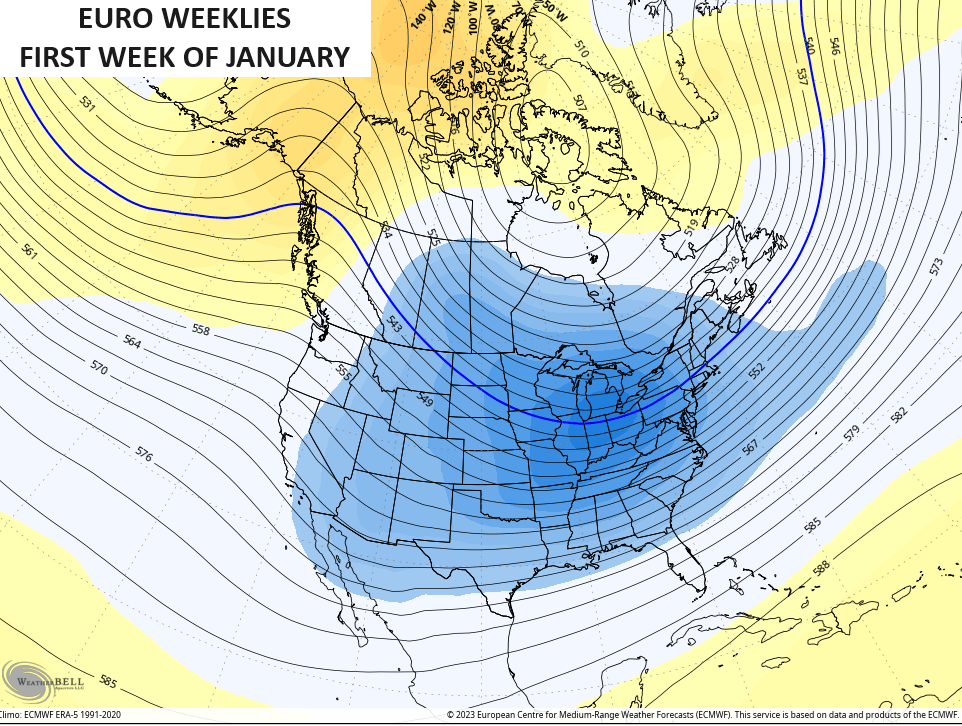
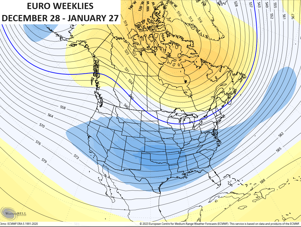
The 30 day mean from the end of December through much of January continues to show higher heights across Canada with the trough underneath across the US…
I’ll see you guys for updates later today. Have a great Thursday and take care.

The December ENSO update is out, and El Niño is expected to continue through the Northern Hemisphere winter, with a a 60% chance of transitioning to ENSO-neutral during April-June 2024. There is also a 54% chance that this El Niño will be historically strong.
Here’s the full report:
https://www.cpc.ncep.noaa.gov/products/analysis_monitoring/enso_advisory/ensodisc.shtml#:~:text=Synopsis%3A%20A%20transition%20from%20La,Ocean%20%5BFig.%201%5D.
In terms I can understand guys lol what does that mean for our area????
It’s really hard to say, Crystal. Rising global temperatures are causing many of the factors that drive our weather not reacting like they have in the past. El Niño has been relatively mild so far, although it did keep most Atlantic hurricanes way from the coast. But it has had major effects in South America, from droughts to extreme flooding. I feel that Winter will flip the cold and snow switch in January, and we may end up with a relatively chilly first part of Spring.
Here’s the outlook for ( JFM ) from NOAA :
https://www.cpc.ncep.noaa.gov/products/predictions/long_range/seasonal.php?lead=2
Here’s the outlook for ( AMJ ) from NOAA :
https://www.cpc.ncep.noaa.gov/products/predictions/long_range/seasonal.php?lead=5
According to the Climate Prediction Center, for the next 8 to 14 days, temperatures are going to be above normal for almost the entire country. http://cpc.ncep.noaa.gov
That’s a far cry from last December, when much of the country was under the influence of bitterly cold Arctic air the week prior to Christmas.
The only time that we endure the Arctic air last winter. It’s going to be the opposite this winter when January rolls around.