Good Friday, everyone. Our weekend storm system continues to be on track to bring rain and gusty winds to the Bluegrass State. This will also unlock much colder weather that should bring in some light snow and snow showers early next week.
Let’s break down the forecast:
SATURDAY
- Temps spike into the 50s once again ahead of an upper level system moving in from the west.
- This system causes clouds to increase and thicken through the day.
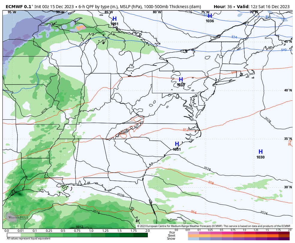
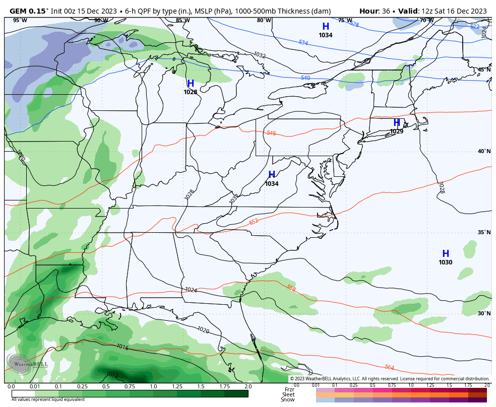
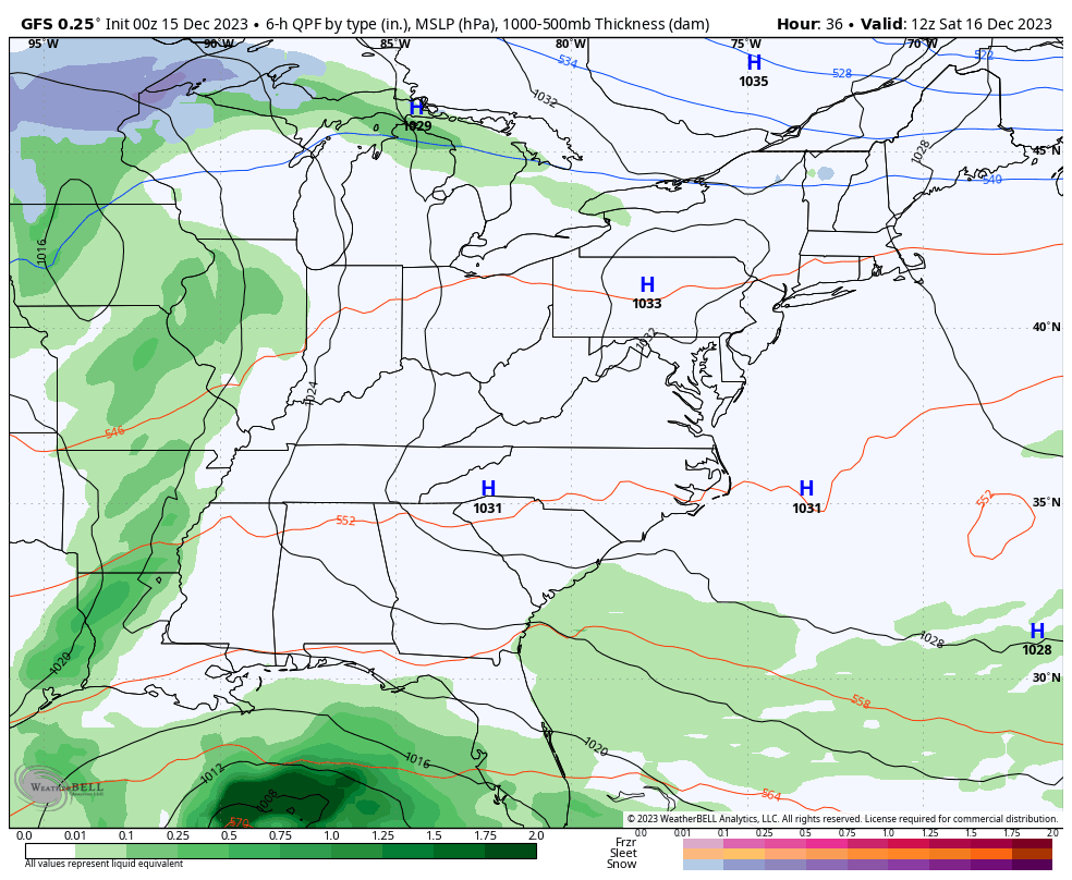
- Rain arrives across western Kentucky during the afternoon and moves east during the evening.
SATURDAY NIGHT
- Rain becomes widespread across the entire state with this system right on top of us.
- Winds start to gust up a bit and may hit 25mph.
- Colder winds settle into the western half of the state.
SUNDAY
- The upper level system continues to push east as the monster low rolls northward into the Carolinas.
- That storm system may pack hurricane force winds all along the east coast.
- It throws rain into the eastern half of the state with lingering showers in the west.
- Steady rains decrease as the day wears on.
- Colder winds gust up from the northwest and may reach 30mph at times.
- Temps fall through the 40s.
SUNDAY NIGHT
- A few showers show up across central and eastern Kentucky.
- Cold air continues to push in from the northwest with temps in the low-mid 30s.
- A flake or two may show up late at night.
MONDAY
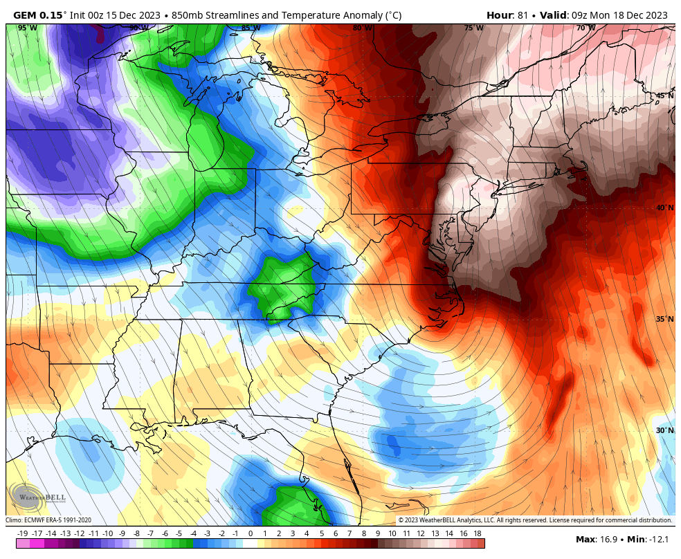
- As the powerful storm along the east coast batters New England, it carves out a deep trough behind it.
- This trough will have an upper level system dropping into it.
- As this swings through here, some snow showers or areas of light snow and flurries may form.
- The best chance for this is across central and eastern Kentucky through Monday night.
- Can we get some of these flakes to stick? The chance is certainly there for something light stuff.
- Temps stay in the low and middle 30s but winds gusting to 30mph may take wind chills into the upper teens and low 20s.
- Wind chills Monday night may bottom out around 10 degrees.
The models are all in pretty good overall agreement with just some of the smaller differences showing up as usual.
The Euro was the first model to show the chance for light snow to follow this big east coast storm and it continues to do so…
The Canadian Model looks similar in showing the chance for light accumulations Monday and Monday night…
Check out the shot of “Barney” colors coming in with this…
The GFS is seeing more and more of the light snow potential on Monday…
Please keep in mind how this whole setup has evolved. Just a few days ago the models had no cold anywhere to be found and kept this storm hanging around for days off the southeast coast. This is why we don’t simply regurgitate exactly what’s on a model.
Temps bounce back for the second half of next week with another big storm system likely impacting our weather Christmas weekend. Once again, this looks more wet than anything else, right now.
The transition to this much colder setup continues to show up on the EURO Weeklies. The positive height anomalies continue to lift northward into Canada for the end of the year into January. That allows for troughs to sweep eastward across the country. This shows up very well if we look at the 30 day height anomalies…
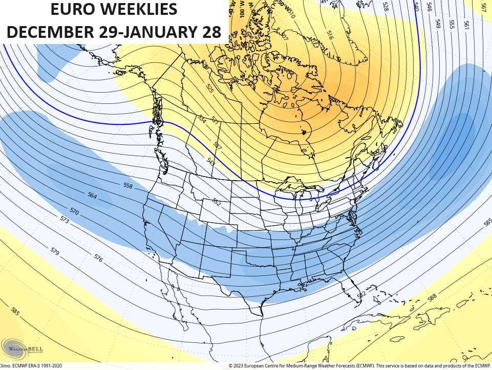
Not only would that be a colder than normal pattern, it would likely be one featuring a lot of winter storms.
The control run of the EURO weeklies for the same 30 day period goes ballistic. Look at these 30 day temp anomalies….
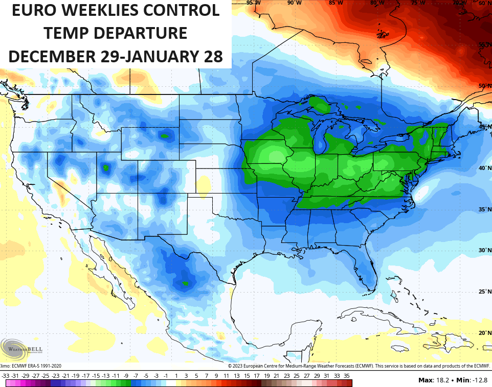
Yowza. Again, that’s the extreme case but if these other yahoos can show bogus 115 degree temp forecasts from models, I can show the opposite. 😜 I kid, I kid, but at least the above map has a history of happening around here. 😁
I’ll update things later today. Make it a good one and take care.

Thanks for the update Chris. It’s dry here, but this is beautiful late Fall weather. Have a Great day !
It’s not looking good if you want a white Christmas.