Good evening, folks. My time is short this evening, but I wanted to drop by for a quick update on where the pattern is going for this weekend into early next week. The main point is… I have no changes to the thoughts I laid out for you guys last night.
Rain moves in from west to east late Saturday with gusty showers and falling temps on Sunday. The upper level system diving in behind it for Monday and Monday night will have areas of snow showers and some light snow across central and eastern Kentucky.
Can we get some of this to stick? Maybe, but it would be pretty darn light.
The best chance of seeing this would be across the east and southeast after dark on Monday.
If we just look at the Ensembles to get a picture of what they’re thinking in terms of the areas that can see some light snow, we actually find pretty good agreement…
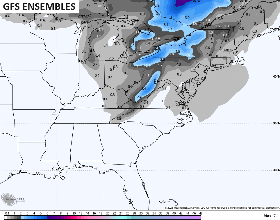
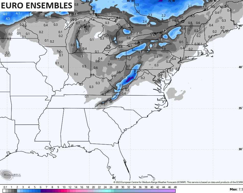
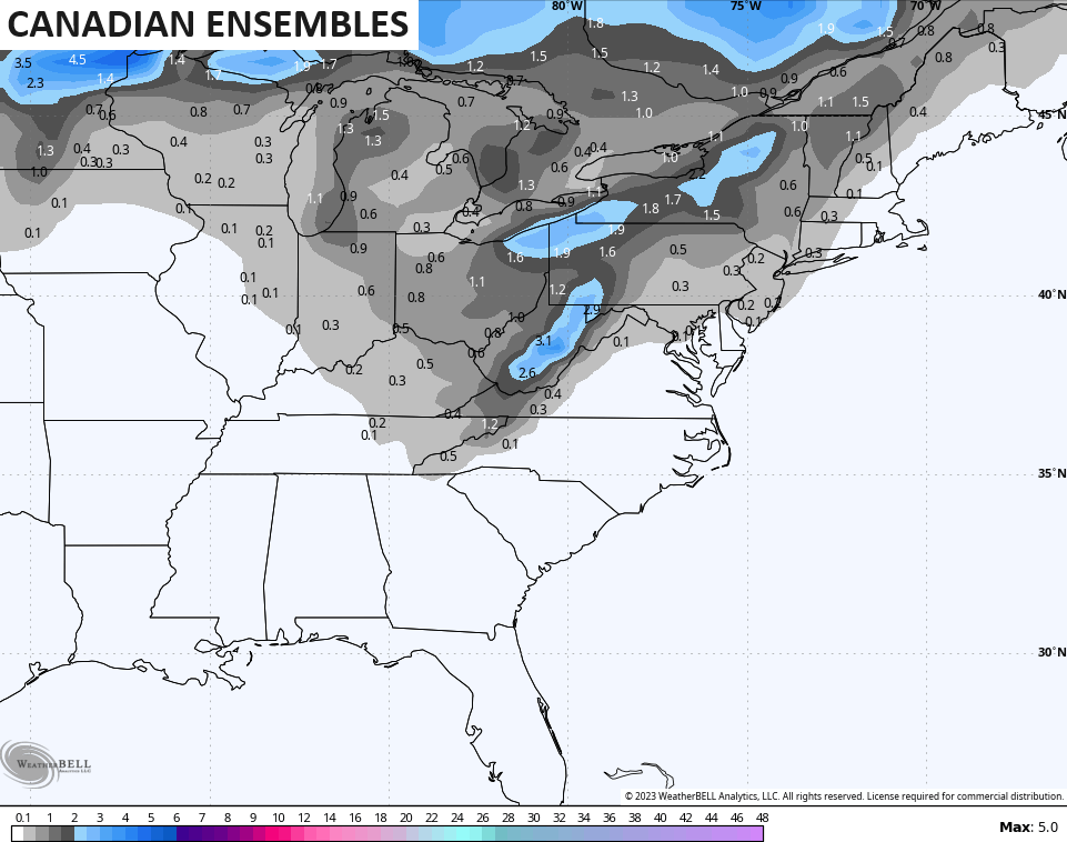
Lake Michigan may briefly throw a band of snow showers into the region late Monday or Monday evening. If we can get a true northwest flow off LM, then we may deal with a few delays Tuesday morning in the east. ❄️😲
Monday is a flat out frigid day as gusty winds combine with those falling temps to really do a number on wind chills. Watch the numbers tank from 7am to 7pm Monday…
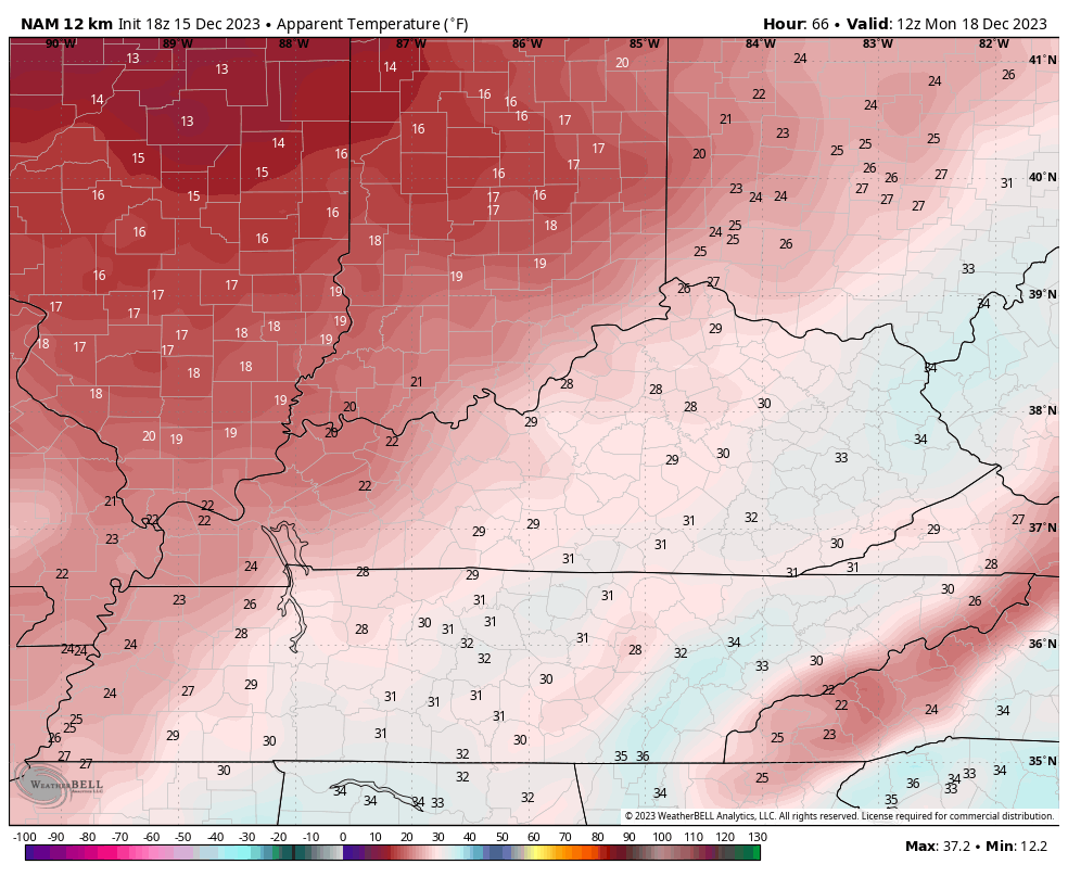
Wind chills to begin Tuesday would be near 10 degrees. Brr!
I’ll go more in depth on all this and the evolving pattern that follows coming up later tonight. Have a great rest of your evening and take care.

CB, not sure about you, but not having a super good snow vibe this winter- especially after the bottom level totals of last winter. Nowhere to go but up at least!