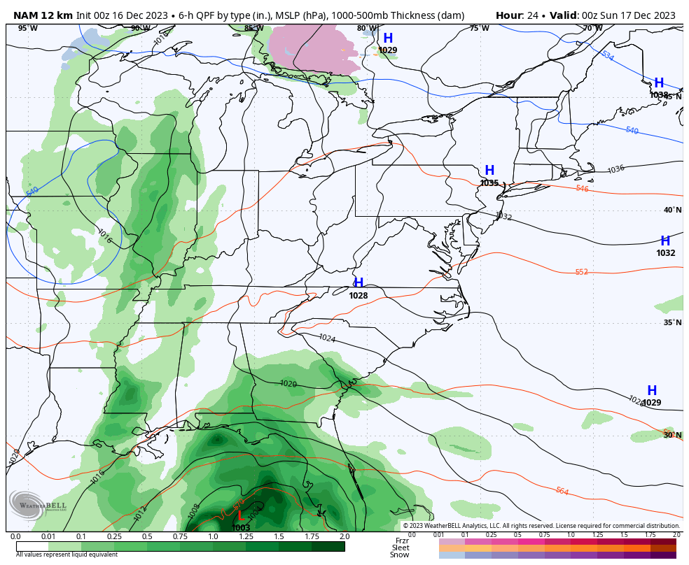
Good Saturday to one and all. Rain is rolling into the region today and overspreads us tonight and early Sunday. Beyond that comes a quick-hitting blast of winter weather complete with some light snow and frigid wind chills.
Temps are back into the 50s out there today as clouds thicken ahead of the system working in from the west. This will bring rain into western Kentucky this afternoon and that overspreads the state tonight with rain around into Sunday. Temps Sunday are in the 40s.
This system then slides east and merges with the monster east coast storm system that rolls right up the east coast into Monday.
As this storm deepens, it carves out a sharp trough behind it with another system dropping into this trough and across our region. The end result is light snow and snow showers from Monday into Monday night for central and eastern Kentucky. Some light accumulations are possible.
Here’s the NAM showing how this plays out…
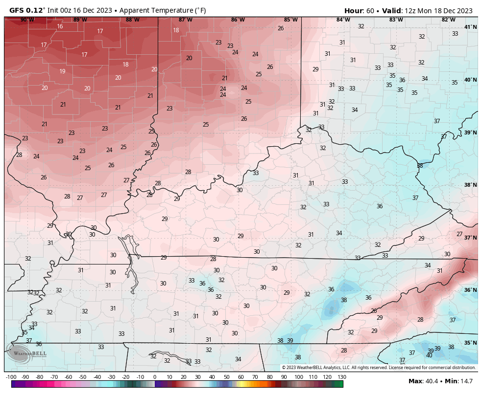
Monday is a wintry day with flakes flying, gusty winds and crashing temps. Wind chills are going to be absolutely frigid as they drop into the teens by late afternoon and early evening. This wind chill animation goes from 7am through7pm Monday…
I had someone tell me they really liked the forecast breakdown from the last post, so let’s do it again…
TONIGHT
- Rain becomes widespread across the entire state with this system right on top of us.
- Winds start to gust up a bit and may hit 25mph.
- Colder winds settle into the western half of the state.
SUNDAY
- The upper level system continues to push east as the monster low rolls northward into the Carolinas.
- That storm system may pack hurricane force winds all along the east coast.
- It throws rain into the eastern half of the state with lingering showers in the west.
- Steady rains decrease as the day wears on.
- Colder winds gust up from the northwest.
- Temps fall through the 40s.
SUNDAY NIGHT
- A few showers show up across central and eastern Kentucky.
- Cold air continues to push in from the northwest with temps in the low-mid 30s.
- A flake or two may show up late at night.
MONDAY
- As the powerful storm along the east coast batters New England, it carves out a deep trough behind it.
- This trough will have an upper-level system dropping into it.
- As this swings through here, some snow showers or areas of light snow and flurries may form.
- The best chance for this is across central and eastern Kentucky through Monday night.
- Light accumulations are possible for some areas and may even lead to a delay in the east by Tuesday morning.
- Temps drop into the low and middle 30s but winds gusting to 30mph will take wind chills into the upper teens by late afternoon.
- Wind chills Monday night may bottom out around 10 degrees.
Tuesday is a cold and blustery day before temps return to the 40s for the rest of the week. A couple of systems look to make a run at us for Christmas weekend and both are likely rain makers, diminishing hopes of a third white Christmas in 4 years. The chance is small, right now.
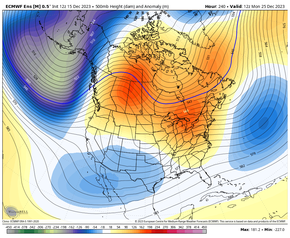
The overall progression of the pattern continues into the final week of December as our trough deepens into our region and into the eastern US. Watch the positive height anomalies work northward into Canada during this time…
The Control run of the EURO Ensembles show the potential for a big storm system in the closing days of the year…
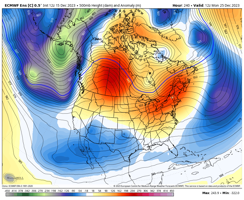
Hmm.
I will have updates later today. Until then, let’s track some rain into western Kentucky…

Have a great Saturday and take care.

Wow, what a surprise another weekend rain event followed by insignificant festive flakes mainly east of I-75.
Thanks for the Forecast Breakdown Chris. I really like it too. Easy to understand, as I have a difficult time with all the model confusion. Keep hope for that fourth year White Christmas. Have a Great day.
This past Thursday, my PWS near Bowling Green recorded a barometric pressure reading of 30.74 inches of Hg, (1041.3 mb), which was the highest barometer reading we’ve had in BG over the past 10 years. For some individuals who are sensitive to pressure changes, Thursday was kind of rough!
After months of same ole weather pattern, the pattern is slowly changing in our eyes folks enjoy what’s left of it. Mother nature is getting ready to flex it’s muscle on us soon