Good evening, folks. Rain is rolling from west to east and will continue to overspread the region tonight into early Sunday. A blast of winter is set to follow that with light accumulating snows possible early in the week ahead.
I have no changes on the overall forecast. The rain will be heaviest overnight into Sunday morning with a half to one inch of rain possible for several areas. The rain is currently working through the west and you can track it all on your regional radars…

The rain becomes more showery from west to east Sunday as temps drop into the 40s as a northwest wind kicks in.
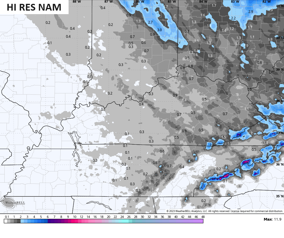
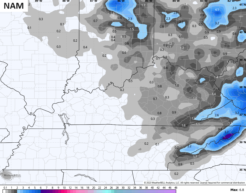
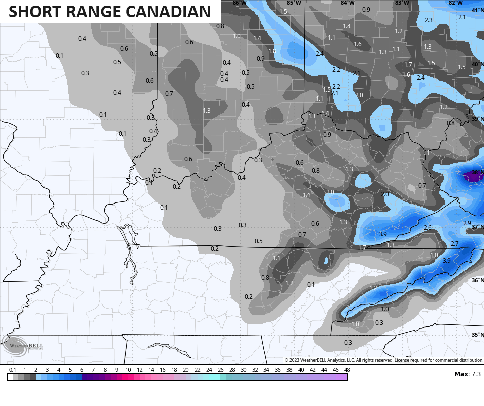
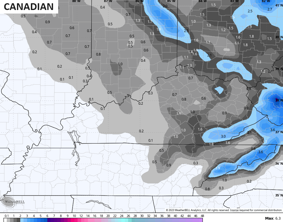
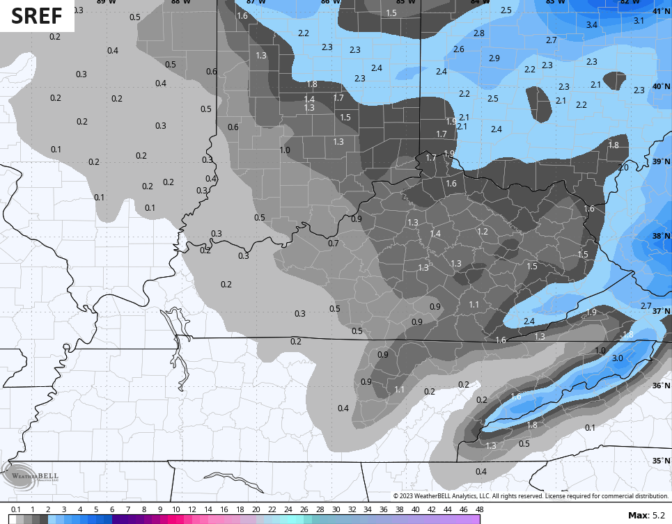
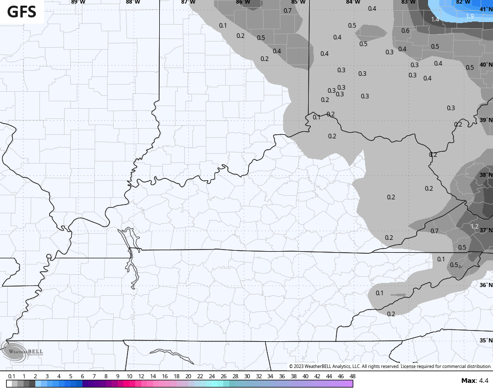
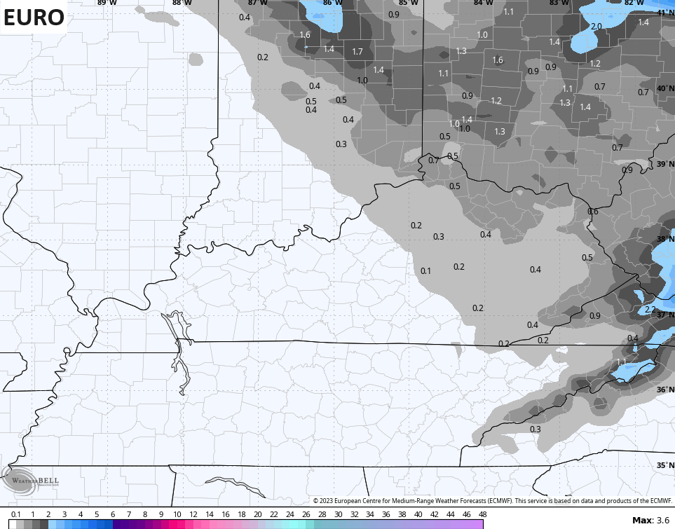
A few more showers develop Sunday night as another system drops in from the northwest. This system is a pretty stout upper level system and it’s likely to touch off periods of light snow and snow showers Monday and Monday night. This brings our first threat for light accumulating snows to much of central and eastern Kentucky as cold air surges in.
Check out the future radar from the Hi Res NAM from Monday morning through 1am Tuesday…
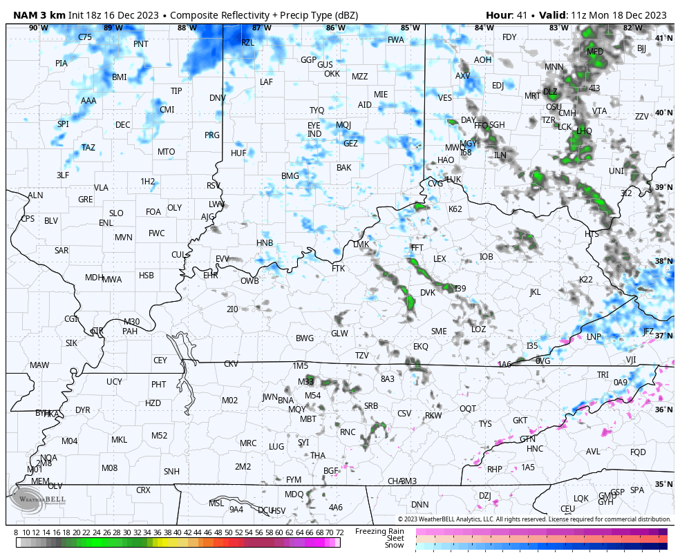
Light accumulations are a good bet across areas of central and eastern Kentucky, especially Monday evening into the wee hours of Tuesday morning. Light is the key word, but the forecast models are getting a little more aggressive with that potential…
Cold winds and falling temps will add to the blast of winter. Wind chills drop like a rock through Monday into Monday night. Check out the wind chill animation from 7am through 11pm Monday…
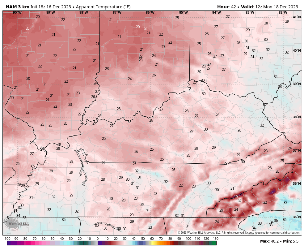
Those numbers have a chance to hit the upper single digits by Tuesday morning. Brrrrrr!!!!
Guess what’s coming tonight? The first First Call For Snowfall!! 😲❄️🥶
Enjoy the evening and take care.
