Good Sunday, folks. It’s a damp and windy day across Kentucky as colder air slowly presses in. This cold air will also be accompanied by some light snow and snow showers to start the new week and some of this may stick.
Let’s begin with today’s wet weather and roll forward.
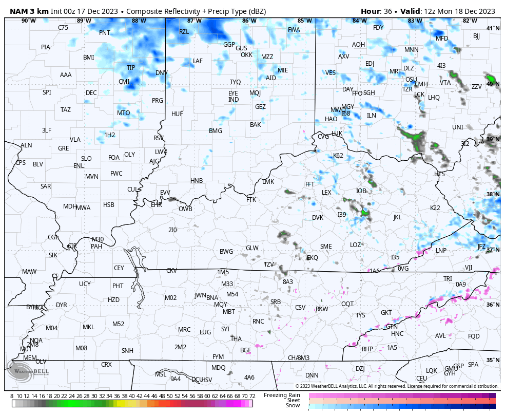
The rain is steady this morning across central and eastern Kentucky then tapers off to a few showers from west to east. By the afternoon, it’s just scattered light showers and some mist. Here are your radars to start things out…

Winds will also be very gusty today and may reach 30-35mph as temps drop into the 40s from west to east today.
Here’s a breakdown from where we go from here:
TONIGHT
- Northwest winds continue to gust up to 20-25mph at times.
- That same northwest wind also brings a steady drop in temps with most areas in the low and mid 30s by Monday morning.
- Scattered showers kick back in during this time with the chance for a late night flake to mix in.
MONDAY
- The day starts with a few showers mixing with some flakes and temps in the 30s.
- An upper level system arrives by the afternoon and brings an increase in light snow and snow showers.
- This action is moving from northwest to southeast, impacting areas of central and eastern Kentucky.
- With a pocket of very cold air aloft diving in the afternoon, there’s an outside for a rumble of thunder.
- Temps hang in the low and middle 30s then drop below freezing by late afternoon.
- Gusty winds really crank and may hit 30mph or a little better at times.
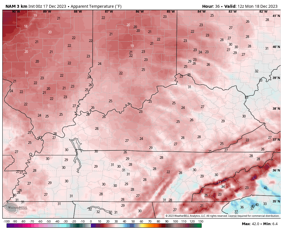
- Wind chills will be in the 20s for most of the day before dropping into the teens by the late afternoon and evening hours.
MONDAY NIGHT
- Light snow and snow showers can put down some very light accumulations, especially in the north and east.
- This action tapers off to just some flurries late.
- With temps closing in on 20 degrees for lows, some slick spots may develop on roads, especially in the east.
- Wind chills will drop to near 10 degrees by morning.
TUESDAY
- Morning flakes quickly end in the east.
- Highs are in the low and mid 30s across the eastern half of the state and near 40-45 west.
- Gusty winds will make those numbers feel much colder.
Here’s the future radar to show the progression of the light snows and light snow showers from Monday morning through Monday night…
So how much snow are we talking about? Not much at all, but just enough for the first First Call For Snowfall…
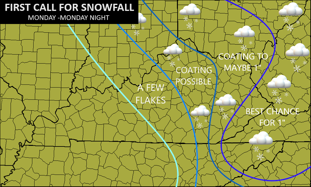
Most areas won’t see anything on the ground and anything that sticks would be mainly on grassy and elevated surfaces. At this point, I’ll take just seeing some flakes!!!!
To cap off the winter look is a winter feel. Wind chill numbers from early Monday through Monday evening absolutely tank…
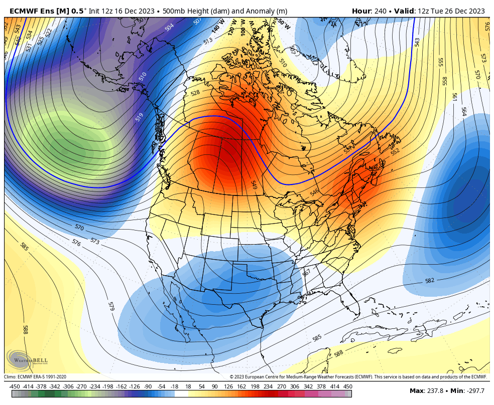
Temps bounce back the second half of next week into Christmas weekend as another storm system or two coming at us. Rain is the likely scenario and that may mean a wet Christmas for our region. This is right along and ahead of the change toward a sustained winter looking pattern.
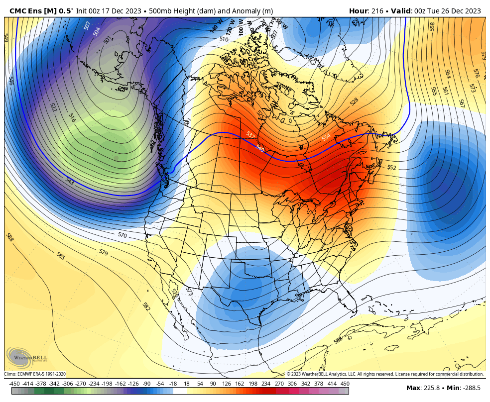
The Ensembles are doing exactly what the seasonal models have been showing for a while to end December and begin January. Watch the higher heights lift into Canada, allowing for our trough to get established in the east and southeast…
EURO Ensembles
Canadian Ensembles
Have a great Sunday and take care.

Thanks Chris. Here in Maple we received 0.53 ” of most welcome Rain. Not looking forward to the Wind driven Cold tomorrow, but I would like to see some Snow Flurries. I am looking forward to milder temperatures mid week with more chances of Rains next weekend. Sorry for the Snow Lovers, but we have two and a half months left for those Snows to happen.
2.5 mos? How you could possibly discount the month of march is shocking since big snows can happen in that month… especially the first 1/2…. I think it’s safer to say 3 months from this point. Snows can happen in April but not usually big snows
Mark, I was just going by the three months of Winter : December, January and February. December is more than half over. And yes, some of our biggest Snows occur in March a Spring month. Only saw one 8 inch Snow in April 1971 and Snow Flurries in early May. Now that’s late !!!