Good Monday to one and all. A quick-hitting blast of winter is rolling into the region today and it’s bringing the chance to put a little snow on the ground. Make sure we stress the LITTLE part of that statement. 😜
Let’s break it down:
THIS MORNING
- Temps are in the low and middle 30s for many
- Winds gust up to 35-30mph at times as our system drops in from the northwest
- A rain or snow shower will be possible across the central and east.
THIS AFTERNOON
- Snow showers and a few snow squalls develop and roll in from northwest to southeast.
- The greatest chance of seeing these is across the eastern half of the state and there’s an outside chance for thunder.
- Any snow squall that develops can briefly put down blinding snow and cause a few slick spots for a short time.
- Any accumulations will be scattered and light, and mainly confined to grassy areas and elevated surfaces.
- Temps drop through the low 30s with wind chills approaching the upper teens and low 20s late.
THIS EVENING
- Snow showers will still be noted, especially in the east.
- This is when some light accumulations may show up as temps drop into the upper 20s.
- A few slick spots will be possible in the east.
- Gusty winds will continue to be noted, creating wind chills in the teens.
OVERNIGHT
- Lingering flakes will be possible in the east and southeast.
- Watch for a few slick spots.
- Temps reach the low 20s with wind chills closing in on 10 degrees at times.
TUESDAY
- Morning flurries end in the east.
- Can we get a delay or two? Maybe
- Skies become partly cloudy with highs mainly in the 30s across the central and east. Temps reach 40 in the west.
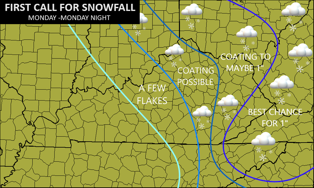
OVERALL THOUGHTS
- This is NOT big deal in terms of snow.
- Most people won’t see any snow on the ground. Areas of the east have the best chance at some very light accumulations.
My snow map from 2 days ago is still in decent shape…
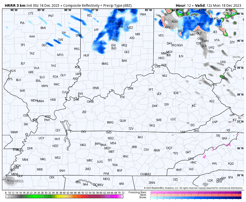
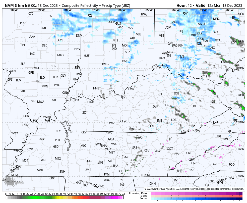
The future radars from the HRRR and Hi Res NAM are pretty similar in showing the snow showers and squalls increasing this afternoon and decreasing later this evening…
HRRR
HI RES NAM
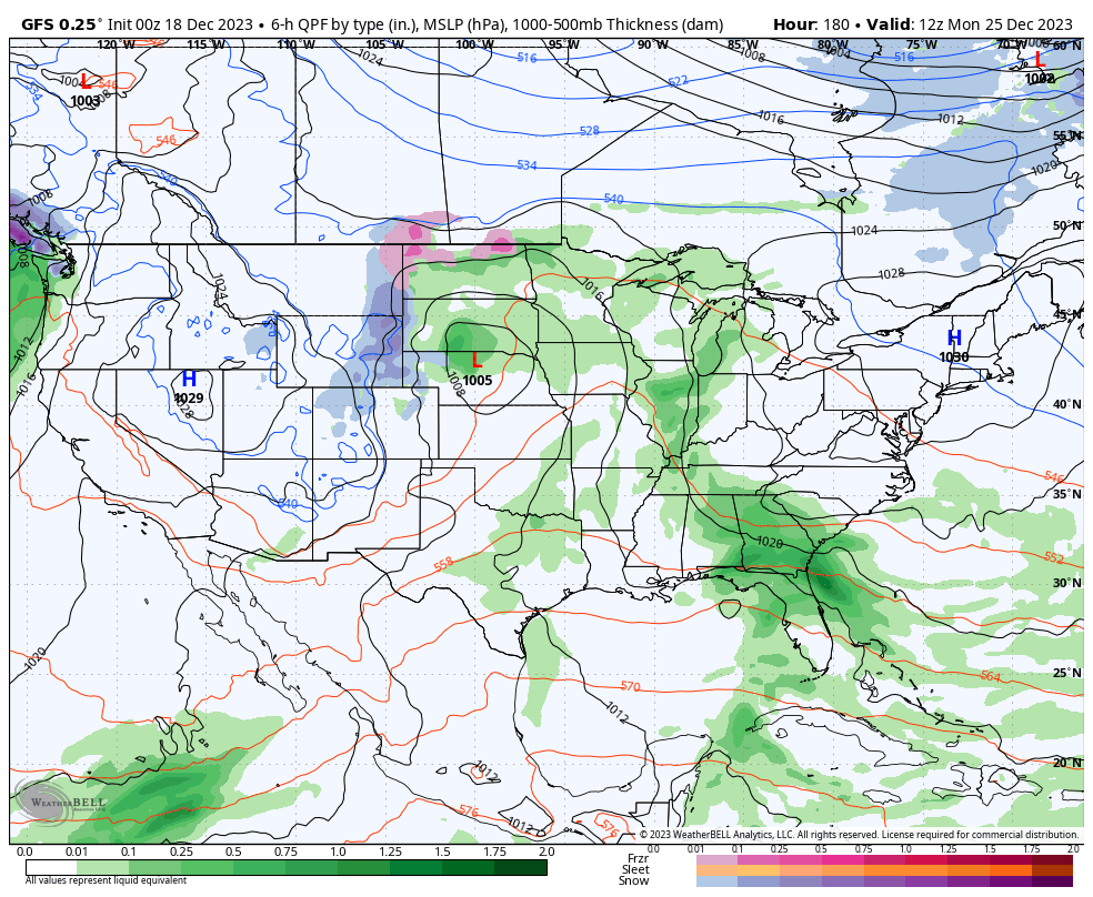
Temps rebound behind this system for the middle and end of the week. That’s when one system makes a run at us with the chance for some showers on Friday as we kick off the Christmas weekend.
A much bigger system then targets the region by Christmas with what looks to be a rainmaker. If you want this to tun into a snowmaker, hope for a much faster moving system because it will likely tap winter weather behind it…
+
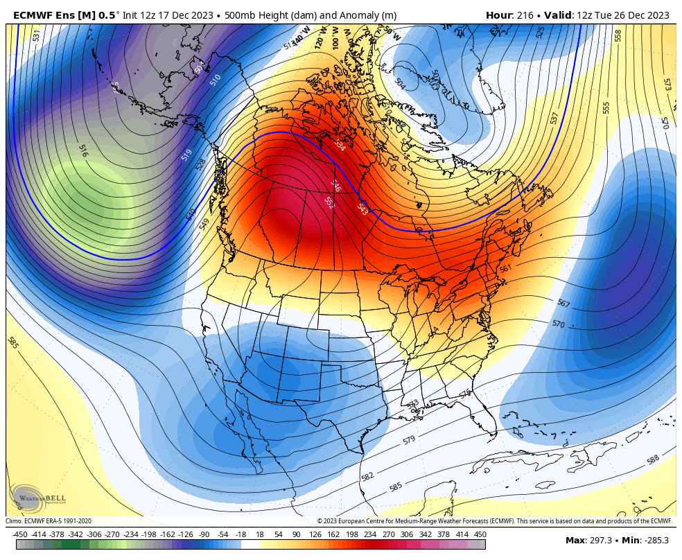
This same look continues to be shown by the ensembles as we deepen the trough in the east to close out the year and usher in 2024…
EURO ENSEMBLES
The Control Run of the EURO Ensembles shows the individual systems a little better…
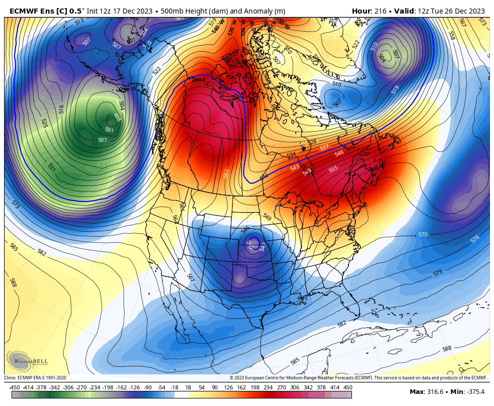
This is a look that can crank out a couple of winter storms across the eastern US.
I will have updates later today. Make it a good one and take care.

Thanks for the breakdown Chris. Have a Great day.
Thanks CB. It will be interesting if we see much snow this winter- especially after last year’s very low near record bar. Again as long as no big ice, or super cold windy weather like last year, all would be good IMO.
I love the snow it just doesn’t last long enough but it has started back. It was so pretty as it fell it came down really good for a few minutes I hope we get some more but the wind is blowing. For a few minutes looked like a whiteout but then stops. At last look it was snowing again but just for a few minutes we are so snow starved in Ky I will take anything. Chris you pinpointed this one perfect especially about the squalls.
Lather, rinse, repeat.