Good Tuesday, folks. A sharp blast of winter weather is in and out of town fairly quickly, but it did give us snow and frigid temps. As we look ahead, we will be dealing with an increase in temps ahead of what may very well be a wet, not white, Christmas.
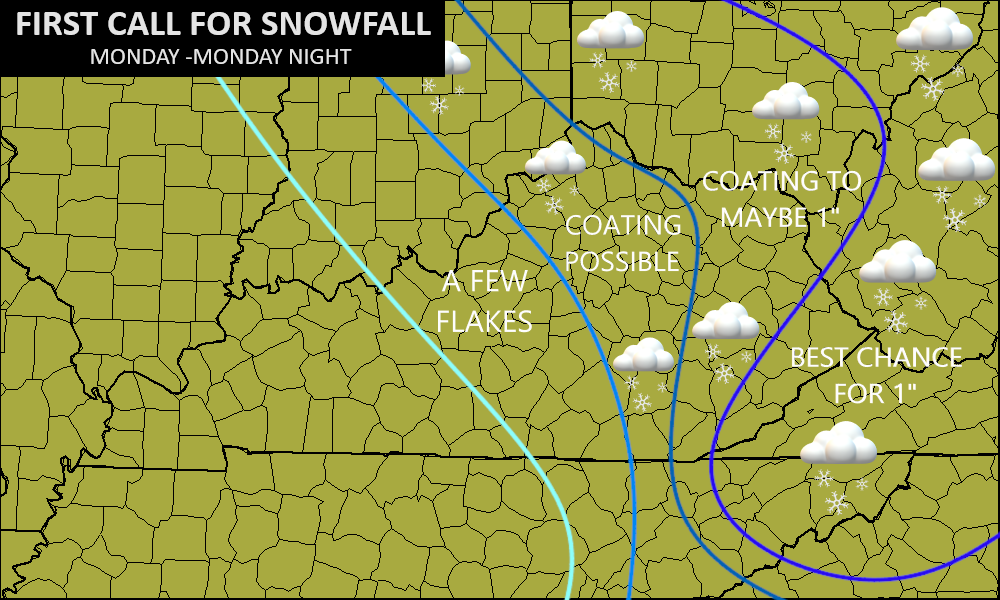
The snowfall forecast map I put out Saturday night worked out pretty darn well…
My Twitter feed has all kinds of snow pics and videos for your viewing pleasure: KentuckyWeather
Some lingering light snow showers and a few flurries are possible across the east and southeast, creating slick roads for several areas. Here are your radars to follow along…

Temps this morning range from the upper teens to low 20s with a wind chill near 10 degrees for some areas. Brr.
Highs this afternoon reach the low and middle 30s in central and eastern Kentucky with 40 in the west.
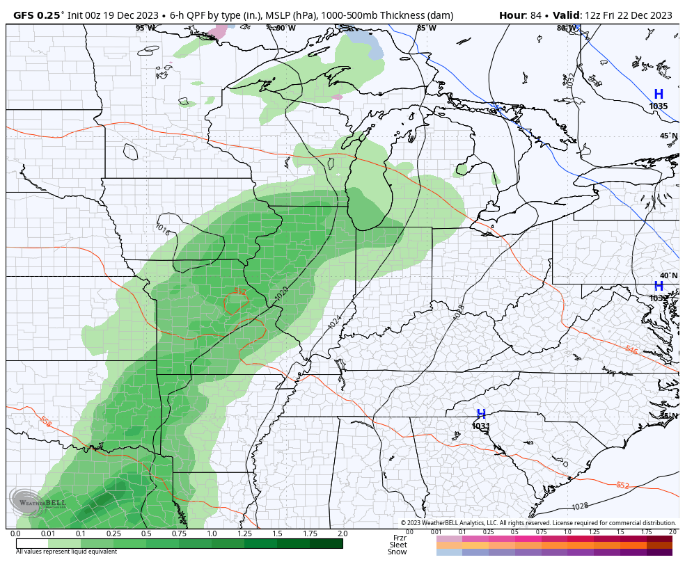
The focus then turns toward the next system moving in late this week a few showers rolling in to start the Christmas weekend Friday into Saturday…
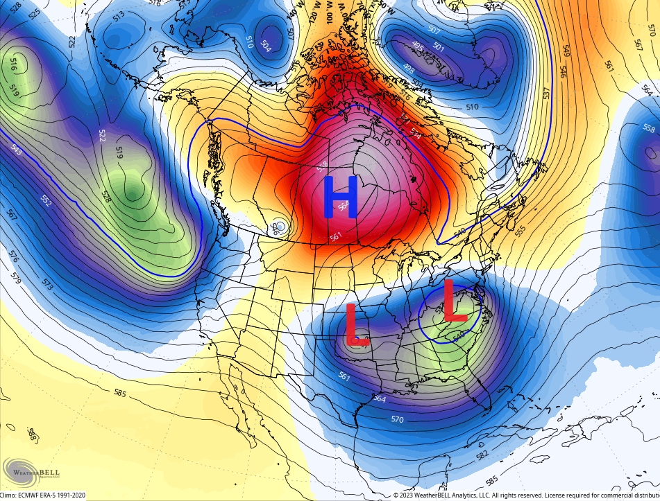
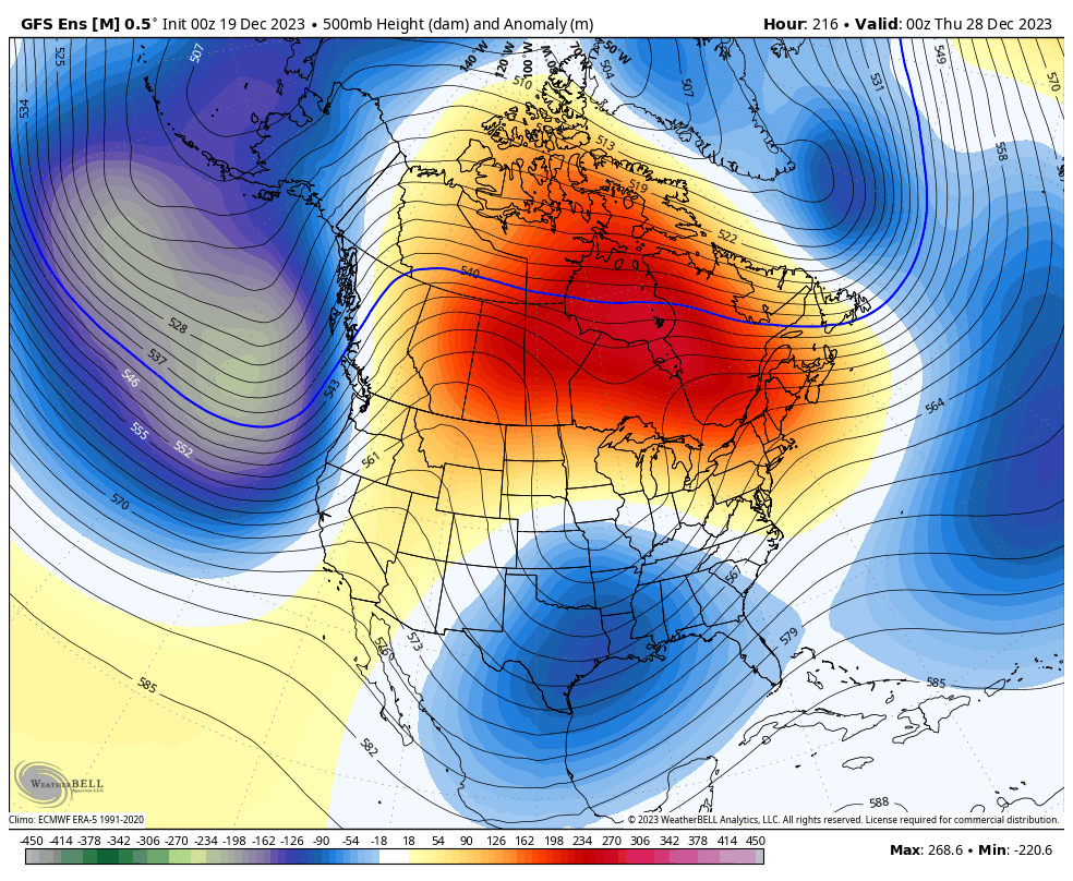
Temps are above normal during this time as we see an overall pattern change settling in. The long range models like the EURO Weeklies first suggested it was around this time we started to see this change take place. Then the ensembles jumped in with the operational models following.
This change sends the greatest height anomalies well northward into Canada with an undercutting jet across the USA. This can fire up some hefty storm systems courtesy of some big cut off systems between Christmas and New Year’s…
The models will spit out some wild solutions with that kind of an upper level look so don’t get to excited with any particular run because I assure you it will change with the next run.
Big cut off upper lows can create some big slow moving storm systems like the ones showing up on the GFS…
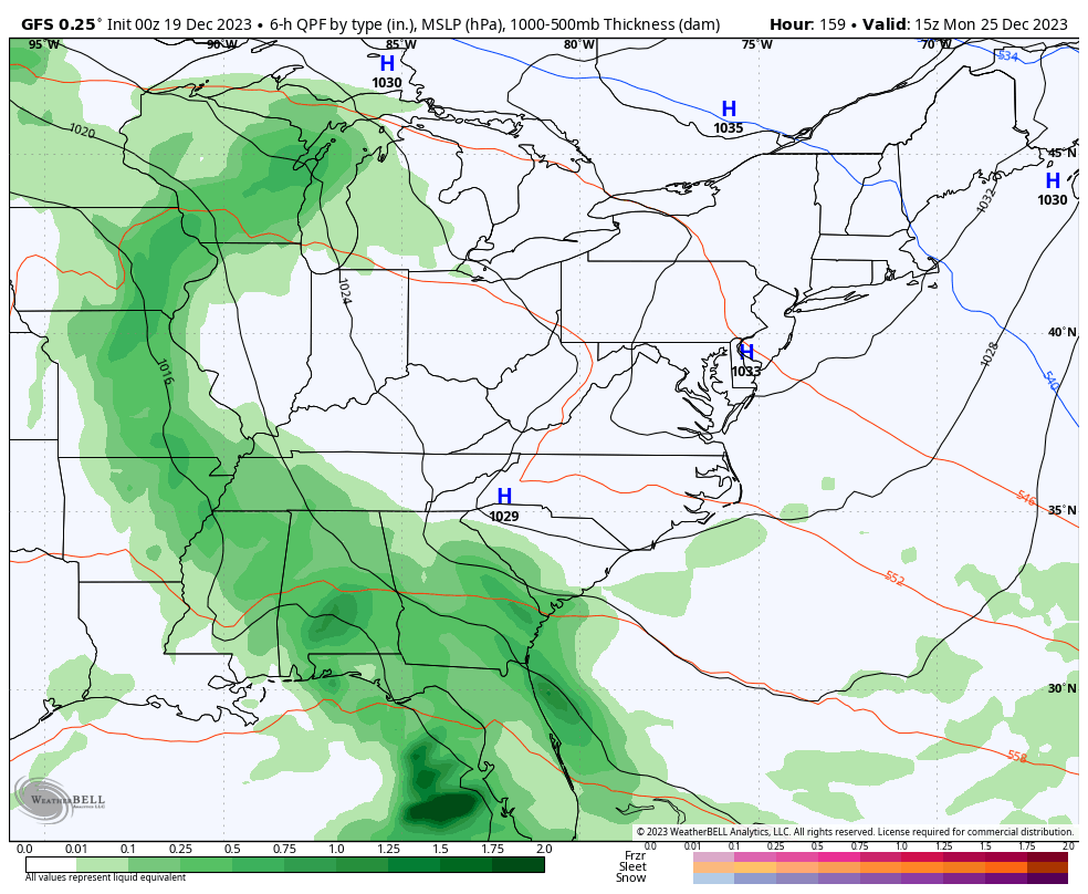
Christmas looks wet and windy with the chance for winter weather coming a day or two after that. This is the beginning of what may turn into a fun winter pattern into January. The GFS Ensembles certainly look the part…
I’ll see you guys back here for another update later today. Have a terrific Tuesday and take care.

It was a relatively cold, blustery day across South Central Kentucky, where there was some very brief, very light drizzle, but as expected there was not a flake to be seen. The winds were cranking, and my PWS just south of Bowling Green recorded a 37mph wind gust during the mid afternoon. The temperature has dropped to 25°F at 2:50 am CST, and it continues to fall.
Sorry no snow Joe. I got some intermittent snow very heavy at times could barely see. Just last a few minutes at a time but I enjoyed it.
You could watch the mesonet yesterday where the snow showers were and see the temps drop…. when a snow shower was hitting southern Fayette the mesonet there would drop to below freezing… Same with the mesonet in north Fayette…
Are they working on the weather station at KLEX? It’s been off for a while last time I checked.
Thanks Chris. We had about 1/2 hour of very light Snow Flurries. Your predictions were spot on. Looking forward to the Mild temperatures for the rest of the week, and hopefully some good soaking Rains later.
Have a Great day Chris !
I am going to a$$ume that a cut off low would be likely to produce its own cold air. if so, we are likely to see some cold rain & wet snow.
Yup, just like I said last week, only cold for the last two days, and a very tolerable and mild December. January will be cold, with February colder.
I wouldn’t be surprised. Several times I’ve seen virtually no winter here UNTIL February and March… 1998 is one year…and…. I forgot what year..2014/15 maybe…. We had two HUGE snowstorms in Late Feb and then 3 weeks later another one in March… I remember one of those snows the temp stayed 12 degrees during the whole thing…I’m trying to remember if we had anything before that at all… Maybe a couple of little snows but definitely nothing major.
Monday was the first day this month that the temperature averaged below normal here in the Chicago area. 16 of the previous 17 days averaged above normal, with the other day exactly at normal.
By Sunday, temps are predicted to be in the 50s here.