Good Thursday, everyone. Christmas is getting closer and closer and our weather just does not look the part. It’s a mild Christmas weekend with a couple of systems rolling our way. The main show arrives Christmas Day with wind and rain, unleashing a colder setup behind it.
Clouds will be rather common out there today with temps ranging from the upper 40s to mid 50s.
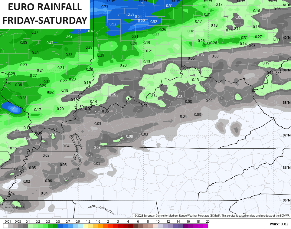
Friday’s temps are deep into the 50s with a local 60 possible for areas getting in on enough sun, but clouds will continue to stream in ahead of a system moving in to start the weekend. A few showers develop Friday night into Saturday. This isn’t a lot of rain with the best chance focusing on the north and west…
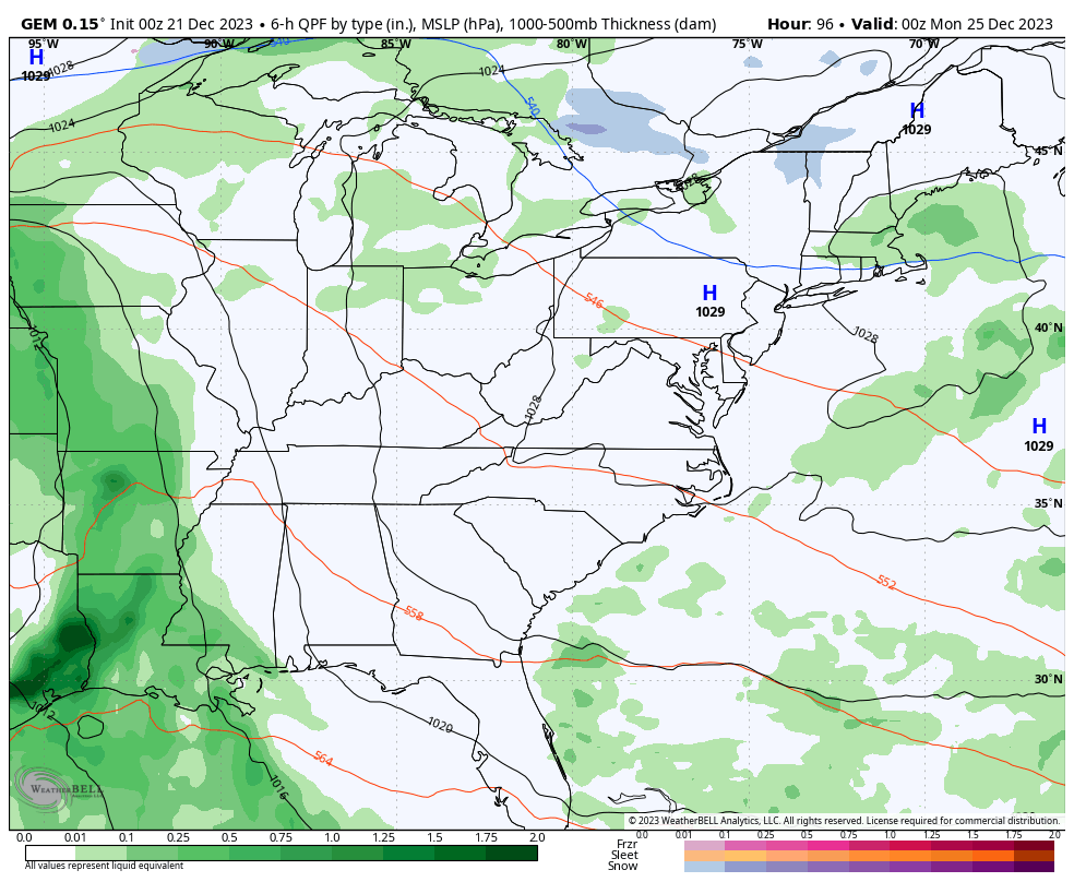
Christmas Eve day is a mild one with 55-60 in most areas. Talk about a stinker!! Clouds will thicken during the afternoon and evening ahead of the system moving in for Christmas Day. This brings gusty showers to the region.
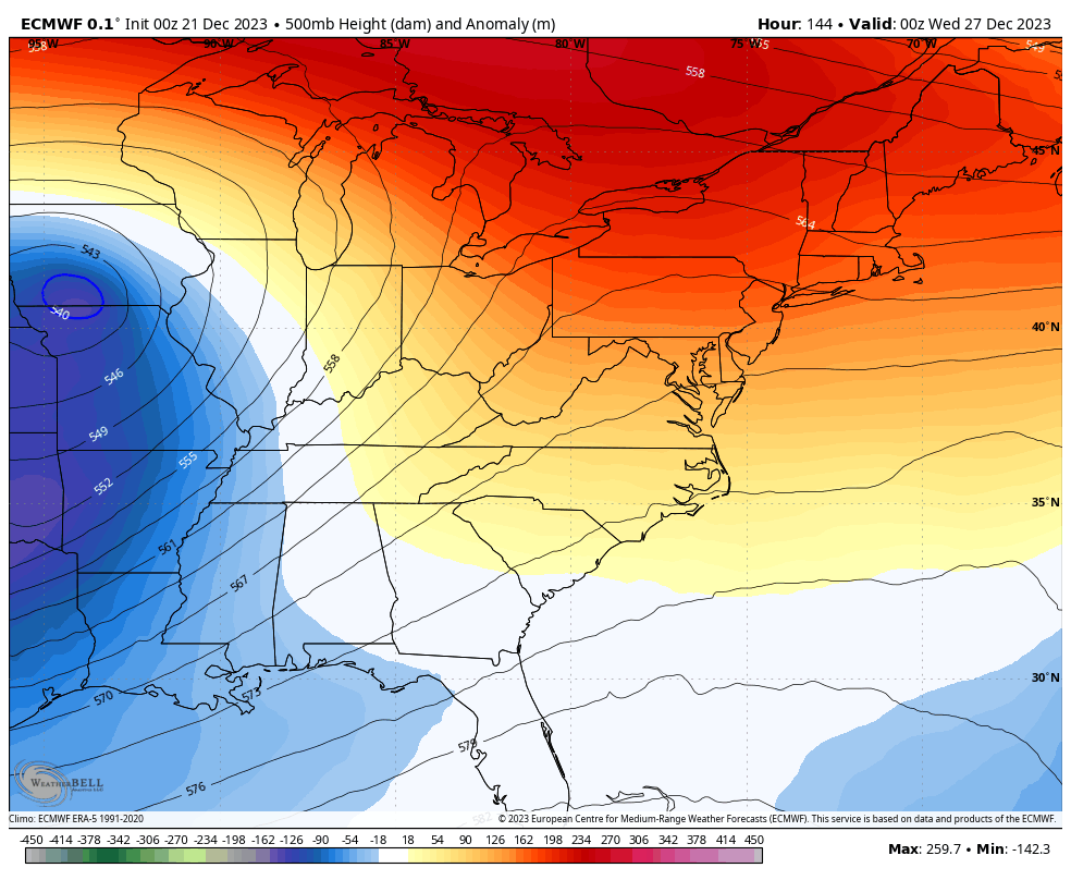
The models are still struggling with how to handle the cutoff systems rolling across the country next week. The EURO is the most consistent with how it’s handling the overall setup of the week. The view from upstairs shows a heck of an upper low/lows in the east…
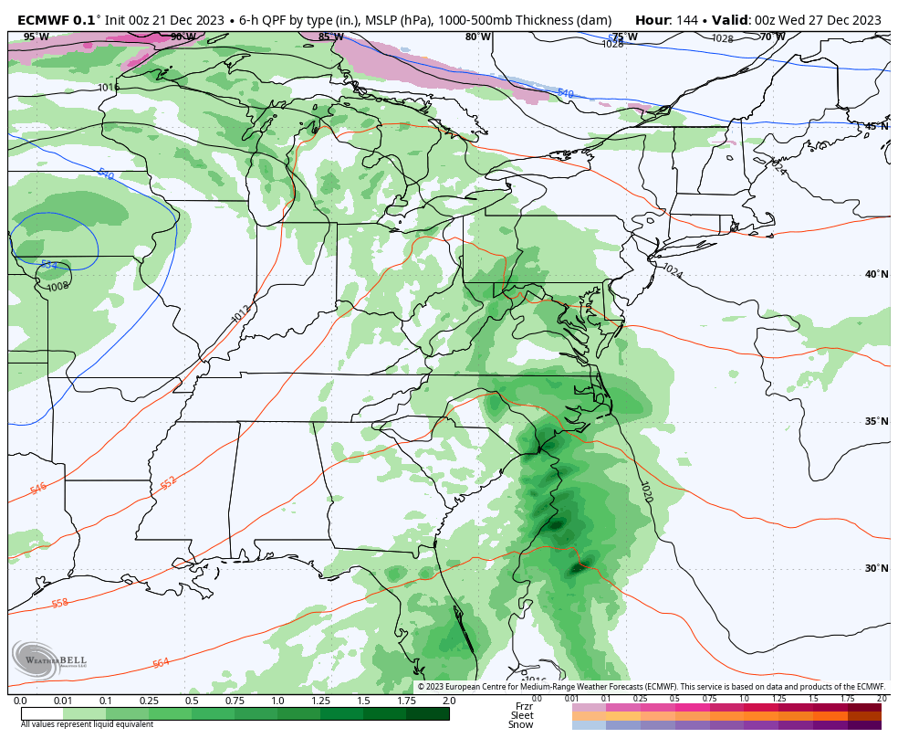
At the surface, we see the Christmas rain followed by the chance for some winter weather coming in behind it…
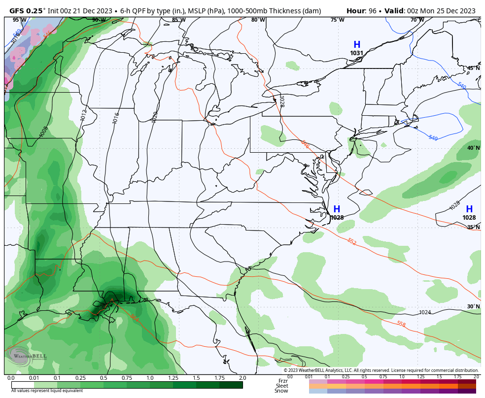
The GFS continues to throw out an entirely different solution with each run…
The Canadian has wet weather for Christmas then a totally different look after that..
As you can see, the models have need to take some self help classes. 😜
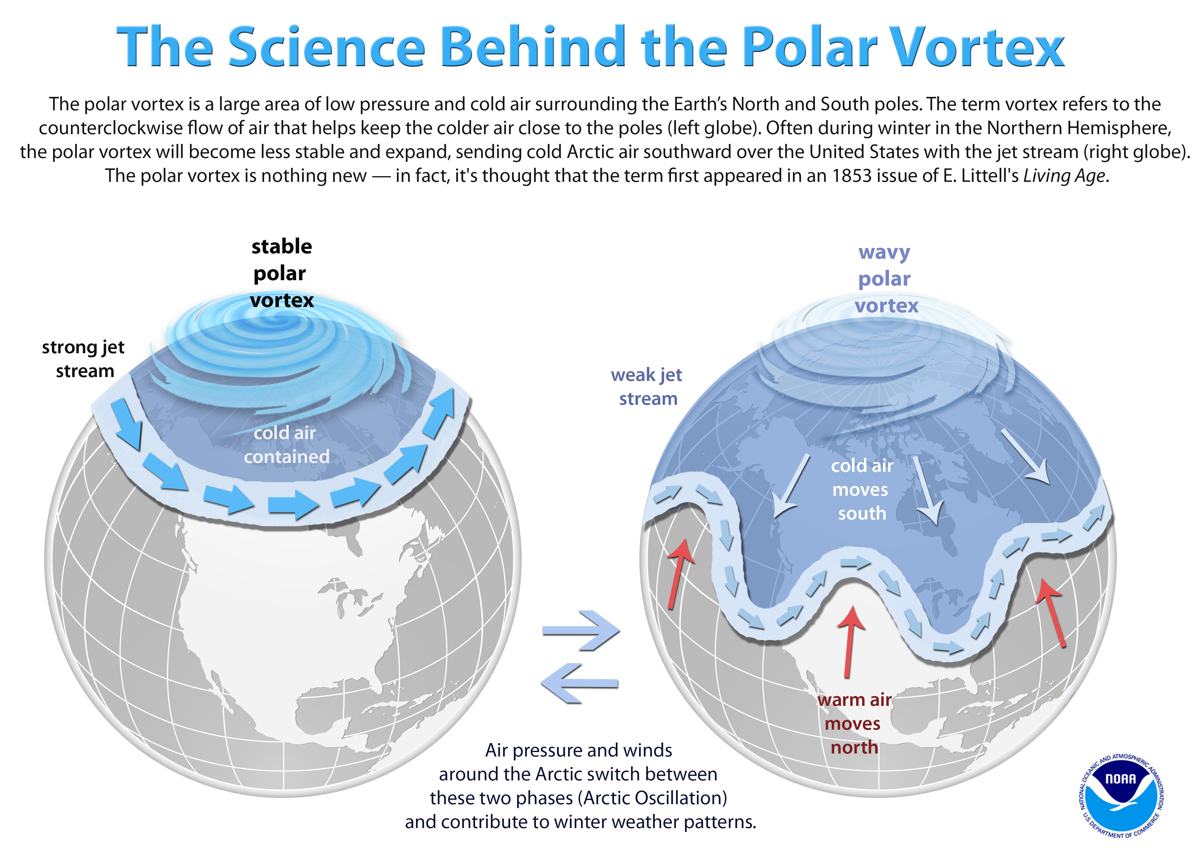
There’s a term you guys may start hearing in the next few weeks… Sudden Stratospheric Warming. The stratosphere is the layer of the atmosphere just above the layer where we live. In winter, it causes the Arctic jet stream to slow and wobble, spilling frigid air and extreme weather south over North America and Europe, often for weeks at a time.
These SSW’s are hard to predict, but one of the charts we look at is the winds way up in the stratosphere. This shows the daily distribution and evolution of mean zonal wind at 10hPa at 60N, essentially the arctic.
Notice the big dip, likely indicating a warming event in the stratosphere…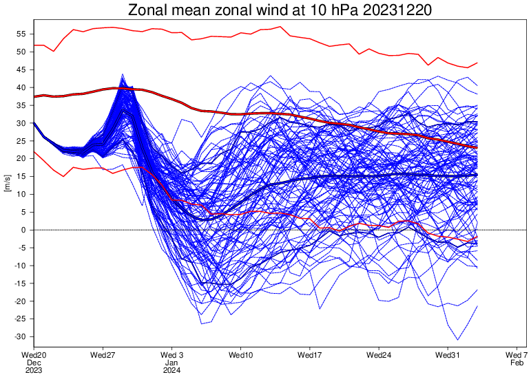
That happens during the first half of January. What does that do? It disrupts the polar vortex and can spread frigid air into North America…
If we can get a true Sudden Stratospheric Warming event, things could get even more interesting in January. That’s still a big IF.
Another update comes your way later today. Have a good one and take care.

If has long been a favorite word for many who choose to make a comment on this site.
December for the most part was warmer than the models (or anyone) predicted.
Chris predicted it would be mild in his winter outlook, to me we had more cold days than warm were I live here in western ky.
Very interesting Blog this morning Chris. While it’s still Mild, I wish we would receive several days of just plain Rain. Have a Great afternoon Chris !
Crystal, here’s the link that explains the formation of Snow Squalls :
https://search.yahoo.com/yhs/search?hspart=litmus&hsimp=yhs-inboxzone&type=1470475-vsub-ext01&p=What+causes+Snow+Squalls
Thank you very interesting
MJO predicted to cooperate, for about 10 days
Betting we get something big, or little to nothing again this winter. If big, no ice please!