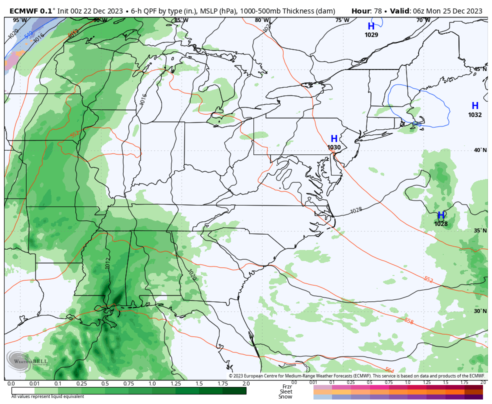
Good Friday to one and all. The all-important Christmas weekend is kicking off with mild air as we track a few showers into the picture. These showers linger into Saturday with a bigger system lurking for Christmas Day before we change it to winter.
Temps today are in the 50s area wide with a mix of sun and clouds. A few showers move into the north and west at some point later today with the best chance of showers coming late tonight into early Saturday.
The models show the best chance for showers being in the north and west with very little in the south and east…
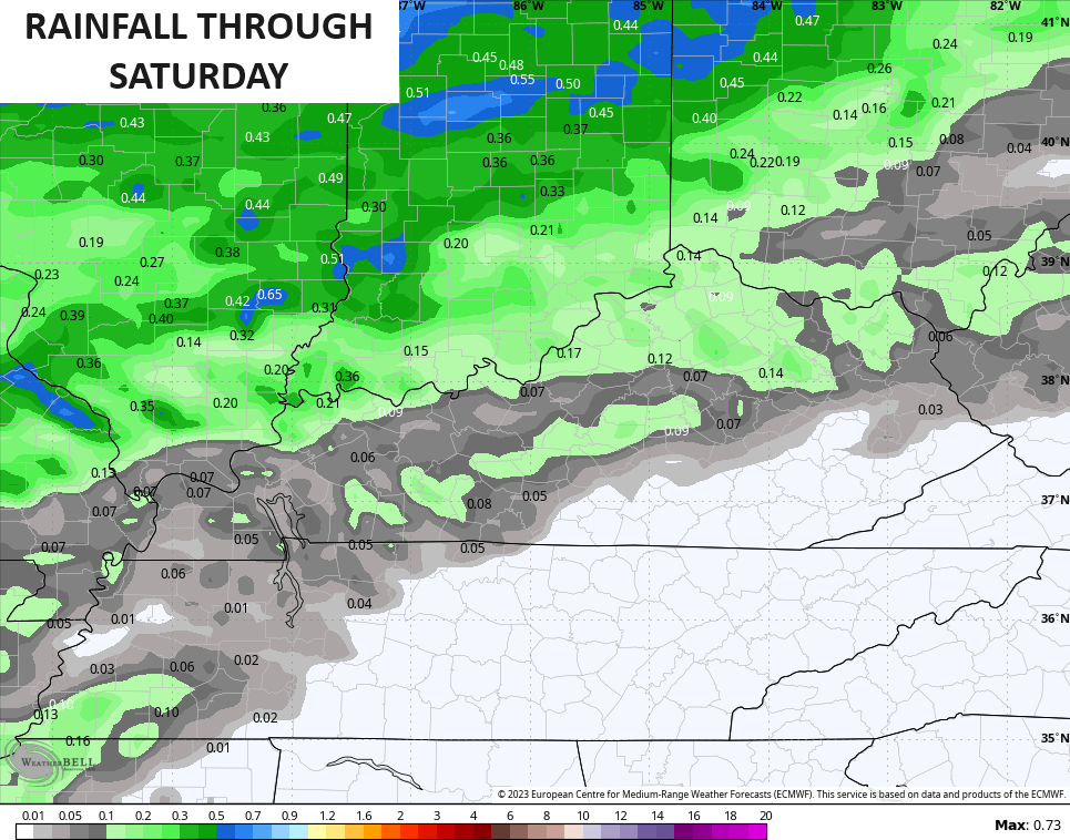
Here are your radars to track the showers from the west…

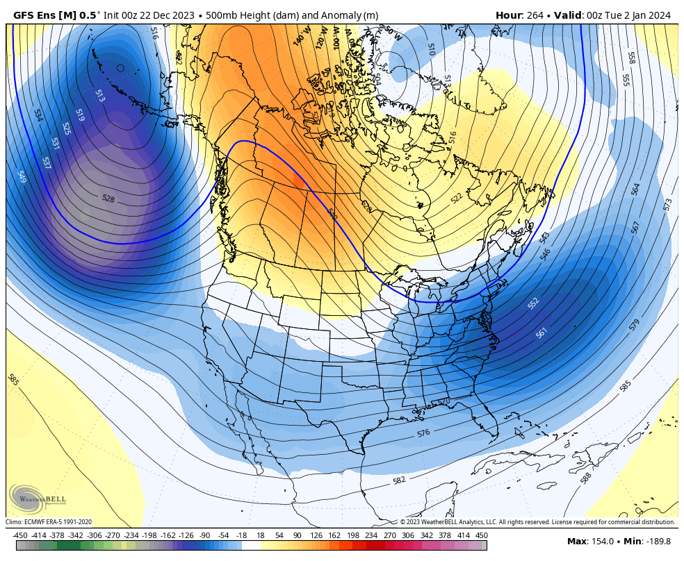
I have no changes to the upcoming pattern and the models are seeing it better and better as we get closer. The blocking in Canada forces slow-moving big upper level systems coming underneath it across the USA. These can grow pretty potent…
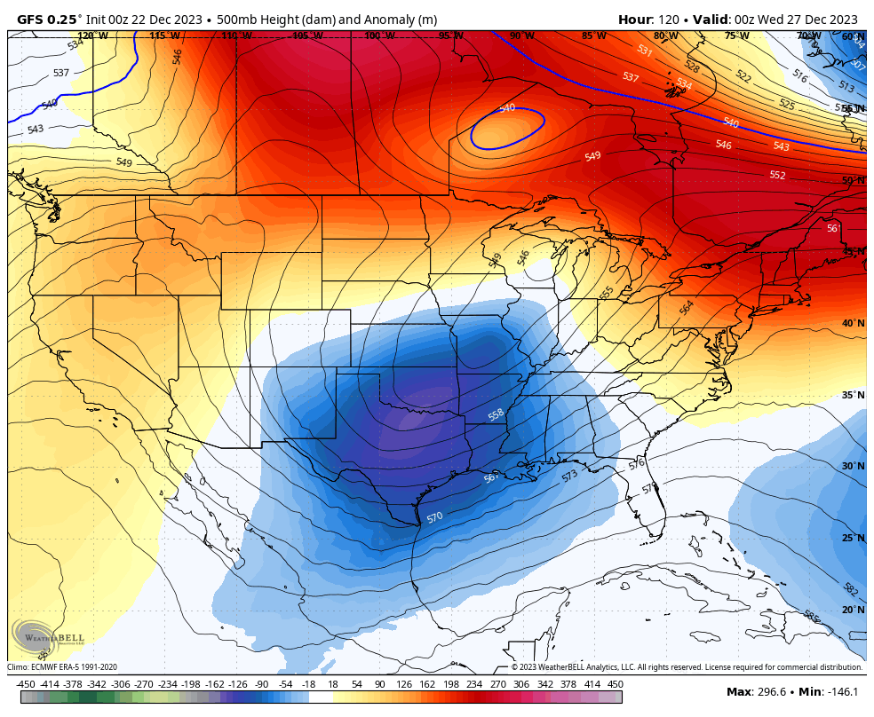
Here’s the GFS from the day after Christmas through the start of 2024…
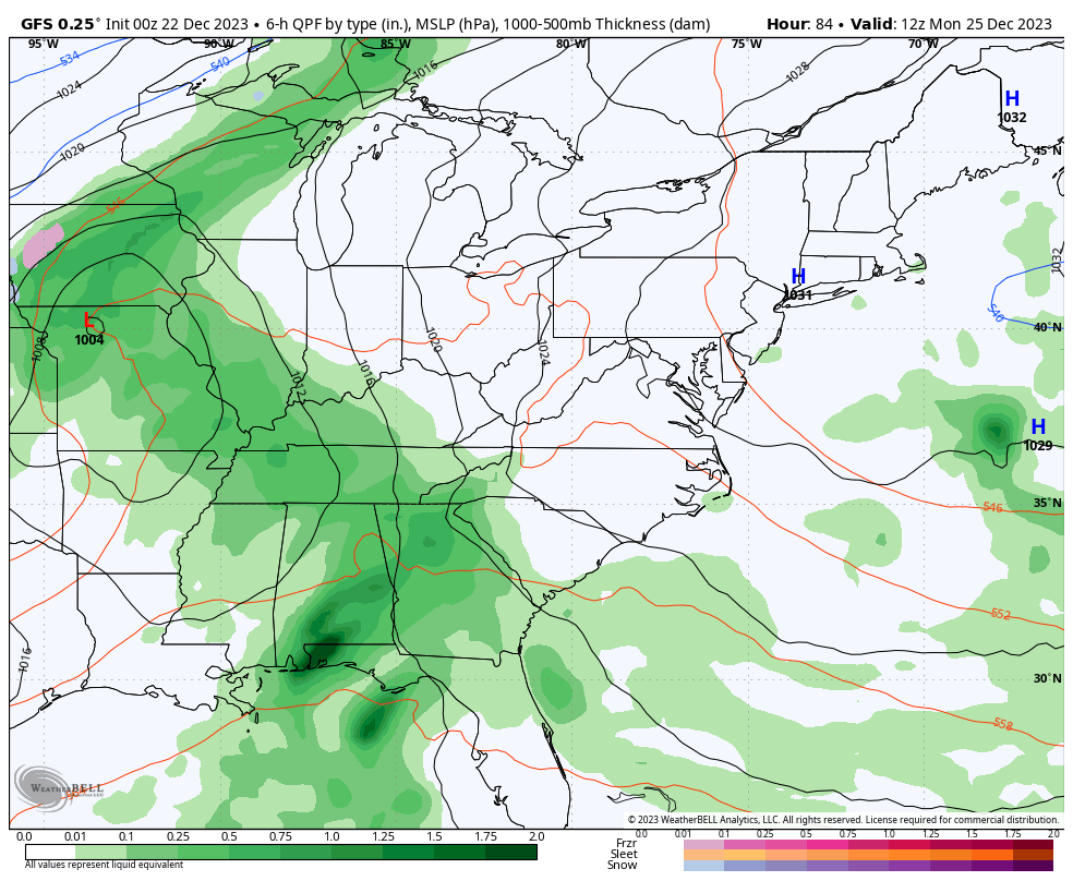
The GFS is slowly coming back around to seeing more winter weather threats…
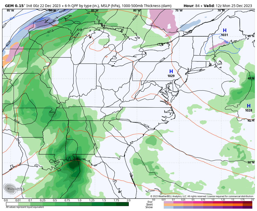
The Canadian is seeing the same…
The EURO appears to be having some upper air issues with this run, but you can still see what we are dealing with…
Once into 2024, the setup looks cold and active with several winter storms likely crossing the country during the first half of January. The GFS Ensembles certainly show this potential…
I’ll swing by with another update later today. Have a fantastic Friday and take care.

Thanks Chris. Hope the Rains predicted on Christmas come about. Too bad it’s not accumulating Snow. Sad for the Snow Lovers out there. Maybe later, but we seem to be ” kicking the can down the road ” with that weather type.
Have a Great day Chris !
Thanks CB! It is what it is!
Still seems no middle ground this winter. Either we have a low wimpy low bar total like last winter, or something big. Question could be what precipitation would the “big” be… Good luck figuring that out! Ho Ho Hoooooo!
It’s going to be in betwern.
NOAA’s outlook for ( JFM ) subject to change, but they been having a good track record. The outlook for this past Autumn ( SON ) was Spot On. Here’s the Link :
https://www.cpc.ncep.noaa.gov/products/predictions/long_range/seasonal.php?lead=1
The Southeast Ridge seems to be stronger this year as the best Rains keep going around us, Look at the radar. This has been happening way too often.