Good Saturday, folks. It’s Christmas weekend but someone forgot to tell Mother Nature as our weather is anything but Christmas-like. Hang tight winter weather lovers, we are ready to lock in a winter pattern shortly after Christmas. 😁🥶❄️
The current pattern is a far cry from what we were going through one year ago today. The Ohio Valley winter storm/blizzard was rolling through the region unleashing snow and high winds…
Closest thing to a blizzard right now in Lexington. #kywx pic.twitter.com/VCWDofNrAp
— Chris Bailey❄️🥶 (@Kentuckyweather) December 23, 2022
That would usher in 2 days of below zero temps and wind chills in the -30s.
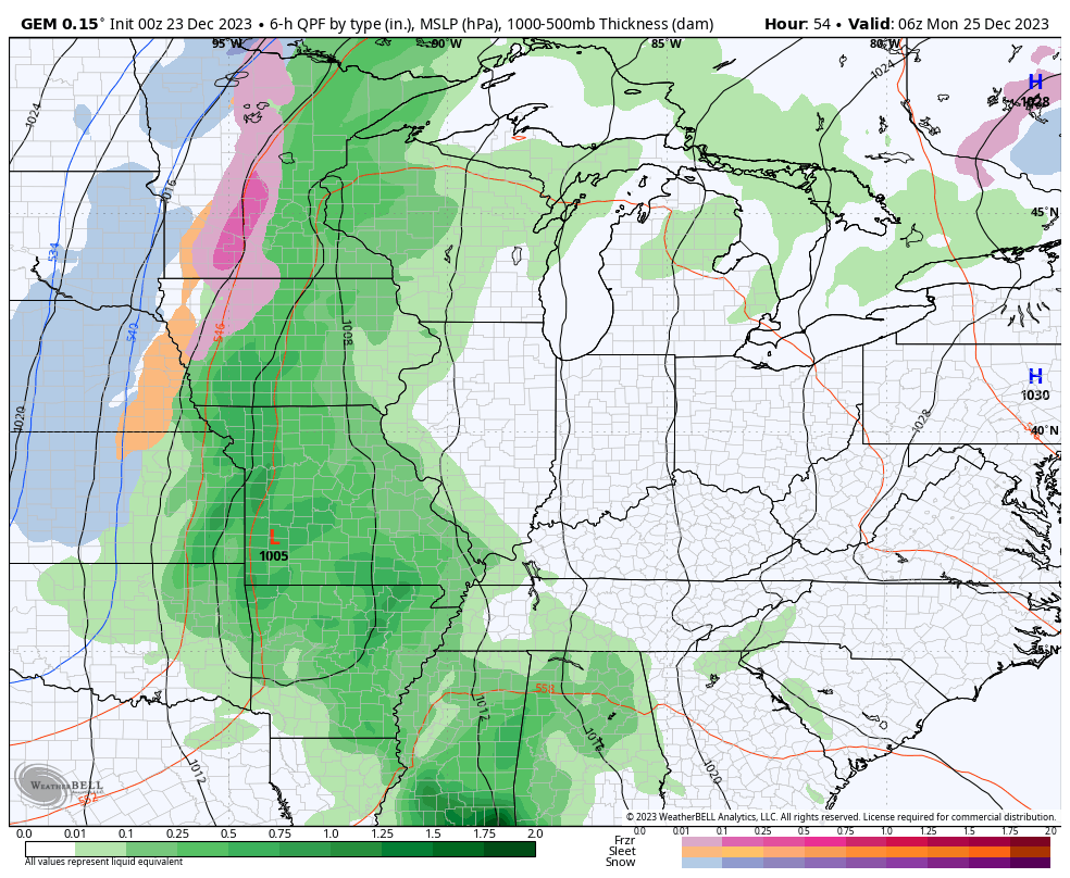
Let us begin with today and hit the fast-forward button. Highs are deep into the 50s once again with a few showers showing up from time to time. This is not all day stuff by any means and not everyone sees showers. The greatest threat is in the north and west and your friendly Kentucky Weather Center radars are on duty to help you out…

Winds are also a little gusty out there today.
A lingering shower is possible early on Christmas Eve Day as temps reach 60 or a little better in many areas.
Christmas Day is windy and very wet with rounds of rain rolling through here as low pressure spins just to our west. Winds may gust to 30-35mph at times with many areas picking up .50″-1″ of rain through Tuesday when the rains slow down…
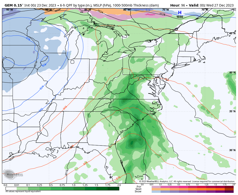
Temps crash from west to east Tuesday as the upper level low spins in and slows down into the middle and end of next week. Little impulses will be rotating around this, bringing light snow chances to the region right on into New Year’s Weekend…
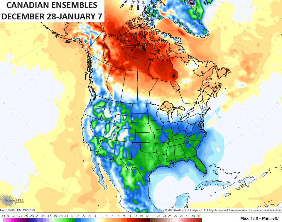
That’s a much colder than normal setup taking hold for a large chunk of the country and this is centered across the south and southeast to start. That big block going up in Canada has staying power and that means the jet undercuts it across the United States. This animation shows the forecast temp departures from normal from the day after Christmas through New Year’s Day…
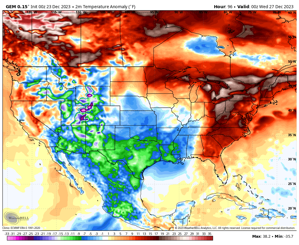
Notice all the above normal temps in Canada as temps across the USA grow much colder than normal.
Once into the first week of January, we find the deepening trough doing some work across the country with increased blocking showing up from Greenland to Alaska…
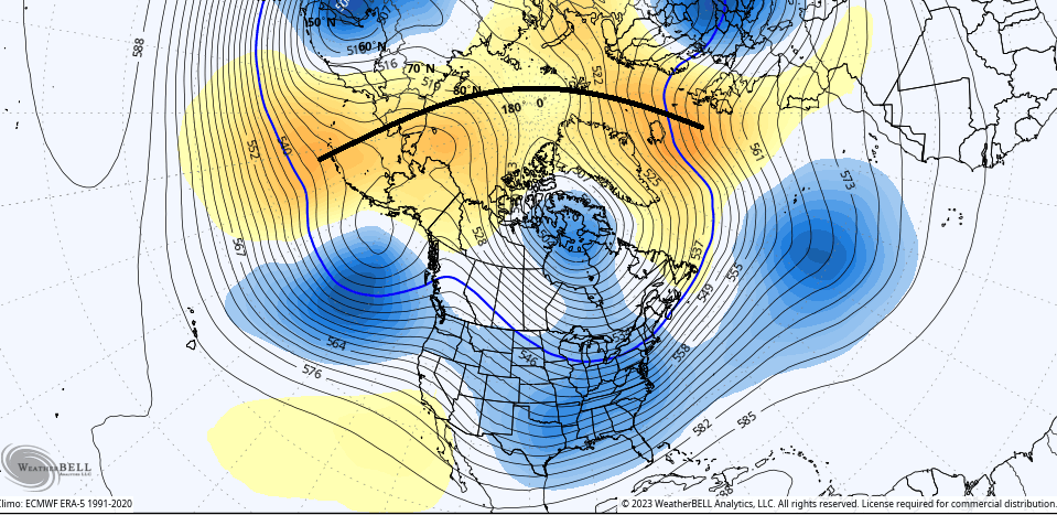
Check out the temp anomalies over a 10 day period from the Canadian Ensembles…
Warmer than normal in Canada and colder than normal in the US of A.
I fully expect snow chances to show up over this time as well. Light snow chances are with us late next week with a greater threat for snow systems during the first week of January.
The ensembles are starting to pick up on the snow chances over the next 2 weeks…
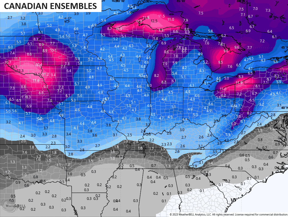
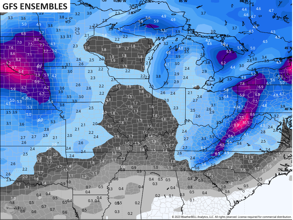
Reminder: Those are just the averages of more than 20 different members of each model.
I’ll drop by later today for another update. Have a good one and take care.

Thanks Chris and Merry Christmas to you and your Family. That Blizzard in Lexington last year was one of your bold predictions in November 2022. I’m really confused about how this Winter will turn out. Doesn’t seem like anything is coming together to change this temperature and precipitation pattern.
I think there will be plenty of cold air this winter.
How much moisture will be available? Is the wild card.
whatever it is, I don’t think it’s the southeast ridge keeping moisture west of here because east and south of here they’ve been getting plenty of rains…South GA, SC, NC, up to New England.
The winter solstice was just two days ago…
Mets say winter starts Dec 1st but mother nature says it’s starts Dec 21st
What do you mean Schroeder? Look at the teleconnections. The EPO is about to be negative, the PNA is about to be positive, and the AO and NAO are about to be slightly negative to neutral. Plus with the MJO going into phase 8, 1, and 2 we have about everything we need for cold. Oh and the polar vortex will be weakening and splitting as well. Even a negative EPO lets artic air down in the South East. There’s not a whole lot more we can ask for in this set up coming up.
operationals have found the cold, no idea if that last but it’s different.
One year ago today, the high temperature at Chicago’s O’Hare Airport was 1 degree below zero, with a low of 8 below zero, and a wind chill between 30 and 38 below zero. There was only around an inch and a half of snow on the ground though.
This December is on track to be one of the warmest and least snowiest on record for the Chicago area. The month so far has averaged nearly seven degrees above normal (which will only go up for the next several days), with a pitiful 0.3 inches of snow the entire month. Heck, we had more snow on Halloween (0.9 inches) than we’ve had the whole month of December to date!