Good evening and Merry Christmas Eve! It has certainly been a a mild holiday across the region and we continue to track rain and wind for the big day on Monday. Beyond Christmas, look out… I’m even more pumped up about the winter pattern locking in.
In the short term, rain increases from the southwest tonight and will engulf the region Christmas Day. Winds will also be gusty and may reach 30mph-40mph at times. Here are your Christmas Eve radars to track the rains into the Commonwealth…

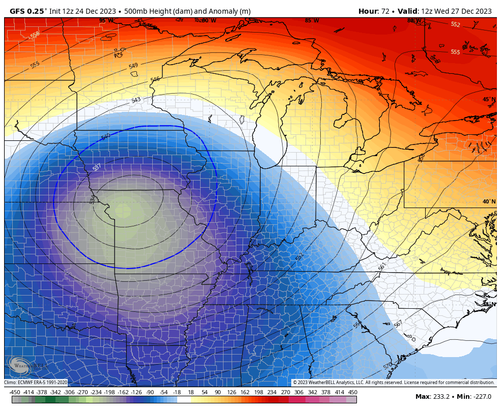
Showers and gusty winds continue into Tuesday as colder air seeps in slowly from the west. This sets the stage for a bigger temp drop from west to east on Wednesday as a bowling ball of an upper low spins through the region.
Along and north of the track of the upper low is where to watch for a thumping wet snow. Yes it rhymes, but it’s also something for us to watch by Thursday and Friday…
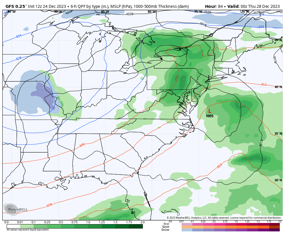
The GFS shows the thumper potential for parts of the region…
So does the Canadian…
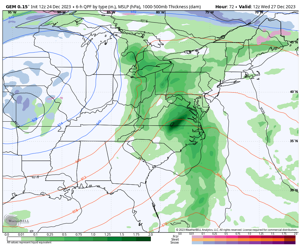
This one is getting more of my attention, folks.
The setup after that and into the first week of January is loaded with potential. An active southern storm track will combine with increasing cold shots to make for a lot of winter weather threats across the country.
We are also seeing the models reacting to the Sudden Stratospheric Warming event. This ups the ante on some significant winter weather for the country through January and into February.
I’ll go into that later tonight and Christmas Day. You guys know the weather never stops and neither do I. Kentucky Weather Center is almost 16 years old and I’ve never missed a day of updating this site.
Since we can’t have a white Christmas, how about we enjoy some White Christmas…
Merry Christmas Eve and take care.

Sure is nice to be tracking snow again 🙂
For sure!