Good Saturday to one and all. Periods of light snow and flurries continue through the region today and we have another system due into town to kick off the brand new year. This is the start of a very wintry setup that threatens to turn harsh as we roll into January.
Coatings of light snow may start the day across parts of central and eastern Kentucky as the current flake maker slowly moves away. Snow showers and flurries will begin to fade this afternoon with highs in the 30s for many.
Here are your Saturday flake trackers…

A clipper moves through here quickly on Sunday and brings another round of snow showers and flurries. The HRRR is the fastest with the passage of this front and you can see the snow showers going up behind it Sunday afternoon and early evening…
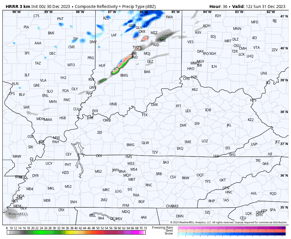
The Hi Res NAM is a little slower and slightly less pronounced with the snow showers on this animation that goes through 7am New Year’s Morning…

A few snow showers and flurries would continue into New Year’s Day, especially in central and eastern Kentucky.
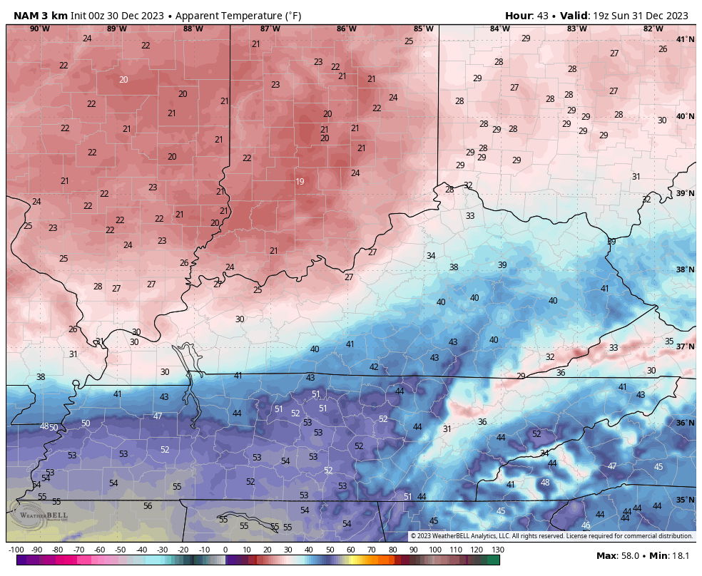
In terms of temps, the numbers on Sunday spike into the 40s ahead of the front then quickly crash through the 30s behind it. Gusty winds are a big issue as well, creating wind chills in the upper teens and low 20s by the time we hit midnight. Watch how quickly the wind chills drop from Sunday afternoon until the clock strikes midnight…
Following this, we have two potential storm systems to track from the middle of the week into next weekend. I say potential storm systems because the models continue to figure out how to handle any potential interaction between the active southern storm track and the northern branch of the jet stream. The more these two decide to play together, the better the odds of some winter weather around here.
The first system of interest is in the Wednesday-Thursday time frame with the second arriving a few days later by next weekend.
The Canadian Model has had the hot hand of late and it’s currently showing the greatest potential of winter weather around here from both of these systems…
The GFS is close on the first one with only some light snows and has a little better signal with the second system…
The EURO had been leading the charge on those systems, but the latest run looks to be having issues with the energy coming out of the southwest. This is a common bias of the EURO, but the model seems to be developing other biases, too.
I will have updates later today. Have a great Saturday and take care.

Thanks Chris for the update. Confident on near normal temperatures next week, but low confidence on Precipitation.
Enjoy your Saturday Chris.