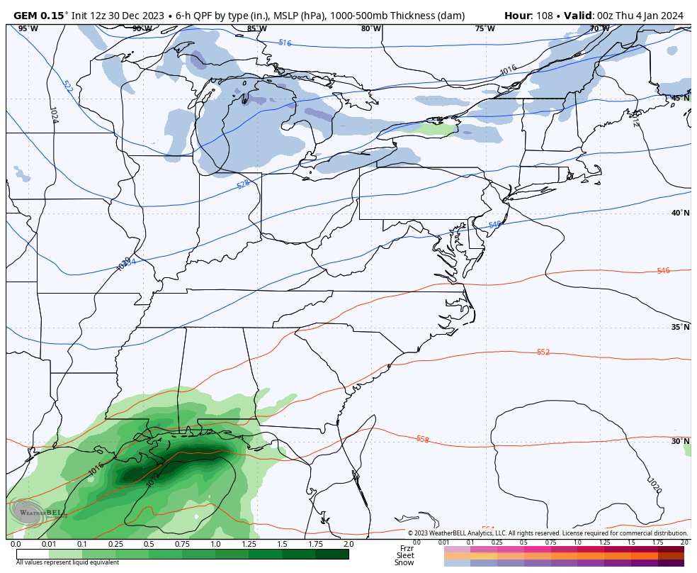
Good evening, everyone. Our brush with winter weather is slowing down but another is on the way as we kick off the brand spanking new year. A cold front brings light snow and snow showers in here as we watch an active winter pattern taking shape down the road.
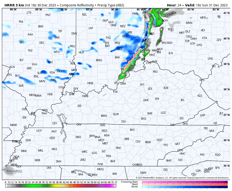
A New Year’s Eve cold front dives in from the north and has a narrow band of rain and snow showers along it with snow showers coming in behind it. Those continue on and off into New Year’s Day and can put down some hit and run coatings across central and eastern Kentucky.
The future radar from the HRRR shows all this well from 1pm Sunday through 1pm Monday…
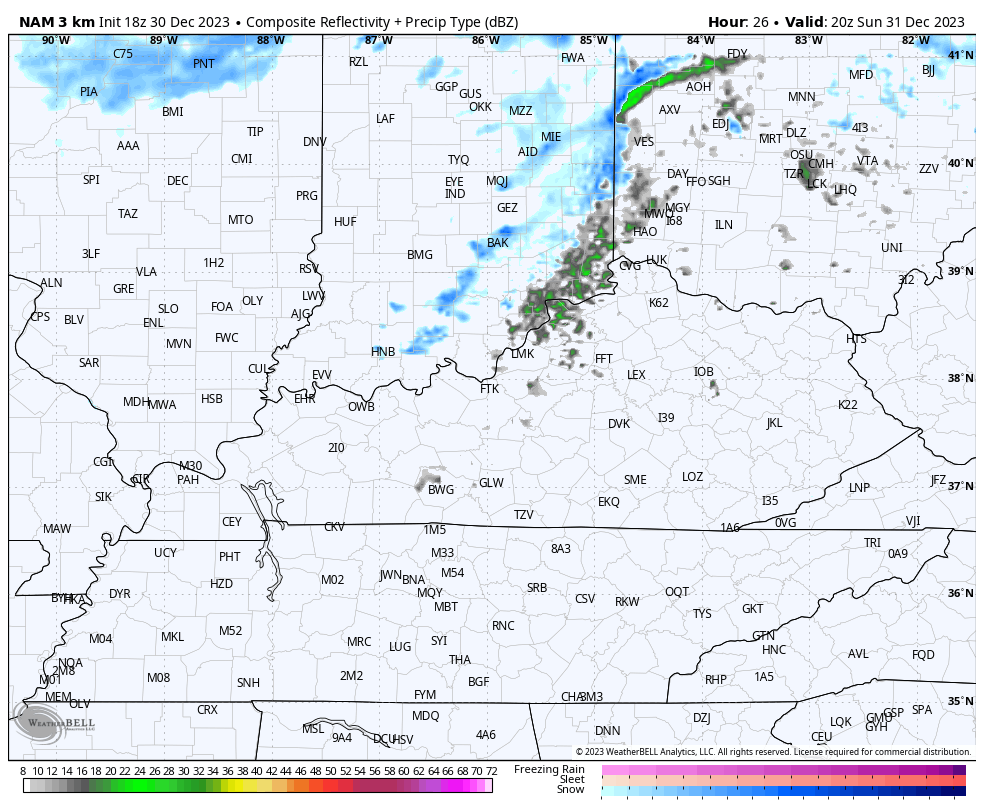
The Hi Res NAM goes all the way through Monday evening and keeps a few flakes going through the first evening of the New Year. Here’s the Hi Res NAM…
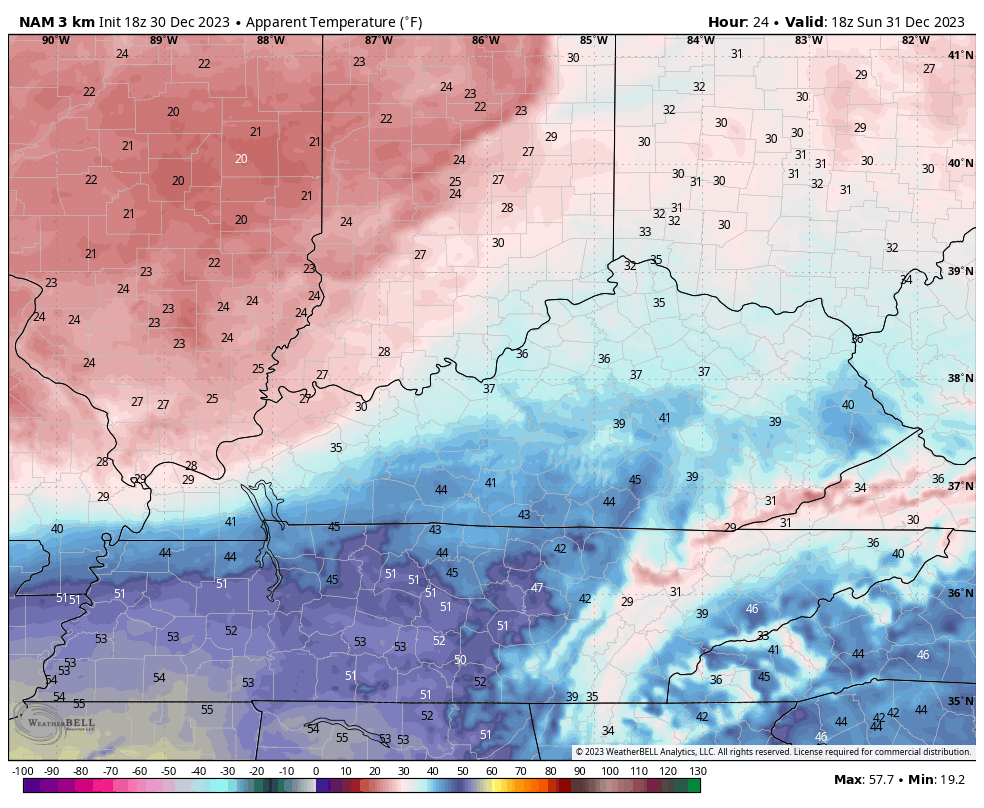
Temps spike into the 40s ahead of the cold front on Sunday, then crash through the 30s right behind it. Winds will also be gusty and this gives us wind chills in the 20s with some upper teens by the time the clock strikes 2024…
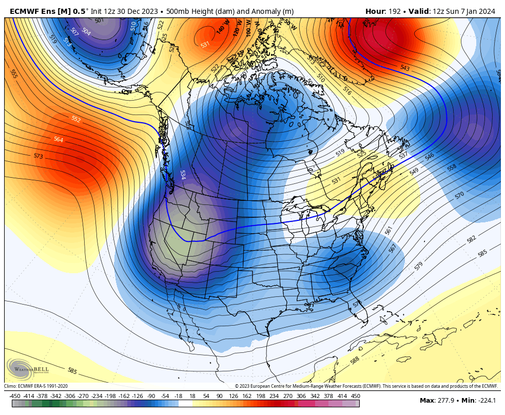
The models are still trying to figure out how to handle the active southern storm track and troughs digging in from the northern branch of the jet stream. Can we get some interaction between the two? That’s the big question on both our systems with the first coming late Wednesday and Thursday, and the next coming a few days later.
The GFS overwhelms the first system with cold air and some flakes, keeping it well to the south. It then cranks out a complicated storm system for the weekend…
The Canadian isn’t as enthused on the interaction potential as earlier runs…
After these systems roll through, we find arctic air getting involved in the pattern for the first time this winter. The pattern going into the second week of January is loaded with monster blocking going up across Greenland and into the North Pole. That allows the arctic air to spill into the western half of the country before essentially taking over the rest of the country…
Have a great evening and take care.
