Good Sunday and Happy New Year! It’s the final day of 2023 and we are tracking a cold front into the region. This blows in with colder air and a few snow showers and flurries for New Year’s Eve and New Year’s Day.
Before this front arrives from the northwest, temps spike into the 40s across central and eastern Kentucky through early afternoon. 50 is possible in the south and east. This cold front then sweeps in here this afternoon and evening and may have a broken band of rain and snow showers ahead of it. Behind it comes a few snow showers and flurries that will linger into New Year’s Day across central and eastern Kentucky.
Here’s the HRRR Future Radar from 4pm today through 7pm Monday…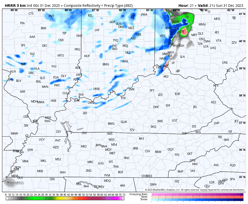
Your friendly Kentucky weather radars are her and on duty for the closing hours of the day…

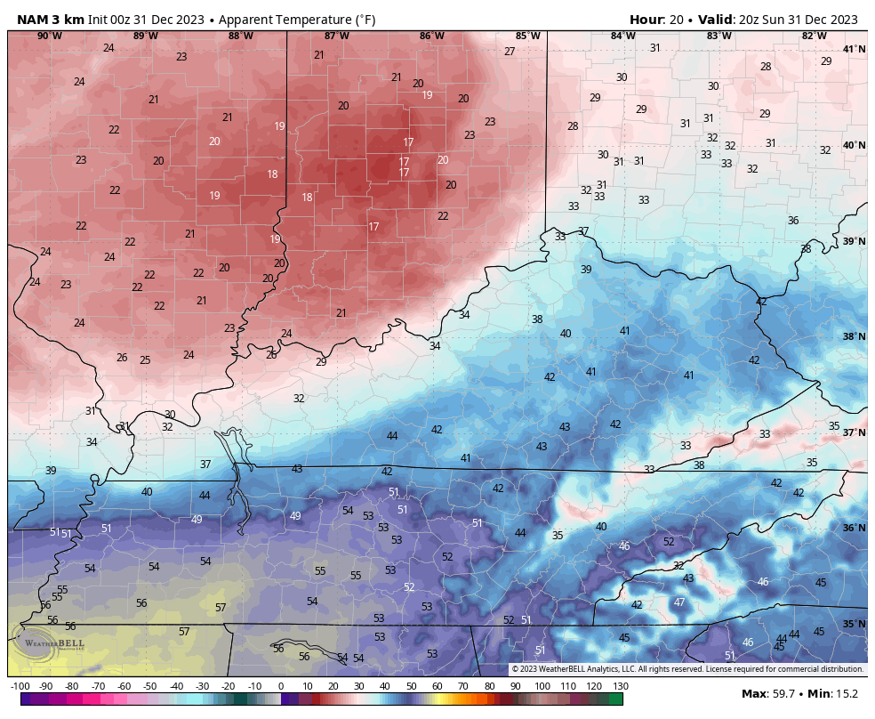
Gusty winds will combine with crashing temps through the 30s to create cold wind chills with upper teens showing up as the clock hits midnight and we usher in 2024…
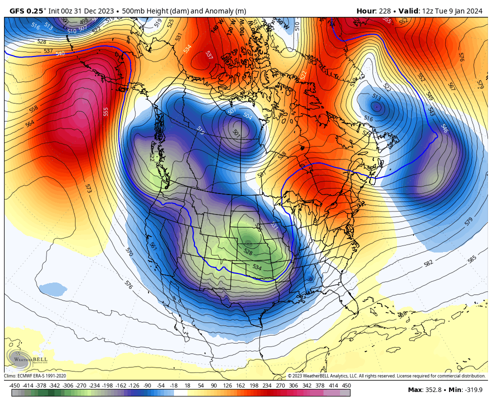
We have to watch the setup from Wednesday through next weekend as we follow two southern stream storm systems and how they may or may not interact with the northern branch of the jet stream. The firsts system to watch is Wednesday into Thursday with the second one coming next weekend.
The Canadian is back to showing a little better connection on the first one and a farther south and east tracking second system…

The GFS has a much colder push with this first system, keeping the storm system far to the south. That cold air brings some light snow in here. The second system on the GFS looks all kinds of funky with the bias of the GFS putting too much emphasis on the northern low. Watch for the model to trend weaker with that and stronger with the southern system…
The pattern after this is one that can turn rather nasty for much of the country as arctic air gets involved. Don’t pay attention to individual runs showing storm tracks as they will all trend east in time.
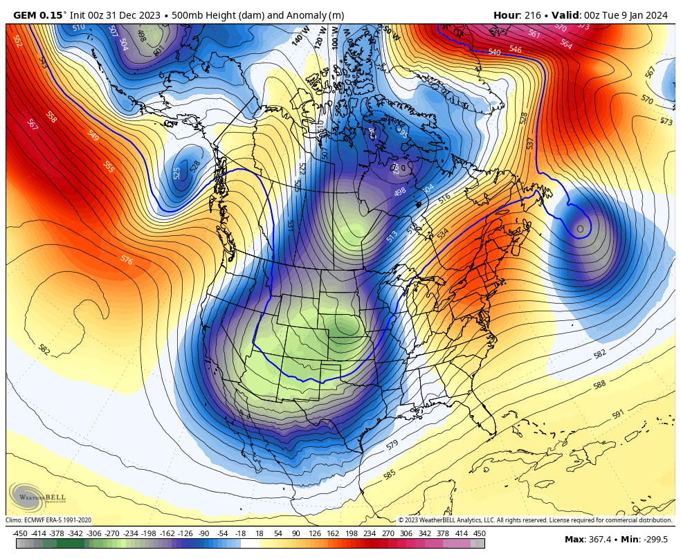
This is a full blown trough with arctic air at showing up on the Canadian…
And on the GFS…
This is a pattern that can go to the extreme with arctic air and an active southern storm track.
I will have another update later today, so check back. Have a Happy New Year’s Eve and take care.

A very Happy and Prosperous New Year to you and your Family Chris. What I can say about the upcoming Weather is that there is no indication of a change in the Precipitation Pattern. Temperatures remain about normal however. Split Flow and Ridging in the Atmosphere makes for a very boring Weather Pattern. Reminds me of the Weather Pattern in 1988. From 1988 to 1991 we had a very Extreme Drought situation throughout the Midwest and Southeast. Hoping that Scenario doesn’t Repeat.
I do agree with the Weather Models on the Frigid Arctic Air making into the Continental US sometime next Month, but this doesn’t necessarily mean a lot of Winter Weather type precipitation. Most of the time when this Scenario occurs it is a very Cold, Dry period with the Potential for an Ice Storm in the return Flow from the Gulf. I would Hope this doesn’t occur. I would prefer 2 plus feet of Snow over this, or better a Significant Warm Up with a lot of Days of Heavy Rains.
Until we see what happens, El Nino continues to Dry up our Real Estate. Hoping and Wishing it stays Mild this Winter, and Wet later on in March without Severe Weather.
I see nothing on the maps to get excited about.
Basically your typical fence setting pattern.
The ‘ Fence ‘ being created by the ‘ Southeast Ridge ‘ has been known to divert the precipitation pattern to our North and West, but this usually happens more often in the La Nina phase of ENSO, but also in the El Nino phase of ENSO sometimes. Also creates a Rain,Snow and Ice dividing line. The last El Nino in 2014 – 15 gave our area of the Country a very Frigid and Snowy Winter. The difference between the El Nino now occurring and the one in 2014-15 is the Pacific Decadal Oscillation went Strongly Positive in 2014. The current El Nino event is still in the weak Negative phase which explains the ongoing precipitation pattern we are in.
Ready for model mayhem to ring in 2024
Happy New Year to all my Weather Commentators !!! I can’t believe I made it through another year. Time goes way too Fast as you Age. Take Care and may God Bless.
Agree Schroeder, it goes way too fast! Happy New Year to you & Chris & everyone here on the blog!