Good evening and Happy New Year’s Eve! As we roll toward the start of 2024, the pattern setting up is one that will give us a ton to track. From winter weather and storm threats to arctic shots, January is primed to deliver fun and games to much of the country.
The closing hours of 2023 find the cold winds kicking in with some flurries and snow showers dropping in from the northwest. These will be noted across central and eastern Kentucky through New Year’s Day and, perhaps, into Tuesday morning.
Here are your radars to follow along…

Some hit and run coatings will be possible, especially in the southeast.
This active southern storm track I’ve been talking about continues to look rather potent, but the exact impacts it has for us is still a work in progress. The initial system will have the cold air winning the battle with just a few flakes possible late Wednesday and Thursday as the southern storm stays south.
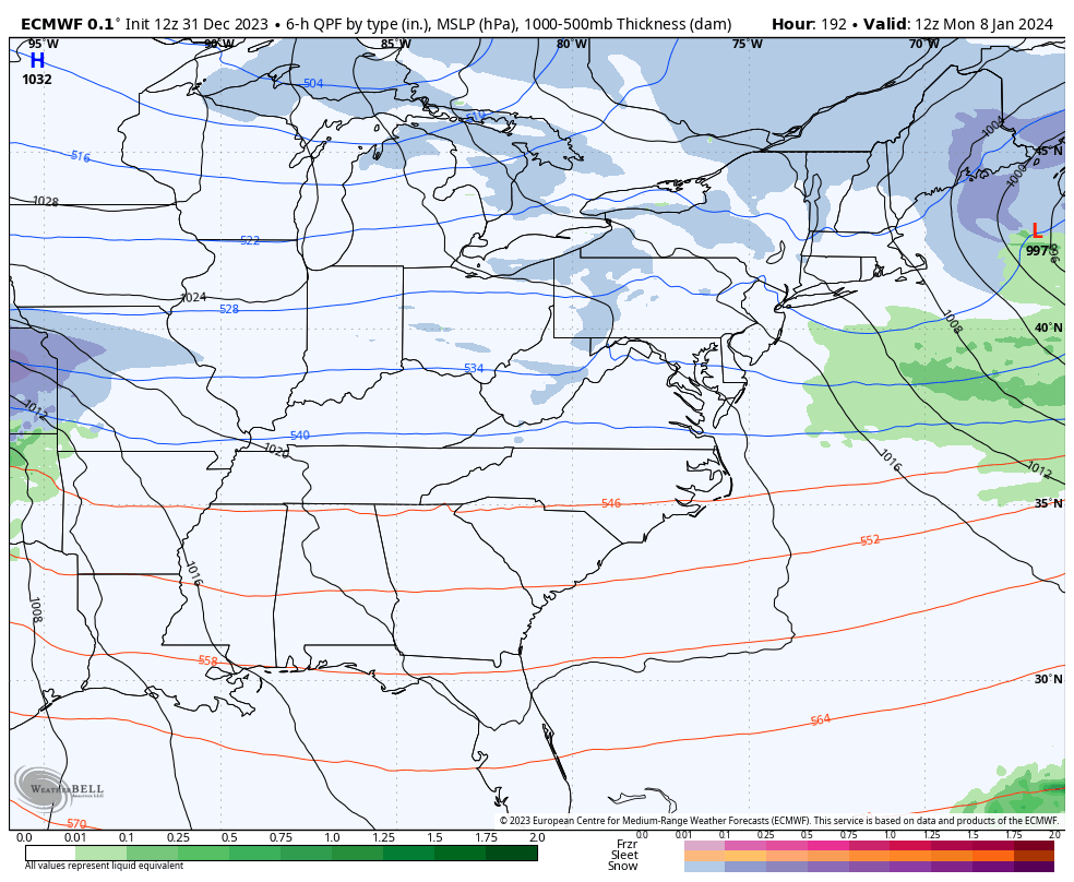
This colder scenario means the second storm system for next weekend is really one to watch. With the colder trend, we are seeing the models sinking farther south and east with the track of what may be a potent system. Here’s the EURO showing that second system with rain, snow and a mix here…

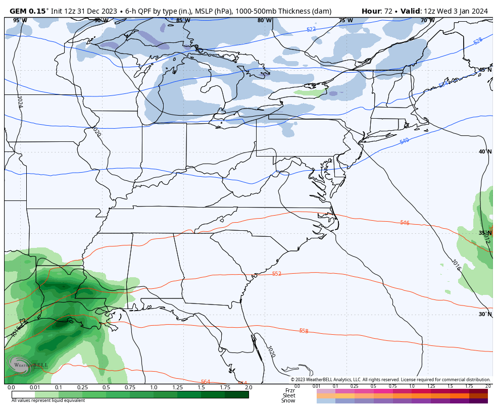
The Canadian is farthest southeast with that storm system and has more of a snow look…
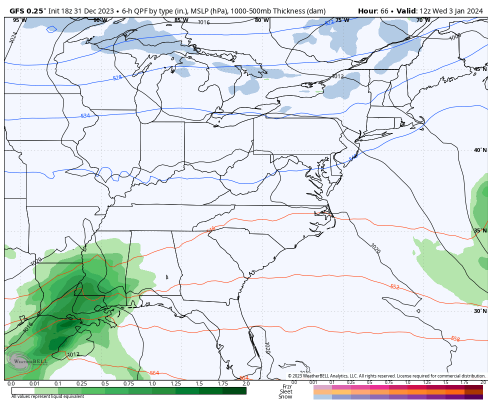
The GFS is doing exactly what we said would happen as it’s not putting as much energy with the northern branch, instead focusing more on the southern low. This run of the model brings rain, snow and a mix to snow…
The pattern will likely throw another big storm in our direction a few days later to start the following week. That storm is also trending farther south and east on the models and should continue to do so because it’s being pushed by arctic air coming in behind it.
Look at this monster on the EURO…
Buckle up, folks.
I’ll go in depth on all this later tonight. Have a Happy and Safe New Year and take care.

Here we go, model mayhem now officially underway. 00z Euro further south, matches CMC and UKMET.