Good Monday and Happy New Year! Here’s hoping you guys have the most amazing year of your lives as we head into 2024. As always, I’m thankful to have each of you along for this wild weather ride that is Kentucky Weather Center as we move into our 16th year.
This brand new year is starting out with a few flakes flying across the region with a much bigger system possible by the weekend. All of this is kicking off what is likely to be a very active winter setup for much of the country.
Let’s start with the flakes out there today. We don’t have a lot of them, but we find a few flurries and the occasional snow shower going up across central and eastern Kentucky. Much of this won’t show up on radars, but here they’re here to help you celebrate day one of the 2024…

Another cold front moves through late Wednesday and Thursday and can bring a few flakes to the eastern half of the state. That cold air keeps the first system zipping by to our south.
This sets the stage for a much bigger system to potentially impact our weather this upcoming weekend. This is also a system coming from the southwest and it’s loaded with moisture. What kind of moisture it brings to us will be highly dependent on the storm track.
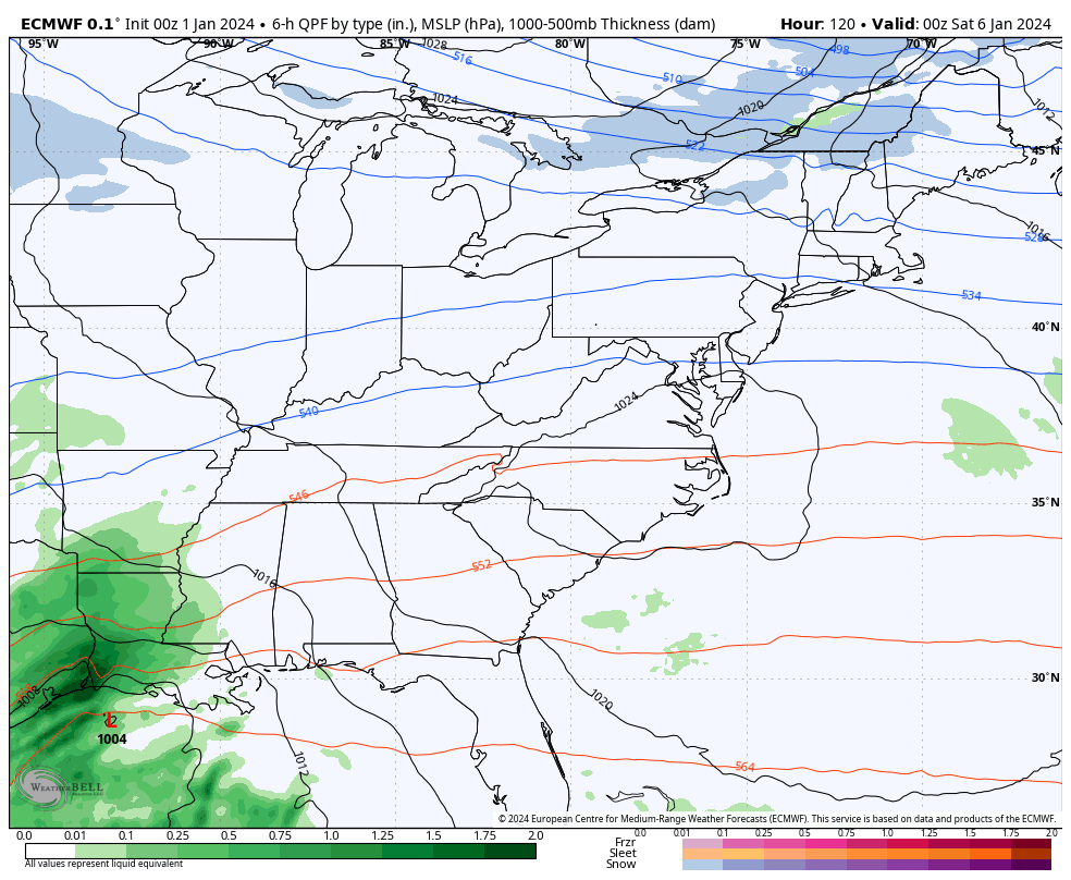
The GFS has two lows with one into the lower Ohio Valley with the second going up the east coast. The end result on the GFS is for rain, snow and a mix…

The GFS is currently the only model with the strong dual low scenario. The EURO doesn’t have much of a surface low into our region but has the system in the Carolinas.
The current EURO brings the best chance for winter weather to the eastern half of the state…
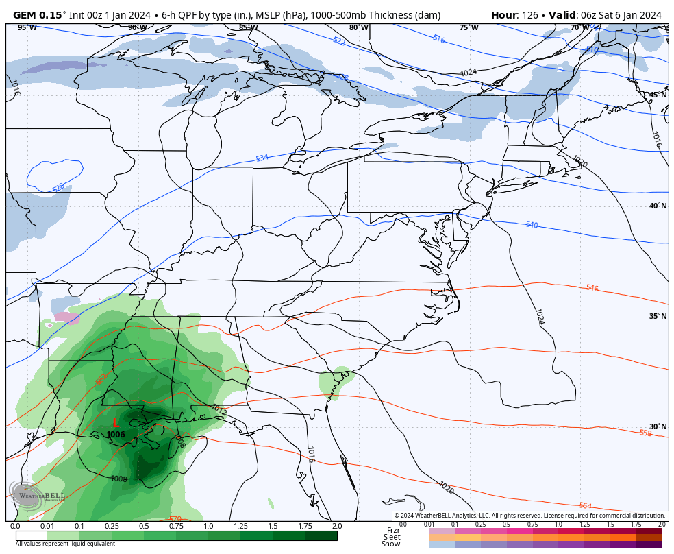
The Canadian has a weak lead surface low into far eastern Kentucky and West Virginia with the main low going up the east coast. This has a pretty good winter hit in our region…
With several systems lined up coming out of the southwest, I suspect we will see the models have some wild swings with storm tracks in the coming days. The system this weekend is of interest and nothing more at this point.
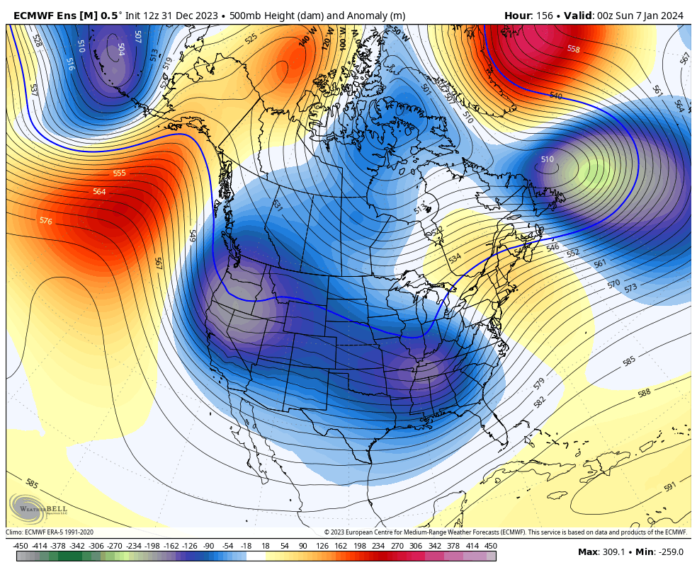
Looking farther down the road from this weekend through the middle of January, the EURO Ensembles are pretty incredible to see with major blocking going up from Greenland to Alaska and a deep trough engulfing much of the country with shots of arctic air…
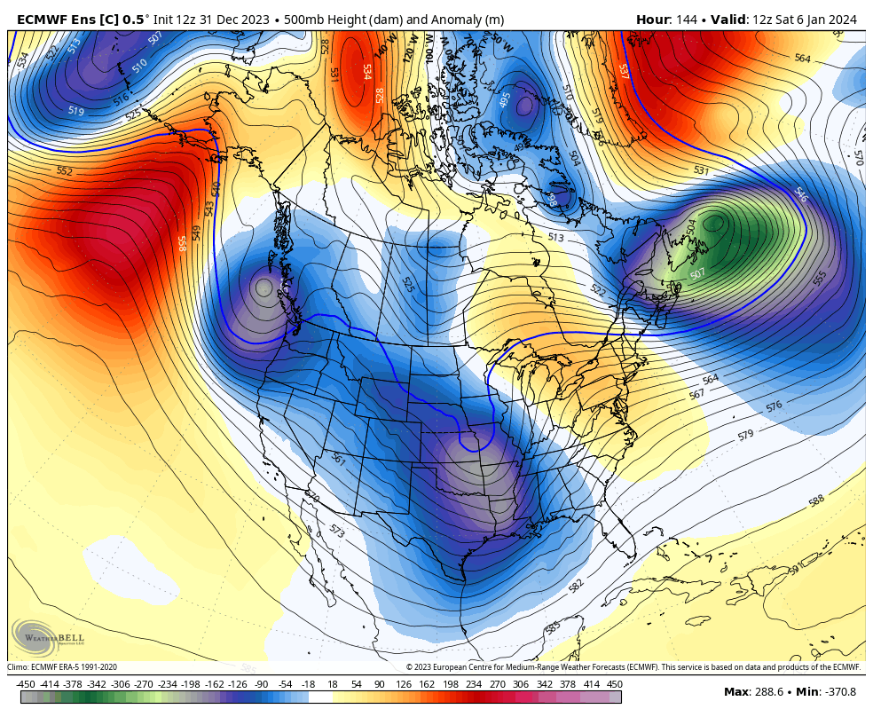
The Control Run of the EURO Ensembles is even more emphatic…
I will have additional updates later today. Have a Happy New Year and take care.

Happy New Year Chris and all here at the weather blog. May we all get a foot of snow lol
Happy New Year to all my kyweathercenter blog friends.
Think snow!!
I Wish Everyone A Happy and Healthy 2024. On the Ventusky Meteogram for Maple, Kentucky is for 3 ” of Rain on the 9th and 0.8″ of Snow on the 10th. Hope this happens.
On the Accumulated Snow through the same period is showing more than 14″ of Snow North of the Ohio River and only 2 ” in Kentucky. Take this with a Grain of Salt Folks as this will change in time.
Happy New Year to Chris and to everyone here!
Happy New Year! Thanks for all you do Chris!
It was fun watching the Bears play and win yesterday in the on-and-off snow that was falling at Soldier Field. 0.9 inches of snow was recorded at Chicago’s O’Hare Airport, and 0.2 inches at the NWS Forecast Office in the SW Suburbs. This was only the second day of the month that there was measurable snow here, with a measly 1.2 inches of snow recorded for the entire month.
A Happy New Year full of snow for all!
The Bear are a better team than their record would indicate, Mike!
NOAA’s outlook for January 2024 issued 12 / 31 / 23 :
https://www.cpc.ncep.noaa.gov/products/predictions/long_range/lead14/
Happy New Year to all. Looks like mother is giving us a chance of snow. Will see and yes think snow!!
Looks like the GFS lost the dual low..More phasing of the northern stream..Nice hit for SE KY..Icon also..Pretty well all models showing snow..Interesting to see how it works out..
Happy New Year!
Seems we’re the fence as usual, for the main action. Again, no ice and I’m good with whatever!
Looks like the Canadian went NW.. Don’t know if it phased earlier or what..Anyway rain..
Of course, GFS comes in south and CMC goes north. UKMET, ICON still South, all eyes on Euro
Euro moves the snow from SE KY into Central KY
A cold day but we have had snow flurries off and on just not enough. I hope we get measurable snow soon. I predict and I hope I am wrong cold rain with snow flurries on the back side. We just have to face it our state is not in a good geographical location for snow always the fence. I agree with Bubba no Ice please. I would rather have cold rain than Ice. I have been reading about some places in 2024 hard to say will get total eclipse I think maybe western Ky and Indiana I should visit my sister to see that.
Crystal, hang in there it will Snow big time someday. We are just in one of those Snow and Rain droughts at the present. I’m with you and Bubba, no Ice please. I just wish we would have Sunshine this week. This Gloomy weather is depressing.
The Total Solar Eclipse will be in South Central Indiana near Washington, Indiana my home town. I’m not planning to go and see as I’ve seen plenty. If you’ve seen one you seen them all.
Here’s the Link on this year’s Solar Eclipse :
https://news.yahoo.com/best-places-us-experience-totality-160001607.html?fr=yhssrp_catchall
Thanks Schroeder I haven’t ever seen a total isn’t that where it gets dark in the middle of day for a couple minutes ????
Yes, It is really something to see, with eye protection of course. When this occurs I always get a weird feeling that the World is coming to an end.