Good evening and Happy New Year! We continue to track some flakes across the region and we have a few more coming at us late Wednesday and Thursday. Beyond that, it’s all about the weekend setup with a storm system likely bringing winter weather our way.
This evening’s snow showers and flurries will take us into tonight and early Tuesday and may put down some hit and run coatings, especially in the southeast. Not a lot of this will show up on radars, but they’re here nonetheless…

The next system coming at us is a cold front dropping in from the northwest late Wednesday. This front may unleash a few snow showers and flurries in central and eastern Kentucky Wednesday night and Thursday.
At the same time, we find low pressure passing well to our south.
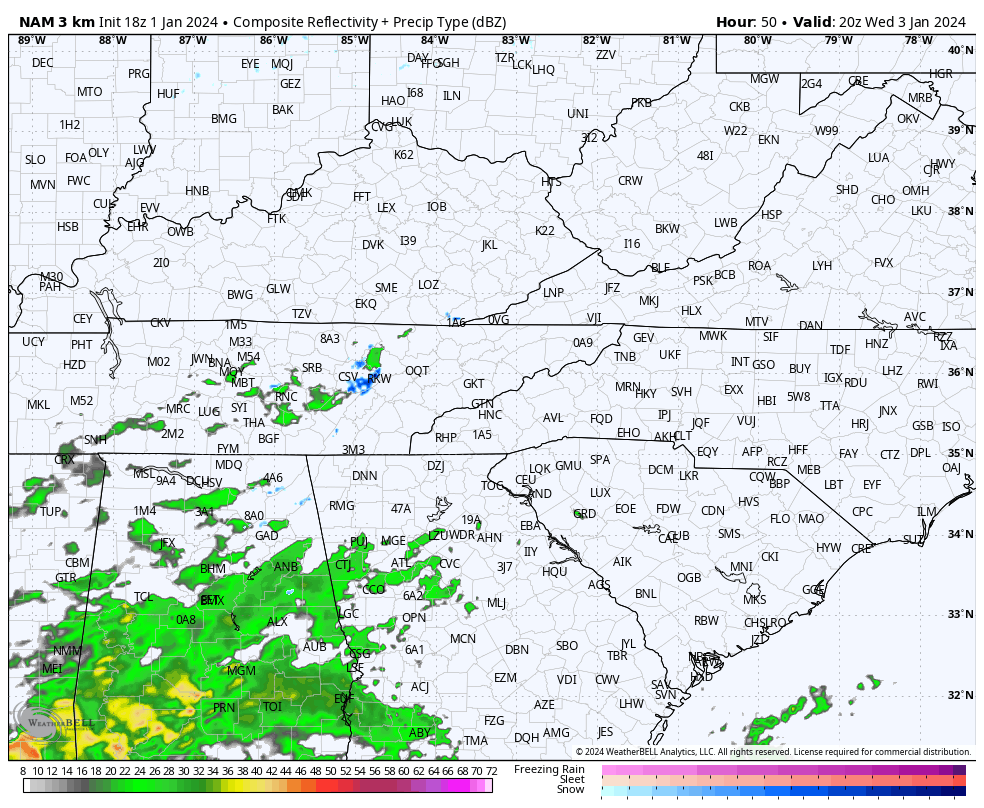
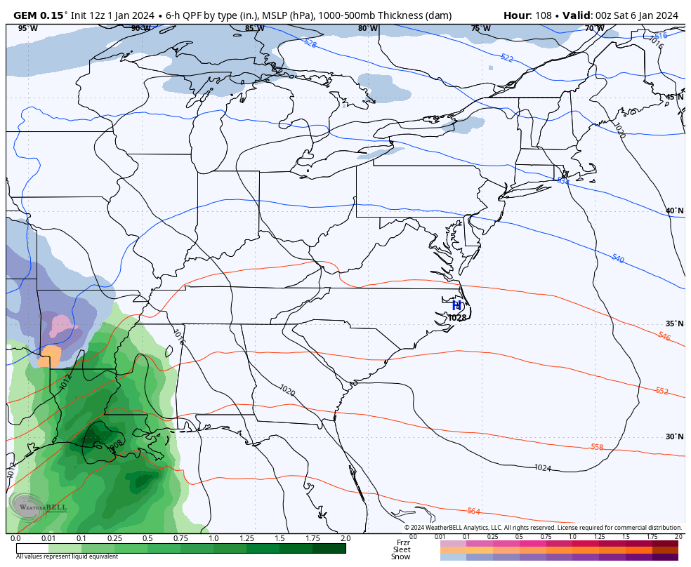
The whole scenario may provide a small window of opportunity for southeastern Kentucky to get in on some light accumulating, snow. The future radar from the Hi Res NAM shows this potential through 1am Thursday…
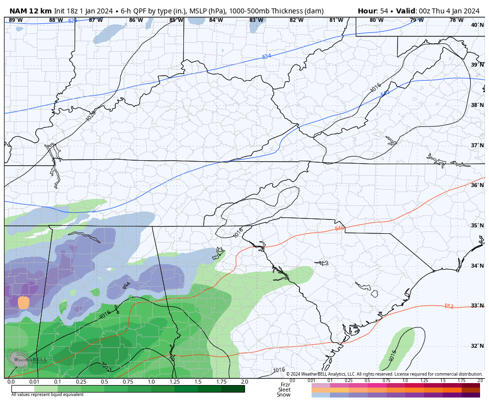
The NAM goes through Thursday and shows a similar look…
All eyes continue to be on the weekend as a developing winter storm tries to target the region. This likely comes down to the track of the low, or lows.
One lead low may very well develop and roll into the southern Appalachian Mountains Friday night and Saturday as the main low takes over from there in the Carolinas. That kind of scenario is usually good for accumulating snows in our region, but again, it’s about the exact tracks of those lows.
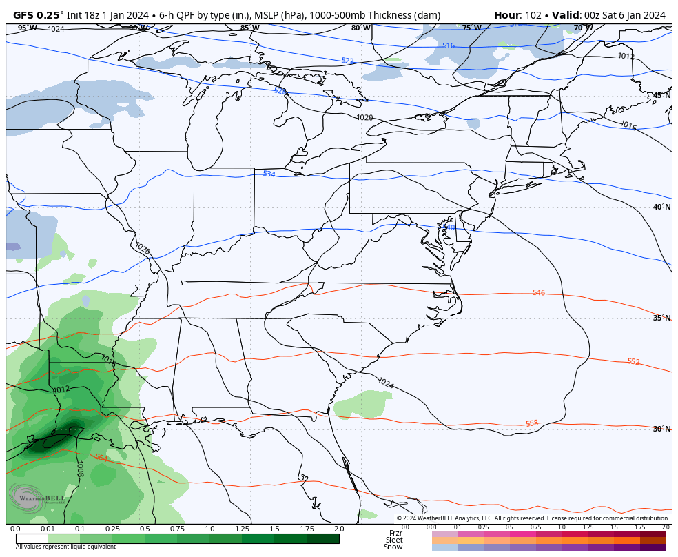
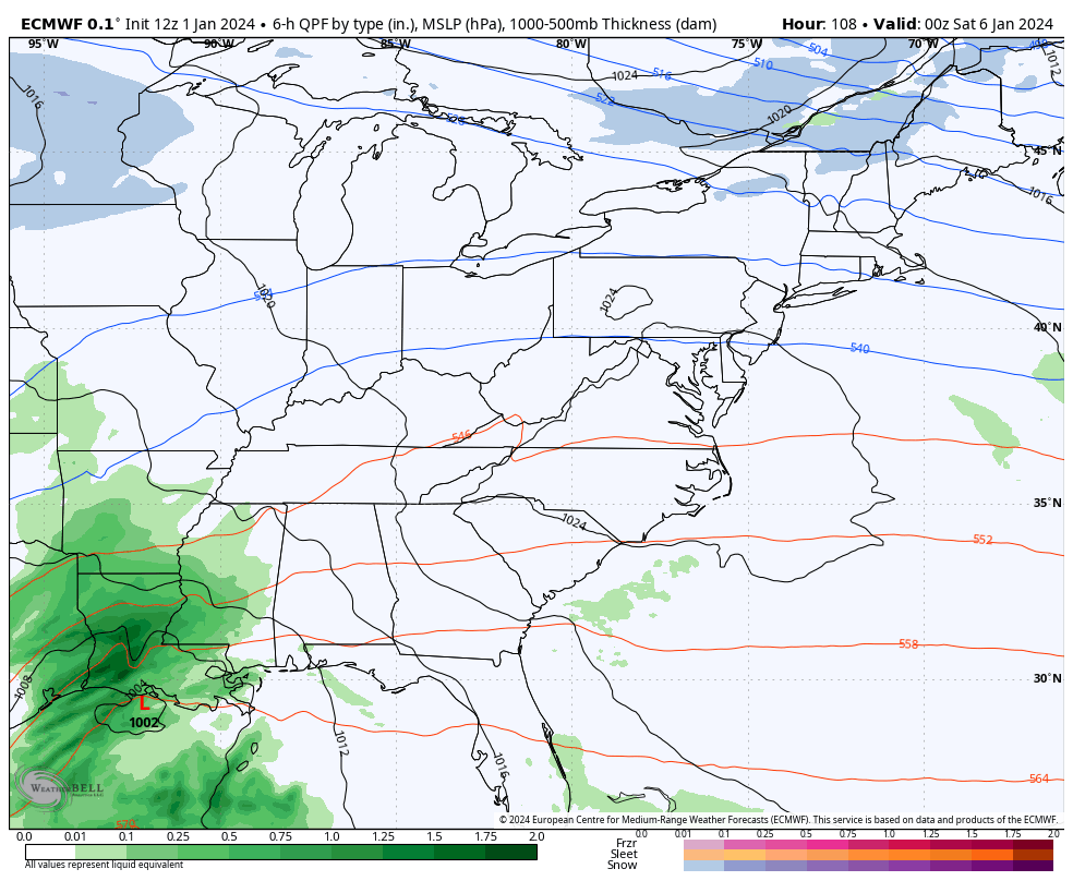
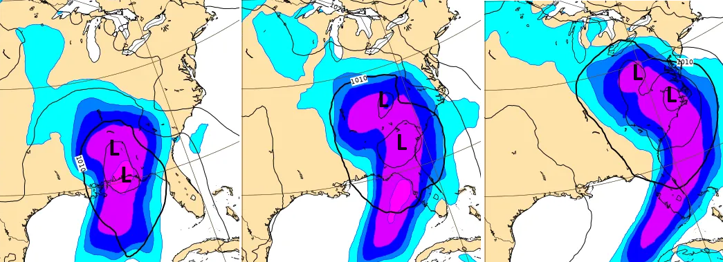
We actually find pretty good agreement between the GFS and EURO from 4 days away. Both have a pretty good snow hit across central and eastern Kentucky on their current runs…
GFS
EURO
The Canadian appears to be the odd model out with more of a west tracking lead low, but still produces winter weather…
If we look at the new AI forecast model known as the GraphCast, we find it agreeing with the GFS and EURO with the tracks of the lows…
Could this system become our first WST since December 2022? We shall see.
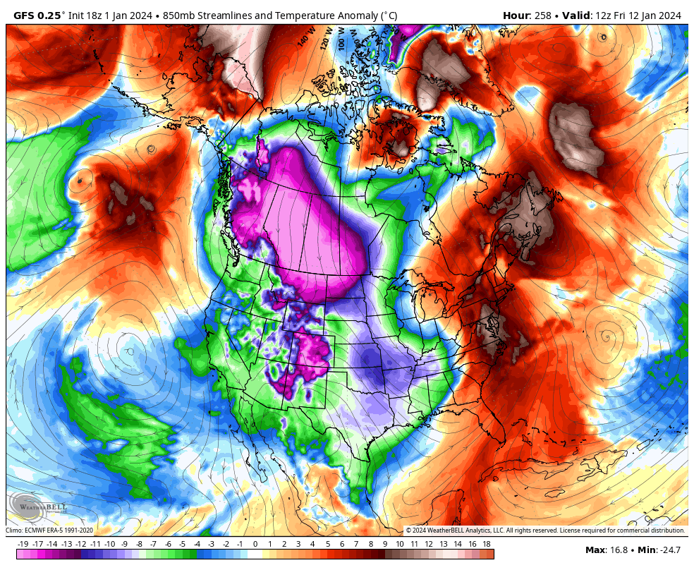
Another massive storm system will follow this one up a few days later and another one comes behind that as arctic air crashes into the country. Look out below…
As you can see, this January looks to be a far cry from what we had last January as it has a ton of potential!
Enjoy the evening and Happy New Year. Take care.

Chris I keep reading more and more about a possible winter storm threat this weekend. I sure hope so but like you said the track will make the difference but I have a feeling someone is going to get it pretty good hit but where is the question?? Schroeder I am with you it’s been dreary last couple days. I was taking my garbage out and it is snow flurrying nothing laying. Am glad it can still flurry in this area lol.
Over here in South Central Kentucky we barely see Snow flurries. Not in the right path of Snow fetches from Lake Michigan.