Good Tuesday, folks. Buckle up for the ride because the upcoming weather pattern is going to try to take a walk on the wild side through January and into February. This may get started sooner rather than later as we track a winter storm system that may impact our weather this weekend.
As always, we track the precious present to start.
A few flurries or light snow showers may be noted to start the day, especially in the east and southeast. That’s where a few hit and run coatings may show up on the rooftops. By the afternoon, clouds try to break from northwest to southeast.
Here are your Kentucky radars to track whatever early day flakes that show up…

A cold front drops in here Wednesday evening and has a touch of flurries and some snow showers behind it Wednesday night and early Thursday, especially in the east and southeast.
The main show to watch is lurking for the weekend as a big storm system crashing into the west coast today spins across the country and looks to impact our weather. What kind of an impact will that have? It’s still too early to tell and I suspect we have some model twists and turns to go through over the next few days before we can fully answer that.
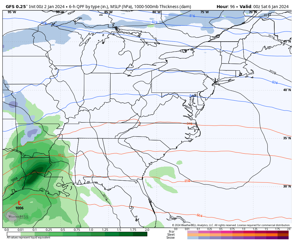
The likely scenario is for one low to work toward the southern Appalachian Mountains with the main low going through the Carolinas and up the east coast. That scenario usually produces snow in our region, but this track is NOT even close to being set in stone.
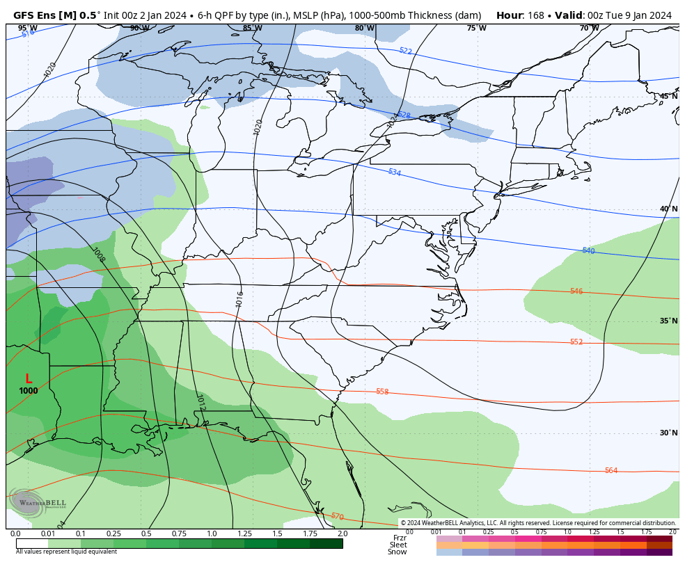
Still, the GFS is fully on board with this and has a healthy wet snow for much of our region…
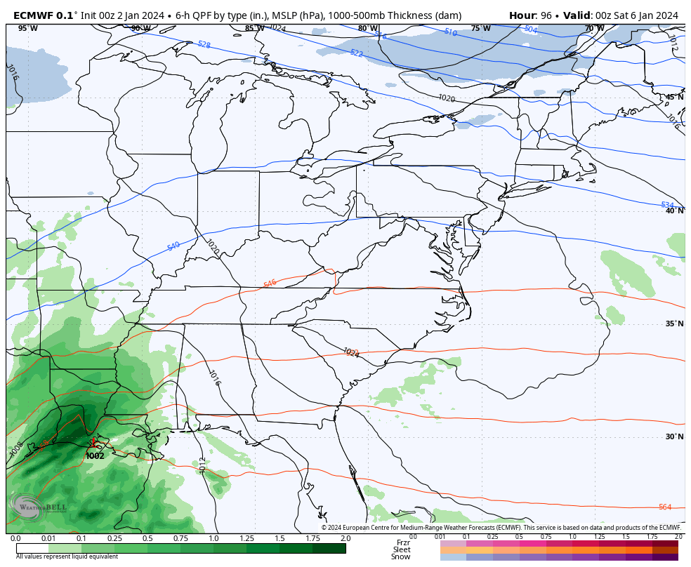
The EURO has a similar overall look to the GFS…
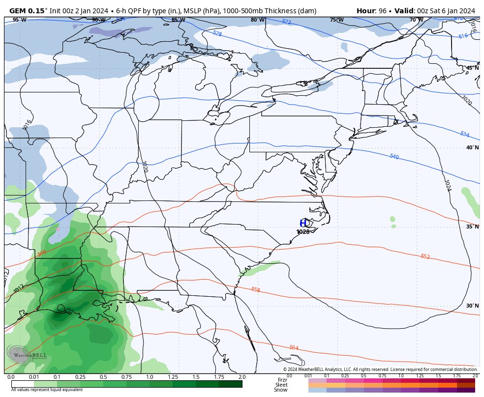
The Canadian isn’t playing nice with other models as it is much weaker with this whole setup and only brings a mix and rain before some light snows on Sunday. This just looks funky and probably isn’t correct…
If we look at the average of the 21 member GFS Ensembles, we find them agreeing with the operational GFS…

Do we have a chance at accumulating snow this weekend? Yes, we do. Is it a sure thing? No, it’s not. Make sure all that sinks in. 😜
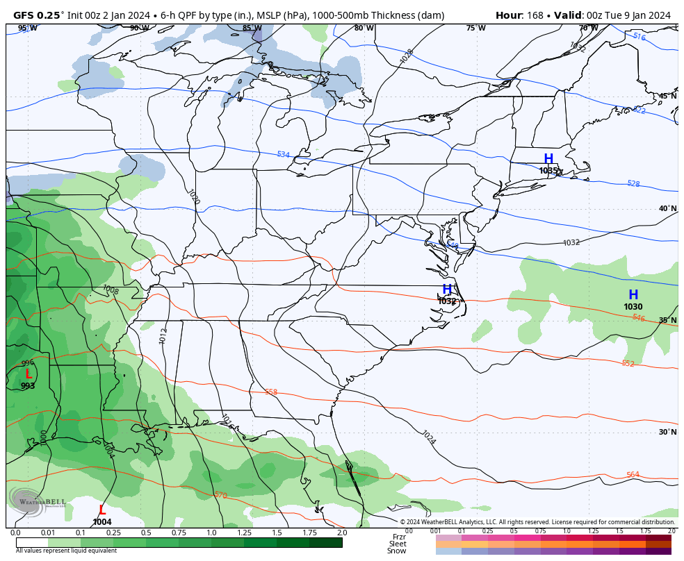
Whatever happens with this, it’s likely to be followed up by a monster storm system early next week. The models are still trying to figure out this weekend’s system so they have their work cut out for them with the one behind it.
The trend is likely farther east with the track of this storm that’s likely to be a MAJOR system. Once again, all modes of weather will be possible with this. A track to our west means heavy rain, high winds and thunderstorms before snow wrapping around. A track over us, or certainly to our east, would mean MUCH more winter weather.
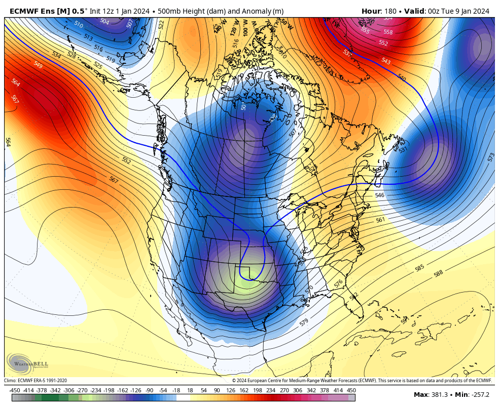
Here’s the GFS with it…
The average of the 21 members of the GFS is east, resulting in more of a winter look…
This pattern can go to the extreme as we see major blocking going up from Greenland through the Arctic to Alaska. That combination forces deep troughs across the United States with arctic air likely taking hold over the next few weeks, at least.
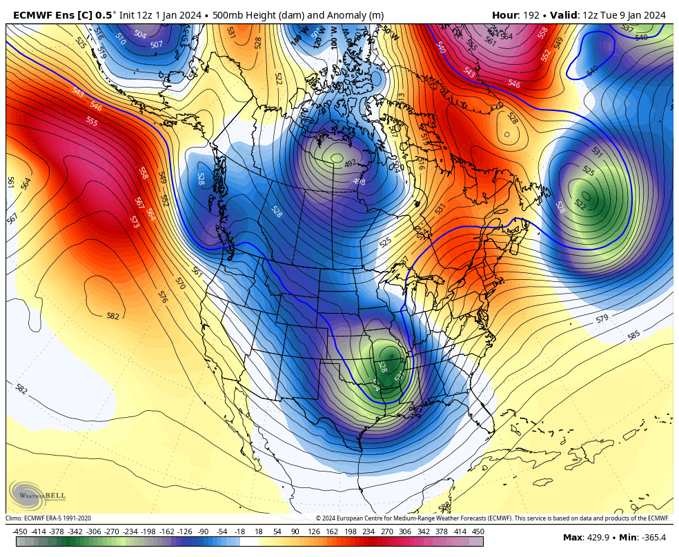
The EURO Ensembles continue to be impressive with this look…
The Operational Run of the EURO Ensembles shows the individual troughs very well and check out the MASSIVE -NAO block over Greenland…
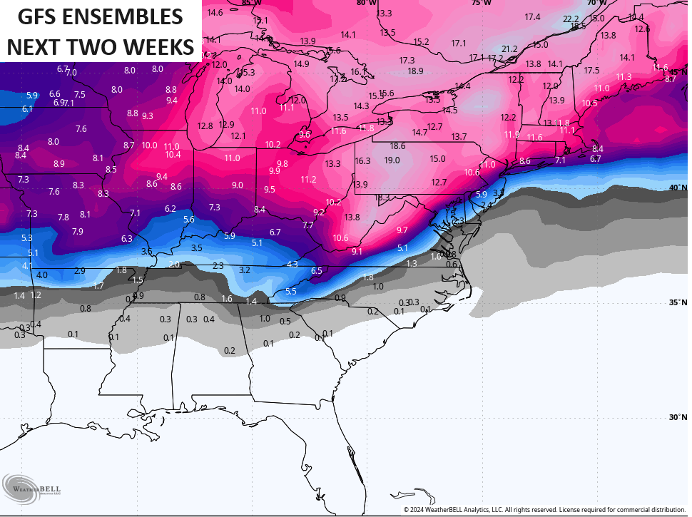
The Euro Ensembles are made up of 51 different members, so things get smoothed out pretty good with that many runs being factored in. For the past few days, the two week snowfall average from those 51 members has been way up there and it continues to be…
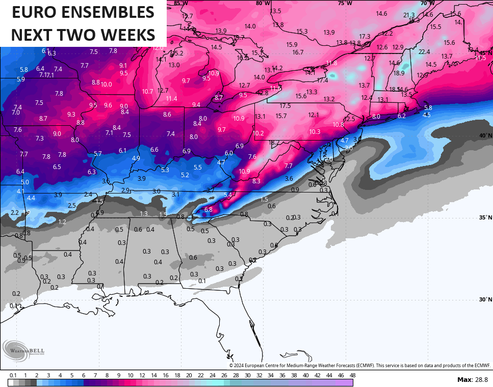
That’s impressive for an average and is an illustration of the potential we are facing. The GFS Ensembles only have 21 members but the average of those members has jumped above what the Euro Ensembles…
So, you guys can clearly see how the potential is there, but, like anything else, it’s only potential unless it becomes a reality. Still, it’s a heck of a lot better than last winter and, to be honest, that’s a better look than we get in most winters around here. It makes for some fun tracking!! 😎
We are likely entering “three a days” here on KWC, meaning the time we get the main overnight post, a midday update, and an evening update. 🥶❄️😁
Enjoy your Tuesday and check back. Take care.

Hurray for snow days!
I’m still pessimistic about snow chances in South Central Kentucky. Aside from some festive flakes, we’re likely to see a cold rain out of both systems. With that, I’m hoping that we squeeze out a few measurable inches by Winter’s end; at the very least something above a Trace, which was the total snowfall amount in Bowling Green for all of 2023, and set a record for least measurable snow, EVER!
Thanks for the update Chris. More model confusion to start the new year. It will be interesting to see how the next three months turnout weather wise ?
What happened to the Goes / East and West Satellite images ? Been out for days.
I never trust a backside low.
Wet snow!! Clearly borderline cold air.
It could be a thumping but the low will need to have a lot of moisture to work with.
Thanks for the updates Chris! Liking the potential for us in the Louisville area, but as always we shall see! ❄️❄️❄️
CB, do you see anything that suggests KY will not be the usual transitional fence for the main snow events? Seems for the next few that is what we appear to be, though parts of the state might fair better…. If you like snow, of course. A low bar was set last year, so nowhere to go in theory but up.