Good afternoon, everyone. You know we have active weather to track when we go to three a day updates. We have a weekend storm system to track and it’s the first of several potential winter weather makers that will take aim at the region over the next few weeks.
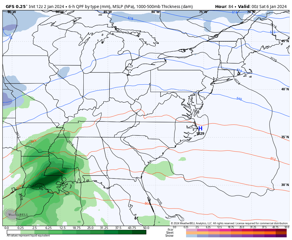
This weekend’s system is all about the track of what appears to be two lows. The lead low is the weaker of the two and it moves into the southern Appalachian Mountains on Saturday with the main low in the Mid-Atlantic.
How far north does the lead low get? That’s the main factor in what kind of precipitation type you get outside your house. If you want snow, you don’t want that lead low to get too far north into the Ohio Valley or that means more rain than anything else.
The latest GFS is a bit farther north, but still has a mix and snow into our region. That’s followed by a light system on Sunday…
The Canadian is just now fully picking up on our system…
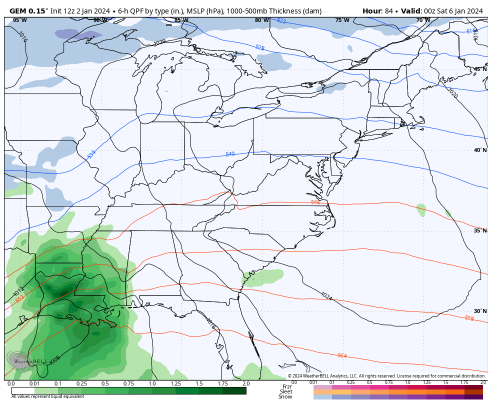
Again, precipitation type and intensity continue to be a work in progress. Can we pick up some accumulating wet snow? Yep, but that’s far from a certainty at this point.
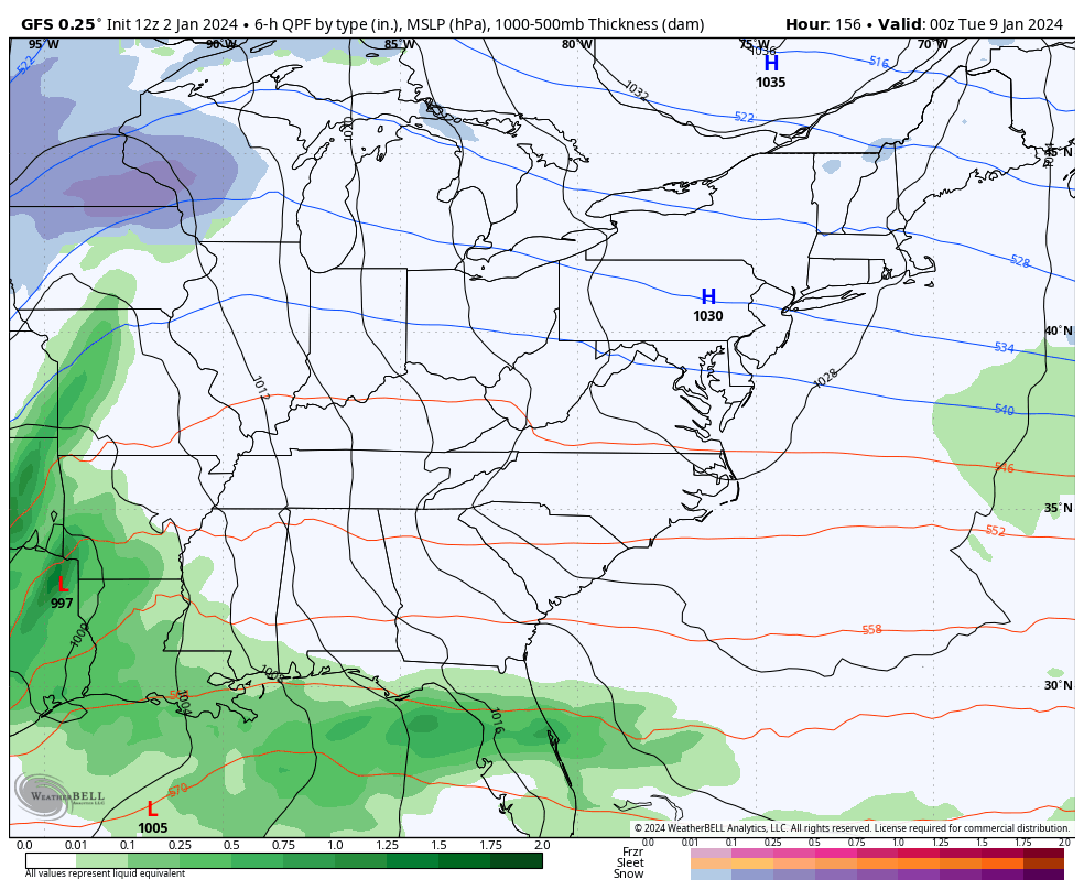
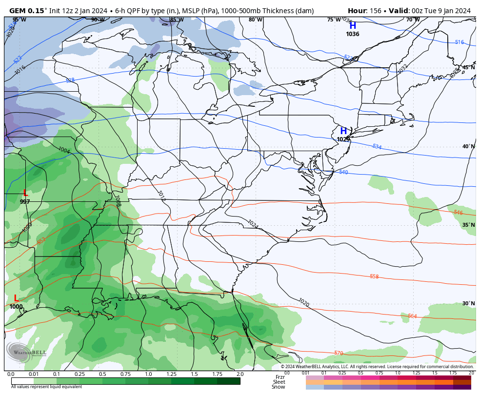
The storm system following that up early next week is likely to be a major storm system. The models are doing what we’e talked about and trending farther east with the track…
GFS
CANADIAN
Another track of the low storm system? I’m shocked, I tell ya!! 🤯😜
I’ll see you guys on WKYT-TV starting at 4PM and with another KWC update this evening. Have a great Tuesday and take care.

Chris thanks for adding a matinee to your daily updates.
It seems that the models can never forecast a slam dunk snowfall.
Because as you know, we’re the fence for most events and why lately we tend to get ice rather than snow. Even the one snow last year was mainly sleet for folks south of Lexington. Would probably take something wild to bust us out of the funk we’ve been in.
Thanks Chris for keeping us updated on the potential. I just hope here in South Central Kentucky we receive a day of Soaking Rains to break this Dry spell.
I wish for once we did have a slam dunk snow forecast for all of us but I guess it doesn’t work that way especially in fence/Kentucky. One of those Models went from snow to rain ice don’t want that. What will it take to ever chance our snow luck?? I know move to another state lol. Just curious last year wasn’t a big snow event anywhere was it????
Last time there was a significant Snow here in Maple was in February 2021. Eight inches fell in one night. The Snow was melted in three days by a warm front. To get a real Snowstorm you need Cold Polar Air in place plus a phased storm ( Polar Jet connects with the Subtropical Jet ) plus a lot of moisture from the Gulf, that tracks through the Tennessee Valley and turns Northeast through the Appalachians.
To receive a Cold and Snowy Winter, ( the ones I remember in Indiana ) a weak El Nino with a Positive Pacific Decadal Oscillation and a Very Negative North American Oscillation plus a Negative Arctic Oscillation. This Scenario produce the Snowy Winters in 1969 – 70 and 1977 – 78.
Best place for Great Snows measured in feet would be on the Southeast side of Lake Superior.
That explains a lot Schroeder do you think we will ever see those winters again??? I hope you get some moisture rain soon
Thanks Crystal. I’m positive that we will have the winters we’ve experience in the past. I really believe that the weather cycle we are in is due to the Solar Cycle # 25. This Solar Cycle #25 occurred back in the late 1980’s.
18z GFS goes south, that’s usually a good snow for us. Just no cold air
CB, do you see anything so far that gets us out of fence mode? All the model progressions seems to have one thing in common- Fencetucky.
Genuine question, BTW. Not rhetorical.