Good evening, folks. We have a weak cold front coming into the region late Wednesday, but the main focus is on back to back storm systems set to hit our region. Both of those will bring rain and snow to the region.
Let’s focus on this weekend system and the possible impact it has on our weather. Here’s a first look at what may play out…
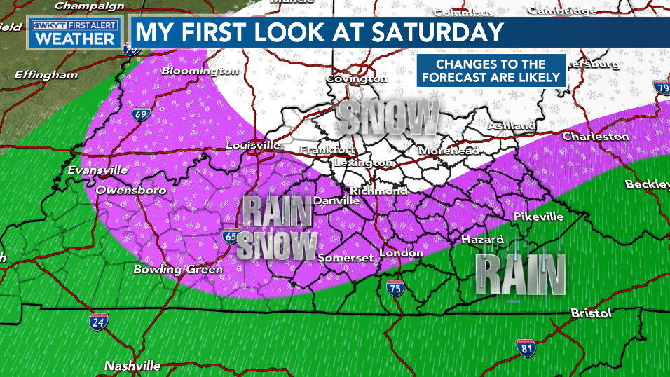
Please take notice of the CHANGES TO THE FORECAST ARE LIKELY part of that graphic! 😁 And just because you’re in the SNOW part doesn’t mean you get a lot… I’m strictly trying to define the precipitation type.
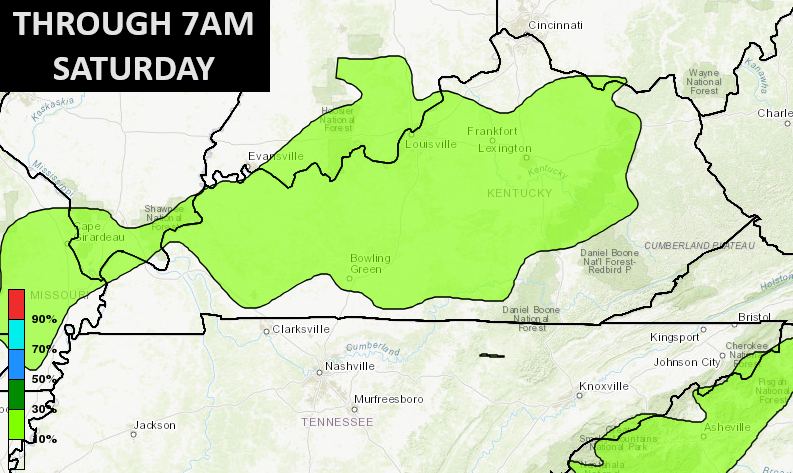
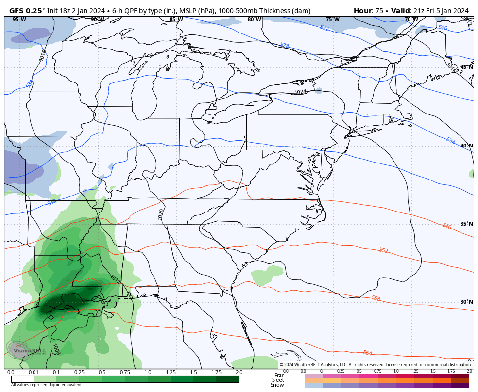
The Weather Prediction Center is highlighting the areas most likely to pick up on some accumulations. Notice they have a low risk in several areas by 7AM Saturday…
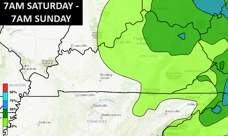
That risk area really expands across the central and eastern parts of the state Saturday and Saturday night…
Again, all of this depends on where this lead low goes and just how strong it is. If you want snow in Kentucky, you want a fairly strong low going into the southern Appalachians. The models go back and forth on this happening.
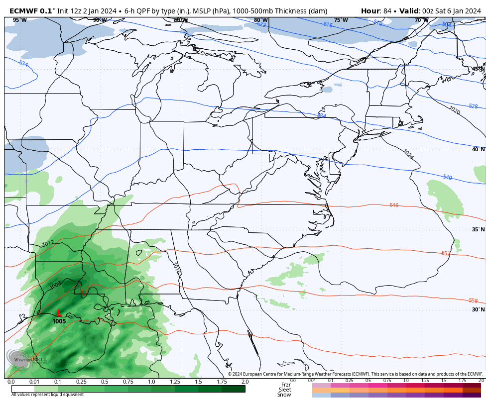
Here’s the latest run of the EURO…
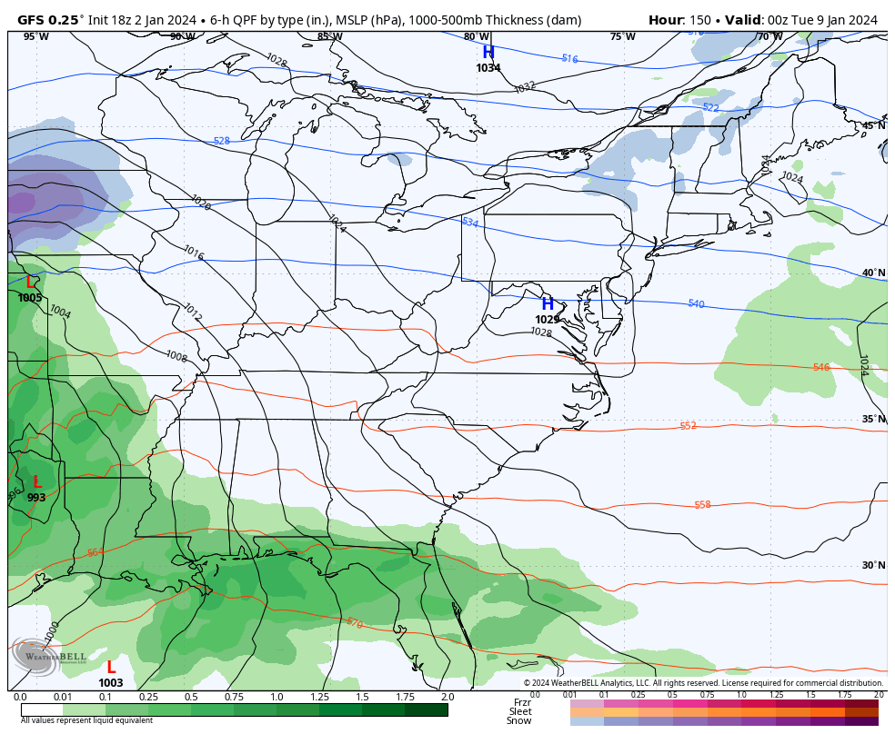
The GFS went much weaker with this scenario on the late day run but has snow across the eastern half of the state…
The next storm system continues to look massive and should bring high winds and rain before snow and the chance for a quick blast of arctic cold.
Look at the EURO deepening this storm right on top of us…
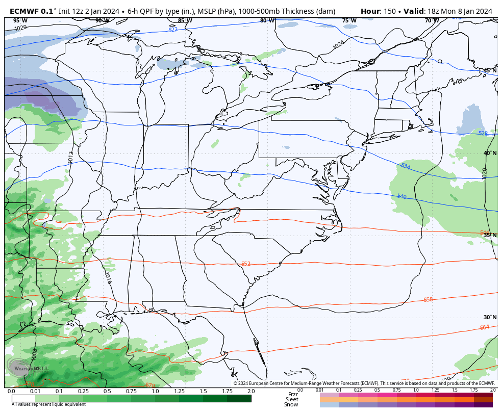
The EURO is a bit west of that, but you can see the trend of a big time storm system…
I’ll have the latest on WKYT News at 10pm on the CW Lexington and on WKYT News at 11.
Enjoy the evening and take care.

First time I’ve logged in, in years! Let’s keep our fingers crossed for a decent snowfall or three this winter!
2 non-events that will be mostly rain
Hoping for a little snow to brighten things up around here! We shall see. Thanks for the updates CB!
Hoping the GFS model is correct (CB misidentified it as the Euro). If it is, the Chicago area will be in for one heck of a snowstorm next Tuesday.
Road trip to Mikes lol
Well looks like Lexington is still in the running but where I am just rain for now I am shocked lol. The only way I think I will see a decent snow is a road trip that would be fun to follow the snow. Something I don’t understand how come we were not are the fence in the 70s snow same location but I guess then the players were all in place just right and the lows and all that. I notice too our temps in this area stay right on the fence for rain vs snow line just a couple degrees keeping it from snow it’s frustrating but what can you do? I hope someone gets a nice snow somewhere in Ky.