Good Wednesday to one and all. We are rolling toward the first weekend of the year and we have a winter storm system set to impact the region. The extent of that impact is still a work in progress and will likely be for a few days.
Before we get to that system, we have a weak cold front dropping in tonight. This may bring a light rain or snow shower along and ahead of it with a few flakes hitting the east and southeast early Thursday. Otherwise, this is pretty much a nothing front.
The overall picture for the weekend is slowly coming into focus, but it’s still a long way from being set in stone. Here are a few quick headlines…
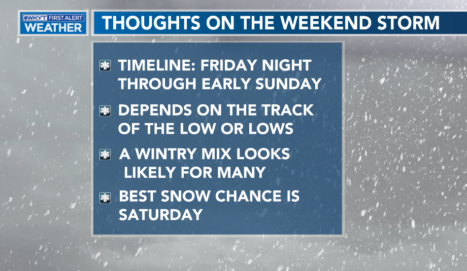
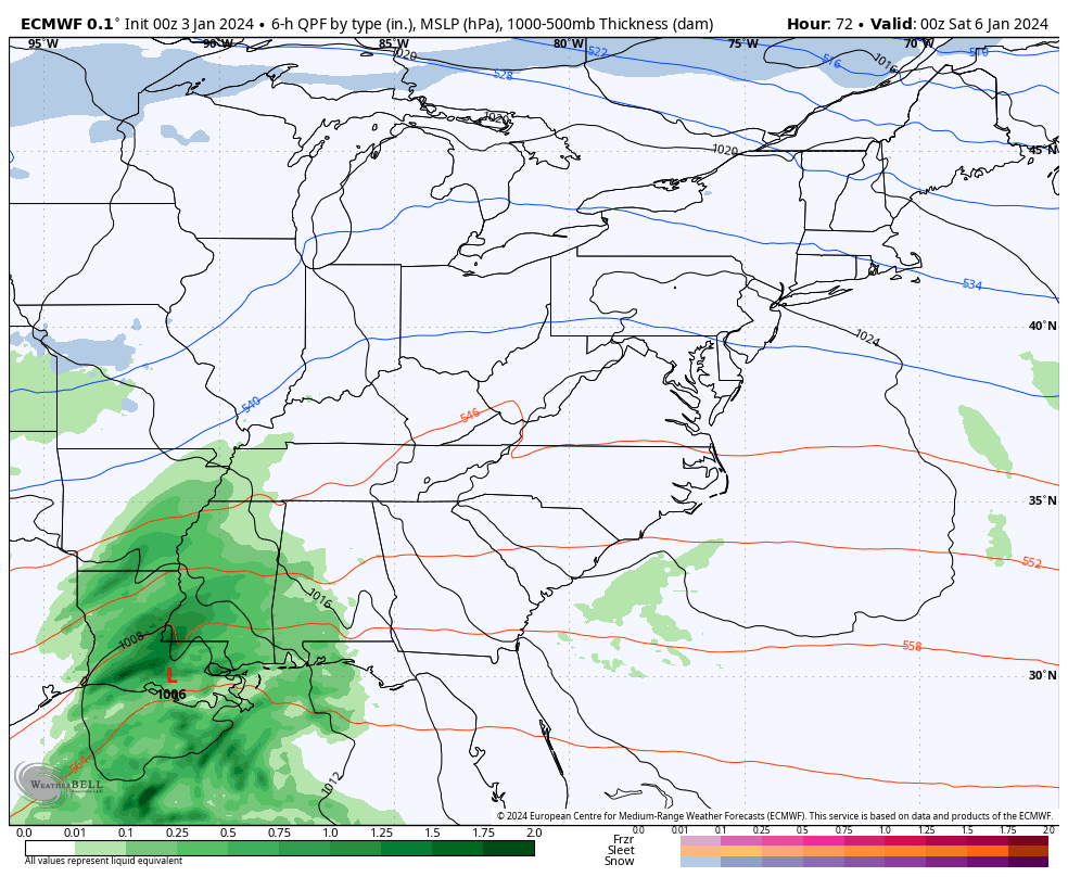
One weak low is likely to track into the southern Appalachian Mountains with the main low riding northward through the Carolinas and into the Mid Atlantic States. While things will come into better focus over the next few days, I’m opening up overall coverage of potential winter weather. This is only showing the precipitation types from Friday night into Saturday and is a work in progress…
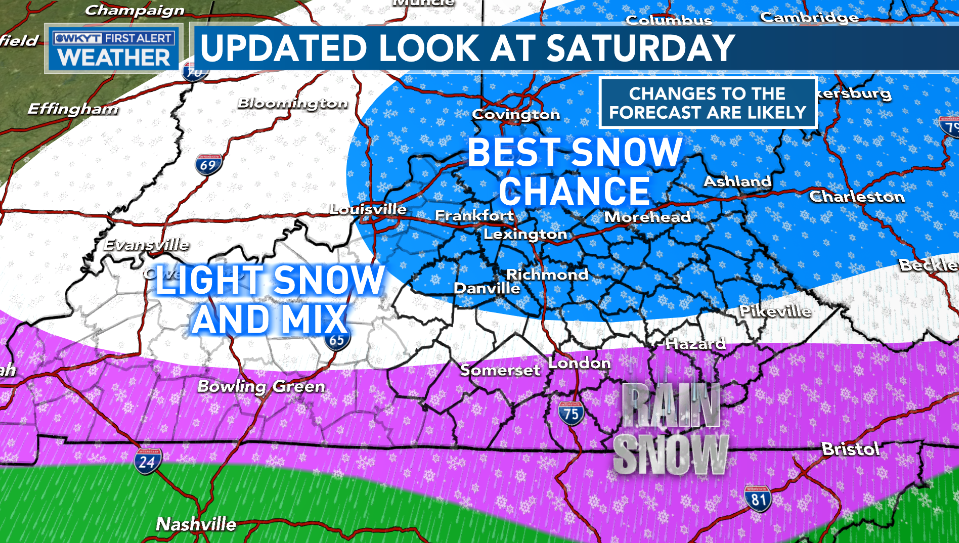
There is a scenario where southeastern Kentucky winds up in the Best Snow Chance category. Do I think this is a lot of snow or a snowstorm? No, I do not. Can some areas pick up slushy accumulations? Absolutely.
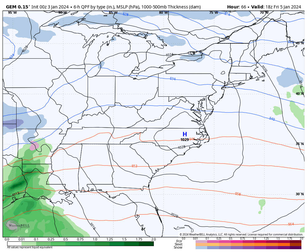
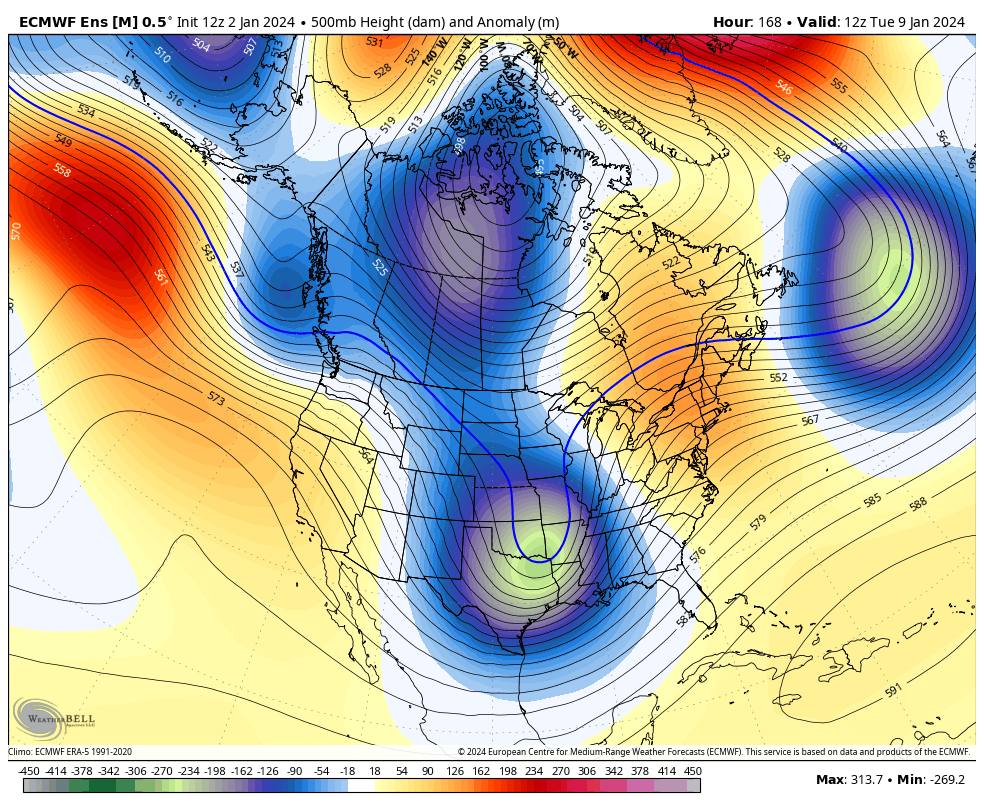
In terms of the models, we find the Canadian being closest to what I believe to be the reality…
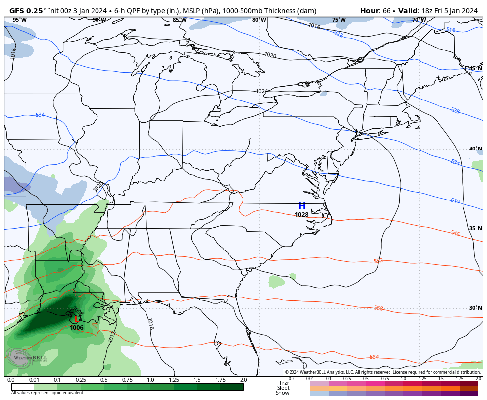
The GFS looks too weak and too progressive (stop me if you’ve heard that one before)…
The EURO is a little stronger version of the GFS…
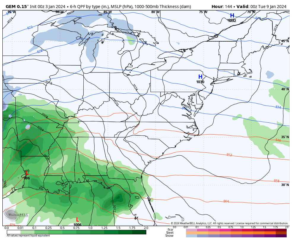
The trend on the next storm system continues to slowly come farther east and I suspect we see more of this in the coming days. This is likely to be a powerful storm as it cuts through the Ohio Valley and Great Lakes, but it has the chance to pop another powerhouse of a low near the east coast.
The Canadian is starting this out as some winter weather Monday night and early Tuesday before wind and rain take over, then we go over to snow and wind by Tuesday night and Wednesday…
The GFS is getting closer to showing that same scenario…
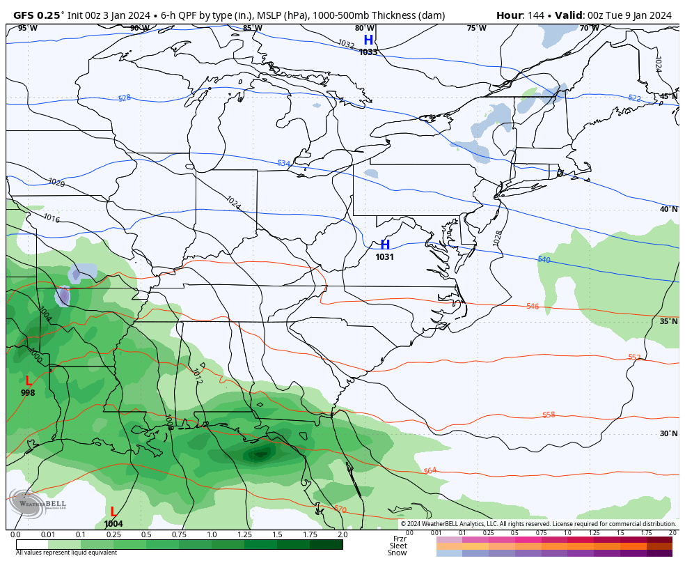
Winds with this system can REALLY crank and the models are seeing this potential…
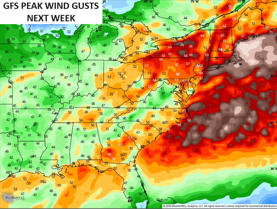
Whoa, Nelly!
This system is on the front of a major buckling of the jet stream that’s locking in for the middle of January as significant blocking goes up from Greenland, through the Nort Pole and into Alaska…
Updates coming your way late today. Make it a good one and take care.

Let’s get ready to experience some winter for a change, ya’ll!!! Happy 2024!
A sloppy slushy of a forecast.
Maybe some areas can max out around 4” between the two events. Best chance N.Ky
A lot of backside low action dependency to make it work.
Just put my December electric bill to bed, and it worked out to be 68% lower than the previous year’s December. But with this major pattern shift, it’s looking as though January could be the exact opposite!
The Chicago area could be in the sweet spot next Tuesday and Wednesday for a major snowstorm, according to both computer models. The Chicago NWS, in their forecast discussion, is saying that this definitely needs to be watched. Of course, it’s much too far out for anything to be set in stone. As we all know, things can significantly change over the course of several days.
Chicagoland loves a Great Lakes cutter.
Thanks for your daily updates Chris. It’s too bad that we don’t have a real defined storm to track. It’s a pattern that just won’t quit. Meteorology is always a ” work in progress. ”
Have a Great Day !
2023 set a record for the most tornadoes in the NWS Chicago forecast area (which covers 18 counties in Northern IL and five counties in NW Indiana). A total of 58 tornadoes were reported, shattering the previous record of 30 set in 2015 (NWS tornado records go back to 1950). The strongest of these tornadoes were three EF-2s which occurred during the March 31st outbreak.
The state of IL reported 120 tornadoes for the year, which led the entire nation.
Here is the link for the complete summary: https://weather.gov/lot/2023tornadoes
The weekend maker just don’t have enough cold air to play with. The one next week looks like we may have a shot, but again that’s a long way off you know how mother nature plays with us
For snow fans, fences are hard! Not seeing anything in model progressions that gets most of KY out of fence mode.
There is no such thing as a literal fence in regards to snow.
With the MJO likely moving into and thru the warmer phases, we’re going to need some hail mary blocking to setup.
The Southeast Ridge is the Fence and It seems to Dominate our Winters for quite some time now. It’s the Solar Cycle we are in that causes changes in Climate. We had this Solar Cycle #25 back in the late 1980’s’ that cause one of the worse Droughts since the 1930’s. I hate to see how our Summer 2024 turns out ?