Good afternoon, folks. The forecast models for the weekend are slowly coming together and they’re painting a picture similar to what we’ve been talking about. Snow, rain and a mixture of the two will be with us over the weekend with a monster storm system to follow early next week.
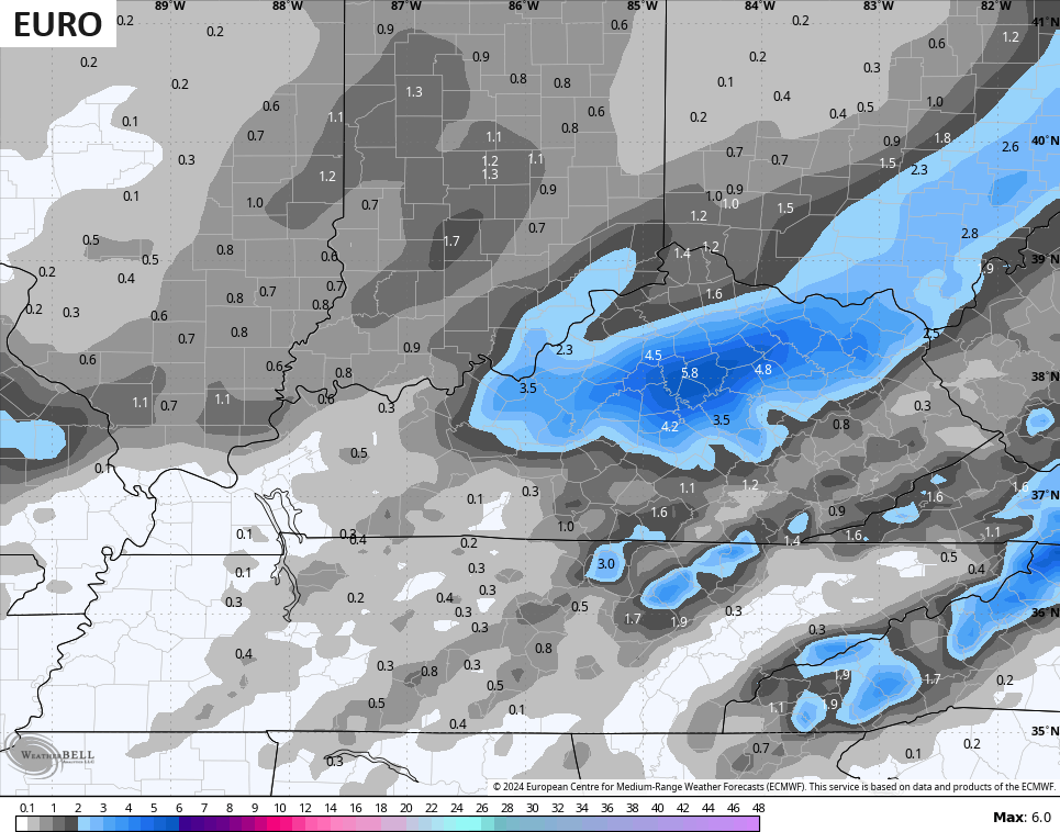
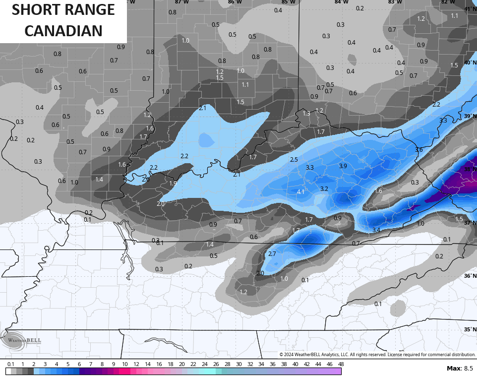
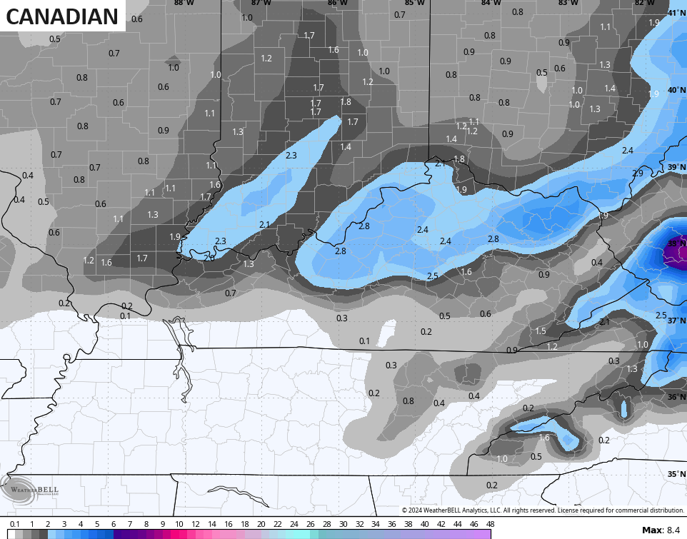
We essentially have the GFS, EURO, CANADIAN and SHORT RANGE CANADIAN in pretty good agreement with one another for our region.
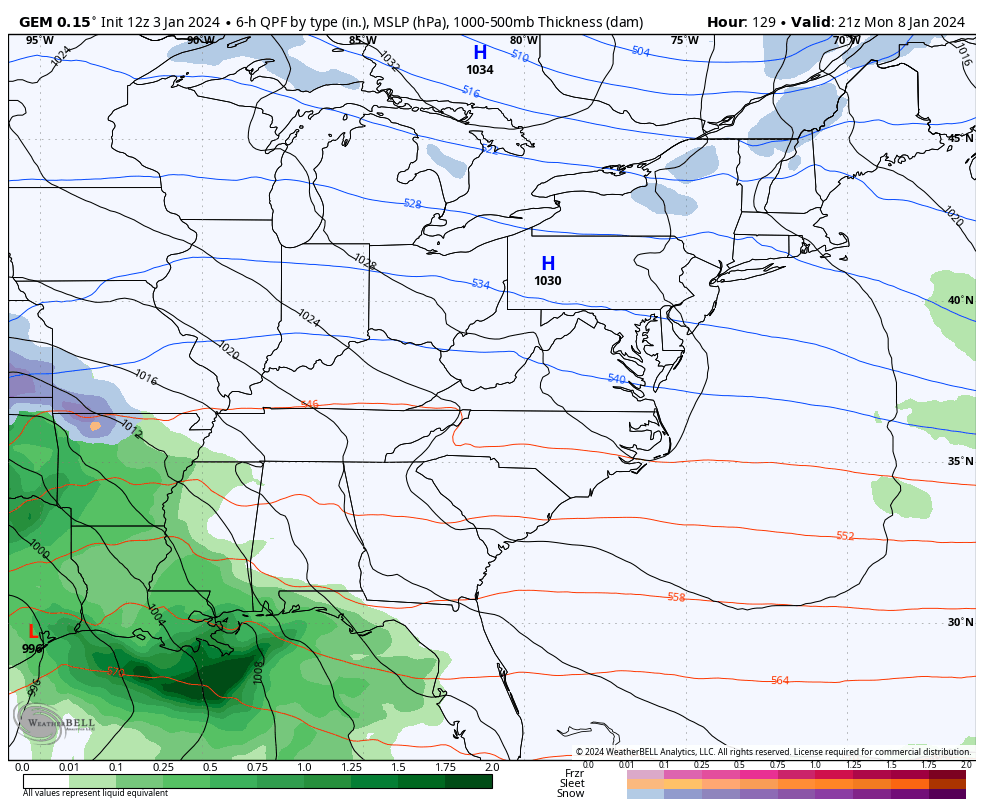
Here’s the SHORT RANGE CANADIAN…
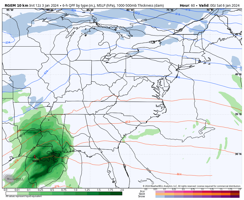
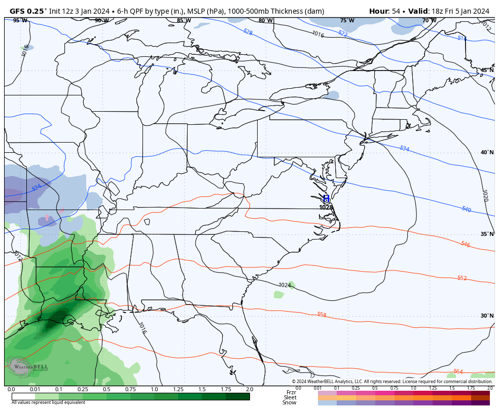
The GFS has work to do with this storm farther east, but it’s similar for our region…
I’m a little concerned this system strengthens some as we get closer, but as of now, this matches up well pretty well with the map I made yesterday…
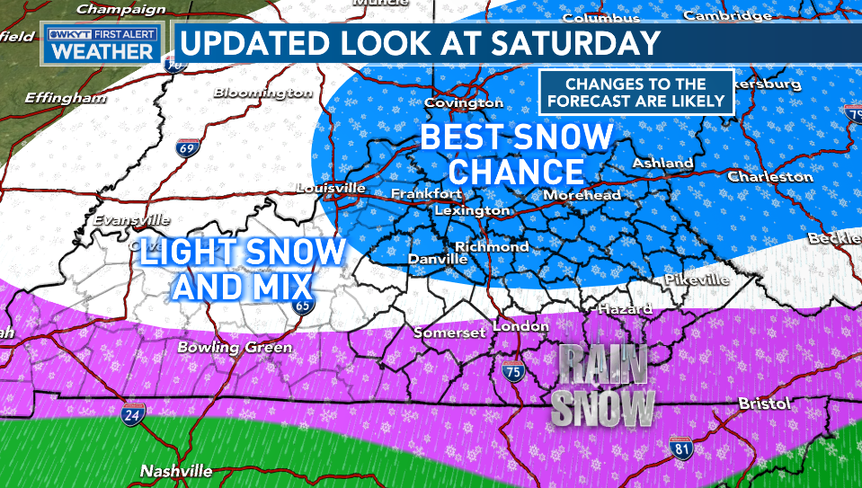
In a rare occurrence, we find the GFS and EURO in good agreement on the bullseye of snow across…
The Canadian family isn’t too far off from that, but is a bit farther south…
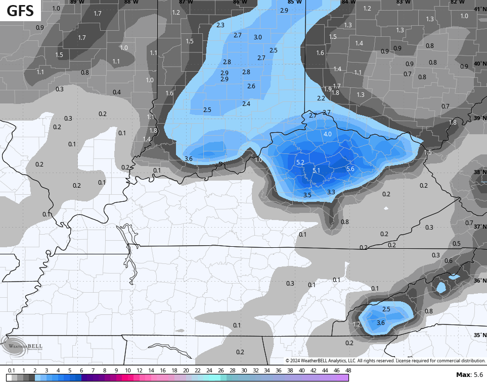
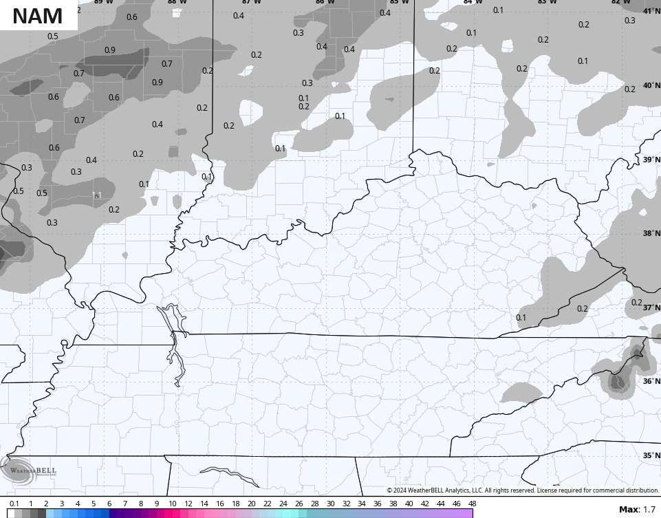
And then we have the NAM who hates everything about life, including snow…
The models continue to slowly push farther east with the track of the Monday night through Wednesday monster storm system. We may very well start this out with a wintry mix, then go to rain, then go to snow. Winds are a major player with a storm like this…
I will have the latest on WKYT-TV starting at 4pm today and I’ll drop by for another update on KWC this evening. Have a good one and take care.

What a mess for my area looks like rain freezing rain or ice lucky me. I just think it’s too warm in my area to support snow ever again you might see flurries but I don’t think it will ever be more than that here. Looks like Lexington area will get a good hit. Our temperatures here always it seems knocks us out of snow I hope this time it knocks us out of freezing rain.
Absolutely, No Freezing Rain please. I had a hard time with one of the worse Ice Storm I ever experience in 2009. Power out for three weeks !
I will happily donate my Lexington snow to you Crystal, as long as you don’t send me ice. 🙂
Alright Dottie you are on lol
It’s looking like Letcher county is in for another “mud winter”
I feel your pain in Pike county
Unless things change at 00z, SE KY appears to miss out on the snow. Enjoy Central KY
Either misses slightly to our north or south, every time. The warm air pushes into the Valley and gets trapped 🙁 Just totally different weather down here compared to the rest of the state, winter especially.
That is the meteorological fence we see most of the time. Unless the southern fed stars align, or a clipper from the north, we get the fringe of the system. That, or ice & sleet.
Every time Bubba