Good Tuesday, everyone. High winds and heavy rain are the theme of the weather day before snow squalls and light snow take over. Some light accumulations are likely tonight and early Wednesday. This storm system is kicking off a super active pattern taking a walk on the extreme side. We have a lot of winter on the way.
Let’s start with today’s wild weather and roll forward.
The day starts with winds that can crank to 50mph at times, especially across the southern half of the state. There’s the chance for a few gusts to go above and beyond the 50mph mark, as well. Those winds calm down a bit by the middle of the day before cranking back up late this afternoon and evening. 40mph+ gusts will be likely once again.
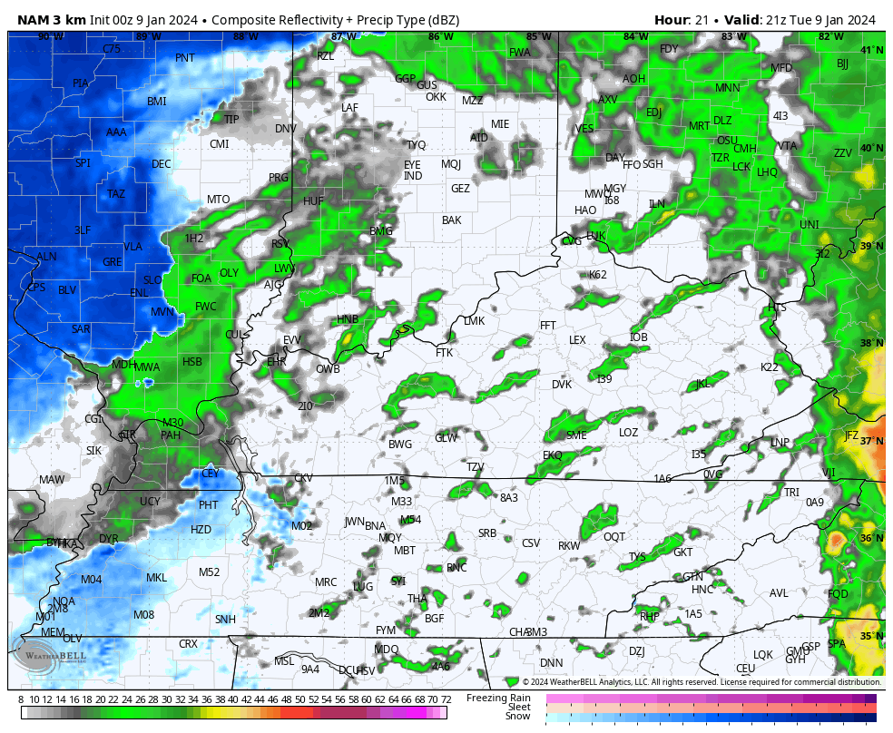
Heavy rain is out there this morning and will continue into the afternoon. Many areas of the state pick up 1″-2″ of rain before all is said and done. Here are your radars…

Ok, let’s talk about the snow that’s like to cause some travel issues this evening through Wednesday morning. Light snow, snow showers and a few snow squalls develop in the west and roll eastward during this time, likely putting down accumulations of an inch or so for many. With winds gusting to 40mph at times, whiteout conditions may show up from time to time.
Watch the future radar showing the snows increasing…
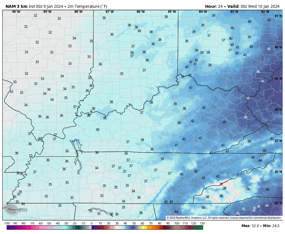
Temps quickly drop and wind up in the upper 20s by Wednesday morning. This animation shows the temp trend from 7pm this evening into the start of Wednesday…
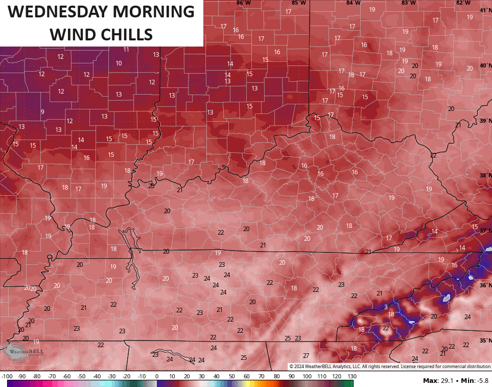
Wind chills drop deep into the teens tonight and early Wednesday…
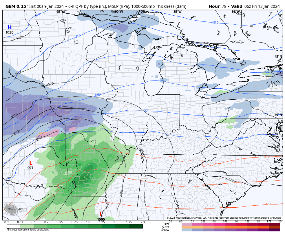
The next system works in quickly behind this for Friday and Saturday. Here’s a breakdown of how this COULD play out as of right now:
- Low pressure moves into the region and heads toward the eastern Great Lakes.
- Heavy rain of 1″-2″ will be possible Friday.
- High winds may once again peak into the 40-50mph range.
- There’s a quicker transition to snow with a wraparound snowfall Friday night and Saturday.
- Temps turn much colder and drop through the 20s.
- With this cold coming in and all that moisture on the ground, a significant ice up is a good bet.
- Travel Friday night and Saturday could get tricky.
- Arctic air comes in behind this with Saturday night lows potentially reaching the high single digits with below zero wind chills.
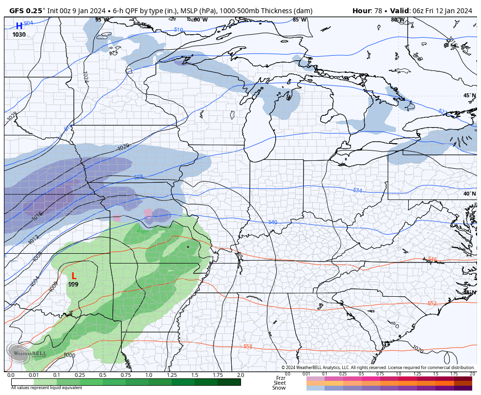
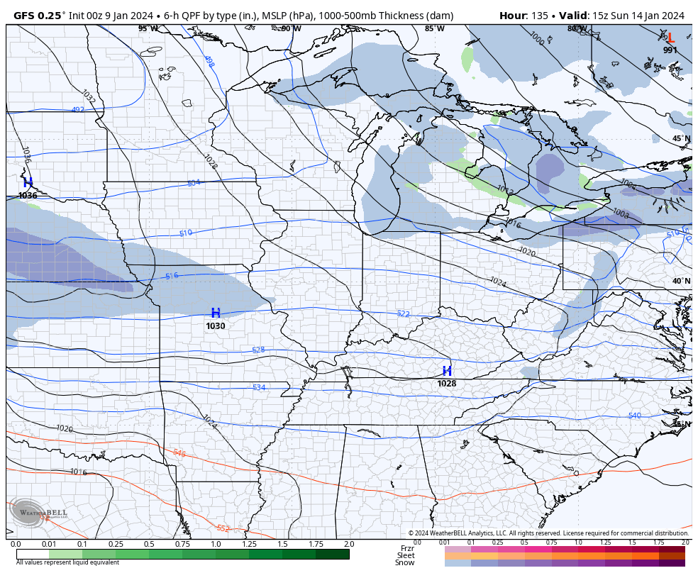
Here’s the GFS with this system…
And the Canadian…
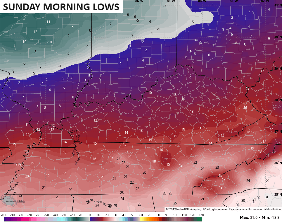
As mentioned, arctic cold comes in behind this system. Lows Sunday morning can drop into the high singles and low teens…
With that arctic boundary sliding in, the stage is set for another storm system to develop and ride along it. Unlike its predecessors, we will already have cold air in place, meaning we have a much really good chance at a decent snowfall, depending on exactly how the low tracks.
While I do expect the models to lose this system or shift back and forth with the track, the signal on the GFS has been remarkably steady…
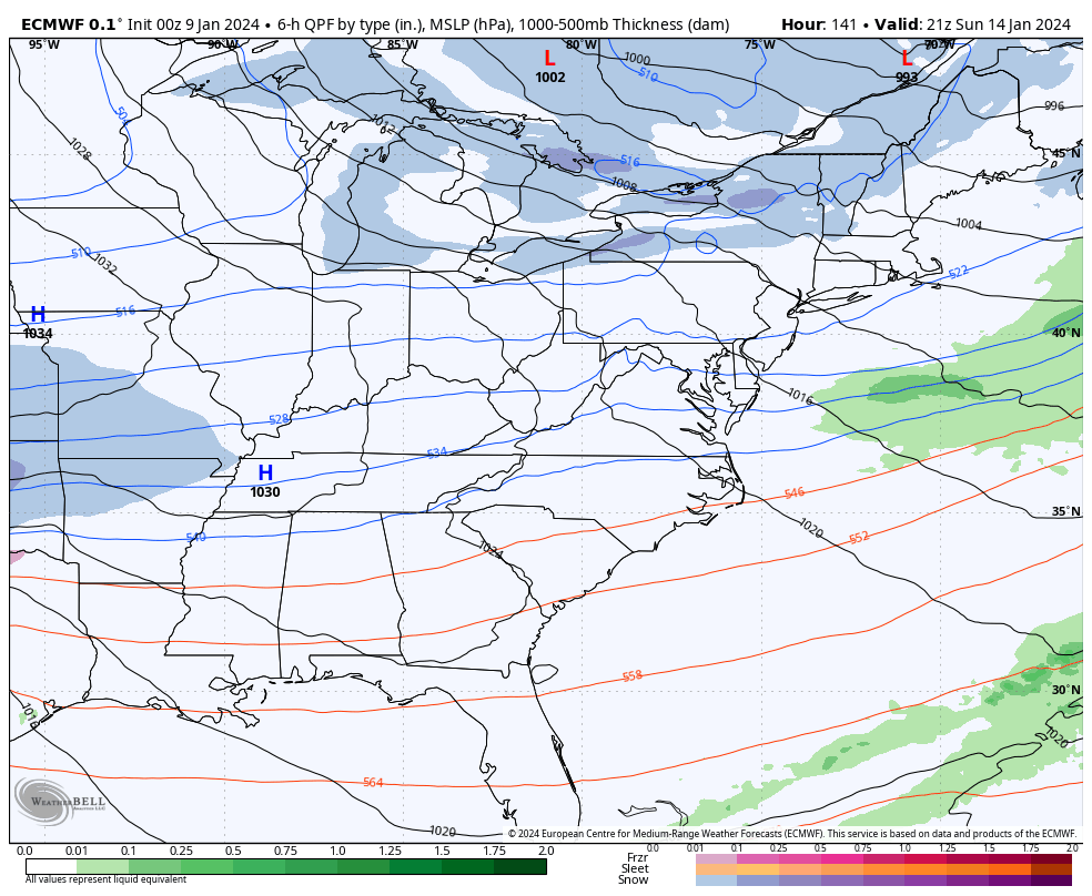
The EURO is seeing a much bigger winter storm that would impact everyone from Texas to New England…
Bitterly cold air comes in behind whatever system we get out of that and we have the potential for below zero lows next week.
It’s a loaded pattern, folks. Let’s just see if we can cash in with the snowfall department for the first time in 2 years.
I’ll have your normal updates through the day, so check back. Make it a great day and take care.

Snow potential is looking good.
Could the Monday system be a rare slam dunk?
Odds on favor it will be.
Thanks Chris. Looks like an actual phased storm on the European model with all snow statewide next week, but this forecast is a long way off and agreement is needed on all models. Again we shall see. We had about 0.45 ” of rain since midnight. We are off to a great start to ending the drought. We will receive the high winds when the warm front moves through later. A dry slot will occur when the main low pressure is due north of the area. My confidence is low on backside snow flurries. The weekend storm looks to follow the same track as the current one. Can’t seem to get a handle on the Arctic Air which may enter the US next week.
The exact track of the low pressure system will be KEY in where heavier snow sets up. Trends have been ticking south and historically data is too strong/too north at this distance (especially the European model). Given this, I’d tend to favor the more southern track.
Ample cold air means areas north of the low track are in play for heavy snow. Much of Illinois, Indiana and Michigan at play. Too early for specifics at this distance, but arrival would be Friday from west to east.
GET READY – FEBRUARY TEMPS WELL BELOW AVERAGE!
I don’t make the weather – just tryin’ to predict it.
Stop capping
My PWS near Bowling Green recorded 1.30″ of rain over the past 24 hours, and a peak wind gust of 37 mph. Barometer reading is 29.30 and will continue to fall as the Low to our west gets closer. With the jet stream winds at 30,000 ft positioned in a SW to NE orientation over KY forecasted to reach 150 mph, wind gusts will continue to increase as the Low moves eastward. I’m going to regret not taking down those Xmas decorations…
IT’s CHRISTMAS NOT XMAS !!!
We may not got snow, but did get much needed rain to ease this drought. Hopefully next Monday forecast pans out to break our snow drought as well.
We’re days away from knowing where the southern low forns and tracks. Buckle up for some wild model swings.
The fact that temperatures have remained a degree or two above freezing here in the SW Suburbs of Chicago since the snow started shortly before midnight really cut down on the snowfall totals. The snow is also occasionally mixing with rain. There’s about an inch or so of slush on the ground and concrete, with roads just wet. The far NW and West Suburbs, along with NW and Western IL have gotten much more snow than the immediate Chicago area, as the snowfall gradient is really sharp.
There could be a period of accumulating snow across the area this evening as temps drop and winds increase.
That Friday/Saturday storm system sure looks like it’s going to be a major snowstorm for Northern IL and the Chicago area, followed by the extreme cold.