Good afternoon, folks. Wind and rain, rain and wind… It’s a nasty day in the Commonwealth as a potent low blows through. Winds continue to be a big player as cold air pours in, switching the rain over to light snow and snow squalls tonight. From there, buckle up.
Light accumulations are likely tonight as we get this period of light snow and snow squalls. Winds gusting to 40mph and temps dropping into the upper 20s will combine to create some tricky travel at times and may give some districts a Wednesday snow day.
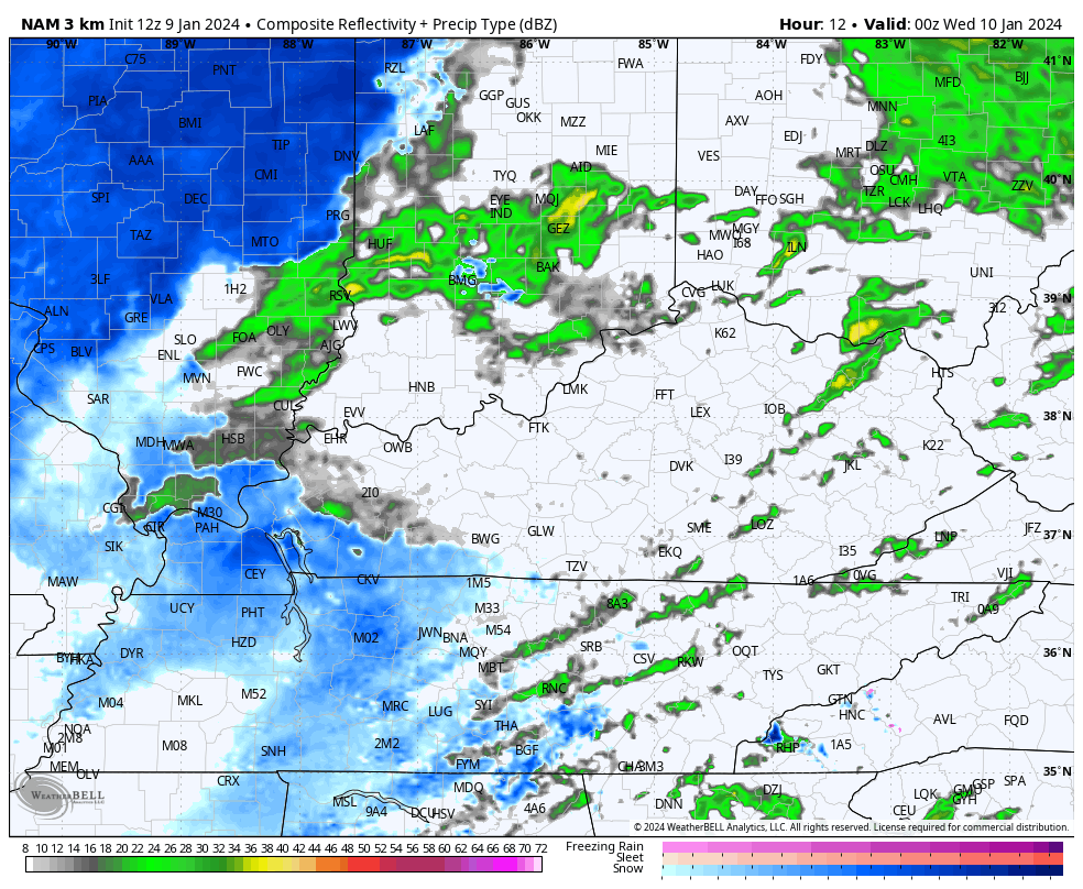
Here’s the future radar from the Hi Res NAM for tonight…
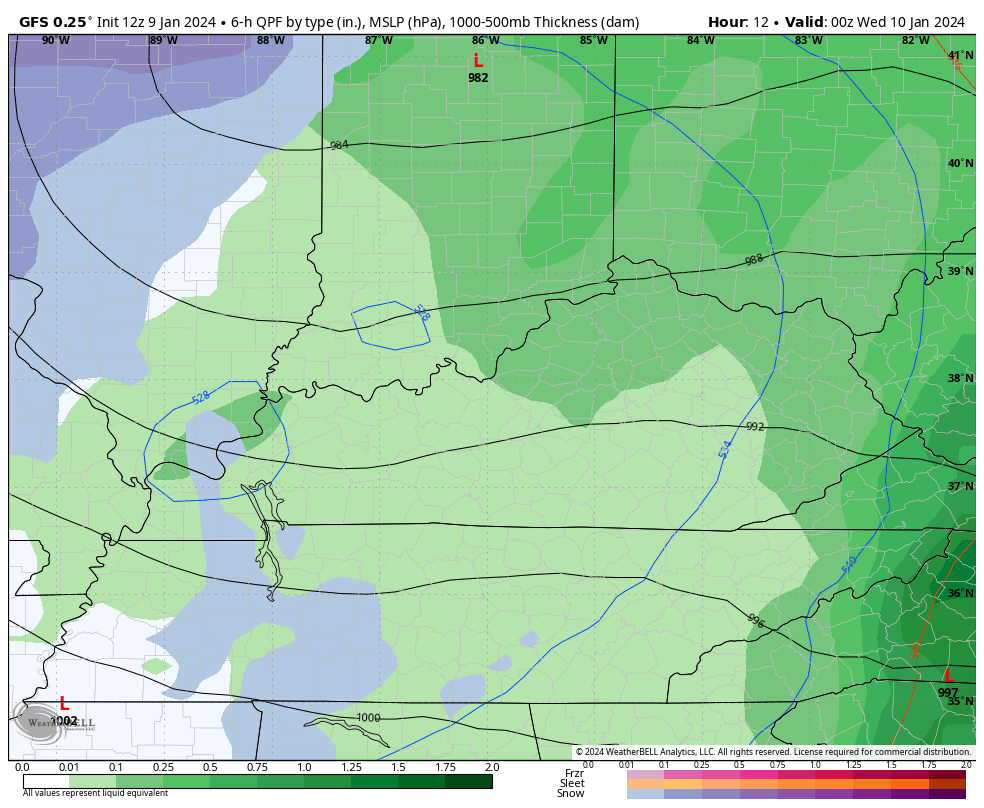
The GFS for the same time…
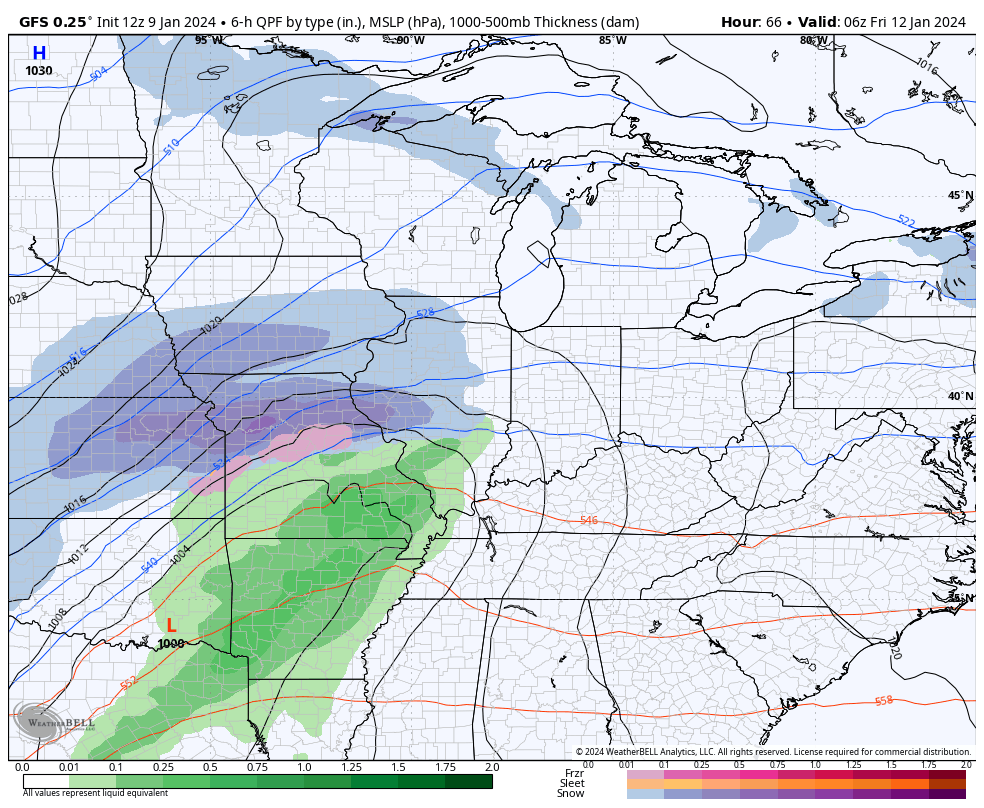
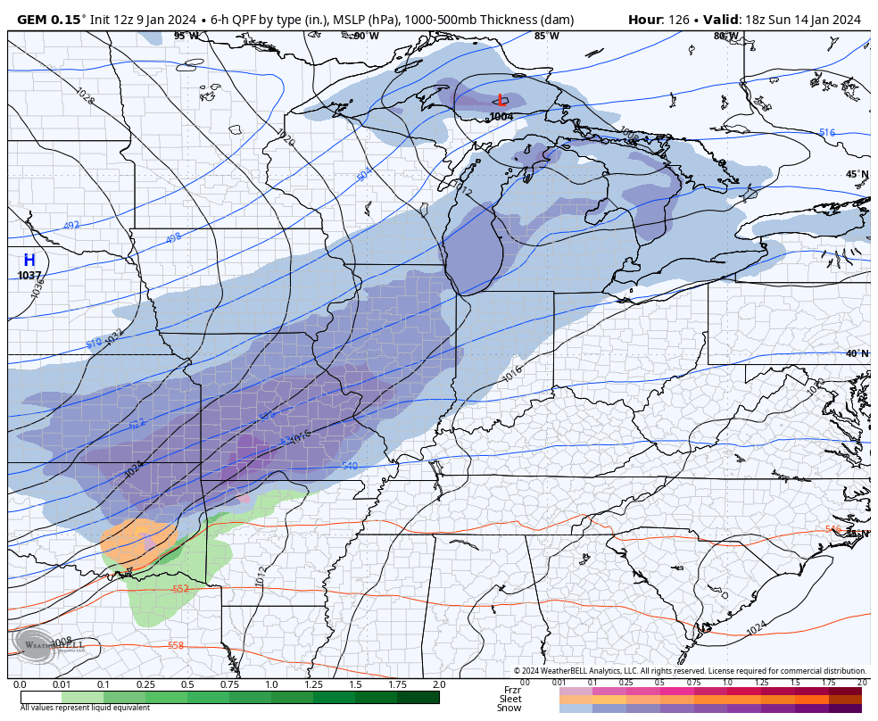
After a fairly calm late Wednesday and Thursday, here we go again. Another strong storm system rolls across the region, taking a track farther east than the current storm. The latest GFS takes the low right on top of central Kentucky with heavy rain and gusty winds Friday. Cold air crashing in Friday evening from west to east will switch the rain over to some snow that carries us into Saturday with accumulations a good bet.
Here’s the GFS…
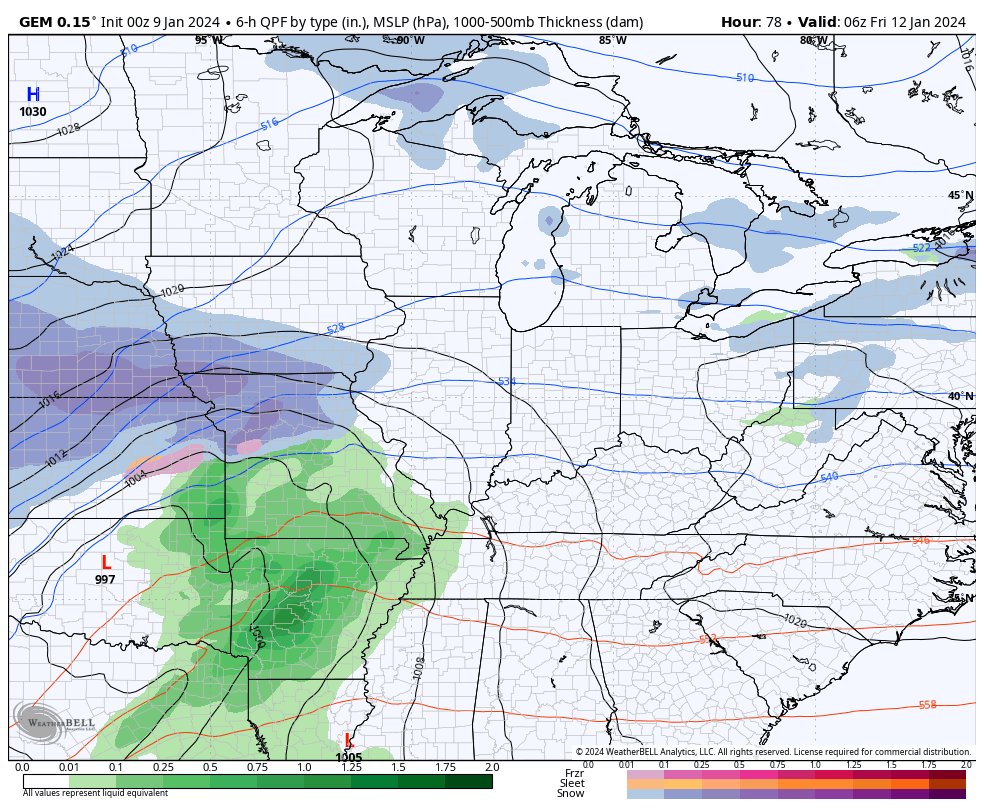
The Canadian is a bit west with the low track, but has a similar overall result…
Very cold air will be noted Saturday as temps drop through the 20s, setting the stage for arctic air to take control starting Sunday. This arctic air will have a storm system riding along the leading edge of it late Sunday and Monday.
The GFS was the first model to have this signal and it continues to do so, even as the model bias of being a bit too progressive and weak with these systems is showing right now…
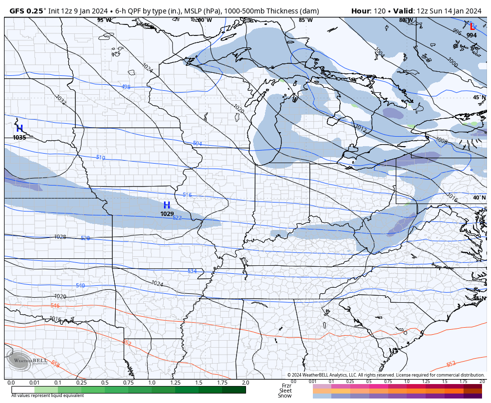
The Canadian is finally jumping on this storm system…
With snow falling into arctic air, snow ratios will be very high!!
Bitterly cold temps are likely to come in behind this with the potential for below zero temps on more than one occasion next week.
I will have the latest on WKYT-TV starting at 4pm and then with another KWC update this evening. Until then, I leave you with your radars to follow today’s action…

Have a great day and take care.

The barometric pressure is all the way down to 28.97 inches of mercury at the NWS Forecast Office in the SW Suburbs, as the rain/snow mix has transitioned to all snow and will accumulate 2-3 inches by the time the snow ends later tonight, along with strong gusty winds. Winter Weather Advisories are now in effect for the entire Chicago Metro Area, with Winter Storm Warnings over the rest of Northern IL.
Thanks Chris. We received 1.46 ” of rain and lots of wind when we entered the dry slot. Power went out for 10 seconds. Just hoping we don’t lose power altogether. Not looking forward to the frigid temperatures next week. The way the winter has gone so far I’m ready for summer !