Good Wednesday to one and all. It’s a snowy start to the day for areas of central and eastern Kentucky as storm system number one moves away. Storm systems #2 and #3 are on the way from Friday through Monday. Those two will bring an increased threat for winter weather and unleash bitterly cold air.
This morning’s snow isn’t much, but some light accumulations are showing up and with temps dropping below freezing, some slick spots will be noted. Watch those bridges and overpasses for a touch of slush.
Clouds and flurries linger through the day for much of the eastern half of the state with temps in the low and mid 30s. Some sun shows up in the west with temps hitting 40 or better.
After a calm Thursday, here we go again! Another potent storm system looks to track right on top of us, bringing more heavy rain, high winds and then some snow.
Here’s a quick breakdown of what to expect:
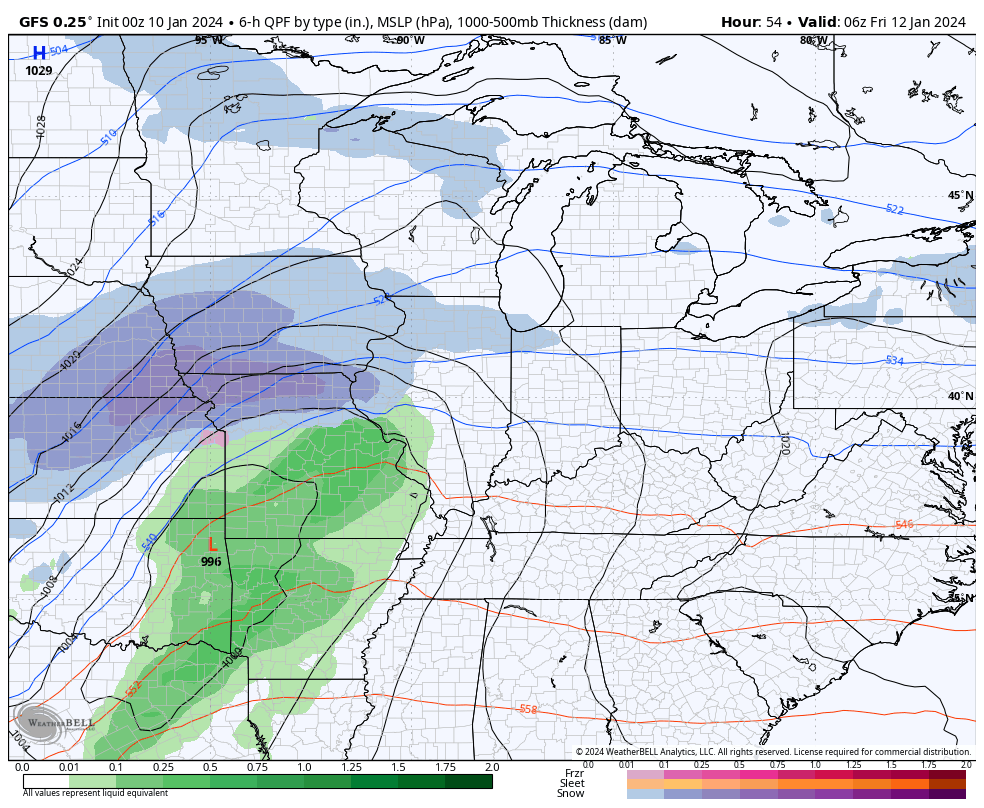
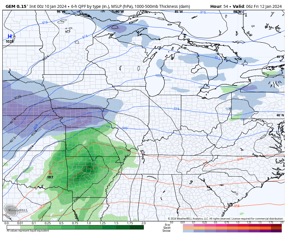
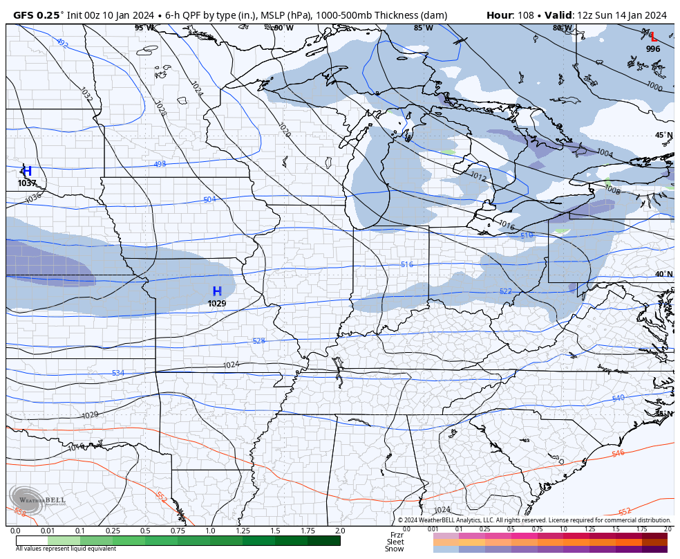
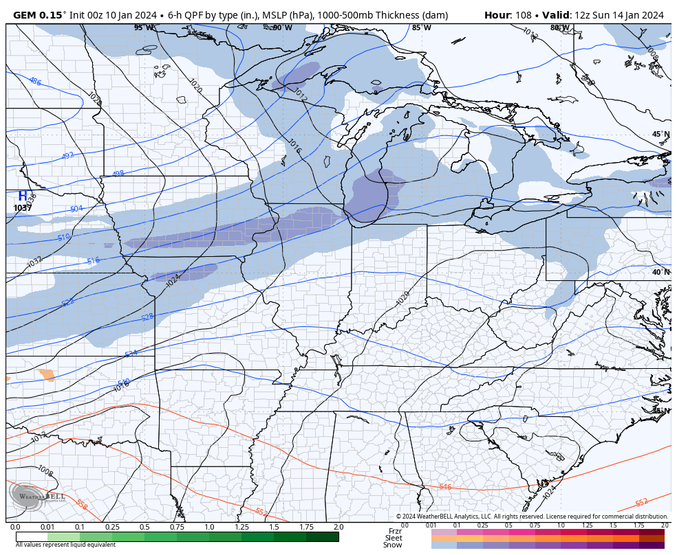
- Low pressure moves into the region and heads toward the eastern Great Lakes.
- Heavy rain of 1″-2″ will be possible Friday across the west with lighter amounts farther east.
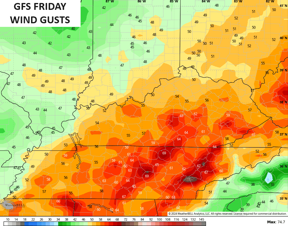
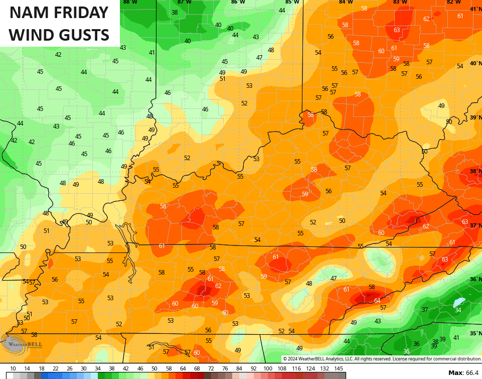
- High winds look to push 50mph or higher once again.
- There’s a quicker transition to snow with a wraparound light snowfall Friday night and Saturday.
- Temps turn much colder and drop through the 20s with wind chills in the teens.
- With this cold coming in and all that moisture on the ground, a significant ice up is possible.
- Travel Friday night and Saturday could get tricky.
- Arctic air comes in behind this with Saturday night lows potentially reaching the high single digits with below zero wind chills.
Here’s how the GFS sees our system…
And the Canadian…
Winds are a major player once again on Friday. There’s the chance for winds to be as high or higher than what we had on Tuesday…
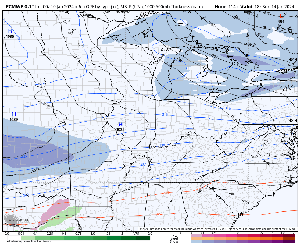
That brings us to the next system that’s riding along the edge of bitterly cold temps dropping in here on Sunday. This potential winter storm continues to show up very well on the models late Sunday through Monday…
The GFS signal has been consistent…
The Canadian signal grows stronger by the run…
The EURO has been touting this stronger and longer duration event for a while. The latest run is really close to producing a much more phased system…
This may very well get a Winter Storm THREAT before the day is over.
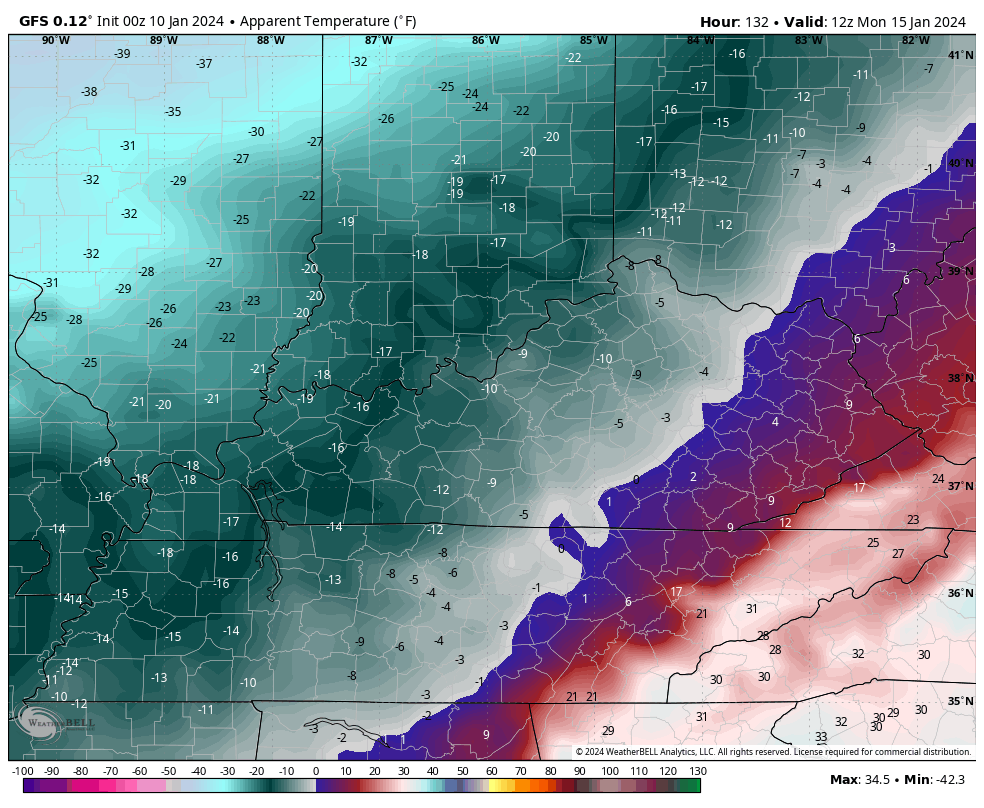
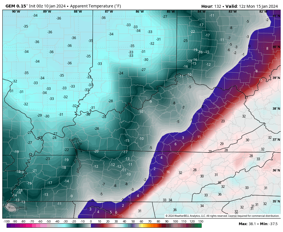
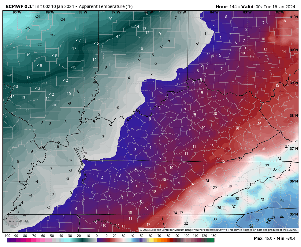
Bitterly cold air comes in behind this system with the potential for actual air temps to go below zero. To make matters worse, winds will be an issue and the models are spitting out some brutal wind chills.
These are the wind chill numbers from Monday morning through Tuesday morning from the GFS and Canadian…
GFS
CANADIAN
If the EURO is right with a longer duration storm, those numbers get delayed by a few hours…
We then have to watch for another system sneaking underneath that bitter cold as it eases just a bit later in the week.
Updates will come your way later today. Until then, let’s track some flakes on your Kentucky radars…

Have a great day and take care.

Make your comments known this morning because this site is likely to crash this afternoon and evening.
Will be interesting to see how KY proud the models stay. Tennessee seems to be getting more love than last night, depending on what model is reading stuff the best. Canadian is a KY fan for sure, but that would be cherry picking the models.
It does make you wonder… what’s the point of Chris even making a post if NO ONE can get here to read it
I think the traffic and nodes are using a Commodore 64 🙂 😉
A total of 2.8 inches of snow fell at Chicago’s O’Hare Airport and 2.9 inches at the NWS Forecast Office in the SW Suburbs on Tuesday, but with rain mixing in and temperatures a degree or two above freezing, the snow compacted down to only around an inch.
The storm system Friday/Saturday should more than make up for Tuesday’s disappointing totals.
Thanks for the update and breakdown of what may happen Chris. Yesterday’s afternoon downtime was quickly resolved before evening. Chris you have a lot followers. Great work.
Yesterday’s recap of what happened in Maple. We had a good soaking rain followed by clearing late with a lot of wind gust that tended to ease through the night. This morning we are still above freezing with some light drizzle.
Not looking forward to the weekend repeat, or the dry Arctic air that is expected next week. At this time, the potential snowstorm for Monday looks weak and the models are not agreeing.
Very concerned as what we will have precipitation type when the Arctic air eases ( ICE STORM. )
This El Nino is behaving like La Nina, The PDO is still – 1.75. El Nino’s in the recent past were always positive, giving the area moderately cold with a lot of snow on the ground.
Schroeder glad you got rain
What were the odds of 2 record low pressure systems moving through Indiana just 2 days apart? It’s still kind of unbelievable that this happened.
I predict backside snow showers, high winds, and low visibility Friday Night for Central KY.
Big snow from Indy to Chicago.
Nobody cares.
Jeff, question: Why are you and Jeff Kidd so rude to Dash. He was just giving his forecast for what may occur the next few days. I agree with his forecast. Please stop being so rude to this gentleman. This is not your Blog.
Yesterday the barometer plunged as the storm approached, dropping from 30.21 to 29.12 In/Hg in just 12 hours. This made it a very bad day for people who suffer with pain from migraines, arthritis, fibromyalgia, and other ailments. One explanation of the relation between a drop in air pressure and an uptick in pain is that lower pressure causes muscles, tendons and other soft tissue surrounding joints to expand, putting more stress on those sensitive areas. Friday could be as bad or worse, so buckle up!
Your spot on Joe about the arthritis pain and the expanding
I’m in pain all the time regardless of what weather type we have.