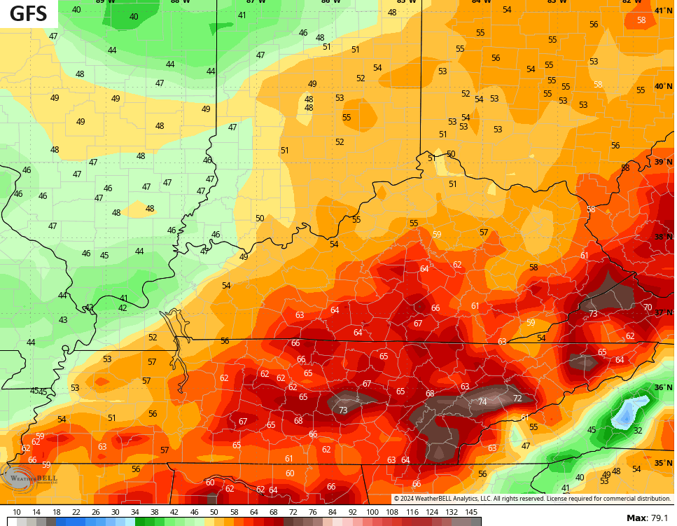
Good afternoon, everybody. The wild pattern we’ve been talking about for a while is about to open up a can of whoopbutt on much of the country. This includes Kentucky as we track strong storms and high winds for Friday with an increasing threat for snow and bitter cold to follow..
Let’s focus on Friday and the strong low pressure moving through the region. This low works up the Mississippi Valley into the Ohio Valley, it brings rounds of heavy rain and strong storms to the state. As cold air crashes in behind the low, watch for a period of light snow and snow showers Friday night and Saturday morning.
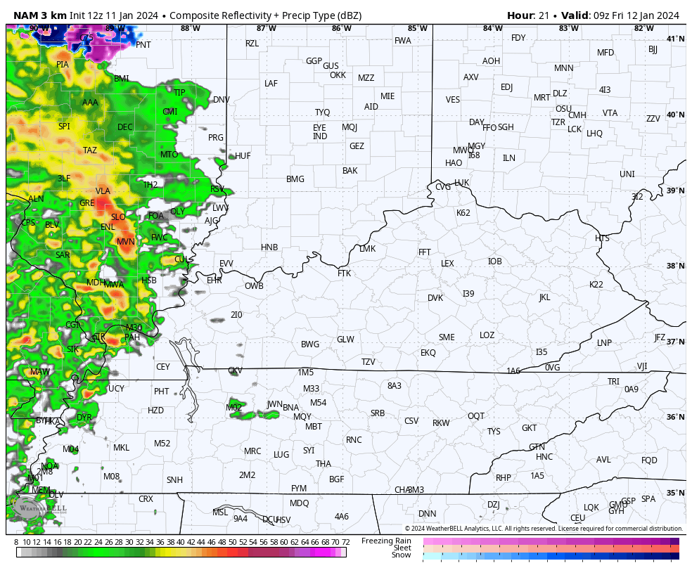
Here’s the future radar from the Hi Res NAM from Friday morning through 7am Saturday…
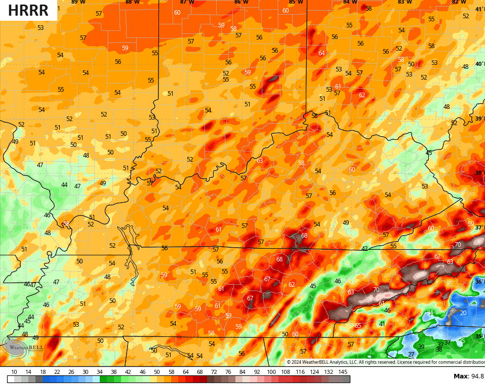
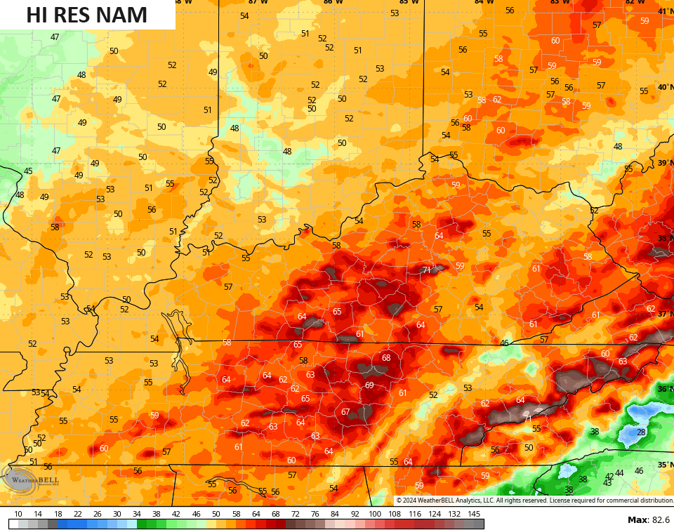
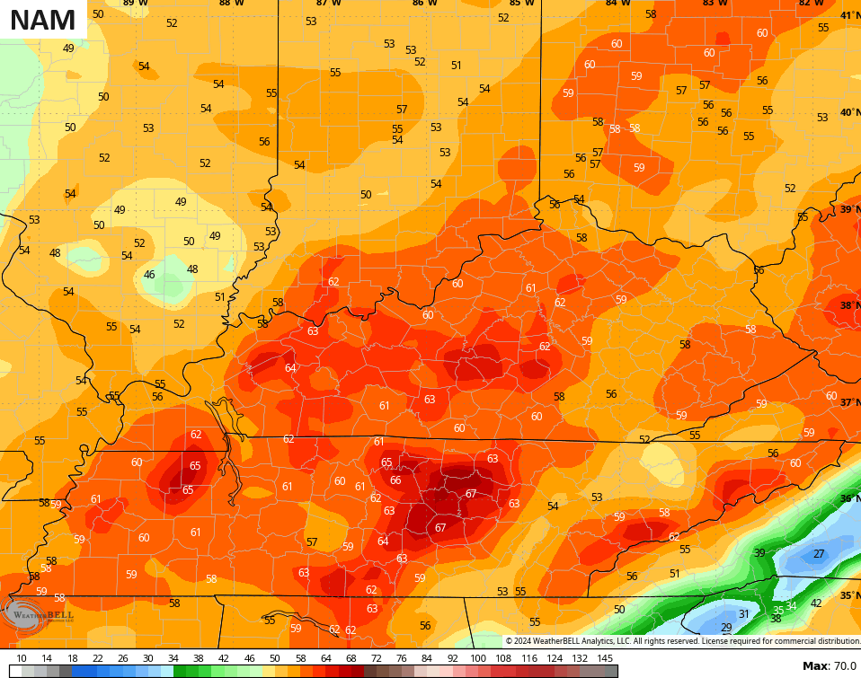
High winds are LIKELY with this setup with widespread wind gusts of 50mph or higher. The models continue to spit out the highest wind gusts I’ve seen since the March 3rd windstorm of last year. 60mph-70mph gusts are showing up on these runs…
Wind damage and power outages are likely Friday, so take whatever precautions you can take to lessen the impact.
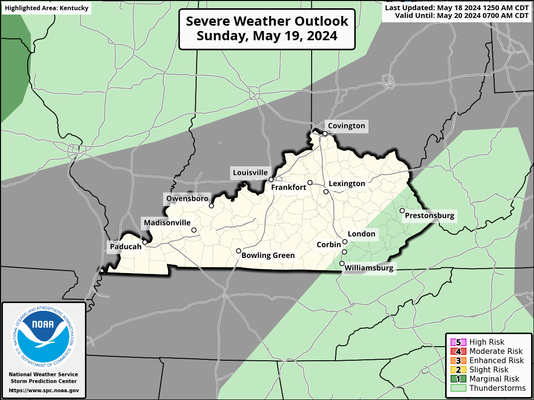
We continue to track a low-end risk for severe thunderstorms as well. Damaging wind is the main player, but there’s an outside chance for a storm with a little spin with it. Here’s the Severe Weather Outlook from the Storm Prediction Center…
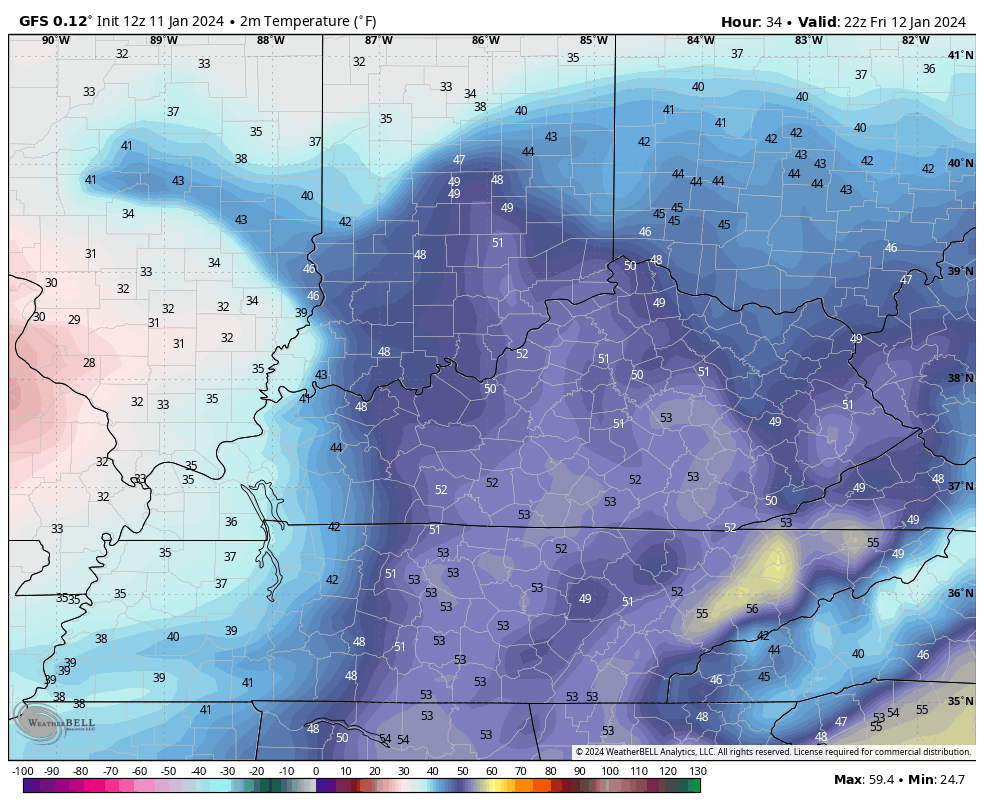
The temp crash with this system is pretty awesome to see on the models. This animation goes from 6pm Friday through 7am Saturday and shows how quickly we go from the 50s to the 20s…
Wind chills during the same time…
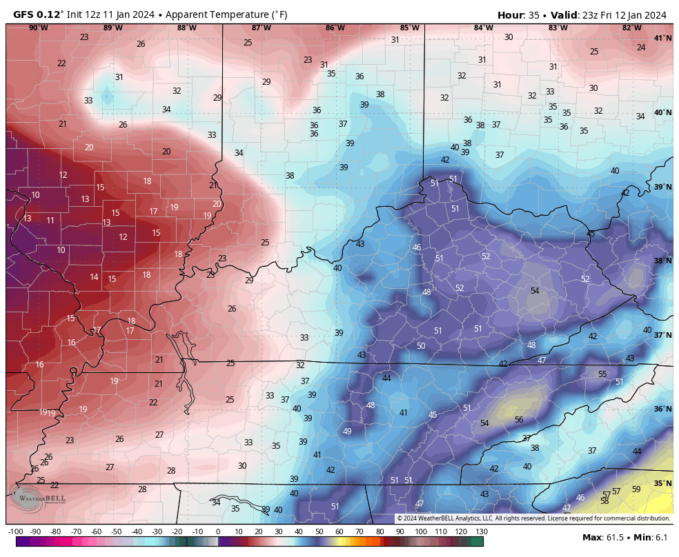
Ouch!!
Ok, let’s get into the late Sunday through Tuesday potential winter storm. The models are still dancing around a bit, but we are getting closer to having them come together on a similar solution.
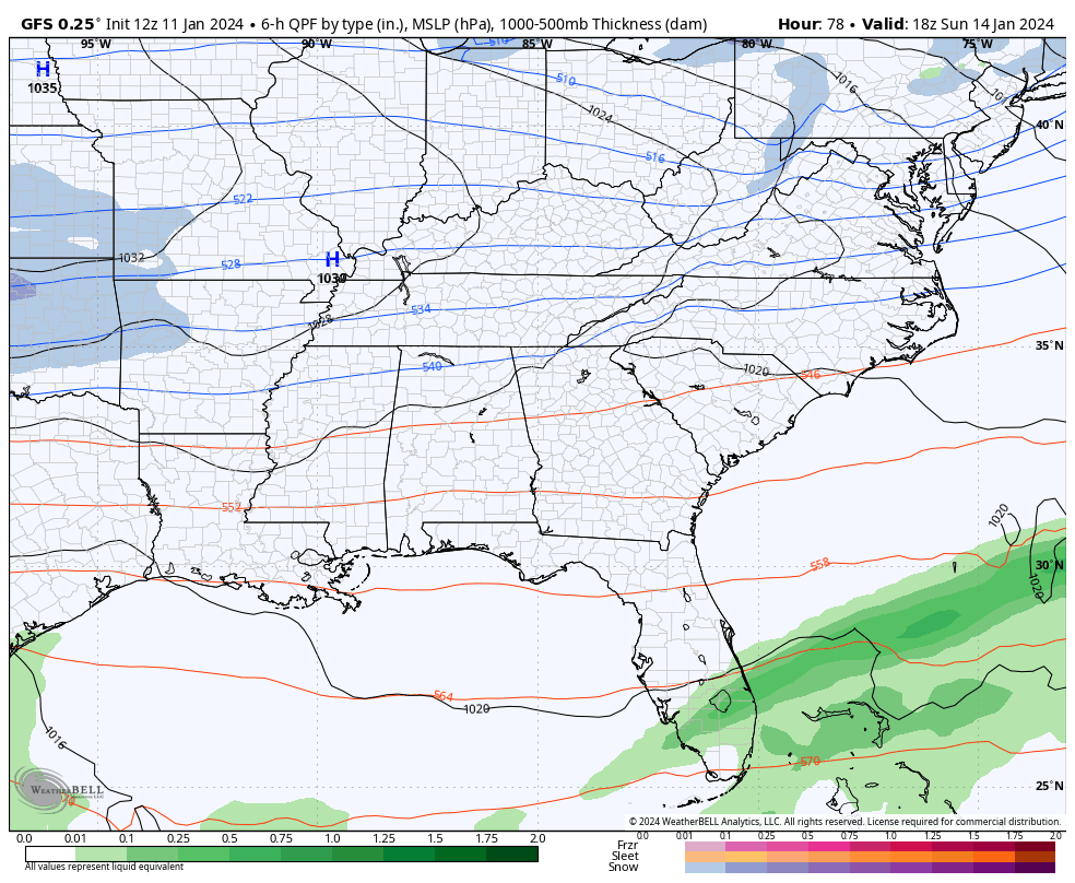
This storm may be spread out with one wave of low pressure late Sunday and early Monday with the main low then coming through from late Monday through Tuesday. This is the trend on both the GFS and Canadian Models…
GFS
CANADIAN
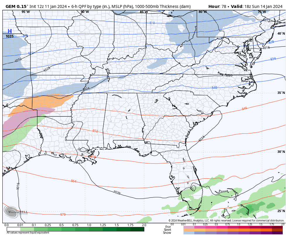
Significant snowfall numbers would show up with this trend and that’s the case on both of those models.
To be honest, this setup is not very far from becoming a big time hit in our region. But, we are a few more runs away from figuring out if it can get to that kind of an event.
What could go wrong with this system? The arctic cold overwhelms the region and pushes the deepest moisture to our south and east. That is a concern of mine and it’s the only reason I’m not pulling the trigger yet on a WST.
I’ll have the latest on WKYT-TV starting at 4pm and with another update on KWC this evening.
Have a great day and take care.

This would make the whole state happy if you like 0 degrees and 10 inches of snow..Personally I’ll pass..
https://www.pivotalweather.com/model.php?rh=2024011112&fh=150&dpdt=&mc=&r=us_ov&p=snku_acc-imp&m=gdps
This would make the whole state happy if you like 0 degrees and 10 inches of snow..
https://www.pivotalweather.com/model.php?rh=2024011112&fh=150&dpdt=&mc=&r=us_ov&p=snku_acc-imp&m=gdps
Southern Ky. East of 1-75 appears to be in the driver seat.
Communities along the Ohio River best hope is the Canadian model.
I am going to wait on Saturday to give the Euro any credence.
More than 6″ of snow is fine if fluffy. The heavy stuff is too much for power and people’s backs. Well, mine anyway- Huge inclined driveway!
The trend so far FWIW seems south, but should be a bit closer to models coming to some semi-agreement and perhaps favor more north. CB could get to the point of flipping a coin 😉
Meh
Thanks Chris. Maybe this storm tomorrow will track a little farther west and lessen the winds here in Kentucky. One can hope. My local forecast calls for a 40% chance of snow showers Sunday night and a 30% chance of snow showers on MLK Day. That Arctic air looks dangerous for old people ( like me ) and I certainly don’t want to be snowbound like we were in 2015. I have another word for that Arctic air, but I can’t say it on the Blog. I’ll give you all a hint, the first letter starts with F .
Drought monitor came out this morning, and still has our area in severe drought and the outlook in drought persist. The 14 day outlook from NOAA has our area in below normal precipitation. Hope we don’t have that ice storm on the return flow from the Gulf, and the warm front arrives before the precipitation.
Winter Storm Warnings are now in effect for the Chicago Metro Area from 3 AM Friday through noon Saturday, with accumulations in excess of six inches, heaviest to the north. The snow is predicted to mix with rain late Friday morning before changing back to all snow late in the day with increasing winds and much colder temps.
The one thing this storm has that the previous storm on Tuesday didn’t have is bitterly cold air behind it, so the snow should stick more than it did on Tuesday. The Chicago NWS says that there could be at least a two or three hour period of near blizzard conditions Friday night through early Saturday, due to the 40 MPH+ winds and falling/blowing snow.
That’s plenty of snow to shovel Mike, but I would be careful being out in the bitter cold.
Enjoy the snowstorm and take care !
Thanks Schroeder! I enjoy the shoveling, it’s a great workout! I have two driveways to shovel, mine and the 86-year old widow’s driveway across from me. I hope to get the majority of the shoveling done Friday morning after I get home from work and Friday night before I go to work. The bitter cold won’t be here until later on Saturday.
That’s wonderful Mike. Helping out your neighbor is what it’s all about. It’s what God wants all of us to do. If everyone did this, we would have eternal peace here on Earth. Again, enjoy the snowstorm. Take care !
Guess the GFS says your move Euro..Personally hoping Euro is right..Don’t want no part of single digits with 6-10 inches of snow..
The Sunday/Monday storm will have a central pressure as low or possibly lower than the storm earlier this week, resulting in a steep pressure gradient, so +60 mph winds are in play. The abrupt drop in pressure also means that people who suffer from chronic pain will have a miserable day.