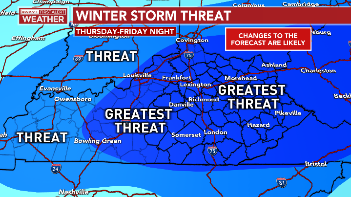
Good Wednesday to one and all. It’s a brutally cold start to the day across the region as we get set for more snow and another blast of bitter cold for the weekend. That Winter Storm THREAT continues from late Thursday through Friday night.
Let’s begin with the brutal cold of this morning. Actual lows for many are in the -5 to 5 degree range but a few spots may very well wind up close to -10 across the south and east. Wind chills are brutal and may reach -15 at times this morning.
Conditions improve this afternoon as a relative heat wave moves in with highs hitting the 20s.
I have no changes on the Winter Storm THREAT ahead…
Low pressure rolls across Tennessee Thursday with a band of snow developing across Kentucky. That combines with a system dropping in from the northwest, bringing light snow in here Thursday night and Friday. Northwest flow snow showers and squalls continue behind that Friday night and early Saturday across the east.
I’m not ready for a First Call For Snowfall just yet, but hope to have that to you with the next update. I still need to see a few more things come together before throwing numbers out there.
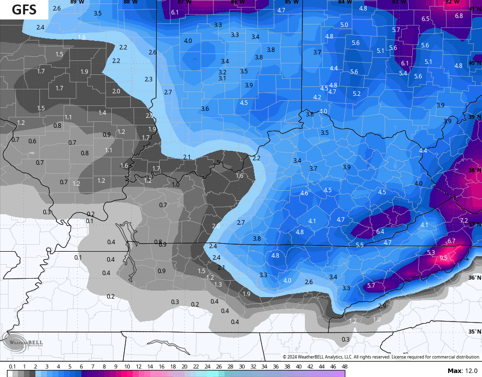
The models are in decent agreement on a nice snowfall for most of central and eastern Kentucky.
The GFS has a widespread 2″-6″ snowfall across this part of the state with much lighter amounts in the west…
The ICON is a bit north with the heaviest snow and is a bit more optimistic for the west…
![]()
![]()
The Canadian family is more in line with a 2″-4″ snowfall for central and eastern Kentucky…


The EURO is a cross between the GFS and the Canadian…

Bitterly cold air crashes in behind this Friday afternoon and night. Temps by Saturday morning drop toward zero with a wind chill back into the danger category…
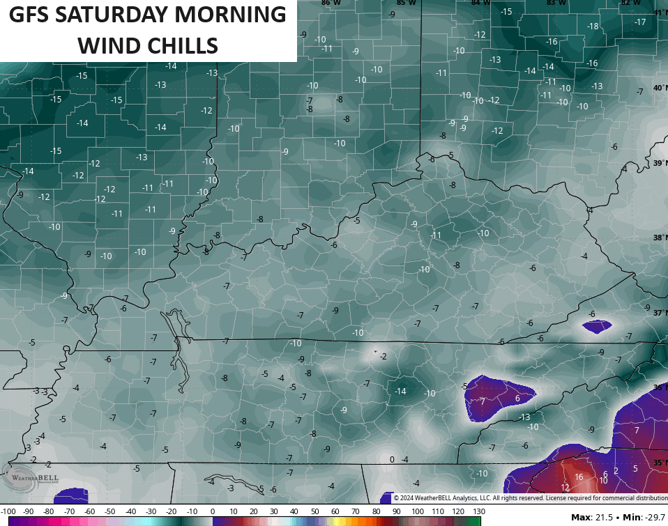
Saturday’s highs stay in the teens with a wind chill near zero all day. Sunday morning lows are likely below zero once again for much of the region.
Milder air floods into the region next week as we go into a January thaw. Unfortunately, we really need to keep a close eye on the potential for high water issues during this time as the patter I see setting up is loaded with heavy rain aimed at our region from the Gulf of Mexico. The models are jumping on this pattern…

This wet and milder pattern won’t last too long as I see winter coming back at the end of this month, setting the stage for a wintry February and March.
I will have updates later today, so check back. Make it a good one and take care.

Thanks Chris for the update. Minimum temperature of 6 below this morning.
Looks like far western ,ky is going to be left out again on the next system.
The majority of major snow events over the last few years seems to be east of I-75.
Scraps for 1-65 & west.
LONG RANGE UPDATE: Another Arctic blast this weekend w/ some snow. Very mild next week with colder risks trying to come back Feb 1st, but that might be too quick. Winter goes into March.
12.2 below on KY MESONET this morning for Johnson Co.