Good afternoon, everyone. I don’t have a lot of time, but I wanted to drop by for a quick update on the next storm rolling in from Thursday through Friday night. This system will bring more snow to the region and unleash another round of bitter cold for the weekend.
Here’s the rather crude looking First Call For Snowfall…
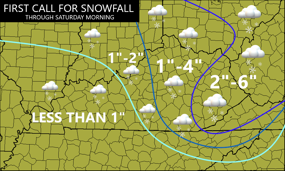
I will be making changes to that later today, but that’s a quick first look at what may play out.
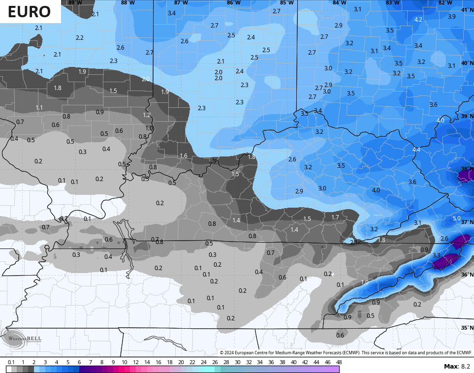
Here’s what the EURO snow map looks like…
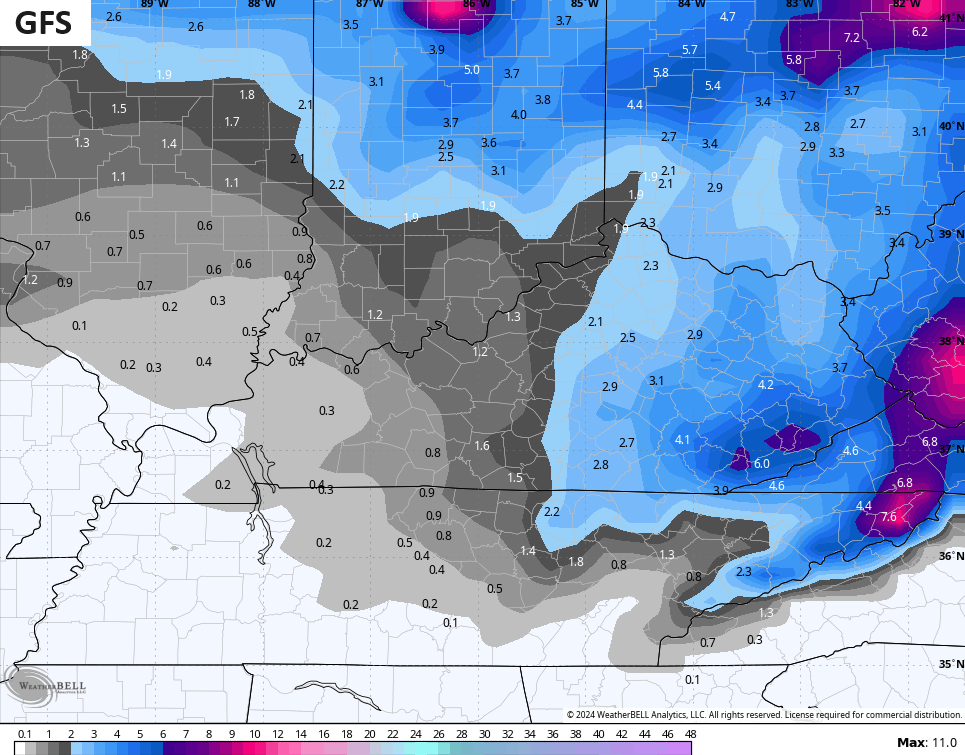
The GFS is picking up on much higher totals in the east as it’s seeing more of the northwest snows late Friday and Friday night…
The ICON looks like the EURO…
![]()
![]()
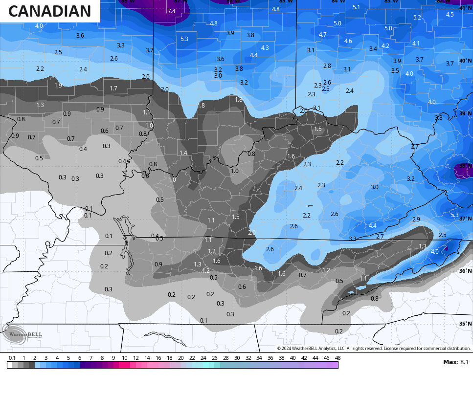
The Canadian isn’t too dissimilar…
I’ll have the Updated Call for Snowfall coming up on WKYT-TV at 4pm then again here on KWC coming up this evening.
Have a great day and take care.

Can anyone tell me where to find overnight lows for last night??.?
Hey Crystal, here is the link for the Jackson, KY National Weather Service page that had that info (I can’t remember right off the top of my head if your area is covered by the Jackson, KY NWS or by Charleston, WV):
https://www.weather.gov/wrh/climate?wfo=jkl
Thank you very much
You can also go to the main NWS pages:
https://www.weather.gov/lmk/ – Louisville
https://www.weather.gov/jkl/ -Jackson
When you click any point on the map, it will go to that location’s forecast. In the upper-right under “More Information:” you can click “3 Day History” and it will give you the data for the last three days for the closest official NWS reporting site.
And here’s NWS Charleston, WV it that’s your local NWS office:
https://www.weather.gov/rlx/
Crystal did you finally get snow?
Yes I did a good one
Yay!!!
Got winter advisory out here in far western ,ky, light freezing rain and snow late tomorrow morning into the afternoon. This was never mention in yesterday or today forecast.
Looks like about half of what they were showing, a day ago. OK by me! Scenic snow and less to shovel.
Richmond will still get the same as we just got, so…..
We got five total inches from the last events. Might not seem like it, but got three and than two more. Gravity is not kind to fluffy snow 🙂
I was expecting about 5″ from this one so would be about the same, but models show less now. Also did not expect temps to be above freezing tomorrow, so looking like not a topping event with current snow.
I have been reading about the i word to start out in my area I hope not I like power and heat too much.