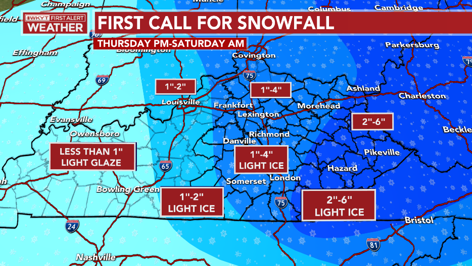
Good Thursday, everyone. Snow works into the region later today and continues through Friday with bitter cold set to follow. This system isn’t as strong as what we had earlier this week, but a few to several inches are likely across, especially, central and eastern Kentucky.
Some thoughts on the setup:
- A touch of light snow or flurries may impact northern Kentucky late morning into the afternoon. Much of the daytime hours are dry.
- Low pressure working to our south throws moisture into southern parts of the state this afternoon. This may start as a mix of freezing rain and some snow.
- This lifts north and northeast across central and eastern Kentucky from late in the afternoon through the evening.
- Light snow then drops in from the northwest this evening through the overnight across the central and east.
- Light snow gives way to snow showers and a few squalls in these same areas Friday into Friday night.
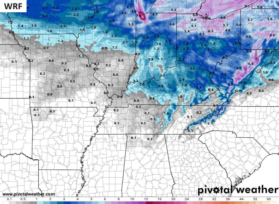
- Snow accumulations will range from less than an inch in the west, to a general 1″-4″ in the central and east.
- Areas of the far east and southeast may see totals a little higher because of the upslope snow showers through Saturday morning.
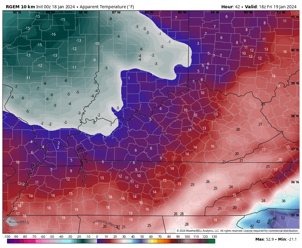
- Bitterly cold temps crash in here later Friday with wind chills from -5 to -15 Friday night.
- Lows in the singles will be with us Saturday morning with the chance to go below zero Sunday morning.
I have no changes to my Call For Snowfall…
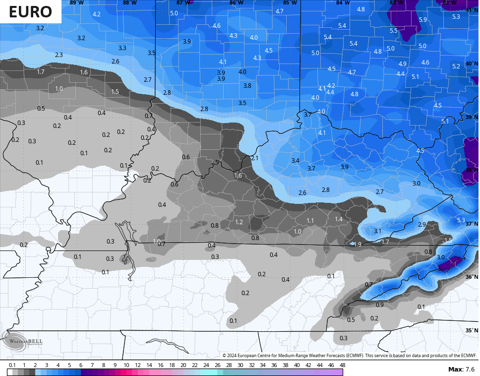
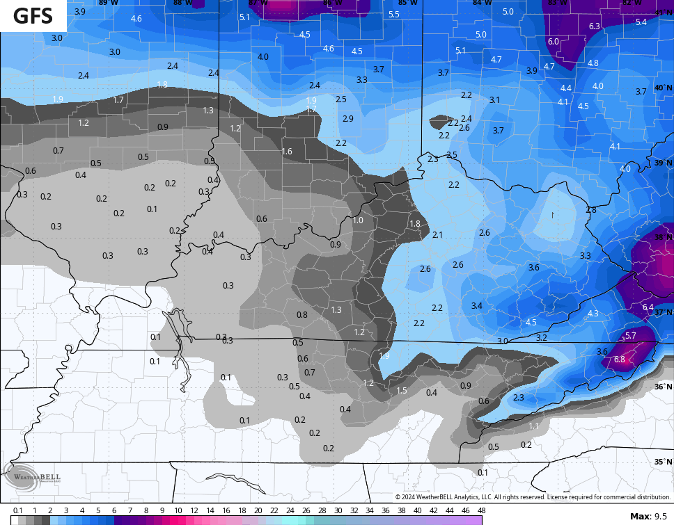
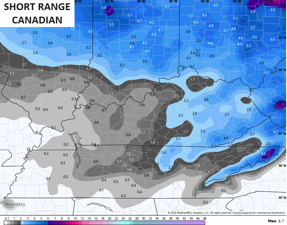
The models are in pretty good agreement with my forecast, but vary a bit on the location of some 4″ or more snows.
The latest EURO is more across the Lexington Metro into northern and northeastern Kentucky…
The GFS is more across the southeast with the higher totals…
The Canadian is a little more jumbled…
The ICON is a bit more generous with the 4″ amounts…
![]()
![]()
The WRF is a bit more generous with snow amounts into the west…
I mentioned the bitter cold coming and this shows up with the wind chills starting 1pm Friday through 8am Saturday…
This pattern flips around quickly early next week as milder winds kick in. This milder setup looks to bring in a lot of wet weather that can lead to quite a bit of rain falling in our region…
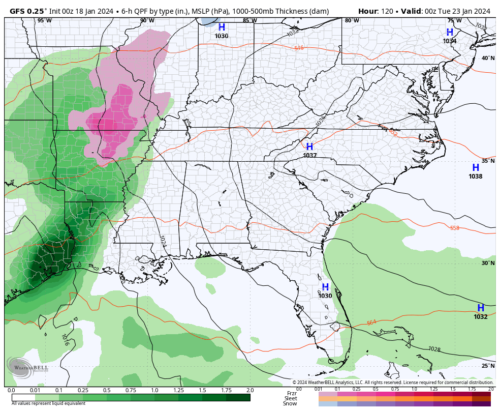
Rainfall totals through the same time on the GFS…
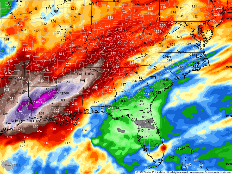
This looks like a super wet January thaw with winter coming right back at us as we flip the Calendar to February.
I will have your normal updates later today, so check back. As always, I have your winter weather tracking tools…

Have a great day and take care.

Thanks for the update and the forecast breakdown. Hoping that the surface temperatures increase above freezing before the precipitation starts. My brother and I have been snowbound since Monday. Nothing was done to make the roads safe for travel. I have a doctor appointment on Wednesday. The weather should be okay by then.
Have a Great Day everyone !
Cloudy and 22 in Corbin
Here is the link for the summary of the extreme cold that the Chicago area experienced from Jan. 14th through the 17th. High temperatures did not get above five degrees from the 14th through the 16th at O’Hare Airport, which is the first time this has happened since February of 1996. It was even colder at the NWS Forecast Office in the SW Suburbs, where the temperature dropped to -14 Sunday and Monday mornings, with a wind chill of -41 Sunday morning.
https://weather.gov/lot/2024/01_14-17_Cold
Sorry for the bad link, here’s the correct one: https://weather.gov/lot/2024_01_14-17_Cold
Wow you are in the cold my friend