Good afternoon, everyone. Our snow system moving in is getting very close to me pulling the trigger and calling this a Winter Storm ALERT. That’s issued when a decent amount of the region can reach snow totals of 4″ or more.
Before we get into that, here’s a look at the Winter Weather Advisory that’s out for all of Kentucky expcept the far north…
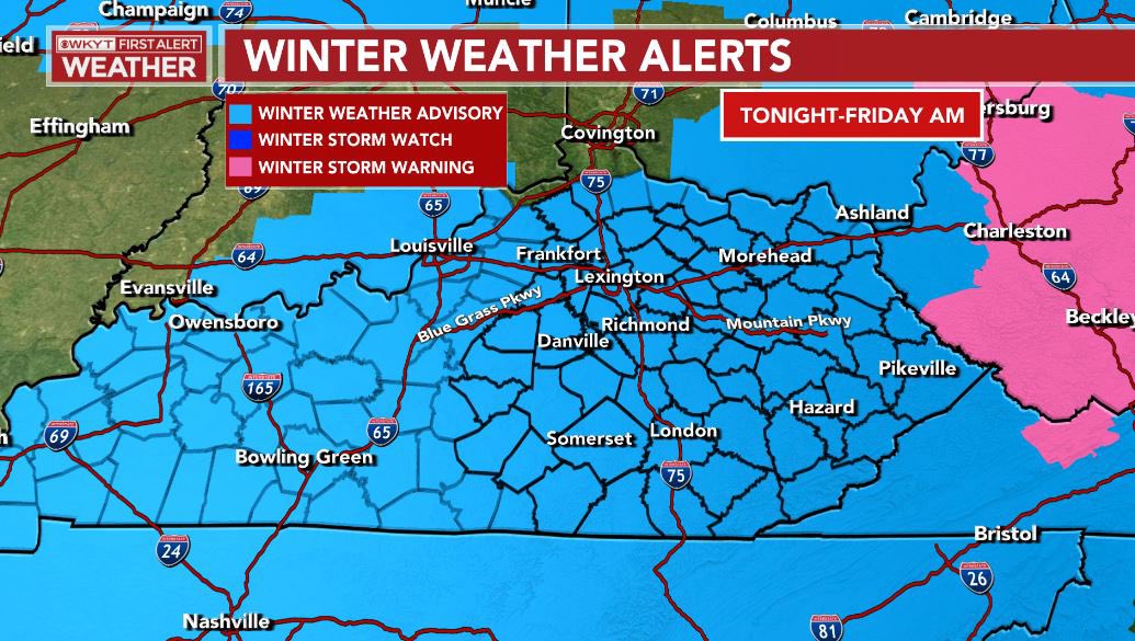
If you’re in those northern Kentucky counties not included in the Advisory, I’m not sure what to tell you. The NWS in Wilmington does not serve your area very well.
You also notice the Winter Storm Warning in West Virginia is right up to the Kentucky border. This may very well get expanded into Kentucky later today.
I’m still rolling with the snowfall map, but I plan to tighten things up with my next update on WKYT-TV starting at 4pm and here on KWC later this evening…
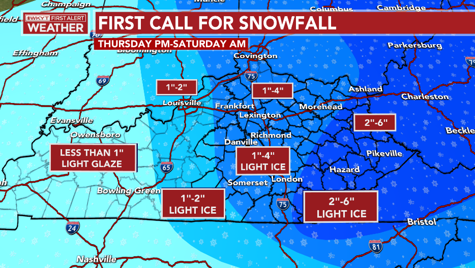
The morning runs of the models are going toward the higher end of my forecast totals. The GFS forecast is for this to meet winter storm criteria of 4″+ snows for much of central and eastern Kentucky…
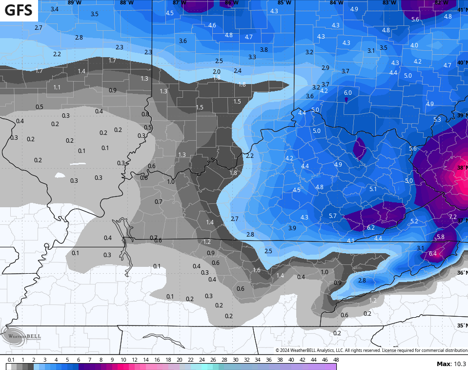
The final runs of the GFS for this last storm actually performed the best of any model, so it will be interesting to see how this one works out.
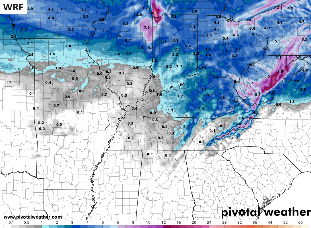
The WRF is close to the GFS…
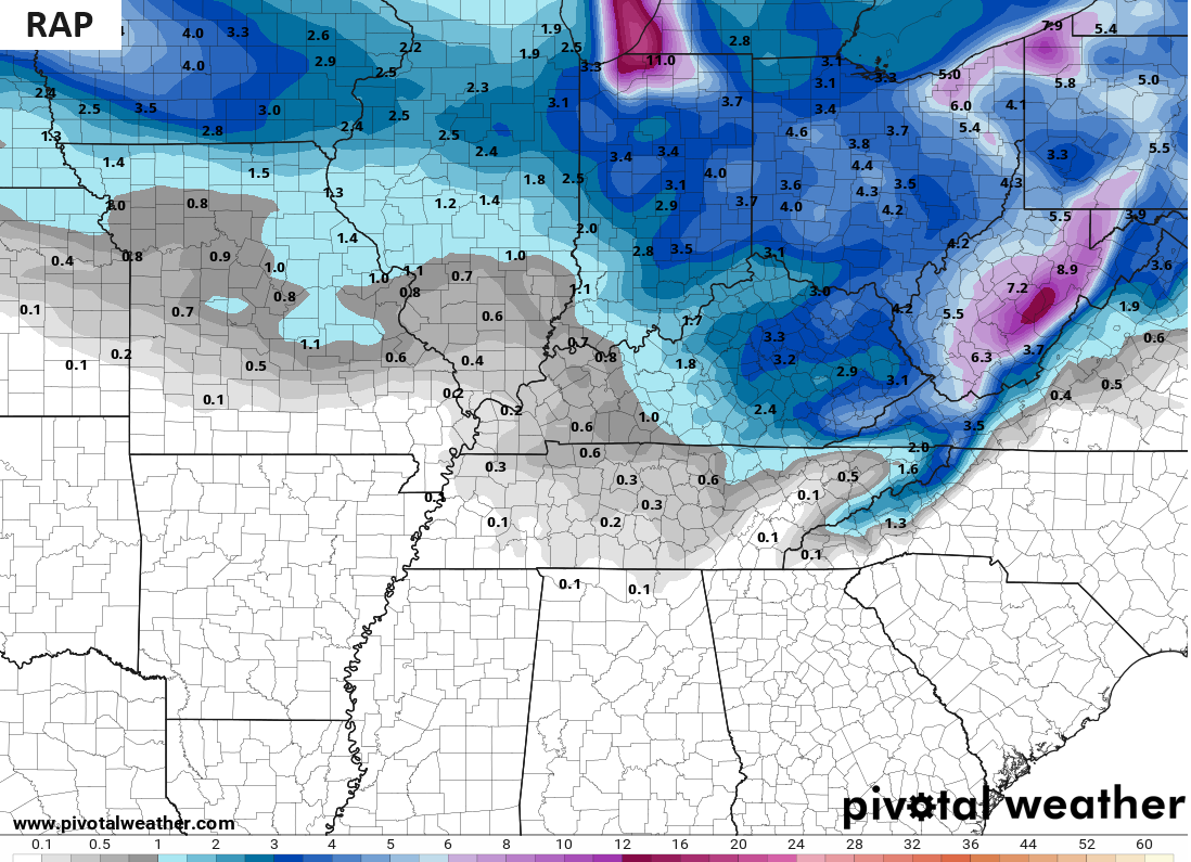
The RAP is in the ballpark…
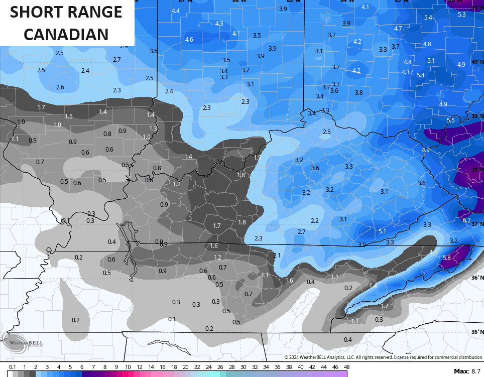
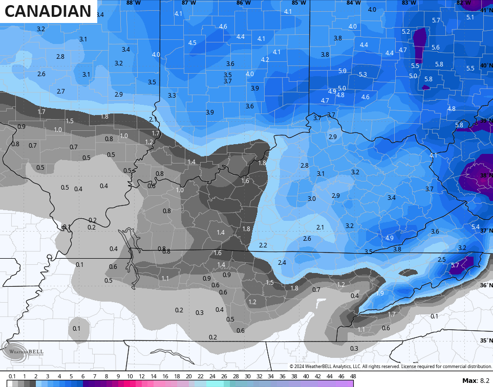
The Canadian family also jumped up the totals, but not to the extent of the GFS…
The ICON has been consistent in showing similar totals…
![]()
![]()
Again, the latest comes your way on WKYT-TV starting at 4pm with another KWC update or two on the way as well. I leave you with your snow tracking radars…

Have a great afternoon and take care.

I see radar returns, that appear to be virga. Has the timing of this moved up? RAP moving towards GFS, interesting
I’m encouraged by this update! I know I’m in the minority, but I want the snow. Thanks for your hard work Chris!
im in the same both as up in maysville, they all up here think im nuts for wanting cold and snow
I think most do like it, but used to things not panning out… That or ice instead.
It’s happening! Chicken little is out of the cage!
*yawn*
Thanks Chris for all your work and time you put into it. I know you have a real job too lol. You always did say sleep is overrated. I wonder will it affect the snow because we are at a balmy 39 and I am not complaining. It feels good after this cold we have had. That will be interesting how it plays out in my area. Everyone stay warm and don’t forget the outside pets.
I just got the winter storm warning for pike county heavy snow it says and 3 to 5 I believe.
Yep, this has a shot of over-performing, rather than the normal opposite for the area.
Blink twice if you need help. 😉
lol
All of KY, even the far northern counties, are now under a Winter Weather Advisory, with the counties in far Eastern and SE Kentucky under a Winter Storm Warning. A portion of NW Indiana is in the bullseye for very heavy lake effect snow later tonight, with totals of 12-18 inches in some areas. In the Chicago area, 2-3 inches seems to be a good bet by the time it ends early Friday morning. The NW winds will pick up and cause blowing and drifting of the snow, with more bitter cold from Friday afternoon through Sunday morning.