Good evening, folks. We continue to track this latest winter storm into the region. It’s bringing unleashing another round of accumulating snows and ushering in bitterly cold temps for the weekend.
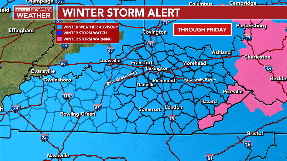
A Winter Weather Advisory is out for almost the entire state and I think there’s a chance to upgrade this to a Winter Storm Warning for parts of central and eastern Kentucky. This is outside of where the Winter Storm Warning that’s already up for the Virginia border counties…
The New Call For Snowfall highlights an area from the Bluegrass Region into eastern Kentucky for the potential of 2″-5″ of snow through Saturday morning with higher amounts in the far southeast…
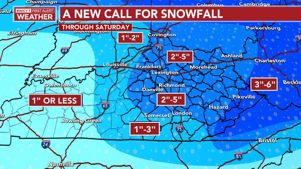
A narrow comma head of moderate to heavy snow is developing this evening across parts of the 2″-5″ area. Snow totals rapidly decrease the father west you go in the state.
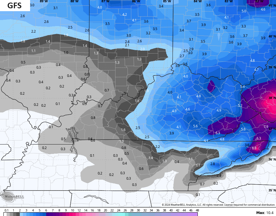
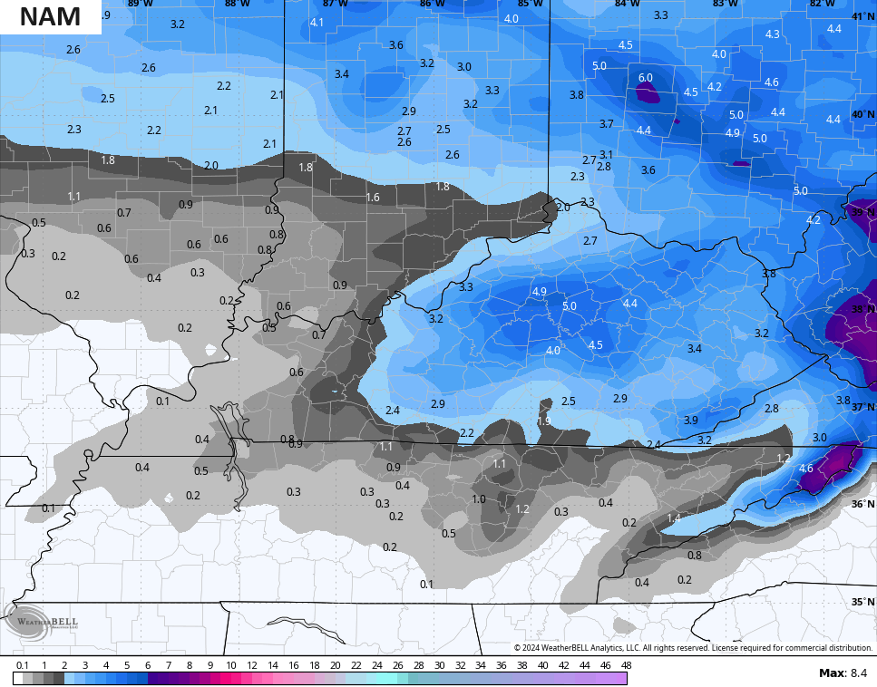
The late afternoon model runs are all in pretty good agreement with the potential for 4″+ snows possible, they just vary on where.
The GFS continues to be the most widespread with the heavier totals…
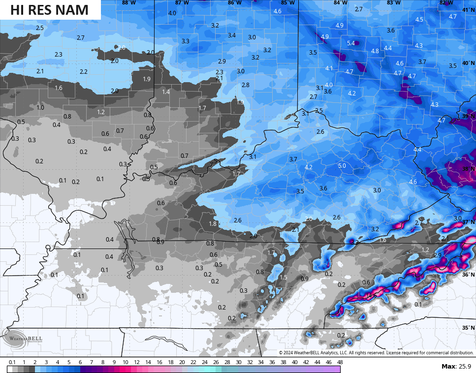
The NAM fam finally caught on to this system…
The ICON is pretty steady…
![]()
![]()
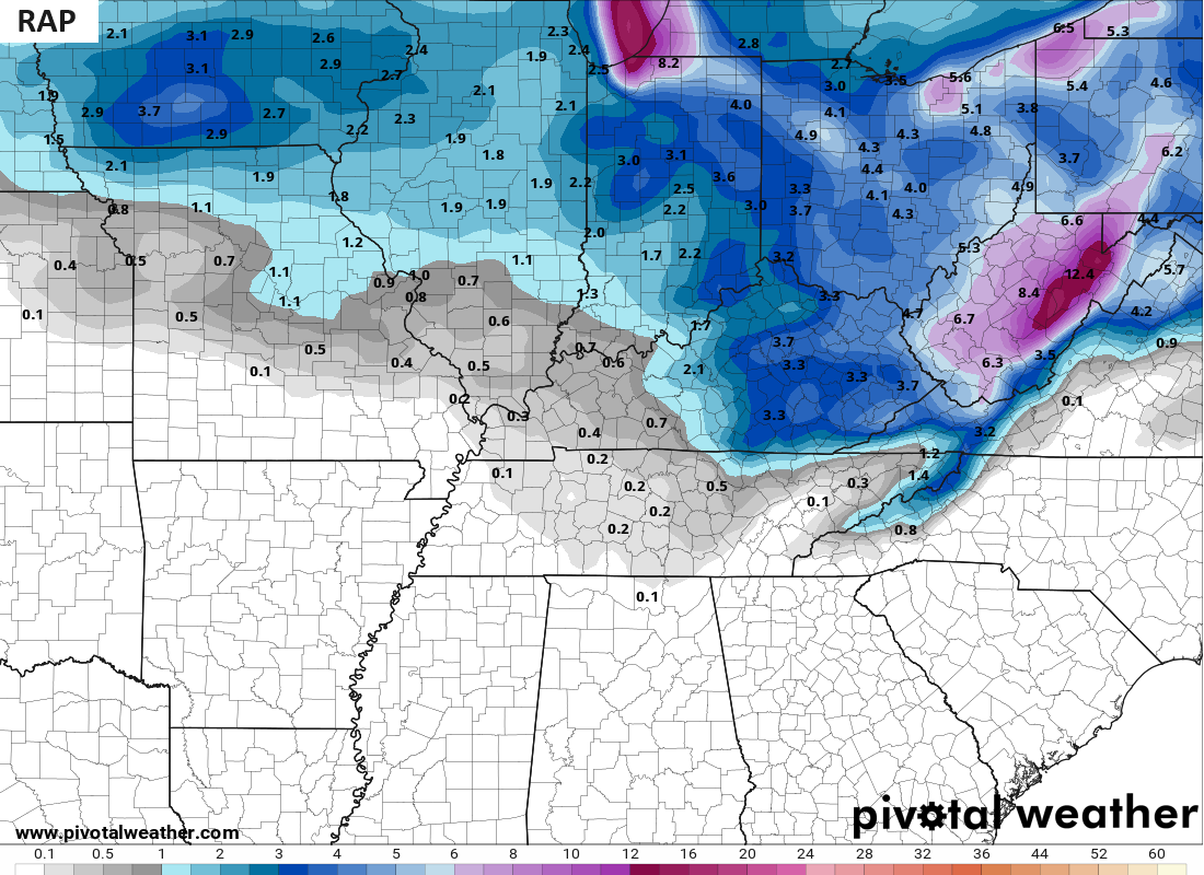
So is the RAP…
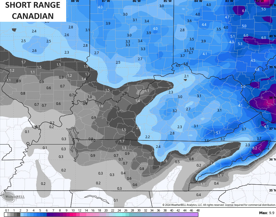
And the Short Range Canadian…
It’s important to note this is through Saturday morning and that includes the snow showers and squalls through Saturday morning.
Here are your radars to follow along with the evening bands of snow…

Enjoy the evening and take care.

This certainly beats ice and also a big heavy snow. Neither are good for power, or shoveling.
Snow is coming down in Pikeville looks like the road has covered back over. Stay safe everyone don’t forget the pets.