Good Saturday, everyone. Our run of extreme winter weather continues out there today with snow showers and brutally cold temperatures. This cold air hits the low mark tonight and early Sunday before we turn the pattern around into next week. That pattern may wind up bringing a problem of a different kind.
The snow showers and squalls are more prominent across the east and southeast, but some flakes will fly all the way into central Kentucky from time to time. Areas of the east will continue to see light accumulations. Here are your radars…

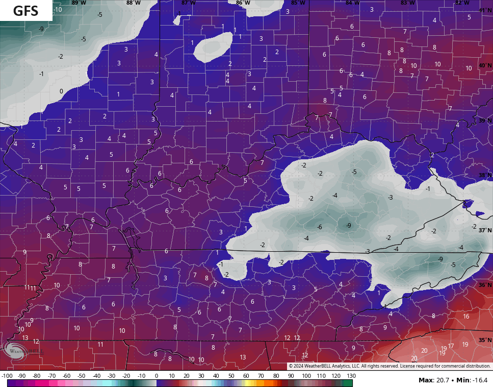
Let’s now talk about the bitter cold:
- Temps this morning are in the single digits for much of the state.
- Wind chills are way down there in the -5 and -15 range. That’s firmly in the danger category.
- Highs are generally low and mid teens with wind chills making it feel even colder.
- This sets the stage for widespread 0 or below numbers tonight and Sunday morning.
- A few areas can drop to -5 to -10. Wind chills won’t be much of an issue.
- Highs rebound into the low and middle 20s Sunday afternoon.
The Sunday morning lows can drop way, way down there. The models are even seeing this potential…
Milder winds kick in next week but the pattern turns very, very wet as a strong southwesterly flow means repeat rains coming at us Tuesday into next weekend…
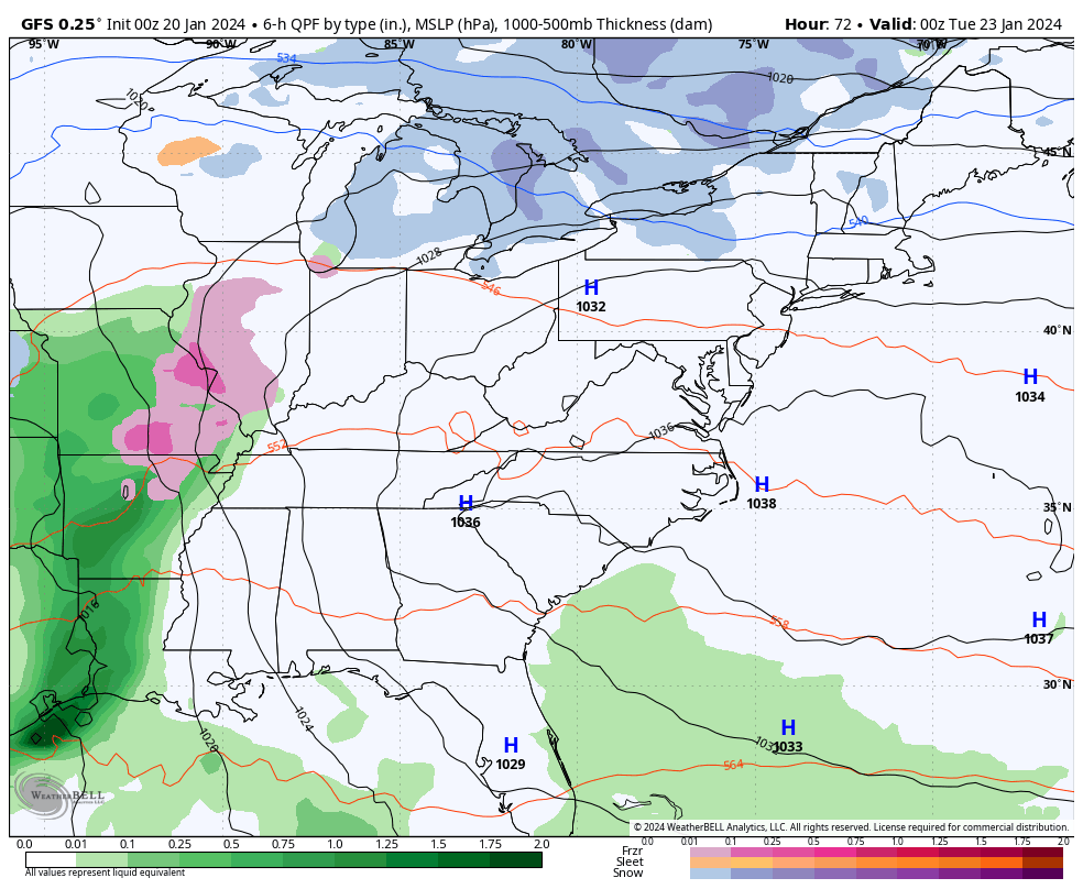
With rounds of heavy rain, we really need to be on guard for high water issues developing as the models are showing several inches of rain through this time. The GFS and Canadian Models are both spitting out some 5″ and 6″ rain amounts…
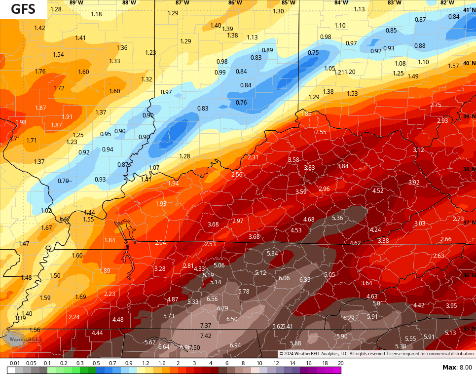
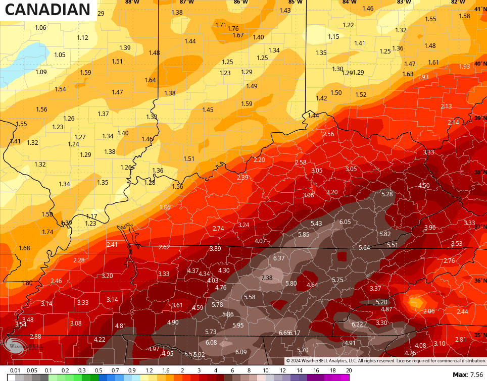
Nothing good can come from this kind of setup, folks.
From one extreme to the other, our pattern remains loaded.
I will have updates later today so check back. Stay safe, stay warm and take care.

Thanks for the update Chris. Two degrees above zero with five inches of snow on the ground here in Maple. I hate to see what my heating bill will be next month. Looking forward to the return of the weather pattern we had before this Arctic air invasion.
Have a great Saturday everyone !
I am so ready for spring and getting some seeds in the ground. Hopefully we won’t have to worry as much about drought going into growing season.
I hear you on the heating bill I will be afraid to open my next one. It finally quit snowing I just dread the cold.
the side roads in Corbin today, are worse than they have been. Must have been the salt the county applied yesterday – right before the second shot of artic air. Haven’t seen one vehicle today for the first time since all of this started.
there was a little snow on top for traction yesterday, but Whitley County plowed it off and applied salt, then they couldn’t remove what had slightly melted/softened up from the salt…
It doesn’t take long does it? For the snow and bitter cold to start to get a little old? I see the KLEX thermometer still reads a couple of degrees about the other 2 mesonets…without fail… I haven’t noticed it EVER being the other way around. Usually in winter the difference is not nearly as pronounced as it is in the summer.
It’s amazing how much of the country has snowcover now compared to last month at this time. All of KY and TN have snowcover, which certainly doesn’t happen at the same time very often.
The snowcover extends as far south as Northern MS, Northern Alabama, and the AR/LA border.
Here in the SW Suburbs of Chicago, there’s around 4 inches on the ground.
https://weather.com/maps/currentussnowcover