Good afternoon, everyone. We are FINALLY coming out of this brutally cold and harsh winter pattern as milder temperatures and a lot of rain takes control of the pattern. With melting snow and falling rain, it’s drips and drops, folks.
This morning was beyond frigid with lows hitting double digits below zero in some areas…
As expected, it was another brutally cold start to the day with several locations in the -10 to -15 range. Here’s a look at the numbers from the Kentucky Mesonet. #kywx pic.twitter.com/4ubCqNfcLF
— Chris Bailey❄️ (@Kentuckyweather) January 21, 2024
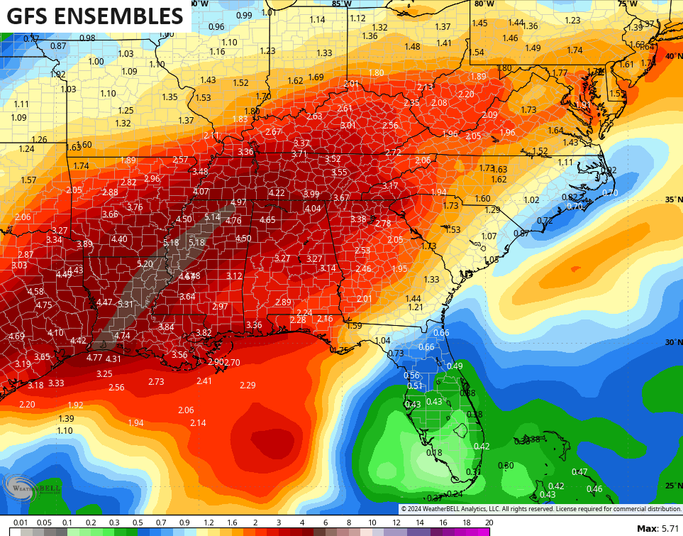
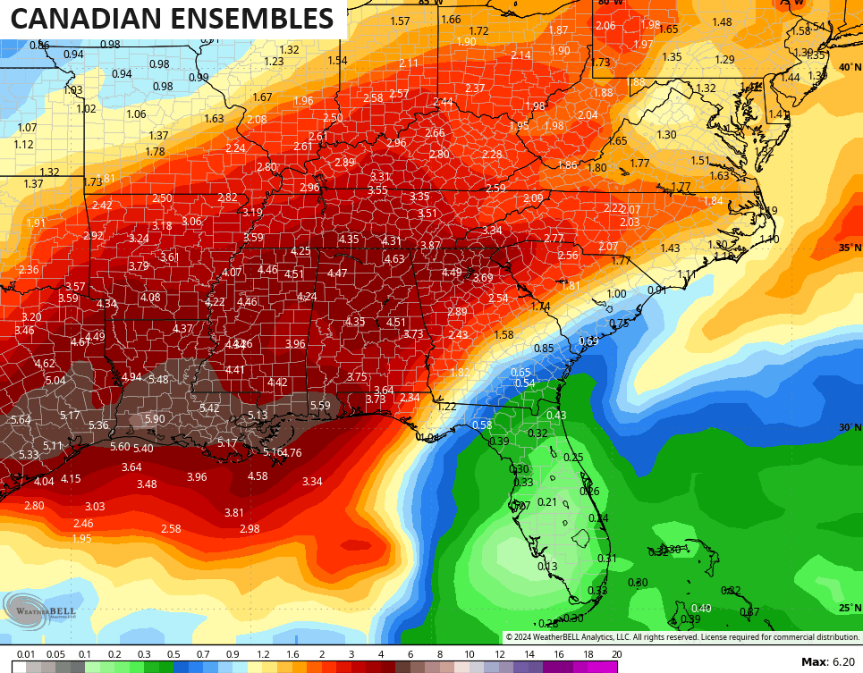
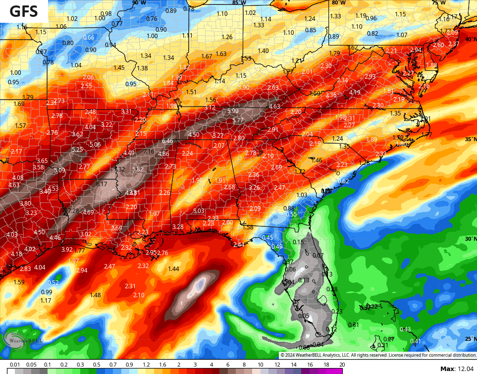
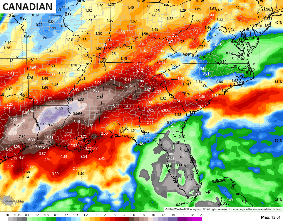
Waves of rain roll in here from the southwest starting Tuesday and continuing through the week and into next weekend. This sets the stage for heavy rain from our region toward the central and western Gulf Coast…
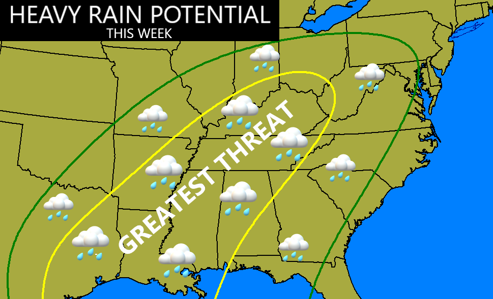
The various ensembles all agree with this…
The operational models typically have more variability from one run to the next, but are on board as well…
My last post highlighted the EURO Weeklies showing the return of winter late in week one of February, with the potential for things to turn rather harsh again. The latest CFS 30 day 500mb height anomalies show a similar look through early March…
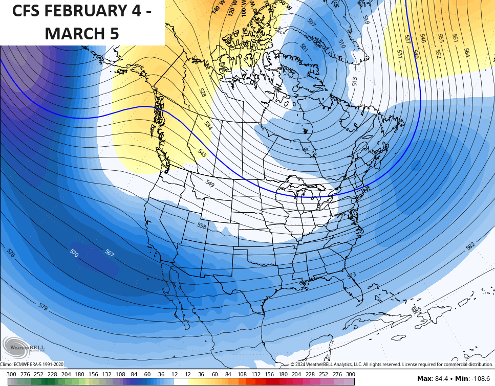
Enjoy this soggy break from winter, because it likely roars back for a harsh end to the season.
Have a great afternoon and take care.

It was actually colder in KY than it was in the Chicago Metro Area this morning! Most overnight and early morning lows in the area were between 0 and -5.
With the transition to warmer weather beginning Monday, freezing rain is in the forecast here for Monday afternoon and night before changing to all rain early Tuesday. Hopefully this won’t be a major icing event.
Yes… crazy!
You could knock me over with a feather because the KLEX thermometer (the suspicious one) that’s always a little warmer than the mesonets… Well, it dropped to -7 for a low this morning being slightly COLDER (if you can believe it) than than the 2 Fayette mesonets…Northern fayette mesonet was -5… Southern Fayette mesonet -1
Last year or the year before (I can’t remember) – when the water frozen in the one bathroom sink in my house that’s on an outside wall…on the other side of that wall is a water hose connection.. Well, we covered that with something I bought off amazon…But just to be safe…I left the cabinets opened and the water on a slow stream and it didn’t freeze.