Good Monday, everybody. As we slowly come out of our harsh winter pattern, it’s time to focus on a bit of a winter break taking shape. This break will bring a lot of rain over the next week, but winter is already plotting a big comeback in a few weeks.
My thoughts on the setup for the week into the weekend remain unchanged…
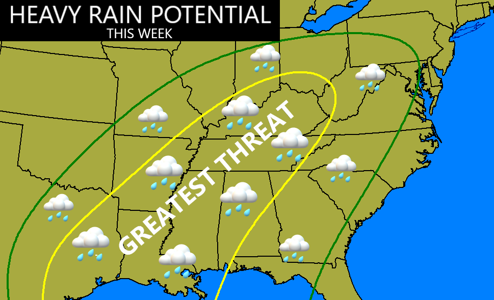
Some thoughts:
- Clouds roll in today as temps struggle into the 30s. We still won’t see much melting out there.
- Light rain pushes in Tuesday and there’s a chance this begins as some freezing rain in the north.
- Heavier rounds of rain kick in on Wednesday and take us through Friday .
- Temps are in the 50s during this time and may hit 60.
- Another storm system comes at us in this strong southwest flow over the weekend. This looks to bring more heavy rain that has a chance to end as some snow.
- A general 1″-3″ of rain is likely through the weekend with locally higher amounts.
- We will need to be on guard for some high water issues developing.
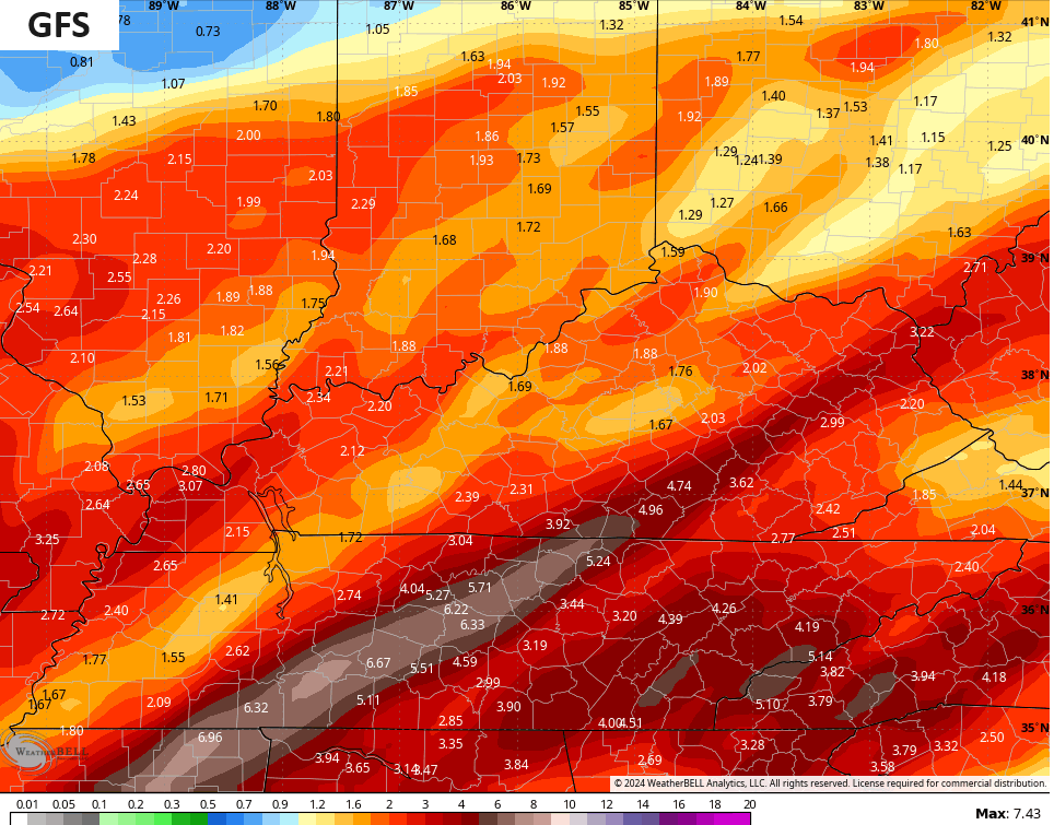
Here’s how the GFS sees all this…
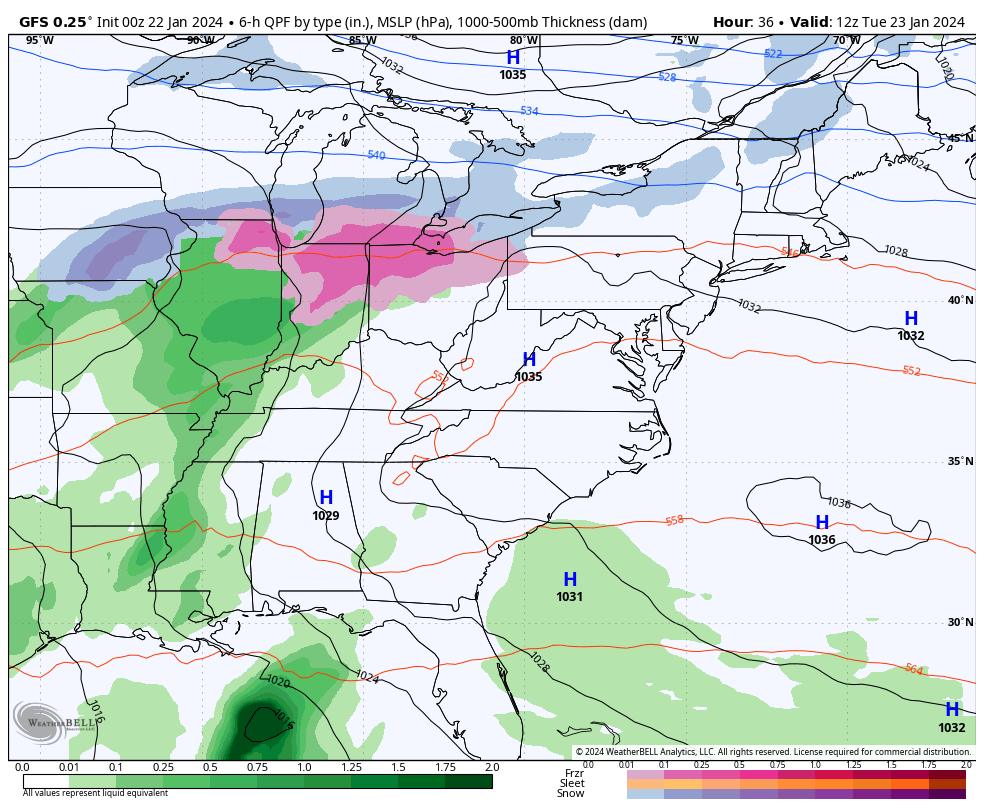
You can see the heavy rains across the region with the highest totals in the south and east…
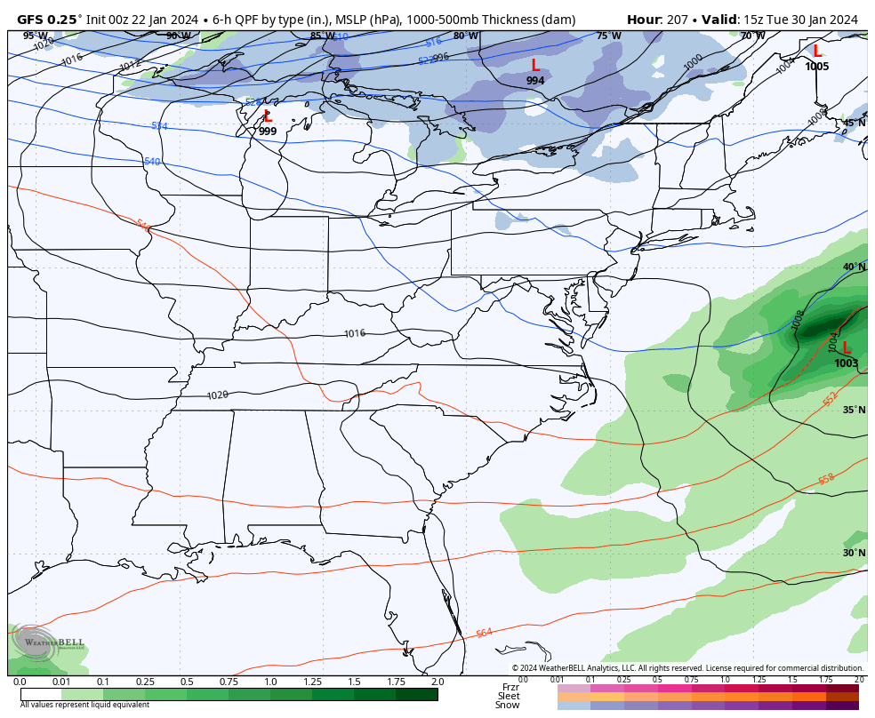
After all this, we need to watch for a sneaky shot of arctic air next week. The GFS is ramping this thing up, especially to our east…
That should get pushed away by a blossoming ridge of high pressure.
Temps bounce back to above normal as we kick off the month of February, but I’m seeing a familiar pattern taking shape. Back in December, I spent a lot of time here highlighting how the ridge bringing the mild temps to the country would get pushed to the north into Canada, allowing troughs to dig underneath it across the USA. We just saw how that worked out like a charm as much of the county just had a prolonged stretch of wicked winter weather.
Well, the same thing may very well happen again as we go into February. Watch how the EURO Weeklies send this upcoming ridge into Canada, allowing for deep troughs to develop under it in the USA…
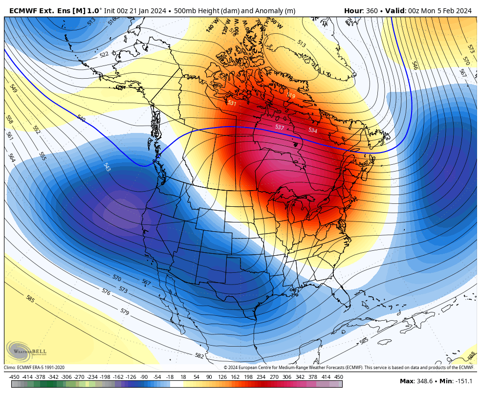
That animation starts February 4th and ends with a massive trough centered in the east on February 14th. That look has harsh written all over it once again and may very well roll into March.
I will have another update or two later today. Make it a good Monday and take care.
