Good afternoon, everyone. As the snow SLOWLY melts away, the focus turns toward rounds of heavy rain moving into the region. This starts later Tuesday and rolls into the weekend, and we may be talking about high water issues.
This heavy rain potential has been outlined here on KWC for the past several days and my thoughts remain unchanged…
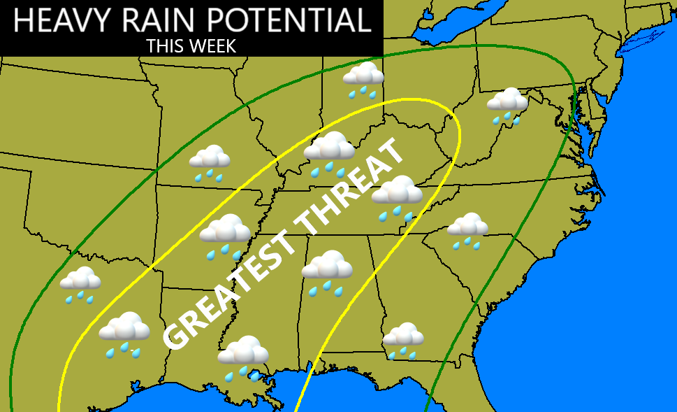
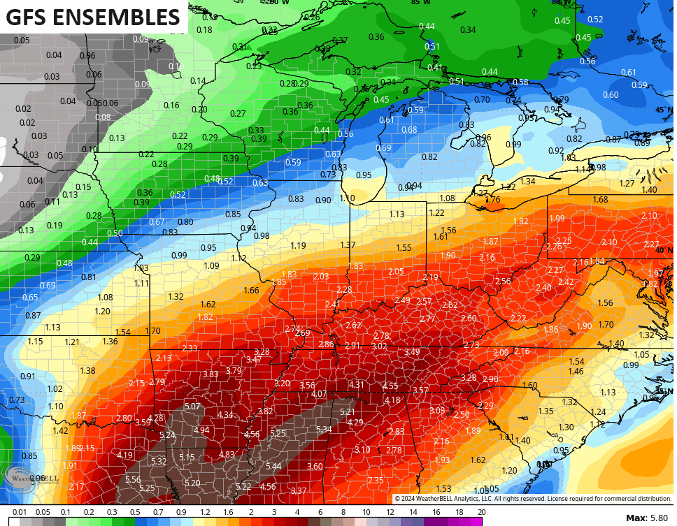
This is a general 1″-3″ of rain across Kentucky, but the potential is there for some 4″+ totals to show up. Combine this with runoff from the melting snow and a still semi-frozen ground, and you have the recipe that keeps us watching creeks and streams.
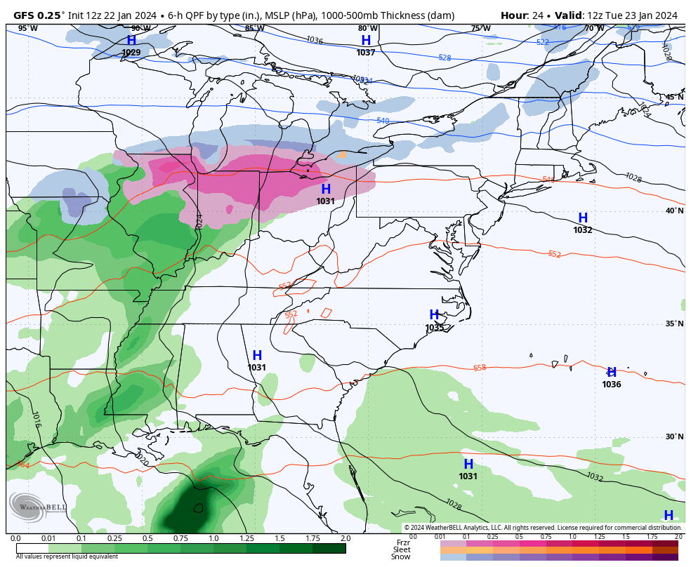
The GFS has some convective feedback issues because of thunderstorms in the deep south and that’s impacting the rainfall forecast…
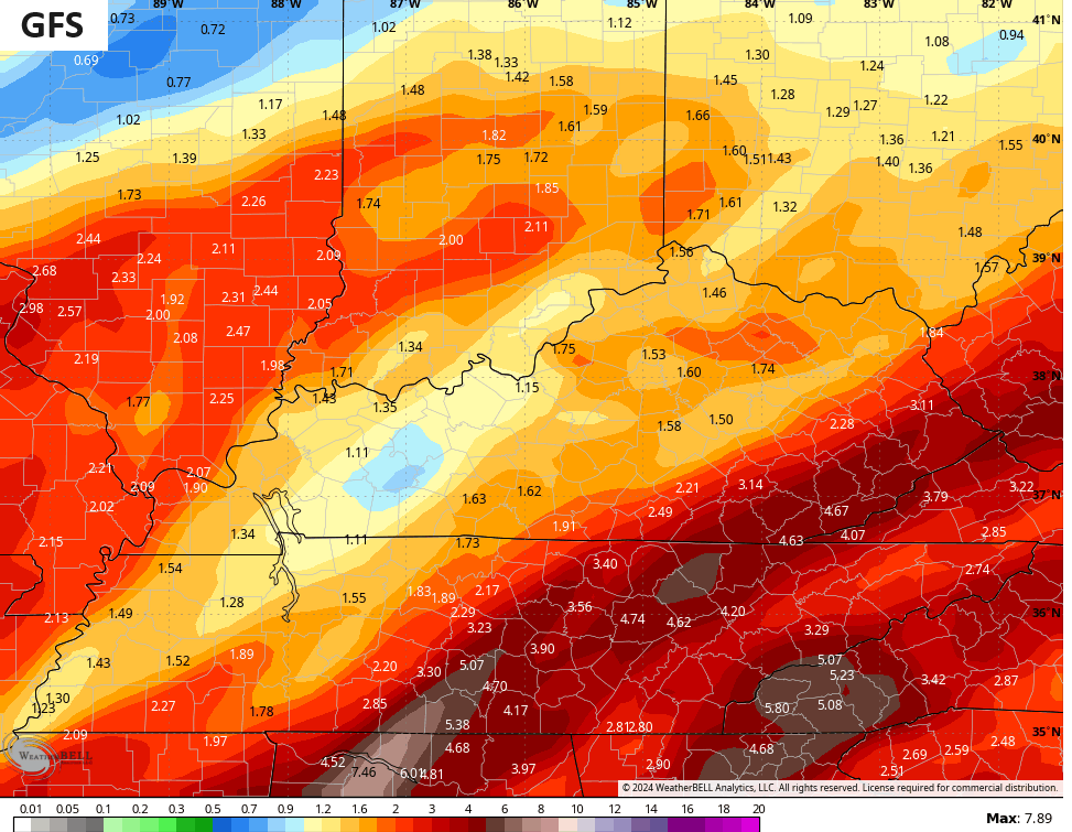
Those numbers will be much more widespread than what the GFS has.
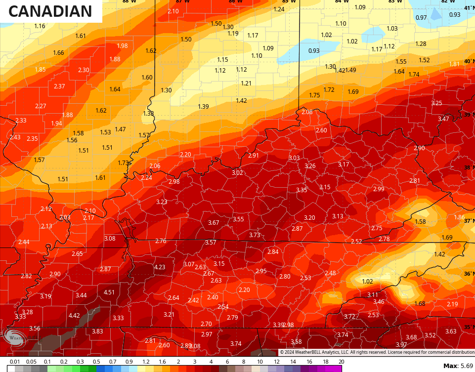
The Canadian shows the more widespread rains…
As does the ICON…
![]()
![]()
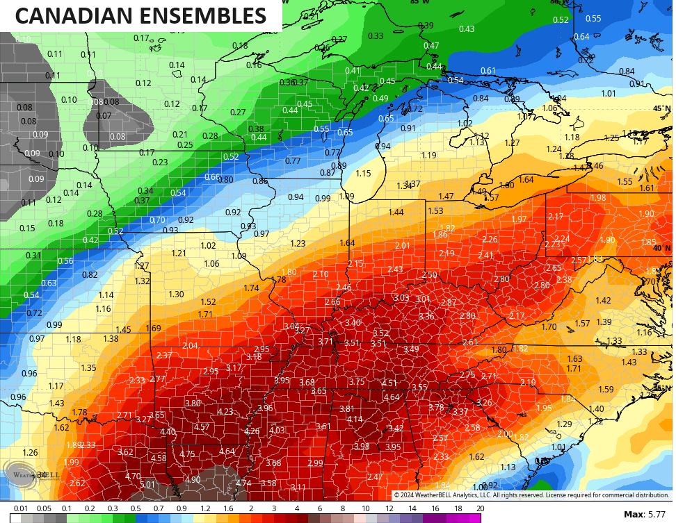
The Ensembles are also showing the corridor of heavy rain aimed right into Kentucky…
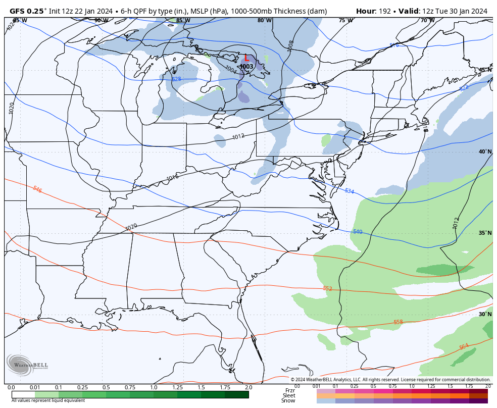
The final wave of heavy rain rolls in this weekend and it could end as some wraparound snow…
This will be followed up by what may be a deeper trough digging into the east to end January. The GFS now lingers this into the start of February…
I think the start of February is likely warmer, but the window for that is getting shorter as we get closer. I’m on board with the potential for another, possibly longer, harsh winter pattern around here and for much of the eastern half of the country as we deeper into February.
The CFS is showing the major block going up in the high latitudes which sets all this in motion. This map is the average 500mb height anomalies into the middle of February…
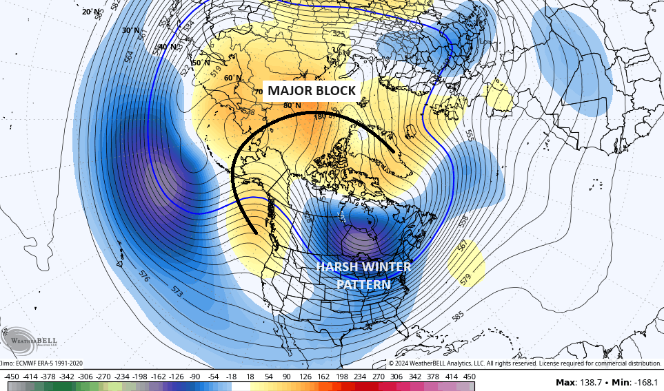
Blocking from Greenland across the North Pole that curves back into Alaska and along the west coast is a pattern that would create some rough times across much of the United States.
Enjoy the rest of your day and take care.

MJO continues to a be thorn in our side, but our last arctic outbreak proves it can be done.
I am happy we received a break from the cold.
I liked to see a 6+ snowfall in February.
The continuation of Winter weather through February is certainly a departure from the past couple of years, and could end up pushing back our severe weather season by several weeks. This could be concerning, since that would correspond to the time when a transition from El Nino to an ENSO Neutral condition will be taking place. Historically, our severe weather season tends to be more active when it takes place while a transition to ENSO Neutral is underway.
Much could (and will!) change by then, but it’s food for thought.