Good Tuesday, everyone. Rain rolls into the region today and it kicks off a super soaker of a pattern as rounds of heavy rain target the region. This brings the increasing potential for high water issues through the upcoming weekend.
The rain out there today is fairly light and may begin as a touch of freezing rain in some of the colder valleys, especially in the east. Keep that in mind if you have early morning travels.
If there’s any ice, it should quickly go over to rain as temps warm into the 40s.
Here are your radars to follow along with today’s action…

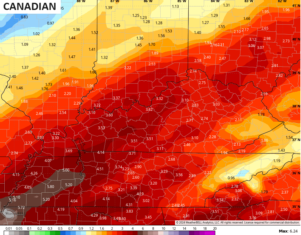
This opens the door to rounds of heavy rain coming into the region from the southwest Wednesday through the upcoming weekend and the threat map I made days ago continues to hold up…
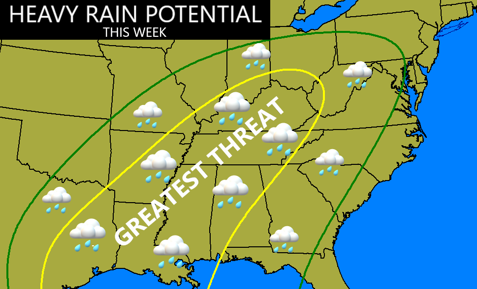
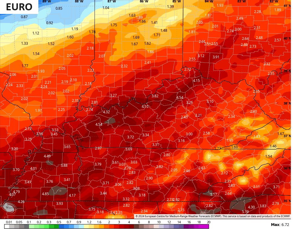
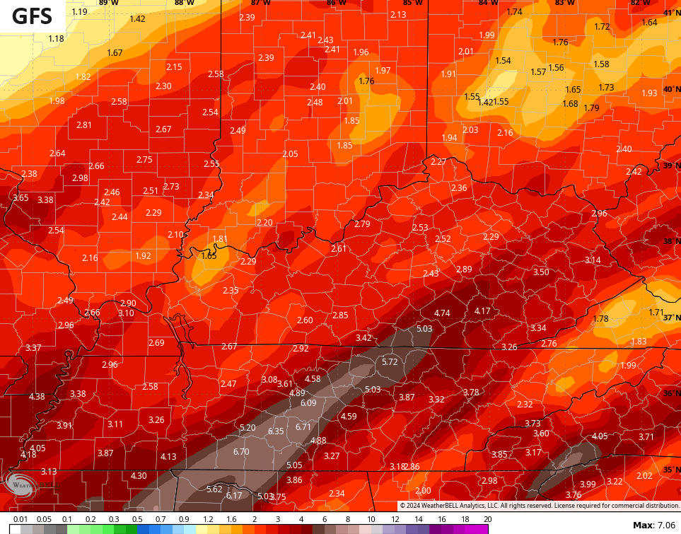
This is a pattern that throws a widespread 1″-3″ rain into our region with the potential for some 5″+ totals to show up. Given the current snow melt, our waterways will be running higher than normal as the rain moves in. My main concern going forward is with general flooding and river flooding, so we really have to pay close attention to rainfall numbers in the coming days.
The models are all now fully on board with this potential, including the weekend system potentially ending as some snow…
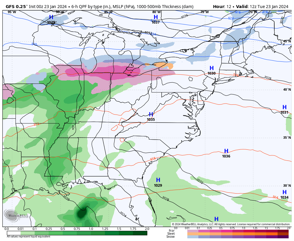
The numbers from the models are concerning, but they still have the usual variations of where the heaviest rains fall…
![]()
![]()
We wish no ill will on any part of the state, but we would sure like to keep the heaviest rains out of southeastern Kentucky for obvious reasons. Not only is this region much more prone to flooding, but folks are still trying to put their lives back together after the historic flooding a year and a half ago.
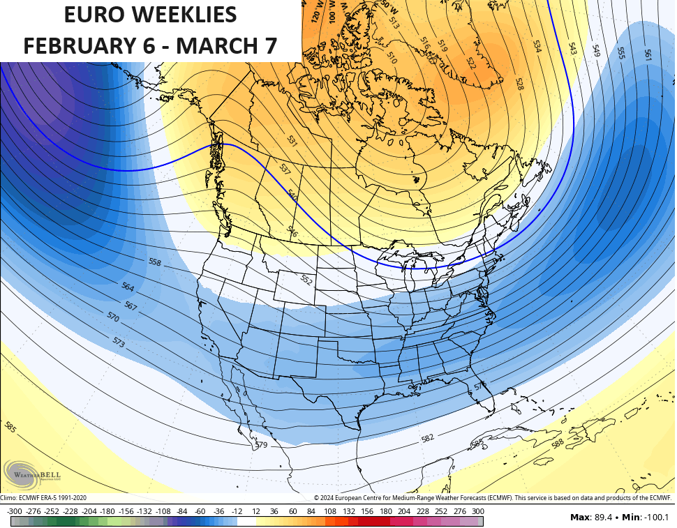
I also have no changes on the potential for another nasty winter period taking over later in the second week of February and, perhaps, continuing into early March. The EURO Weeklies continue to show this well…
The Control run is even more emphatic…
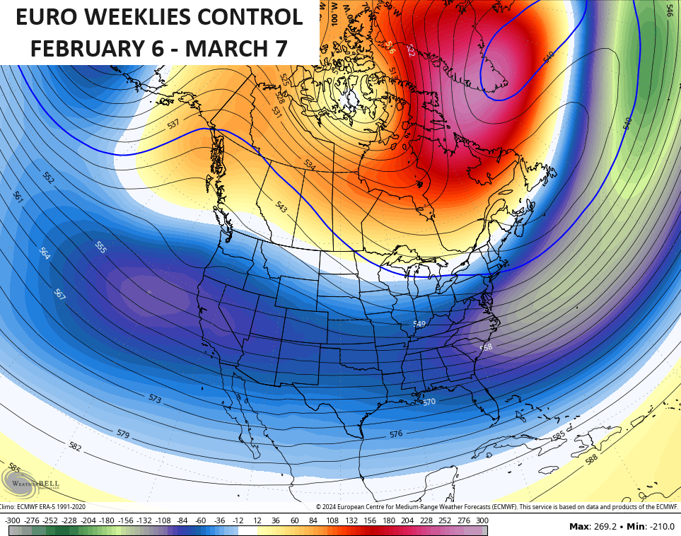
Man, that’s a lot of blocking showing up at high latitudes.
I’ll have updates later today. Make it a good one and take care.

The Atmospheric Shock Continues Ahead.
Arctic cold for many over the last 2 weeks, followed equally by an absolutely blow torched warm forecast the next 2 weeks.
There seems little doubt that when we look back & think about the winter of ’23/24, it’ll be one categorized by “extremes”.
I’ll stick with a real meteorologist like Chris.
Yeah, quite a change. I’m just glad that the surface temperatures went above freezing before the precipitation started.
540 line is well to our north from February 6 to March 7. Doesn’t it have to be well south of our area to have cold and snow ? I don’t put much stock in that model’s forecast. Can’t plan on that.