Good evening, folks. We continue to track rounds of heavy rain across the region and another round is on the way to start the weekend. That system may still end as a period of mixed rain and snow or some wet snow.
Another 1″ of rain has fallen across parts of the state today with a little more to go tonight before we catch a bit of a break.
Here are your radars to show the spiraling bands of showers lifting through the region…

Friday is a raw day with drier conditions, but that doesn’t mean its totally dry. Some misty showers and drizzle will be noted as temps come down.
The next low rolls in here Saturday and Sunday with widespread rain on Saturday with the chance for some wraparound rain and wet snow Sunday into Sunday night. The NAM is showing our potential well…
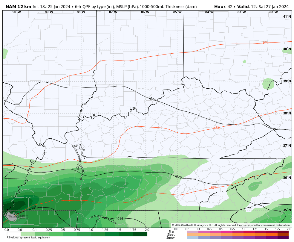
Another 1″-2″ of rain will be possible in our region.
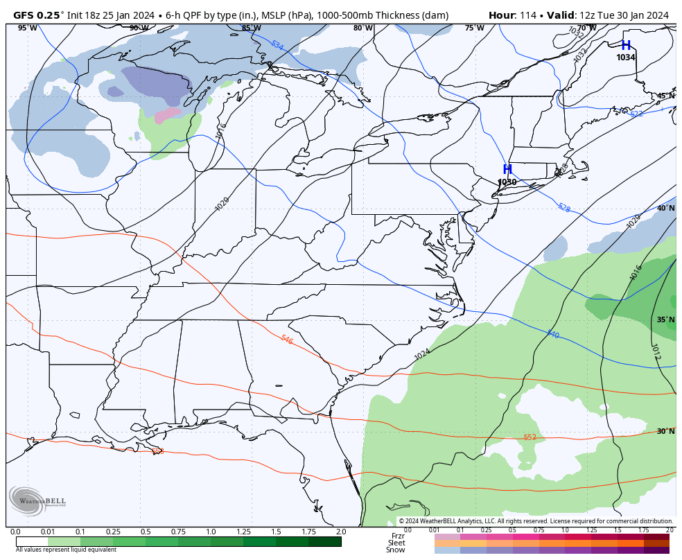
A clipper then follows this up on Tuesday with some rain and snow possible. Here’s the GFS…
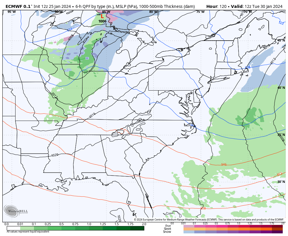
And the EURO…
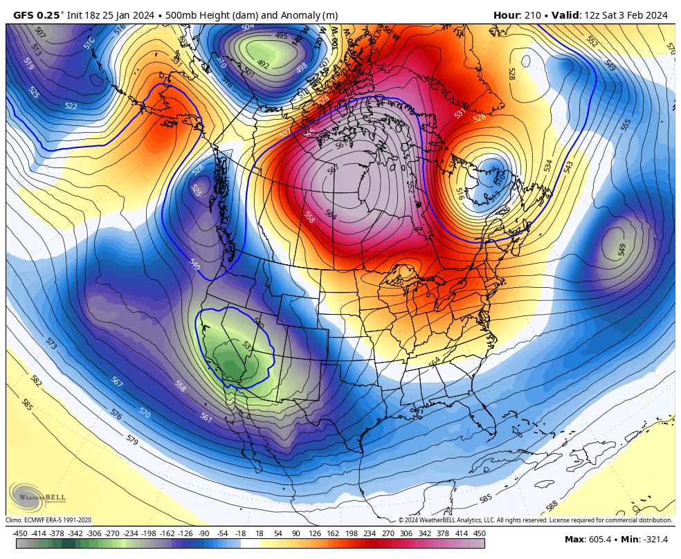
This is coming in the middle of what the models said would be a super warm pattern in the eastern part of the country. That’s not going to be working out and it’s a sign of what’s ahead as blocking develops in the high latitudes.
The operational models are locking in on this setup that allows for undercutting storm systems as early as the first few days of February…
GFS
EURO
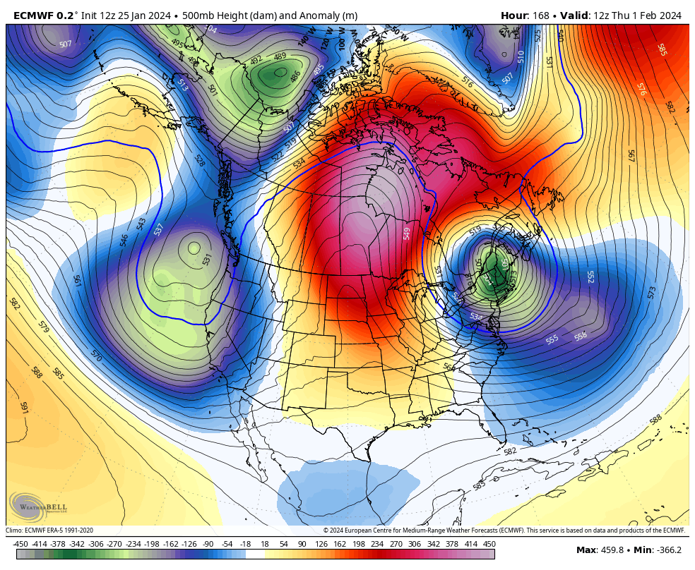
That’s how you can get some west to east moving winter storms and I fully expect this to ramp up even more as we get into the middle of the month.
Make it a great evening and take care.
