Good evening, everyone. Our break in the rain is about to come to an end with rounds of heavy rain returning for Saturday and Saturday night. That will be followed by a colder Sunday with some rain and wet snow showing up.
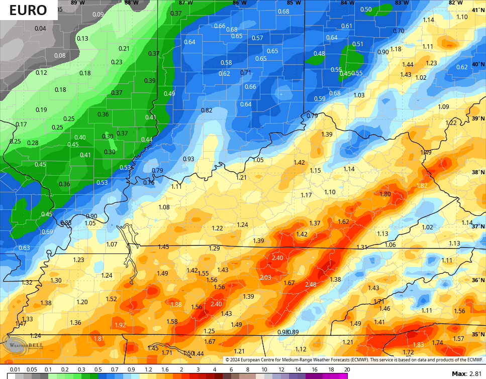
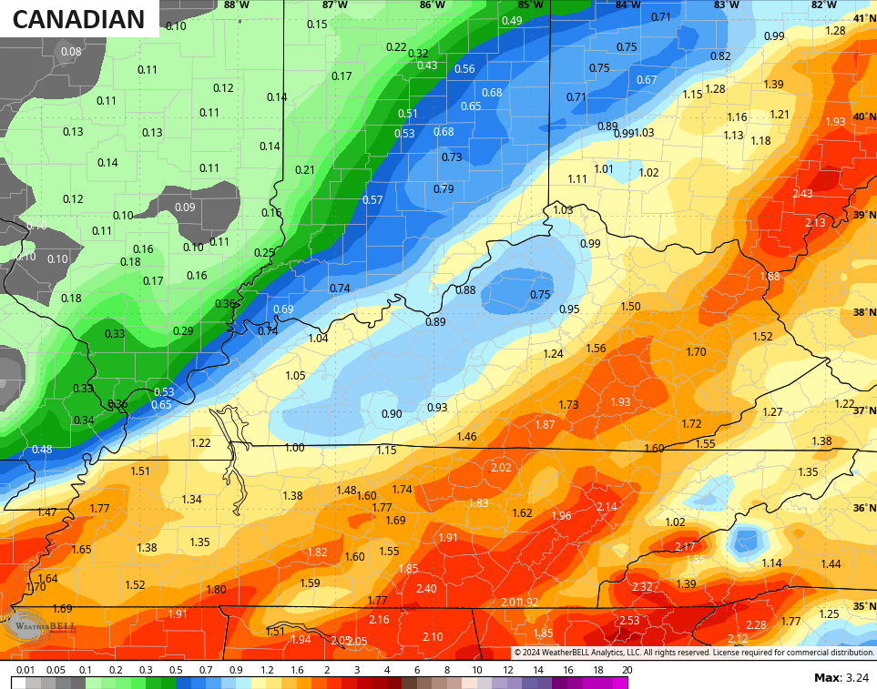
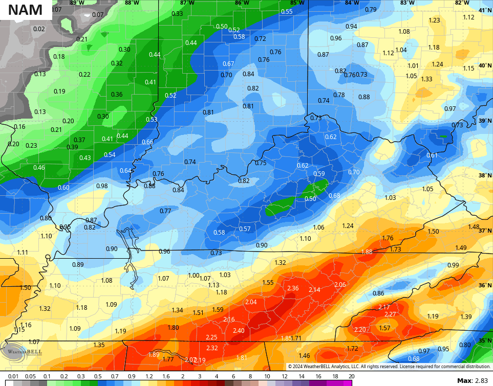
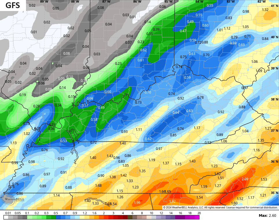
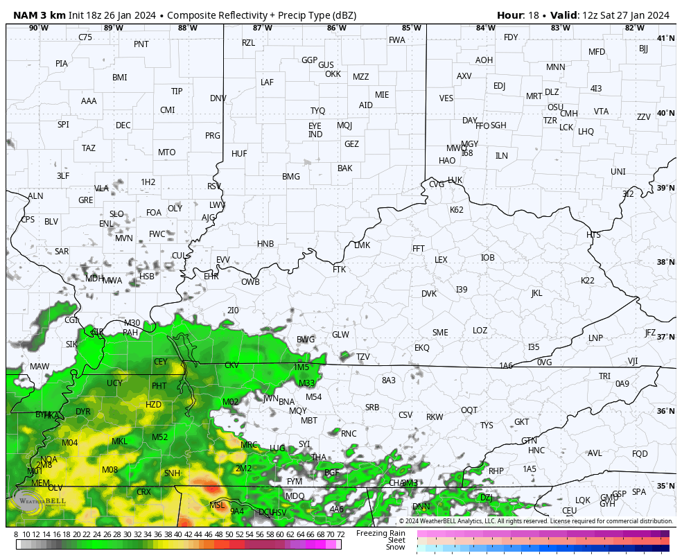
The next low spins through the region on Saturday with heavy rain. This looks like another 1″-2″ of rain for much of central and eastern Kentucky through Saturday night. There’s a Flood Watch for far northeastern Kentucky, but anywhere is fair game for some hit and run high water issues.
The forecast models show this well, but have the usual variance in placement…
Colder winds wrap in behind this departing low on Sunday and this allows for the rain to change to a period of wet snow with a few flakes flying through Sunday night. The future radar from the Hi Res NAM shows the rounds of heavy rain followed by the flake action…
A clipper drops in behind this Tuesday and Wednesday with gusty winds and the chance for some rain and snow…

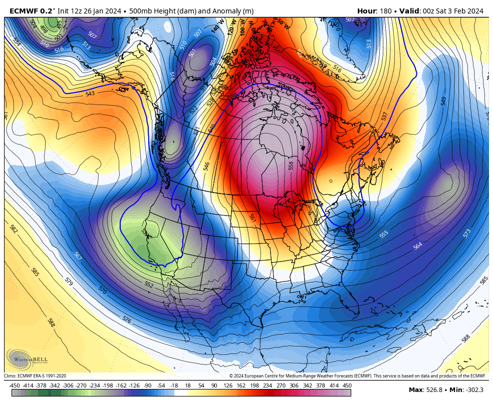
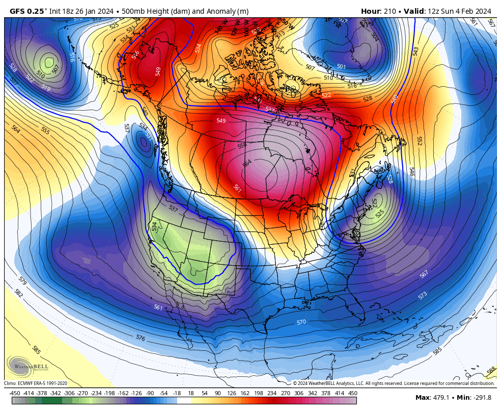
I continue to point toward a very wintry pattern taking shape by week two of February and likely going for the rest of the month and into early March. This is a pattern that is likely to take control of much of the country.
The latest operational models are seeing the blocking going up across the higher latitudes in week one of February, allowing for deep troughs to roll through…
EURO
GFS
Make it a great evening and take care.
