Good Sunday, everyone. We have wraparound rains and some slushy snows across parts of the region out there today. There’s even the chance for light accumulations across parts of the region, with the greatest threat in the east and southeast.
Temps are marginal for any snow, but the dynamics may produce enough cold air for periods of wet snow spinning on the backside of our departing low. Setups like these are tricky because just one degree difference makes all the difference in the world.
I do think the mountains of southeastern Kentucky put some snow on the ground later today and tonight, but I have my questions about the rest of the area. If we are to see some accumulations, it would be in the form of some slush showing up on grass and elevated surfaces.
That said, models like the GFS and NAM fam are a little more optimistic about light accumulations…
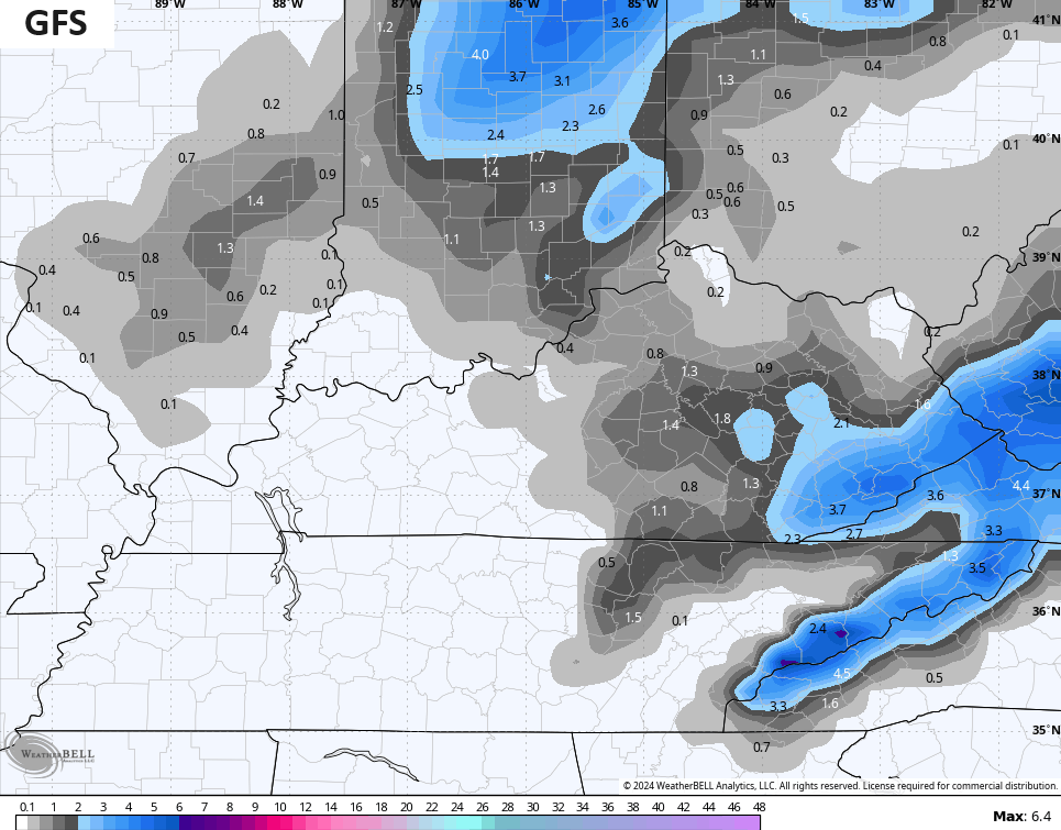
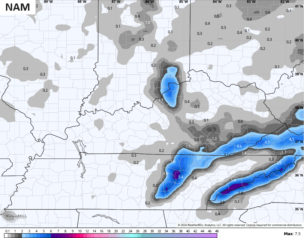
I can’t discount those, but I’m not fully jumping in on them. Maybe this is because marginal rain to snow events are the worst to forecast.
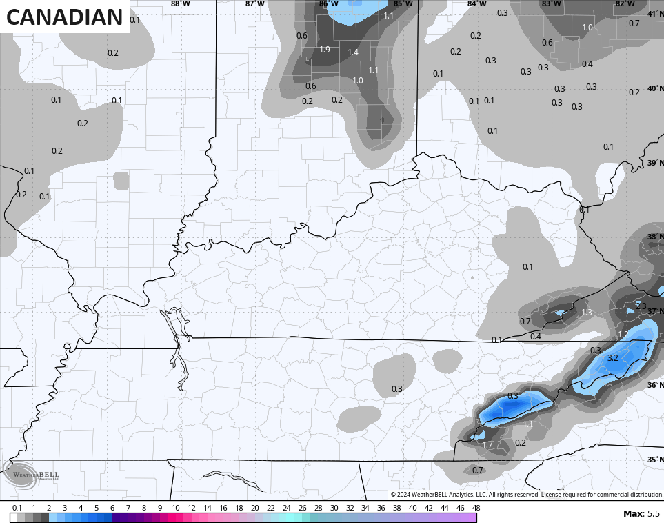
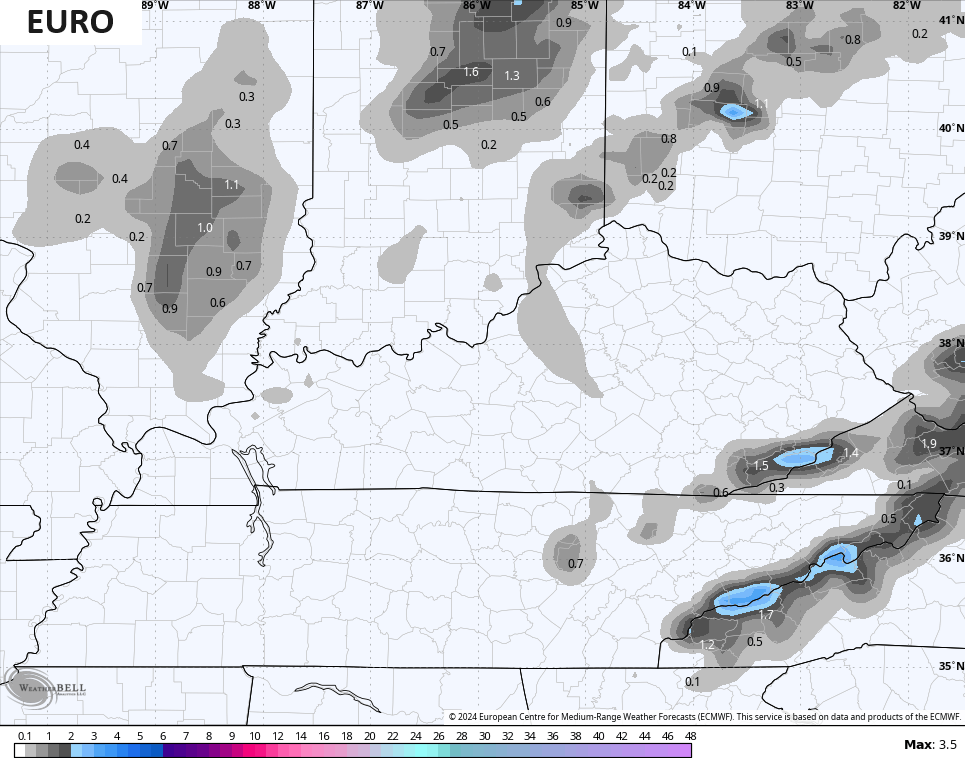
Models like the Canadian and EURO aren’t as optimistic…
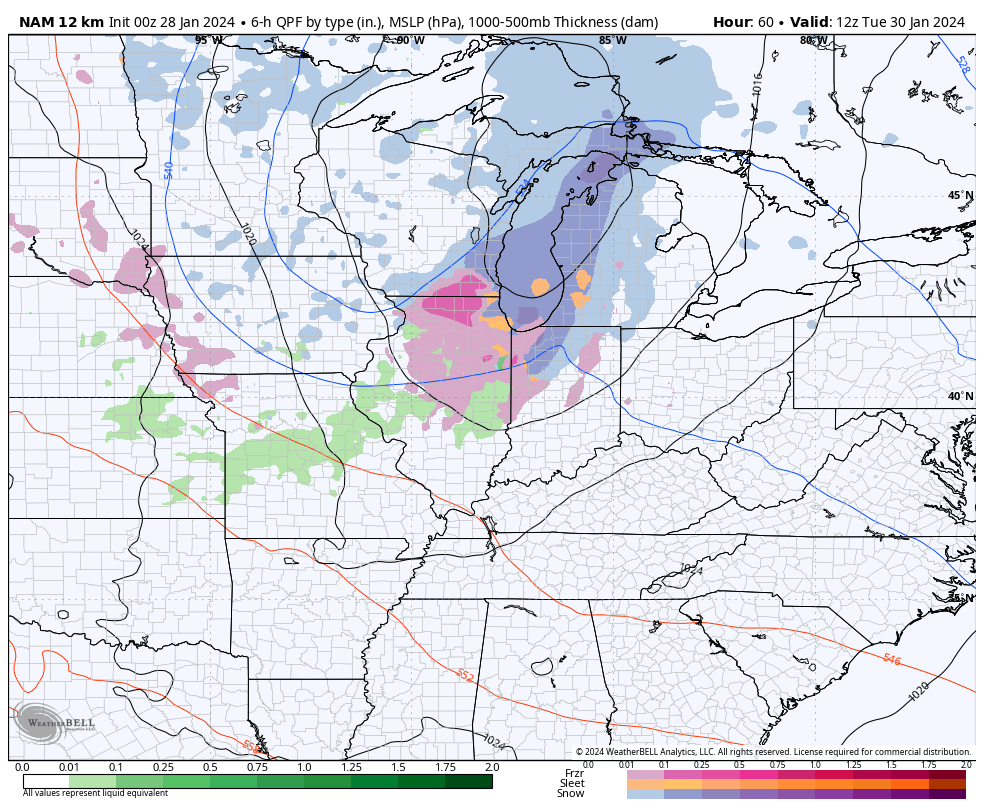
The next system is a clipper dropping in late Tuesday and Wednesday with some rain and snow showers. The NAM continues to be the most wintry looking…
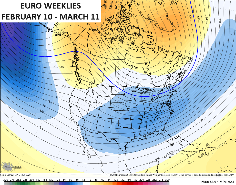
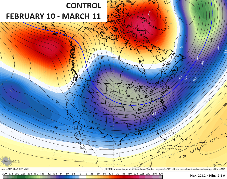
The EURO Weeklies are about as consistent as you will ever see with a forecast pattern. The show the transition to a deep eastern US trough during the second week of February…
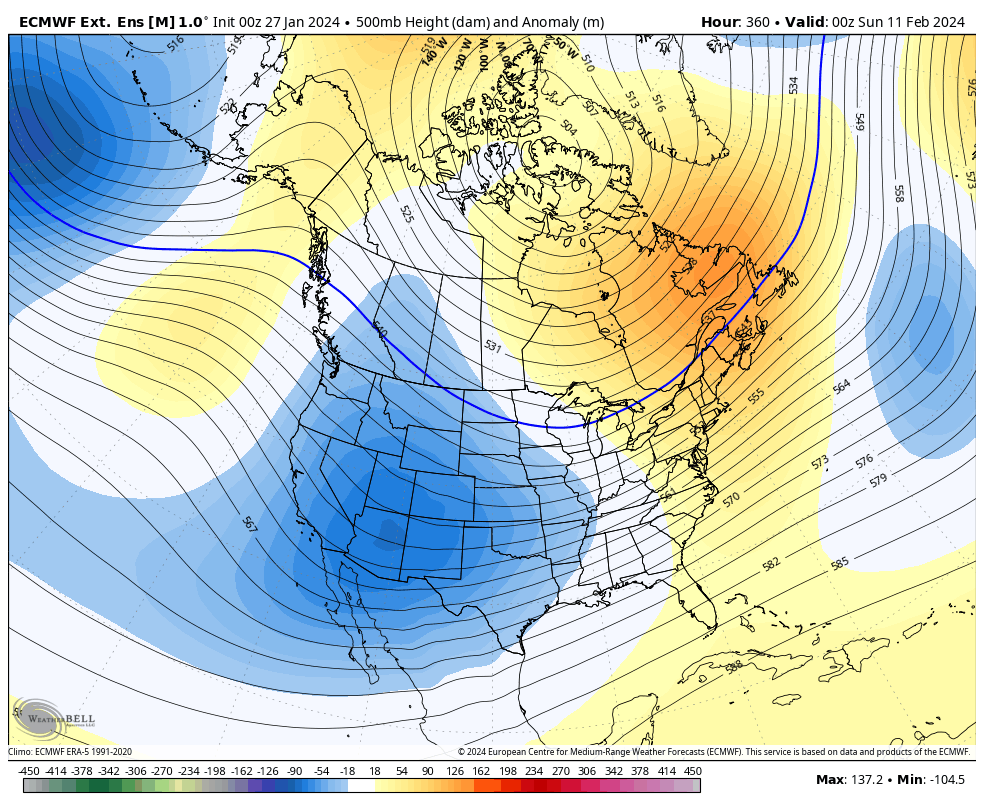
That locks in place through the month and into the start of March. Here’s the 30 day average 500mb heigh anomaly map…
The Control Run of the EURO Weeklies during the same time are even more eye catching…
Here are your radars for the day…

Have a great day and take care.

I thought we were supposed to get an inch of rain at least? So far I see that we’ve had 0.24
Mark, your rainfall total is due to the dry slot or low’s path. Most of the rain fell west and north of the low. My total was from the cold front as it went through.
Thanks Chris. Yesterday evening we had a rare thunderstorm with vivid lightning and loud thunder and some heavy downpours. Being in the dry slot most of the day we only had 0.41 ” of rain. Glad to see our regular precipitation pattern is back, but would like to see more in the way snow and moderate cold to delay the start of spring.
Enjoy your Sunday Chris.