Good Monday to one and all. Our work week is off and running on a very nice note with some sunshine and pleasant temps. This combo is the rule through Wednesday, but things start to change after that as winter slowly presses back in.
Highs today range from the upper 40s to middle 50s in most areas and those numbers keep climbing through the rest of the week. Some 60 degree numbers may even show up before a cold front moves in on Friday.
This front brings an increase in showers and a few thunderstorms as it sweeps in from the west. Lingering showers then take us into Saturday…
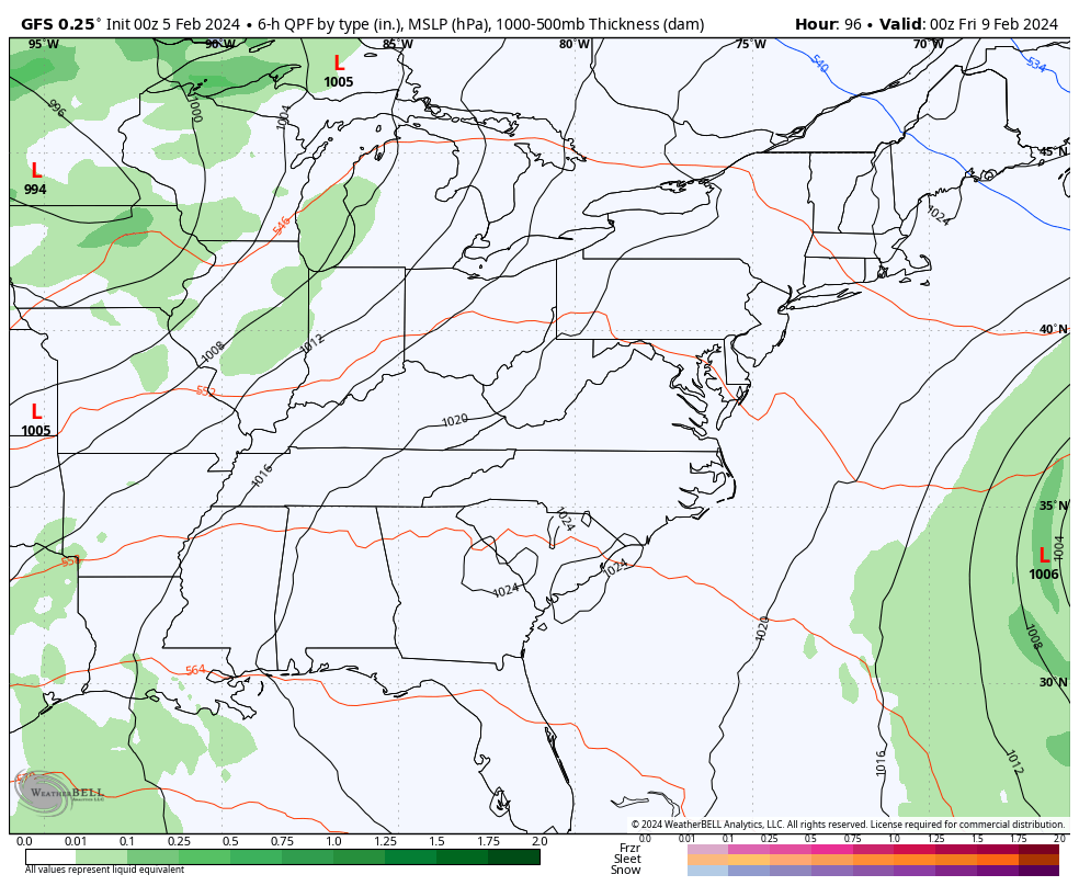
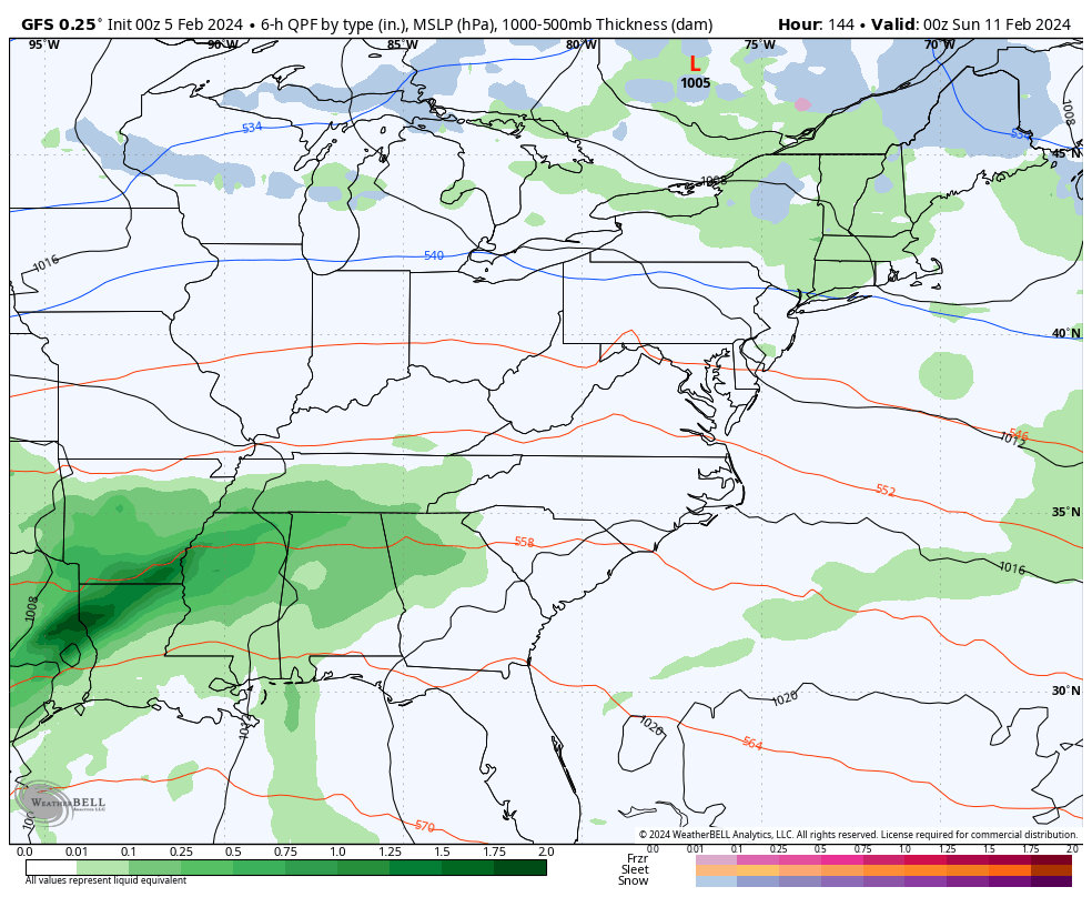
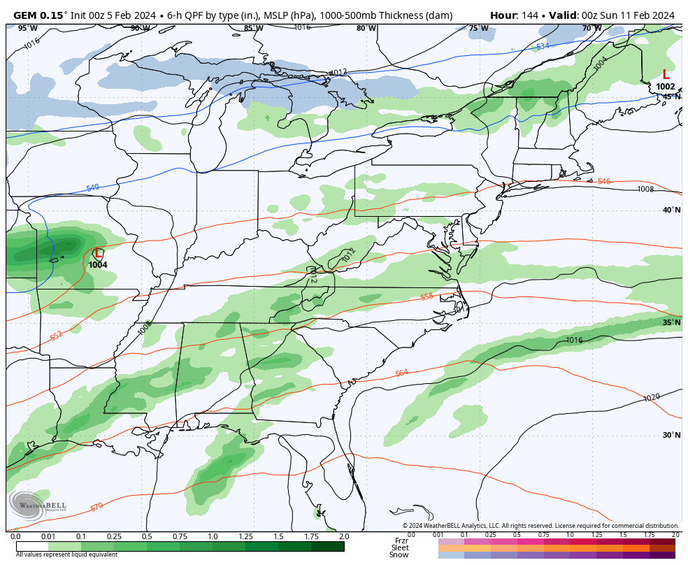
Another storm system comes in behind this late Sunday into early next week and the chance for another one right behind that. Some winter may very well show up right behind these..
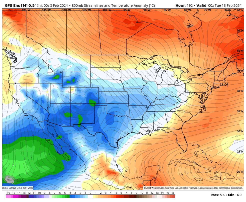
GFS
CANADIAN
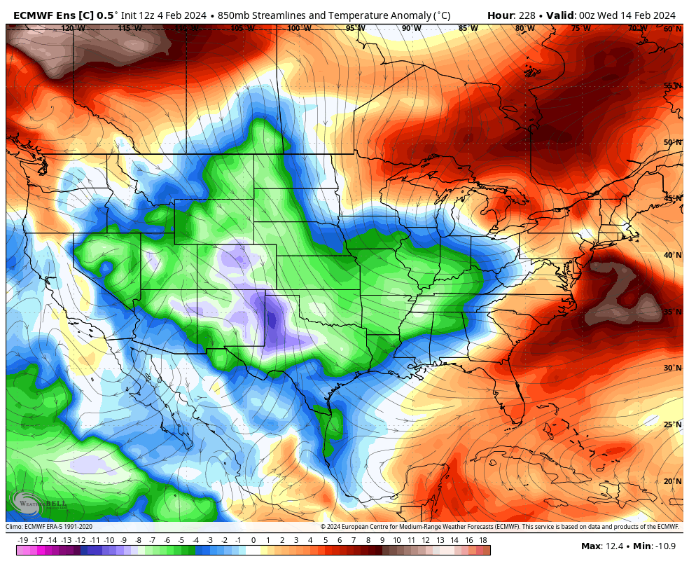
Colder than normal air continues to pour into the country behind all this…
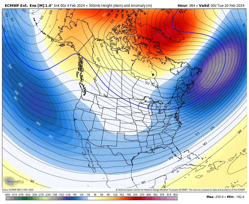
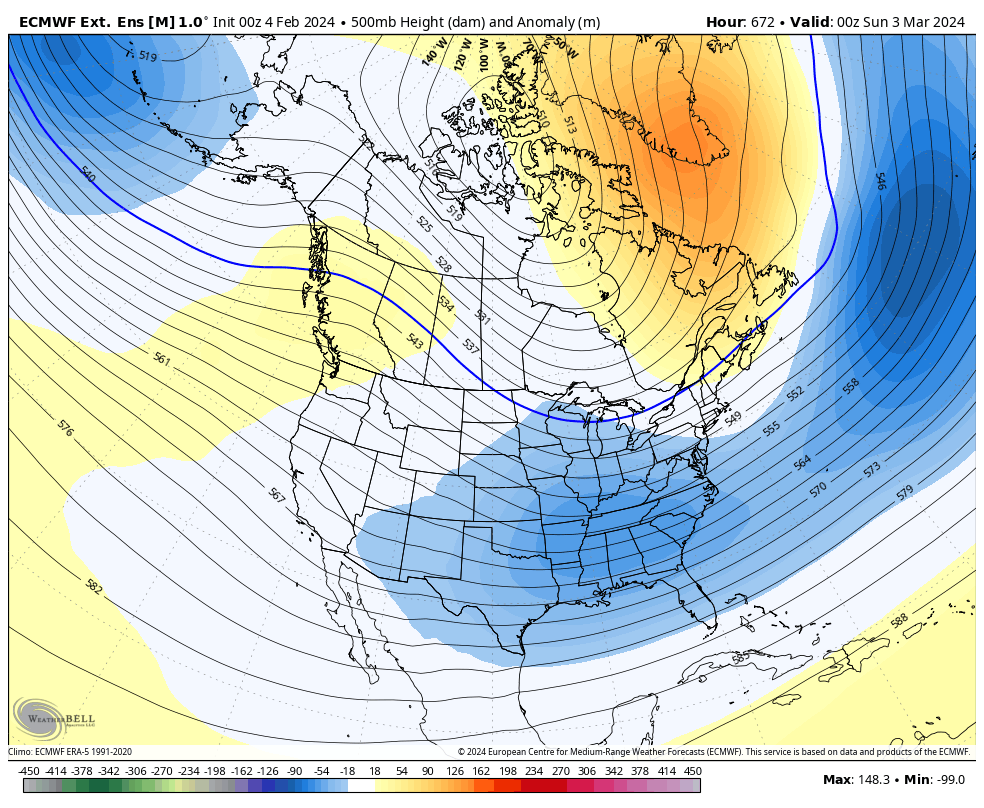
EURO Ensembles Control
GFS ENSEMBLES
Combine that with what’s likely to become a healthy southern storm track and things may get fun again.
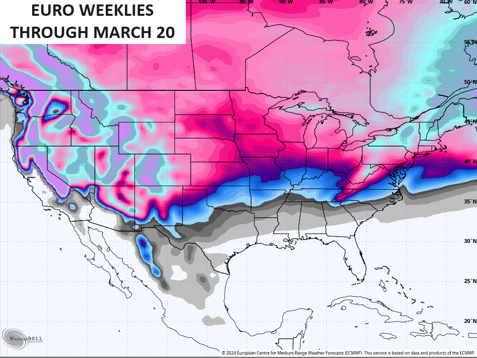
The EURO Weeklies were the first to show this pattern and they haven’t blinked and they’re still on board with troughs in the east through the end of the month. This animation starts on the 19th…
The same weeklies say forget about an early start to spring as they keep the blocking going and, thus, the troughs continuing to take up residence across much of the lower 48. This animation goes from March 1 through March 20…
That’s an average of 101 members, making that even more impressive.
That kind of pattern comes with snow chances, too…
Is patience a virtue for cold and snow lovers? That remains to be seen, but you have to love the pattern!!!
I’ll have updates later today. Make it a great Monday and take care.

Once that blocking is firmly in place, a stretched Polar Vortex incursion may be in the cards during the last half of February, but by the middle of March I believe our focus will shift to a severe weather outbreak
With the current El Nino operating in a – 1.50 PDO ( never experience this before ) I agree on a stormy spring.
Historically, severe weather seasons have been more intense when a transition from El Niño to ENSO neutral occurred during the Spring, as it will this year.
Then again, we’ve seen more than a few scenarios, where what happened in previous years failed to materialize. The “New Normal” has turned many aspects of forecasting on its head!
We never did have an El Nino this year. I think we been in ENSO / neutral since last fall. NOAA will argue that we were in a strong El Nino, but doesn’t seem to put much thought that El Nino forms when the PDO goes positive. Never negative.
Thanks Chris. I been hearing and reading about all the flooding rains and heavy mountain snows out west. Here in the east we been dealing with a lot of strong ridging splitting the two jet streams resulting in the current uneventful weather. I’m hoping this will change as the various models indicate, but I have my doubts.
All I know is I have been outside, taking advantage of the beautiful weather over the last 5-6 days, and will stay out there until it rains on Friday. Being cooped up inside gives me great opportunity to get “inside”things done, but after an extended period I begin to feel inertia and sloth creeping in. Besides, these lovely days in the winter are some of the best for doing certain types of heavy work in the field or woods. No bugs, no sweat, no heat exhaustion.
It is nice for any work that needs to be done outside, but I hope we continue the cold nights, as the plant’s dormancy has been satisfied. Any day it warms in upper 60’s to 70, and the morning temperature are above 65 degrees, plants would break their dormancy if it is extended.
Chris Happy Weather persons Day. You will be working I am sure you always do. Thanks for all you do daily. I was surprised how chilly or downright cold it was this morning early but we are going to upper 50s today. Later.
Thanks Crystal for the reminder. Happy Weather Persons Day Chris !
The pattern will be soon underway. The target for transition continues to be mid-month with a more solidified cold and stormy pattern from February 20th-March 20th in my opinion, give or take some given lower confidence for later in the period. A substantially negative NAO/AO/EPO and positive PNA lends pretty high confidence to such a pattern transition and while some of these indices may oscillate slightly, the support for an extended -NAO/AO looks fairly stout and will have noticeable and impactful implications. Winter storms will be a *possibility* (not a guarantee) over many portions of the Eastern US during this time, but any details on timing, location, or evolution of those threats will have to be determined later on as confidence remains low at this juncture. Enjoy the warm weather prior to Valentines Day. Winter is not over.
AGREED !
I stick with real meteorologists, not armchair “forecasters”.
This ” armchair ” meteorologist predicted many snowstorms in the past by just observing the clouds and wind direction. Cannot predict tornadoes as of yet.
Incorrect
I was referring to myself Jeff.
I am curious what this upcoming Spring holds for Severe Weather. I am starting to feel like that tattoo of a tornado and lightning bolts on my upper right arm is going to waste. As for the remaining Winter. Well all I can say is that there will be no early Spring and that makes me particularly sad. But I guess after the extreme lack of winter last year, I guess Im just going to have to suck it up and deal with it. Happy Weather Person’s day Chris Bailey/Jim Caldwell/Alexa Minton
I wouldn’t mind if we skipped spring and went straight to summer weather and held there until October with a cool and colorful fall.
As temperatures in the northern hemisphere continue to rise, a related increase dewpoints caused by an uptick in evaporation will increase atmospheric instability. This may not increase the frequency of storms that we see during our severe weather season. But it will have a measurable affect on the intensity of storms that do develop.
That very scenario is happening right now on west coast Joe. I hoping this huge high pressure we have breaks down, so we can get some rain or snow soon.
March 21 Spring Begins
I remember when I had to shovel snow away from my greenhouse doors on March 21st, but that was only one time and long ago.