Good Tuesday, everyone. It’s full steam ahead toward a major pattern change as Old Man Winter fights back in here next week. That means the March-like weather of this week is nothing more than a fake.
Temps out there today are back into the 50s for most of the state with a mix of sun and clouds. Those numbers rise to near 60 for Wednesday and Thursday as a southwest flow kicks in ahead of a storm system set to impact us Friday.
That will be followed up by another system or two coming from the southwest and these will have some cold air to work with. The track on these systems is a work in progress on the models as the timing and track will vary wildly from run to run.
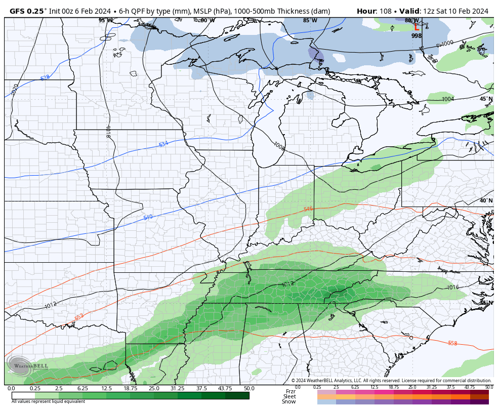
Here’s the GFS showing some winter potential with this…
The EURO is a bit farther east with the winter threat…
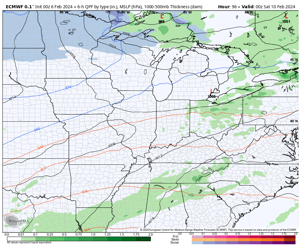
That’s certainly something for us to track in the coming days.
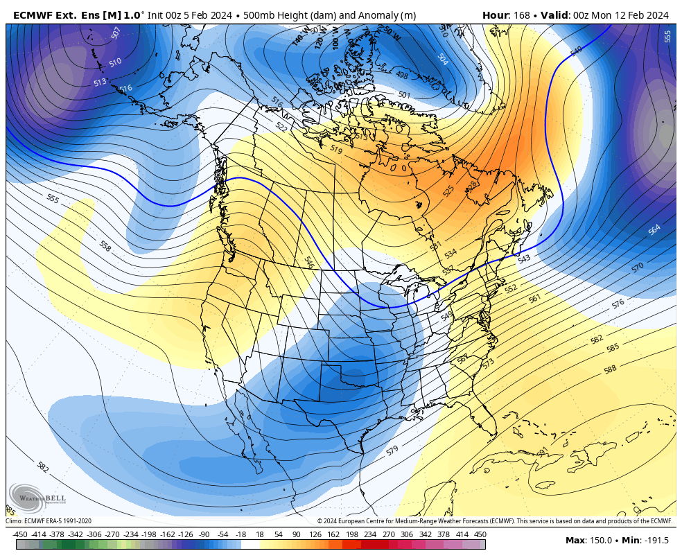
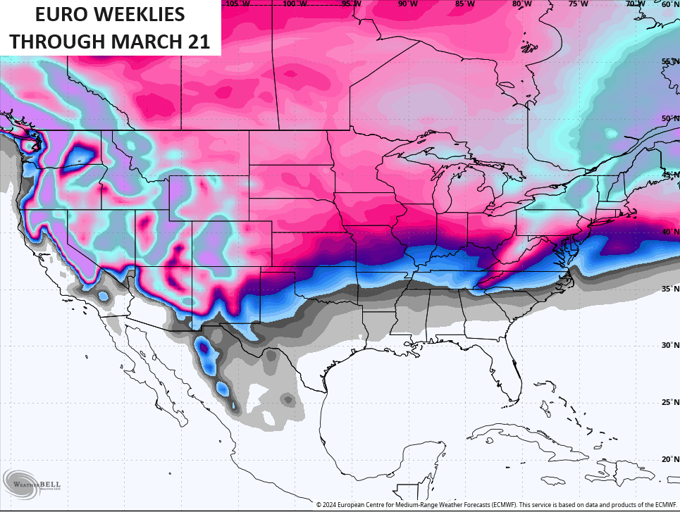
The EURO Weeklies continue to be as steady as I’ve ever seen them in forecasting a pattern from weeks away and they continue to be rock solid as we get closer.
Blocking goes up from Greenland through the North Pole and then hooks up with blocking over Alaska and a ridge along the west coast. All that then forces a deep trough in the eastern US with energy coming into it out of the southern branch of the jet stream.
This animation starts February 11th and rolls through the end of the month…
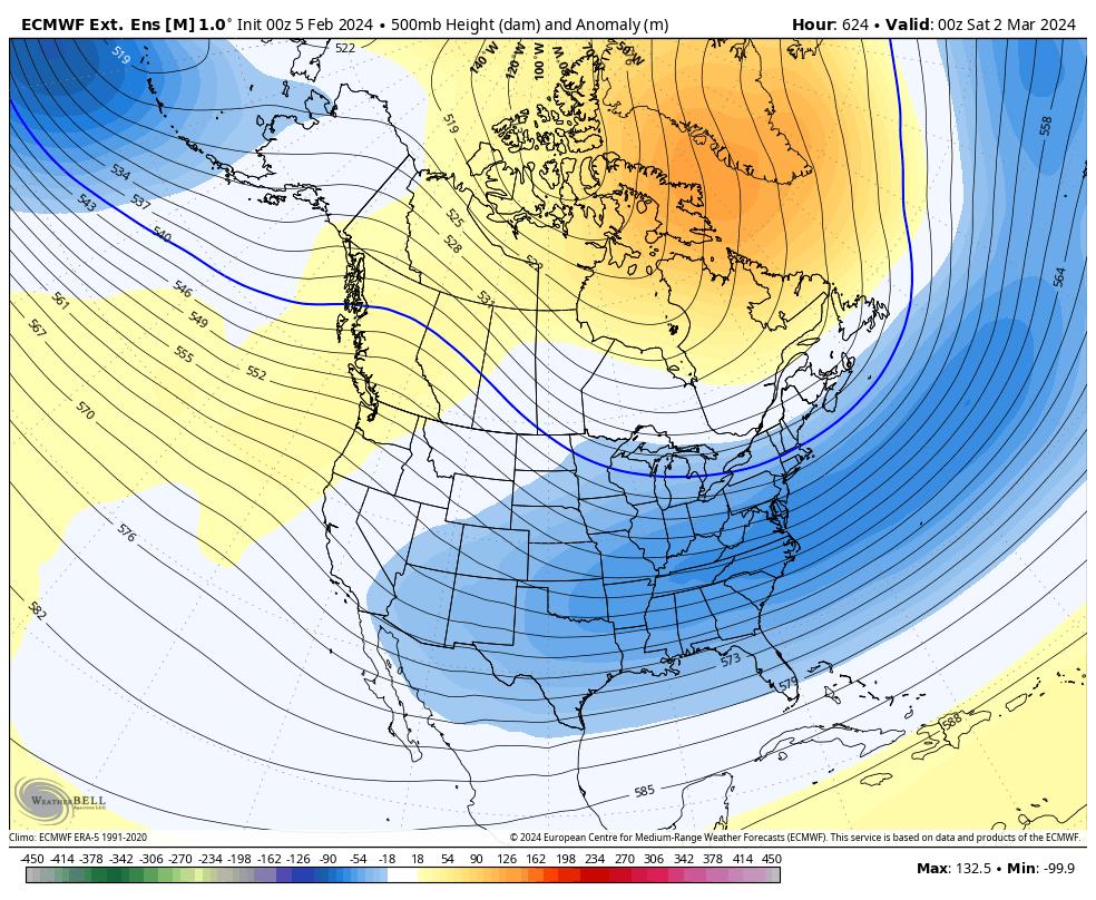
The EURO Weeklies keep the blocking going into March. This animation starts March 1st and goes through March 21st…
The Weeklies are a little more emphatic with snow chances over the next month or so…
I will have updates later today, so check back. Make it a great day and take care.

A little over 30 favorable days for a decent snowfall chance. The cold air will be in place but the difficult part will be finding a low that will take the perfect track.
My guess is that some people will see above normal snow amounts & others will be mainly looking at a partially frozen brown muddy ground.
Thanks Chris. Here in Taylor County we accumulated a little over 6 ” of precipitation since the beginning of the new year, and a minimum temperature of 9 degrees below zero. We are now in good shape for spring planting season. A very normal winter so far.
Hoping we can get rid of the ‘ split flow ‘ pattern we’ve been in since late January, and more ‘ phased storms ‘ when the polar air arrives sometime later this month.
Have a great day !
It’s nothing new at all to see Spring previews in February. We know there is plenty of cold left.
If we can warm the Strat near Alaska & also Scandinavia, it can squeeze the Polar Vortex down into the US & drop cold south. If the squeeze doesn’t happen, cold likely not as notable.
Either way, stormier weather likely looms late Feb / early March.
You’re not telling us anything we’ve not already heard.
This morning’s long range robo forecasts for NKY continue to be rather ho hum with forecast highs every day above freezing. 🙁
I just read somewhere and of course it will change many times that they are watching a system possibly coming in next Monday into Tuesday I think it said starting as rain and switching to snow but seems like in this area anyway when they start with the rain we don’t get that much snow but if we start out as snow we get more I guess the temperature is the difference. I have enjoyed this last few days with good weather and warmer temperatures also.