Good Wednesday, folks. Mild and dry weather keeps on keepin’ on over the next few days before we change it up over the weekend. Those changes are leading us back into a winter pattern that starts to flex a little next week and may hang tough for the long haul.
Let’s begin with today’s awesomeness. Highs reach the upper 50s and low 60s in most areas and may go above that on Thursday. Highs from 60-65 degrees will be possible on a gusty southwest wind. Gusts of 40mph can’t be ruled out late Thursday and Thursday night…
A front slides into the region Friday and slows down, allowing a few storm systems to ride along it. The first one moves in with rain Friday night and Saturday with rain. The second system has more cold air to work with and produces rain and the chance for some snow by Monday.
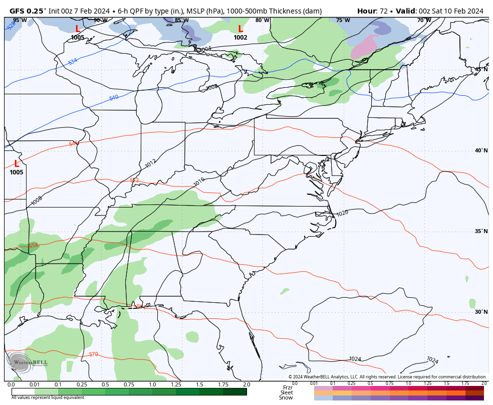
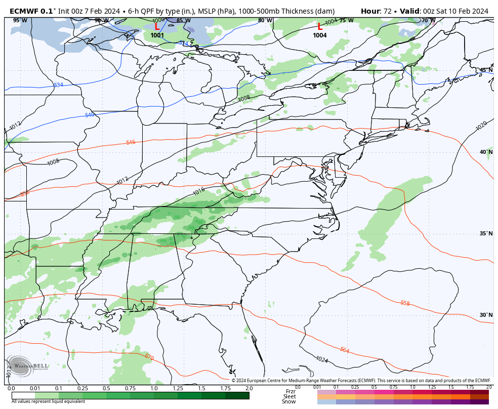
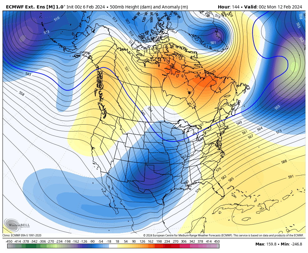
The GFS and the Euro are the strongest with the Monday system and has a period of snow showing up. Here’s a look at both systems…
EURO
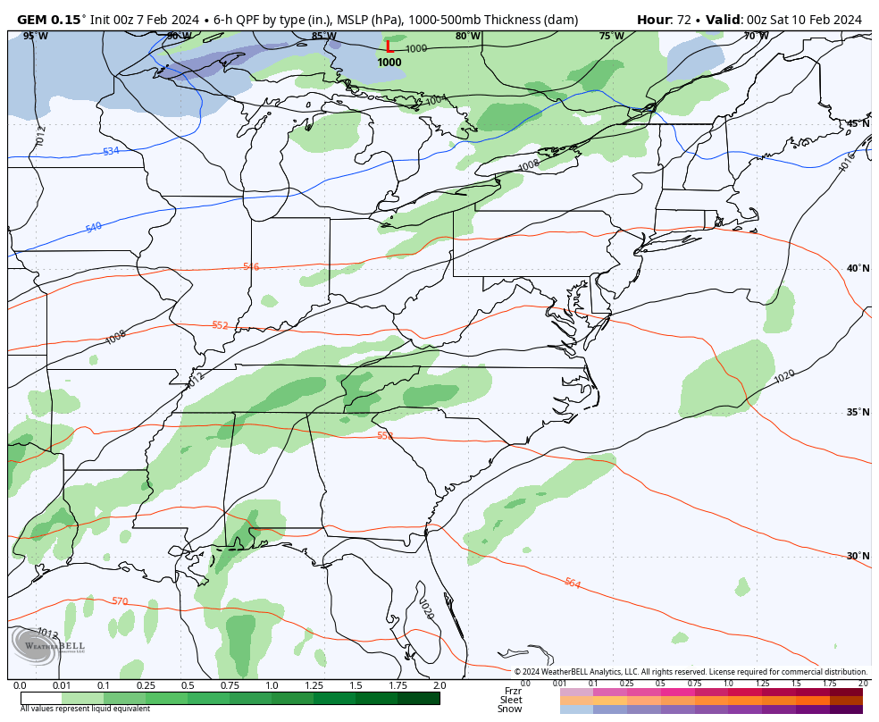
The Canadian isn’t as wrapped up with the second storm…
After that goes through, temps bounce back for a day or two ahead of what’s likely to be an arctic front later next week. The Barney colors are aimed at us…
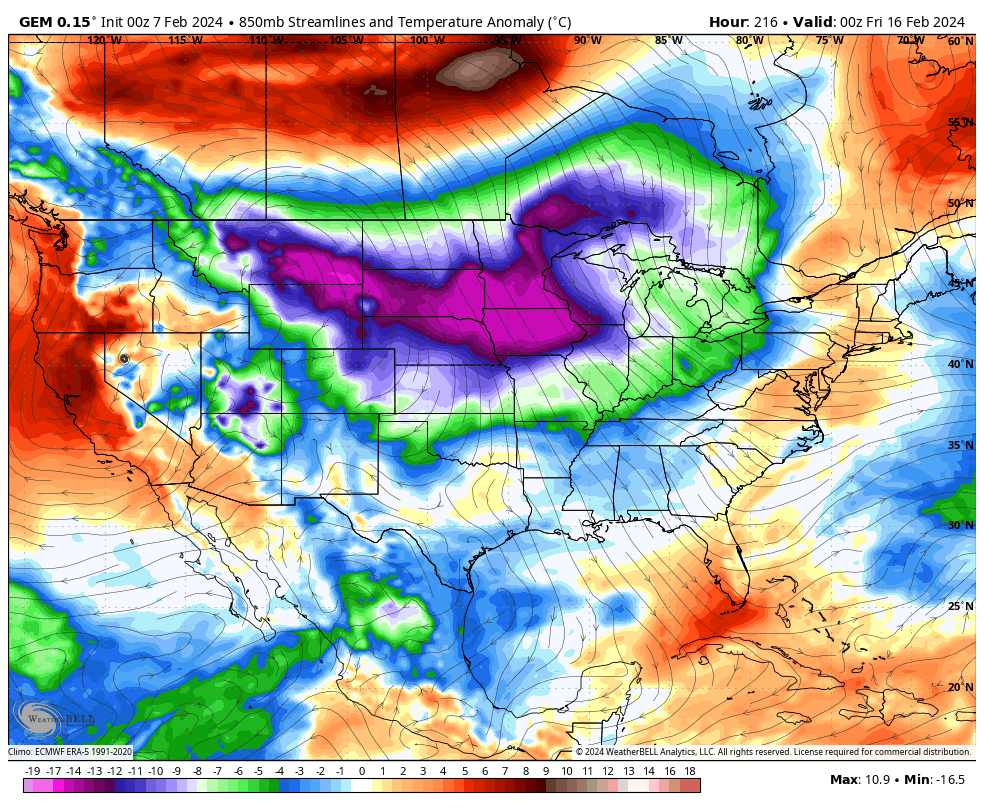
You can also see the next shot showing up behind that in Canada, poised to drop into the country.
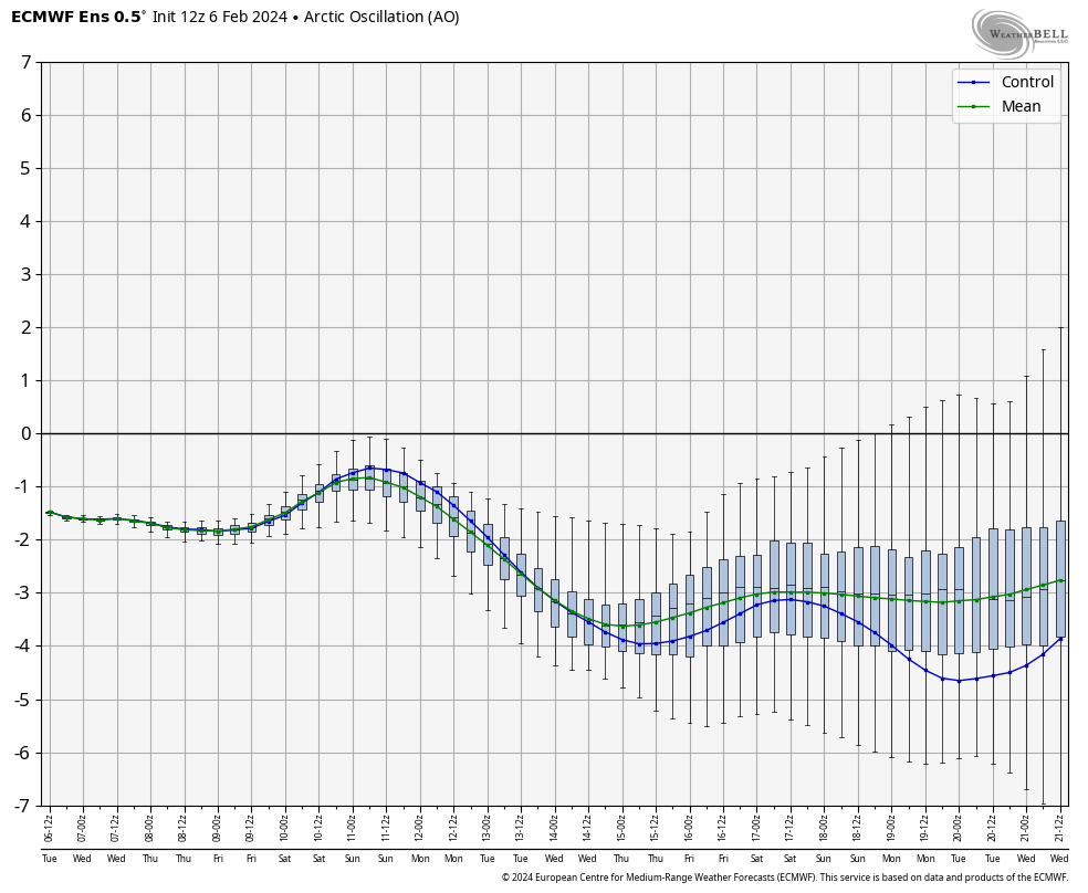
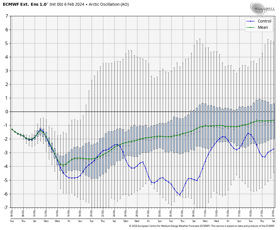
If we look the various indices, we find a very blocky look still showing up. Let’s start with the Arctic Oscillation (AO). When it’s in a negative phase, it means we have some blocking going up in the arctic region. The EURO Ensembles average is the green line and the Control Run is the blue line. Both have the AO going negative over the next few weeks, indicating cold returning to the eastern US…
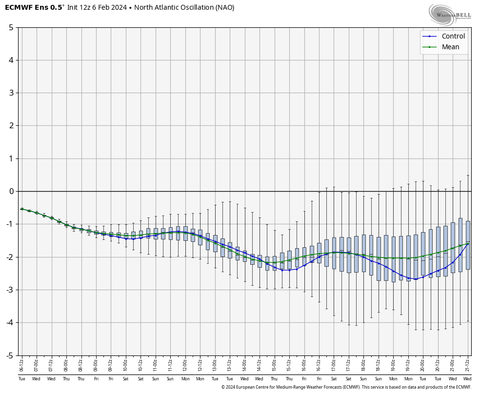
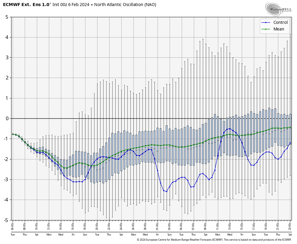
The North Atlantic Oscillation (NAO) is for the area around Greenland. When it’s in a negative phase, that indicates blocking and is a cold signal for the eastern US. Thise same two week period is also negative…
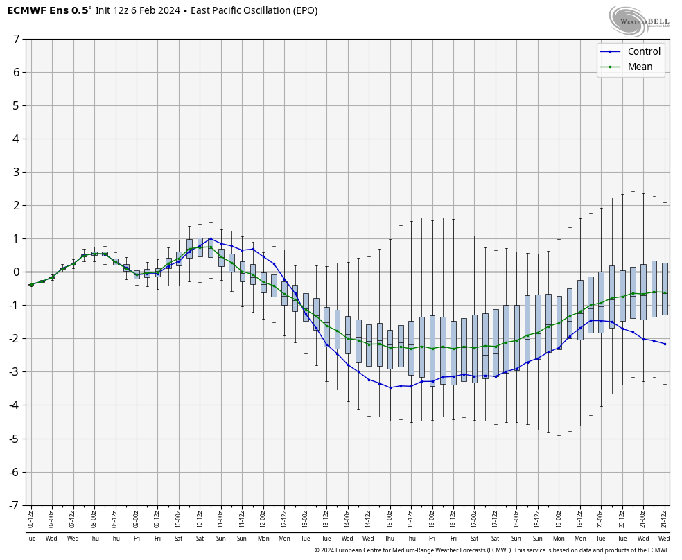
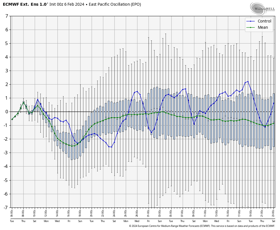
The Eastern Pacific Oscillation (EPO) also is a good indicator for cold in the eastern half of the country when it’s in a negative phase. This would essentially be a ridge over Alaska. The Euro Ensembles have a -EPO developing and holding…
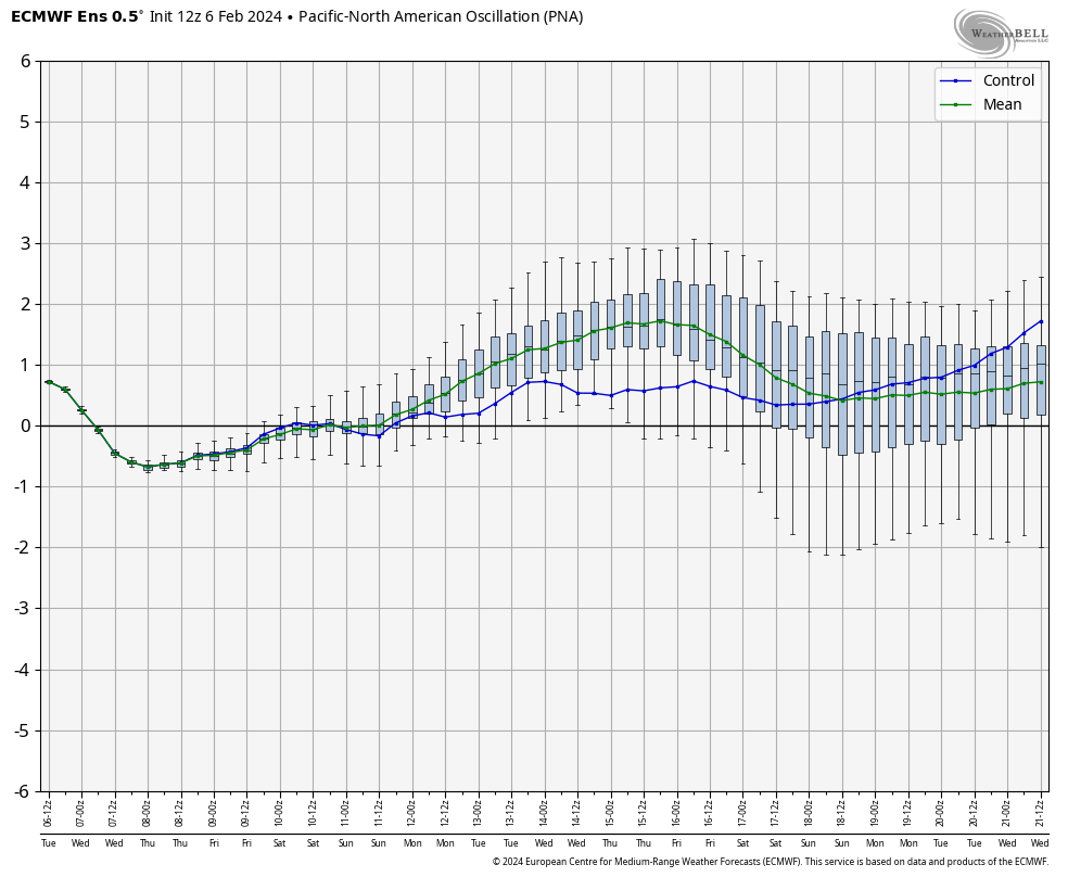
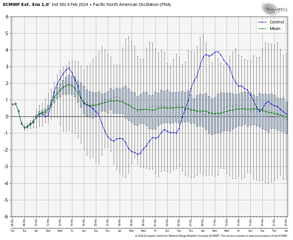
The Pacific-North American Oscillation (PNA) gives us a view of the west coast. A positive PNA is a ridge in the west and is a good indicator of cold and a trough going into the eastern US. Say hello to a +PNA…
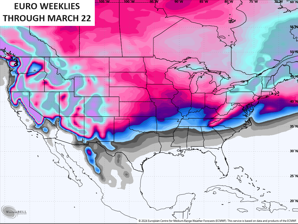
If we extend this out through the third week of March via the EURO WEEKLIES… Wow. The Weeklies have a strongly -AO through the entire time…
The same goes for a -NAO…
The EPO in the mean is also negative the entire time…
The PNA is mainly positive, too…
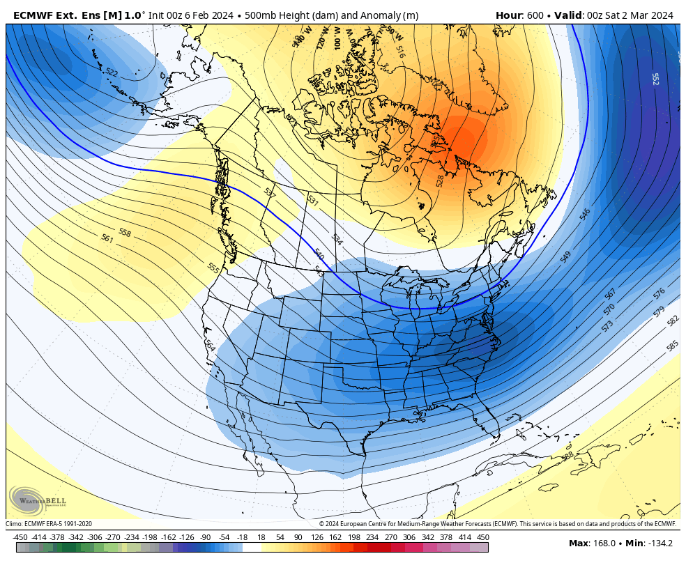
With indices all pointing toward major, prolonged blocking, of course the EURO WEEKLIES show deep troughs across much of the US, especially the east, during this time period.
This animation starts February 11th and goes through the 29th…
The setup from March 1st through March 22 shows no change…
If this is even close to fully verifying, say goodby to any thoughts of an early spring.
This same run of the weeklies also increases the snow threats over the course of this 46 day period..
I will have updates later today. Have a wonderful Wednesday and take care.

I really don’t ever remember seeing southern Cali getting that much rain. 10 inches of rain in downtown LA…over a 2-3 day period..
Honestly – I wouldn’t be surprised if we get another snowstorm or two…. It’s just way to nice and calm for this extended period and the switch is gonna flip at some point.
California had the Atmospheric River last year, but it was more towards the central section of the state. I remember hearing mountains of snow fell in the Sierra Nevadas. The overall weather pattern has not changed that much from last year.
Interesting Chris, but I’m hoping it doesn’t get too warm too early to bring plants out of dormancy only to be damaged by a hard freeze later.
I found that the El Nino jet stream ( the subtropical jet ) is down in the Gulf of Mexico bringing Florida a very wet / cooler than normal winter.
I still think that we are having a very normal February, as we slowly transition towards spring. However, there’s always that slight chance of one of those heavy wet snowstorms. We use to have many years ago, but lately not.
Another very nice day. Thanks Chris for explaining all the charts.
The transition from El Nino towards an ENSO-Neutral state should be well underway by the start of Spring, but the timing of that transition has me concerned. Historical records indicate that when El Nino to ENSO-Neutral transitions take place during Spring, the incidence and intensity of severe weather events east of the Rockies increases. Increasingly unstable Gulf moisture will eventually find its way back into our area, awaiting a trigger.
I think that we are already in ENSO / neutral. The El Nino that was suppose to be strong, turned out to be a dud, because it could not react with the atmosphere ( change the jet streams ) due to a negative Pacific Decadal Oscillation. However, the PDO came up towards positive during January, so maybe we will have more winter weather. Don’t know.
We have severe weather regardless of what phase ENSO is in, but most likely severe weather occurs in La Nina years. El Nino years have the tendency to cause drought conditions, but not always.
I’m concerned that this ” false spring ” may last long enough to cause plants to break dormancy only to freeze later. Hope not ! I ‘m glad I’m not in the nursery business anymore, but I do miss it.