Good Thursday, everybody. Mild and windy weather will be noted across the region today as a cold front inches closer to Kentucky. This front will slow down on top of the area this weekend allowing waves of low pressure to rumble along it. The wave coming Monday has the chance to bring some winter weather with it.
Temps today range from the mid 50s to low 60s with a mix of sun and clouds. Clouds will thicken as we head into the evening with the chance for a shower or two across the etnrie region, but this looks rather scattered.
One or two of those showers may develop across western Kentucky this afternoon. For the first time in a while, your friendly radars are along for the ride today…

Scattered showers and mild temps will be noted on Friday with a surge of showers and maybe a rumble of thunder coming Friday night through the first part of Saturday…
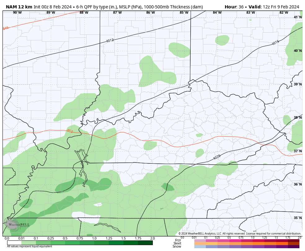
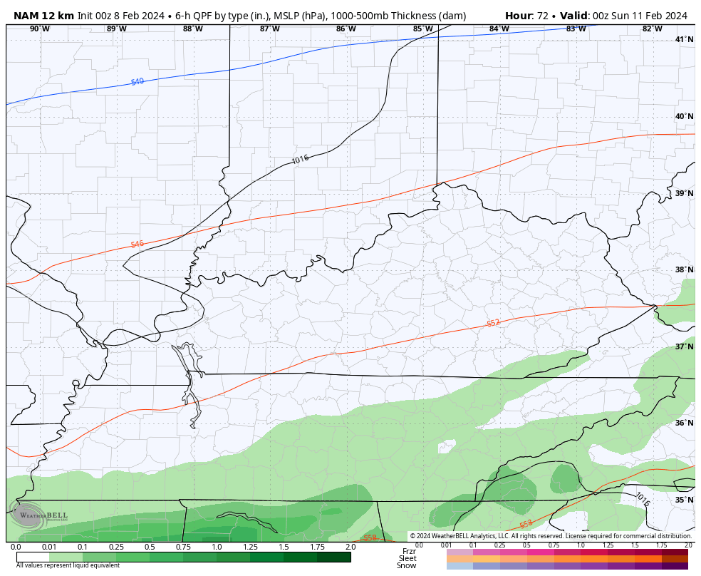
Saturday afternoon and evening turn mainly dry before another round of rain impacts parts of central and eastern Kentucky Saturday night and Sunday morning…
Winds are very gusty over the next few days, especially late Friday and Friday night. The models are spitting out some 40mph+ gusts during this time…
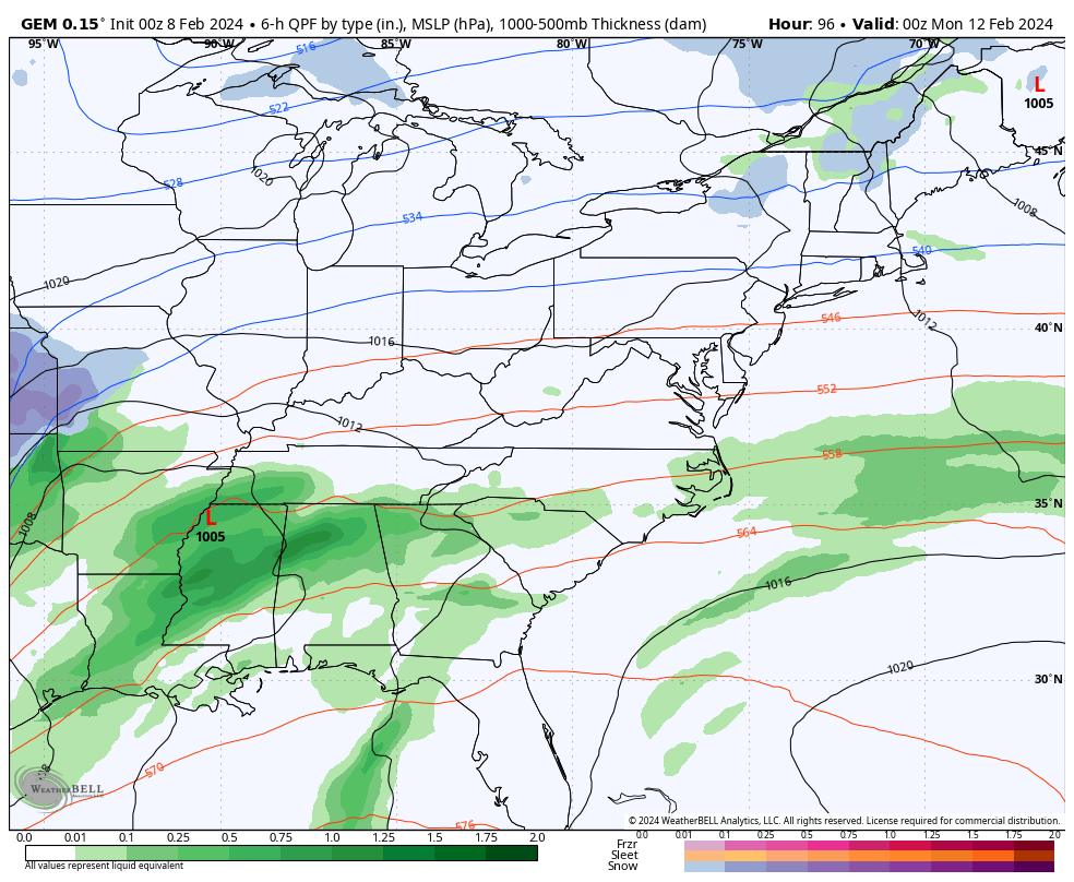
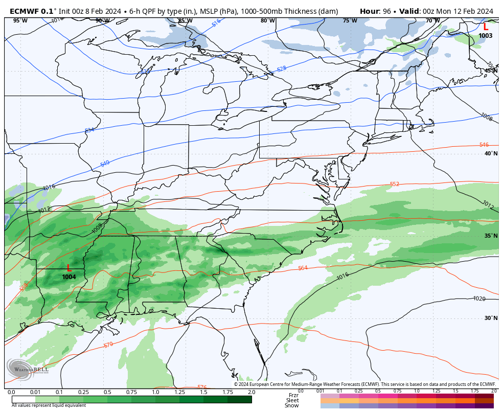
The next system is likely a bigger storm that brings rain and the chance for some snow our way Monday and Monday night. It depends on the track of the low and the intensity of the low.
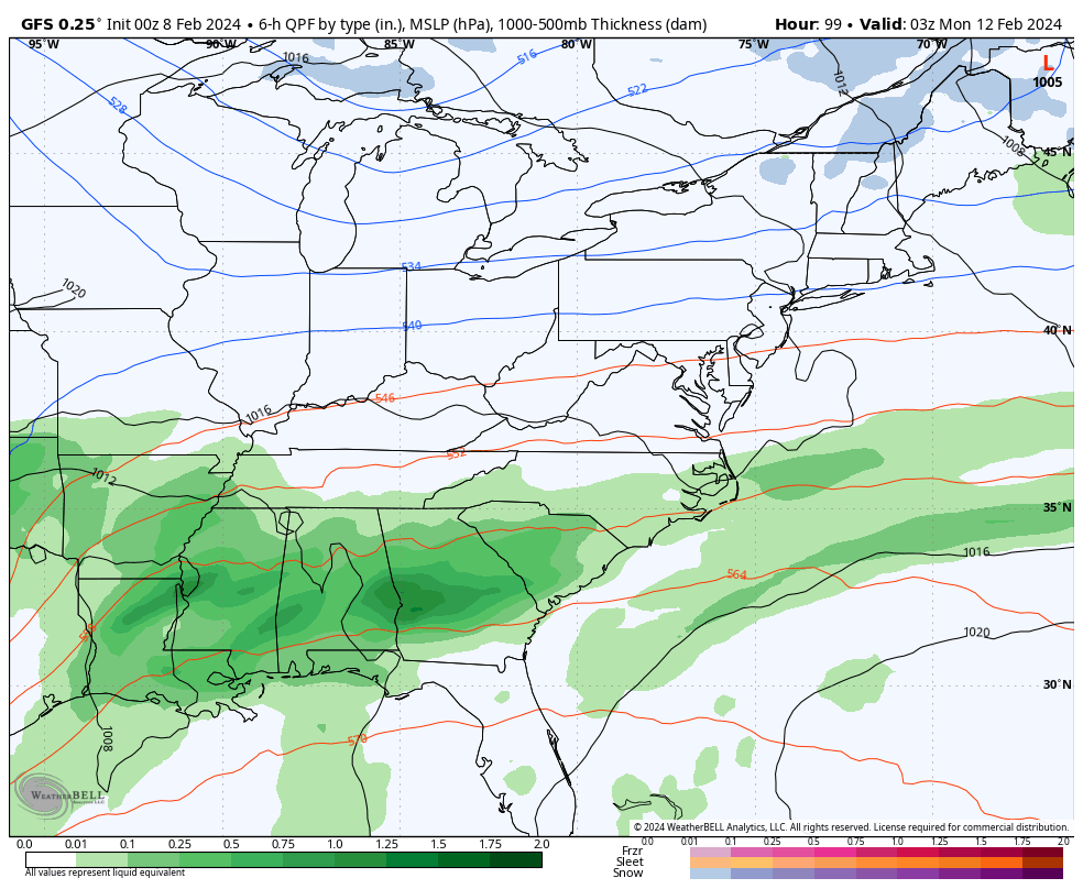
The GFS takes the low across Kentucky with a swath of snow grazing northern Kentucky and some flakes flying for many at the end…
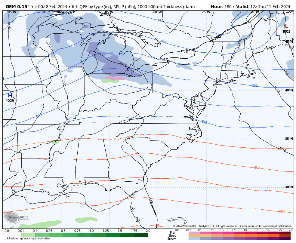
The Canadian is stronger and more wrapped up with the low and takes the snow swath farther north and west with some wraparound light snows and snow showers…
The EURO looks more like the GFS…
Regardless, temps bounce back a bit for the middle of the week ahead of what’s likely to be an arctic front arriving by the end of the week. The Canadian seems to have a decent handle on this…
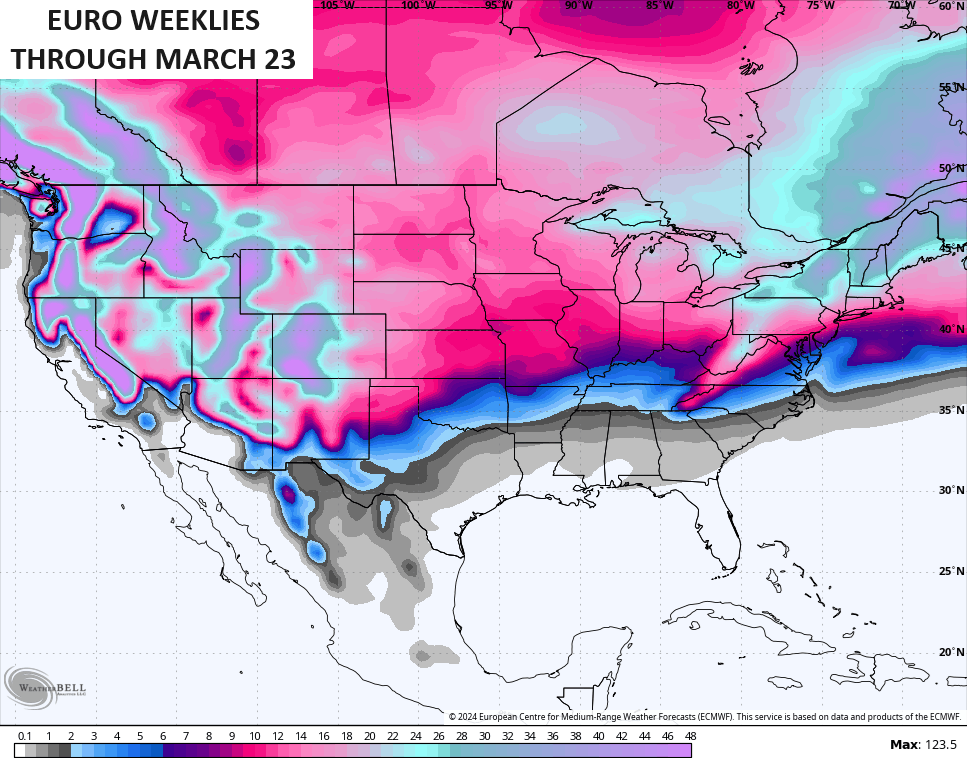
The EURO Weeklies continue to show crazy blocking from the middle of the month through much of March. This 30 day average height anomaly map is kinda absurd…
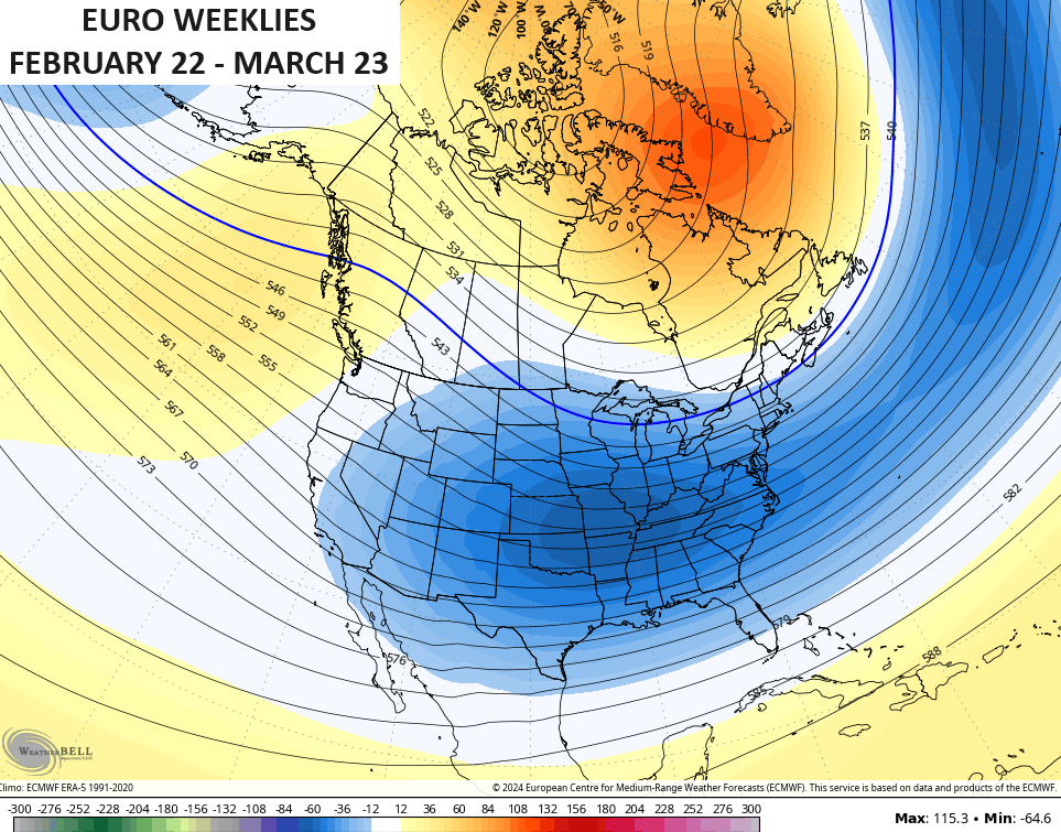
That’s a really cold pattern for much of the country if it verifies. It’s also a pattern for snow chances on the EURO WEEKLIES …
Y’all know this is about the time of year when I join #TeamSpring and this nice weather of late is pushing me more toward hoping none of this happens.
I will throw another update or two later today. Make it a good one and take care.

Sorry Chris, but I dont think it’s time for Spring just yet! #TeamSnow! I do feel like this winter is plsying out kinda odd for what was predicted to be a “record” El Nino year. So far, I think it’s been pretty blah except for the 2 decent snows, and while the 2nd one was more than we’ve seen in a while, it was nothing major (not like we used to get all the time pre-ywar 2000). I definitely think there is something to climate change & that certain areas are much warmer now overall which squashes snow chances, and always causes more “extreme” weather (hot/cold swings).
I tend to agree, the climate is not what it use to be, but the Earth changes and we all must except that. Nothing Man can do to change that.
Agree. Climate cycles on its own, not because of humans.
Thanks Chris. I hope we get some rain soon as we will need it, but with non – phased storms I kind of doubt that it will be enough with all the dry winds predicted. With a pattern like this, February and March is horrible for dry winds increasing the chance for wildfires here in Kentucky. Not really buying the frigid Arctic cold the models keep forecasting for later next week. I think we will have our ‘ split flow ‘ continuing with a lot of temperature fluctuation through spring. teemsummer
This has been an extremely unusual El Niño in that its impact in the southern and eastern US have been more reminiscentof an ENSO-Neutral phase, while parts of Central and South America have experienced the effects of a strong El Niño. It’s become evident over time that atmospheric heating has caused many of the traditional climate measurement metrics to become ineffective, or in some cases, misleading.
Transition to a cooler pattern (not super notable cold), is right on time into the third week of February. Latest EPS resembles my thoughts nicely from the last few weeks.
Attention turns to a SECOND SSWe of the season — it appears the main vortex lobe will move over Asia which is where the coldest air vs. normal will subsequently move the next few weeks.
This should still help keep blocking around and the cooler pattern East through the end of February.
Thanks, Chris…um, Dash.
Correct, Sudden Stratospheric Warming did occur in January and is forecast to occur again later this month, but the bulk of the coldest air will invade Siberia.
More bad news, CPC has officially issued a La Nina watch.
MJO just looks brutal ugh
Here’s the information on the MJO currently :
https://www.cpc.ncep.noaa.gov/products/precip/CWlink/MJO/mjoupdate.pdf
Latest on the impending ENSO / La Nina watch for next winter. Doesn’t necessarily mean we won’t see snows next winter, but it doesn’t help our chances here in Kentucky. It’s just sad and too bad that this El Nino didn’t deliver a very snowy winter that was predicted by many.
https://www.climate.gov/news-features/blogs/enso
#TeamSpring for me all the way
I want #teamsummer. I don’t want the anxiety, property damage, power failure and the chance of becoming homeless that goes along with severe weather that happens every spring here in Kentucky. Best months June through December, but sometimes we have a severe weather in late fall. Fourth of July is one of my favorite holidays. Usually hot and no worry about storms.
Temperatures are in the mid to upper 50s across the Chicago Metro Area this afternoon under cloudy skies and strong Southerly winds gusting over 30 MPH. The normal high temp this time of year here is around 33 degrees, so we’re nearly 25 degrees above normal! The record high for today is 62 degrees.
The Storm Prediction Center even has Northern IL and the Chicago area under a Marginal Risk of severe weather later on today and early this evening, with a small chance of an isolated strong or severe thunderstorm.
It’s 61 degrees and partly sunny / very low humidity and dew point / stiff drying wind out out the southwest. Perfect wildfire weather. My county is in ‘ abnormally dry ‘ on the drought monitor, but improvement likely in the coming days. Total snowfall remains at 5 inches so far this winter season here in Maple.