Good evening, folks. The broken record of a forecast is about over as we head into a very active setup this weekend into next week. This is the pattern that leads us back into wintertime.
A weak front is approaching the area from the west this evening but it has a decaying band of showers with it, so don’t expect much rain tonight into early Friday. Winds, however, will still be a major player with gusts to 30mph.
Another mild temp day will be noted Friday as a few late day showers increase from southwest to northeast. This sets the stage for fairly widespread showers and a few rumbles of thunder Friday night and Saturday morning. This action then decreases from northwest to southeast Saturday afternoon and evening.
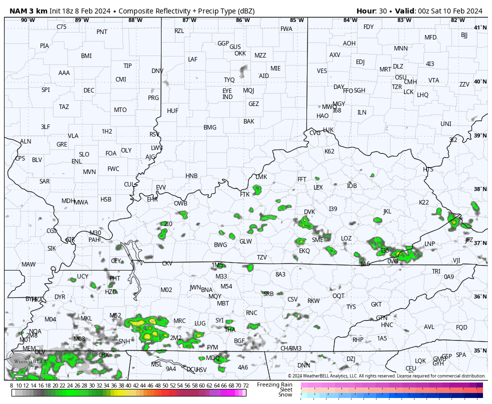
You can see all this on the future radar from the Hi Res NAM…
Another surge of showers impacts the southeastern corner of the state Saturday night and Sunday morning.
Temps Sunday do come down from northwest to southeast as a boundary slides in. How far south does this thing get? That will be the determining factor in what happens with a stronger storm system riding along the front Monday and Tuesday.
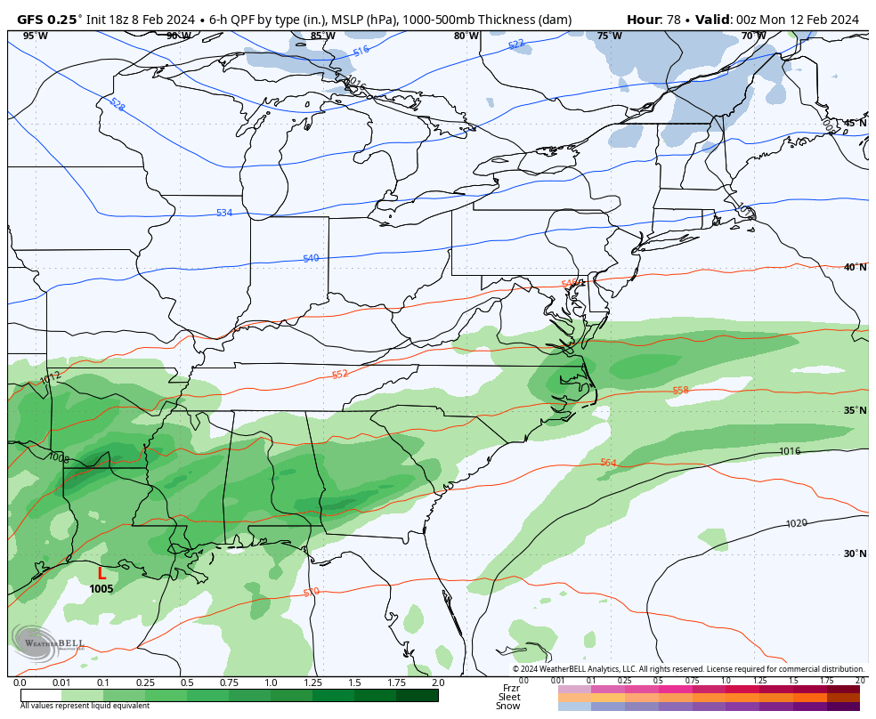
The GFS is consistently taking this low on a path across far eastern Kentucky into West Virginia before developing a new low along the east coast. Given that scenario, the GFS has a band of accumulating snow on top of the region Monday night and early Tuesday…
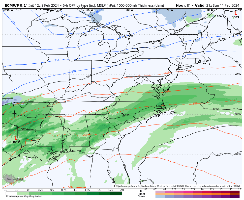
The EURO has a very similar track, but doesn’t have the amount of cold air behind it to tough off the healthy band of snow. Instead, it gives us some light snow Monday night and Tuesday morning…
A shot of arctic air then takes aim at the eastern half of the country late next week and could bring another snow chance by Thursday and Friday…
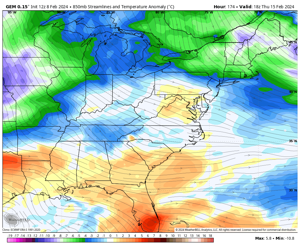
Barney colors sweep into the east behind this…
Winter has a lot more left in the tank, folks. I’m conflicted. #teamwinter or #teamspring?
Enjoy the rest of the evening and take care.
