Good evening, everyone. Gusty showers and a few thunderstorms are set to rumble into the region tonight and early Saturday as the pattern turns active. This setup leads us back into winter as early as Monday night when the chance for some snow shows up.
The rain and storms moving in tonight can put down quite a bit of rain, especially across the southern half of the region. There’s also the low-end chance for a few strong or severe storms to show up in the west and into parts of central Kentucky…

Damaging wind and large hail would be the main threats, but the Storm Prediction Center has a small threat for a tornado spin up…

After a break in the rain for the middle of your Saturday, more rain overspreads the state from Saturday evening into Sunday morning.
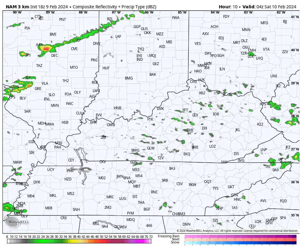
All of this shows up well on the Hi Res NAM future radar from tonight through early Sunday…
Heavy rains may cause some local high-water issues across southeastern Kentucky, so keep that in mind.
Colder air then bleeds in from the northwest into Monday as another low pushes into the region from the southwest. Rain is likely ahead of it with a period of wraparound wet snows possible Monday night and early Tuesday.
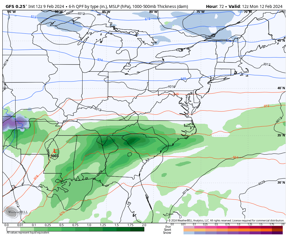
The GFS keeps on keeping on with this…
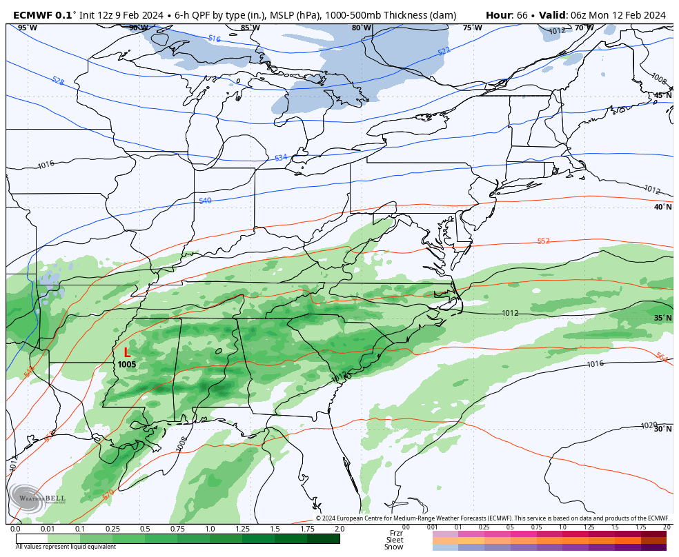
The EURO now looks a lot like the GFS…
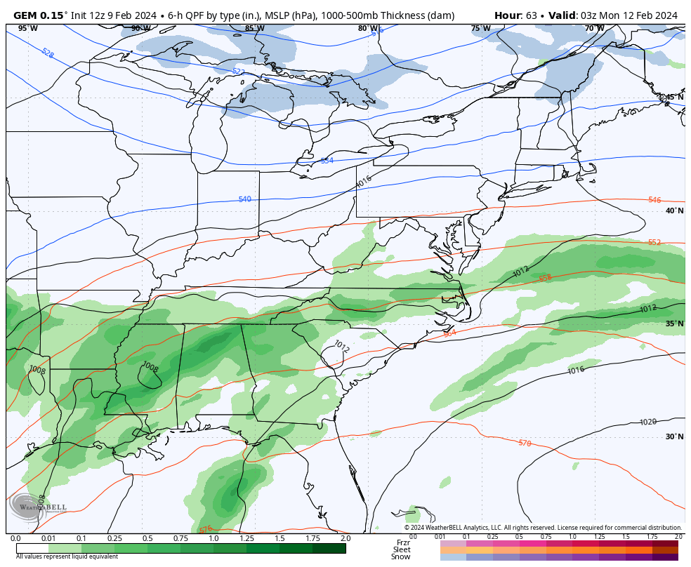
The Canadian is getting there…
I leave you with your rain and storm tracking tools…

Current watches

Possible Watch Areas

Enjoy the evening and take care.

I’m hoping there’s as much moisture as the models suggest. Looks kinda light and somewhat scattered to me.