Good Saturday, everyone. Rain and some thunderstorms are with us early today as our weather pattern starts to really rev up. Rounds of additional heavy rain will be with us through early Sunday before an interesting system rolls in Monday and Tuesday. This system looks like a rain to snow maker.
To simplify things, let’s go to the headlines:
- Showers and some noisy thunderstorms are out there early today and will put down hit and run heavy rains.
- The rain takes a bit of a break from the middle of the day into the afternoon with just scattered showers.
- Another wave of rain moves across the area this evening through Sunday morning.
- Some areas will pick up 1″-2″ of rain in this 24 hour period and that could lead to quick rises on some creeks and streams, especially in the southeast.
- Super Bowl Sunday afternoon and evening turns pretty nice with drier and chillier air coming in.
- Low pressure moves from near Nashville on Monday to near Pikeville Monday evening, to near Charleston, WV Tuesday morning.
- That kind of track means rain pushes through Monday with the chance for a chance for a period of wet snow Monday night and Tuesday morning.
- The best chance of that is across the northern half of Kentucky as colder air crashes in behind the low.
- Some accumulation will be possible during this time.
- Can we get a narrow band of thumping snows? That’s certainly a possibility.
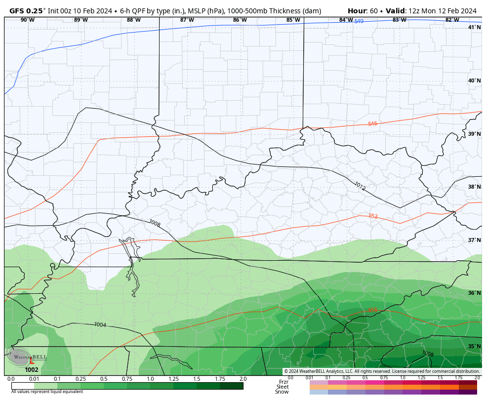
The GFS has been the most consistent model in bringing a swath of wet snow into our part of the world. That has not changed one bit…
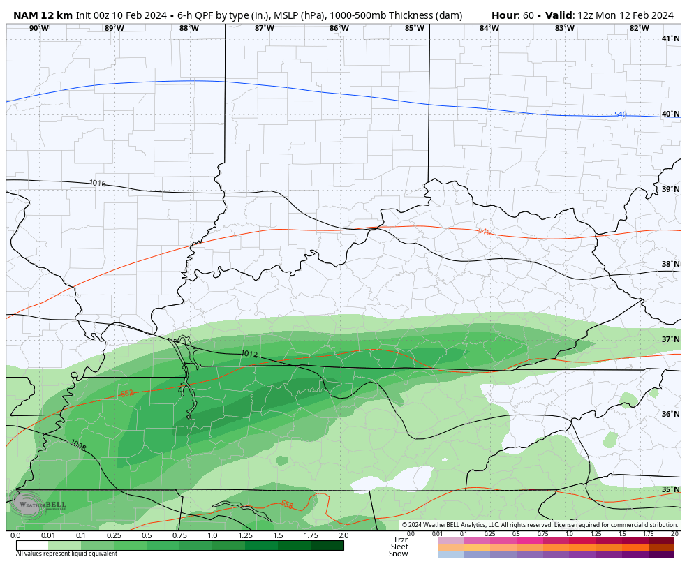
This barely gets into the range of the NAM, but it has the band of snow…
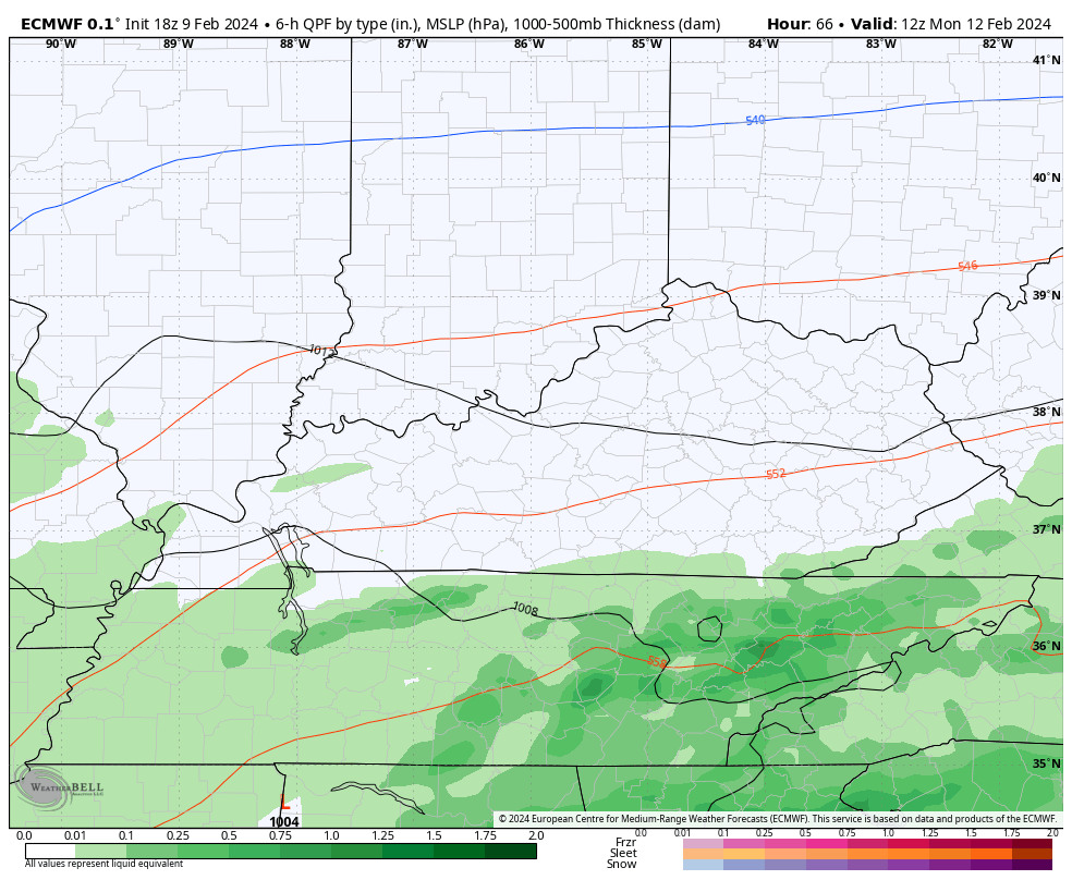
The late afternoon run of the EURO strongly trended toward the GFS with a healthy snow hit for some…
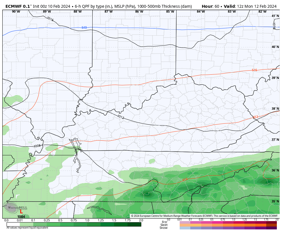
The latest run followed that up with a very similar look…
The average of the 21 member GFS Ensembles has a decent look for some snow across the northern half of Kentucky…
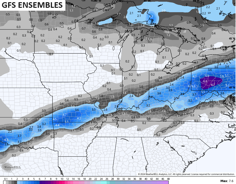
Northern Kentucky… Can we get this thing to a Winter Storm THREAT? Hmmm… That’s a good question.
From here, the models have no idea on how to play the next few systems late next week into the weekend. We will need to watch for a trend toward another southern stream storm system that can bring another winter threat to the region.
I will have another update later today. Until then, let’s track some showers and storms to start the day…

Have a great day and take care.

Thanks Chris. Enjoying the early morning thundershowers.
Have a great day.
Wet snow isn’t my favorite type.
I like mine dry.
But beggars cannot be choosy.
It will have to come down awful heavy if it’s going to become a winter storm threat.
Temps in the 50 -55 range on Sunday.
Temps in the upper 40s on Monday.
The snowflakes will have to overcome a warm ground.
5-1 ratio maybe even lower.
The majority of it will be gone by Wednesday
Forecast highs in the 50s
The March effect in mid February.
I like the wet snows because it’s not as cold and the Children are able to make snowmen and throw snowballs. We use to have a lot of these wet snows where I grew up in south central Indiana. Where I live now, I have yet to experience any late major wet snowstorms. The only winter storm I can remember was the horrible ice storm in January 2009. When I was in college at Murray State University for four years back in 1971, hardly a flake of snow fell, but we did have a major ice storm the first winter I was there. The snow line has moved farther north. I looked up the years 1976 to 1978 winter’s here in Kentucky and it was very cold with a lot of snow during that period, the same as Indiana. Very widespread snow events in a weak positive / El Nino years.The coldest and snowiest winters here in Kentucky and Indiana was way back in 1917 through 1918. Record snowfalls state wide, and these were La Nina years. How the climate has changed, maybe for the better. For instance lower heating bills.
Well the kids will have to enjoy their two hour window to make a snowman. Because it will be gone by Tuesday evening. LOL
That would be sad. I remember the snow stayed on the ground for a week and then you got more on top of the first snow. What was really interesting was when you had three or four snows back to back. I ‘ve seen that happen in the winter 1969 – 70. Another interesting scenario is when you have a thunderstorm at late evening and then in the morning you wake up to 8 inches of snow. Last time I experience that was February 1963.
The high temperature of 56 degrees at Chicago’s O’Hare Airport on Friday tied an all-time record high for the date set way back in 1886. It reached 55 degrees at the NWS Forecast Office in the SW Suburbs.
The first nine days of the month have averaged a ridiculous 14.6 degrees per day above normal, making this the warmest first nine days of February ever for the Chicago area. There hasn’t been any measurable snow here for three weeks.
Any snow you guys in KY receive next week will be more snow than we get here, as there is no measurable snow in the forecast here for at least the next week with cooler but continued above normal temps.
1986 was a very mild winter in Indiana too Mike, but I don’t know about any temperature records that were broken. I remember the drought that started in December 1987 and lasted until 1990. It was a widespread drought, like the ‘ dust bowl days ‘ in the late 1930’s.
In my local forecast the next 14 days there are no predictions for any measurable snow. We did receive about a half of an inch of rain this morning and more rain is predicted tonight and tomorrow.
I would think with the Pacific being negative, you would have received more snow. Next winter, there is a prediction for a La Nina event, which would increase your chances of phased, widespread snowstorms. I thought we would have that happen here in Kentucky with El Nino this winter, but the Pacific did not phase to positive. The new normal.
Vote for the wet heavy snow..Stick’s to everything creating a winter wonderland..As for the rest of winter really don’t see anything exciting..Maybe around the 18th if we can get some cold air but that’s looking doubtful at the moment..Just been another boring winter..Things aren’t what they use to be..
It is certainly not the climate I grew up in. Another disappointing winter in the making, but we can forward to spring and summer. I like the summers here. They are warm and humid, but not that hot with all the trees around in my area.
It seemed strange to wake up to loud thunder this morning early it was good sleeping weather but the cat didn’t like it.
I like it when it thunders and lightning early in the morning, and we receive a good soaking rain. I grew up with many pets of dogs and cats,and they all were afraid of the thunder.